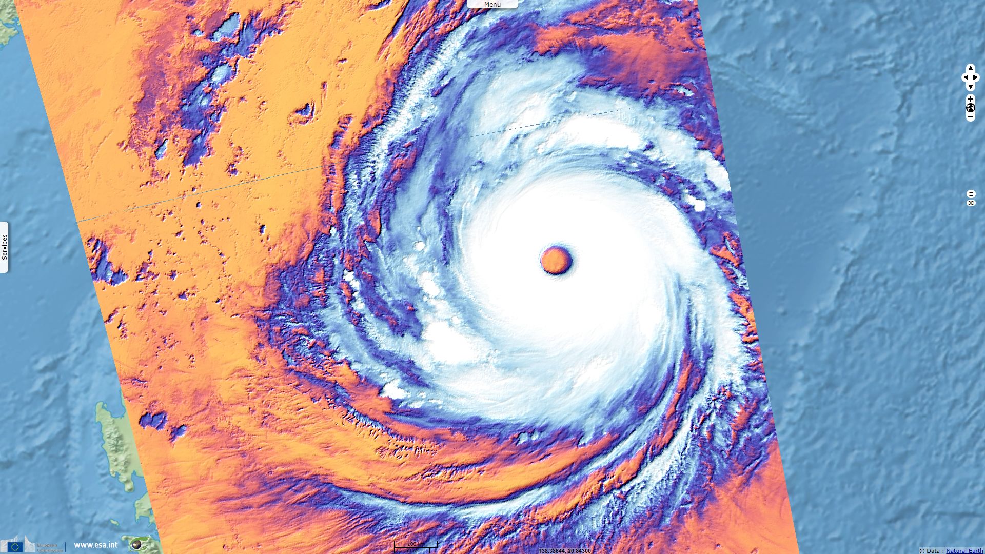
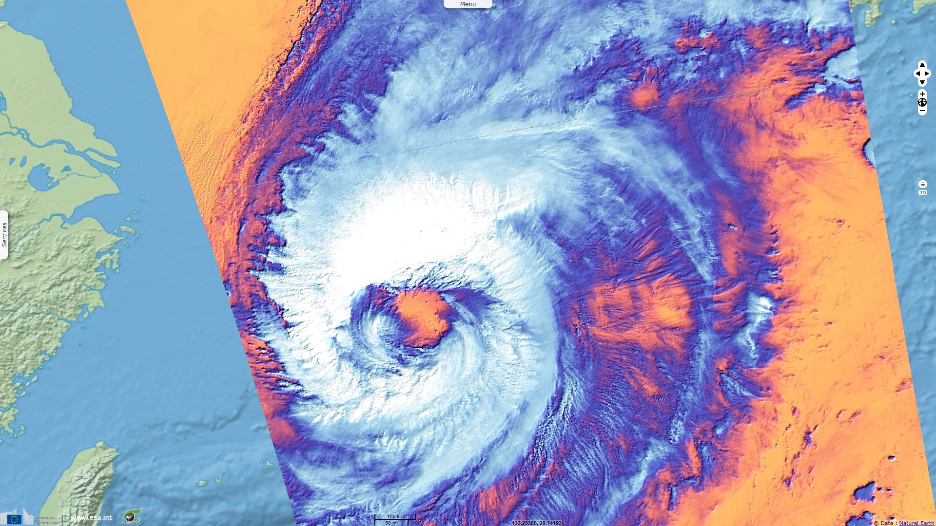
Inside Typhoon Trami big beautiful eye
Sentinel-3 SLSTR RBT acquired on 24 September 2018 from 13:28:09 to 13:31:09 UTC
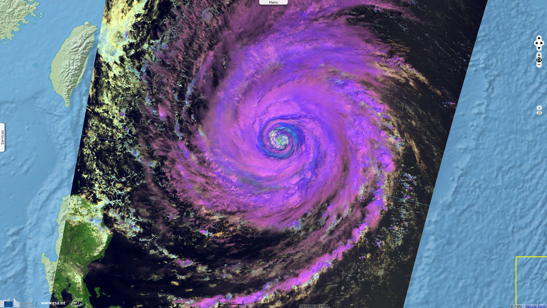
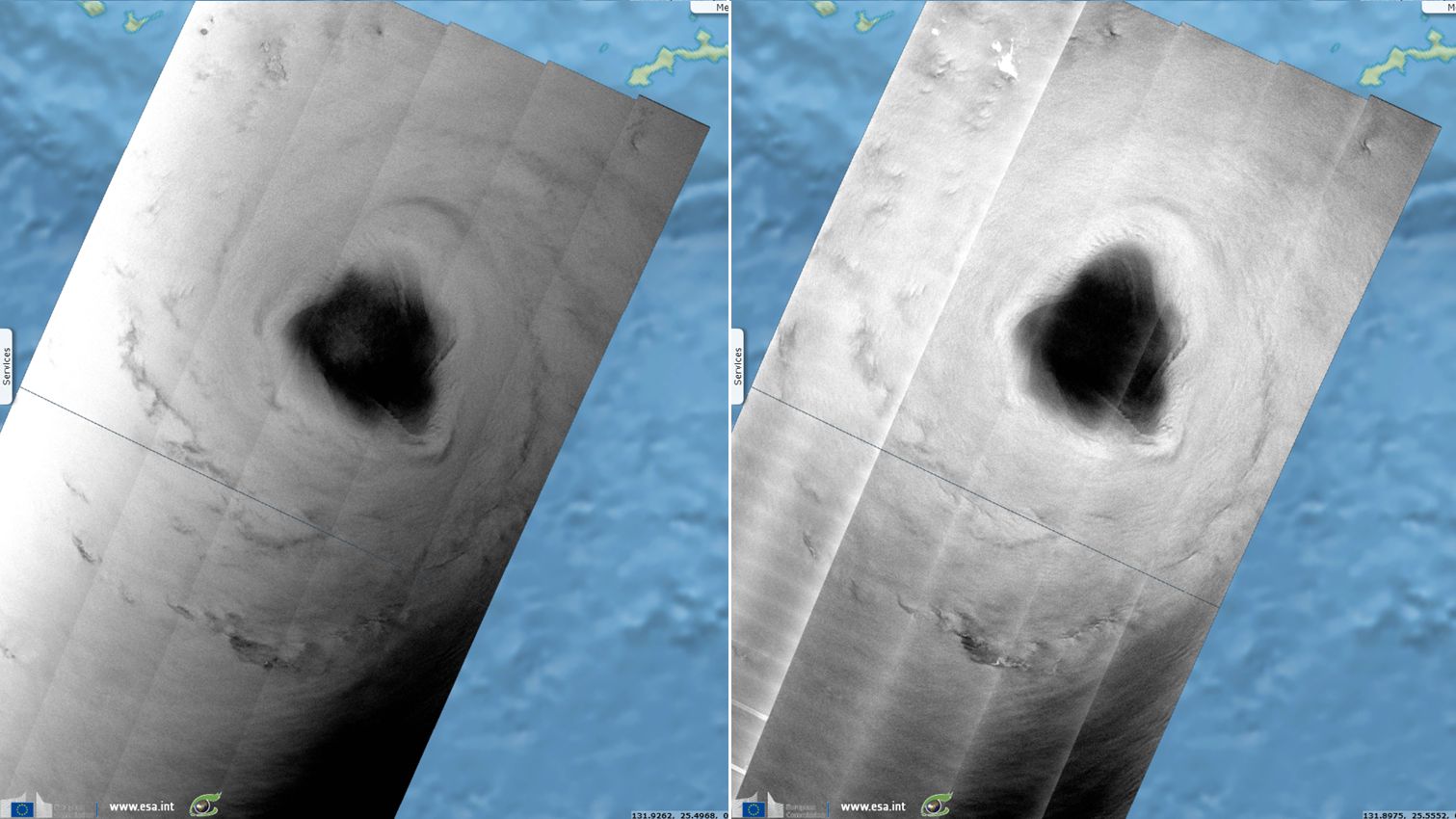
Sentinel-3 SLSTR RBT acquired on 25 September 2018 from 01:51:03 to 01:57:03 UTC
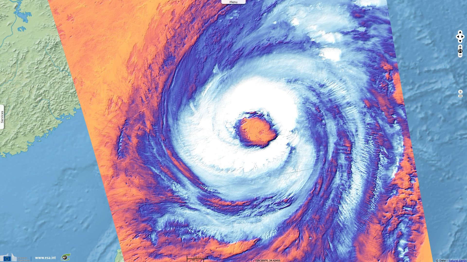
Sentinel-3 SLSTR RBT acquired on 25 September 2018 from 13:01:58 to 13:04:58 UTC
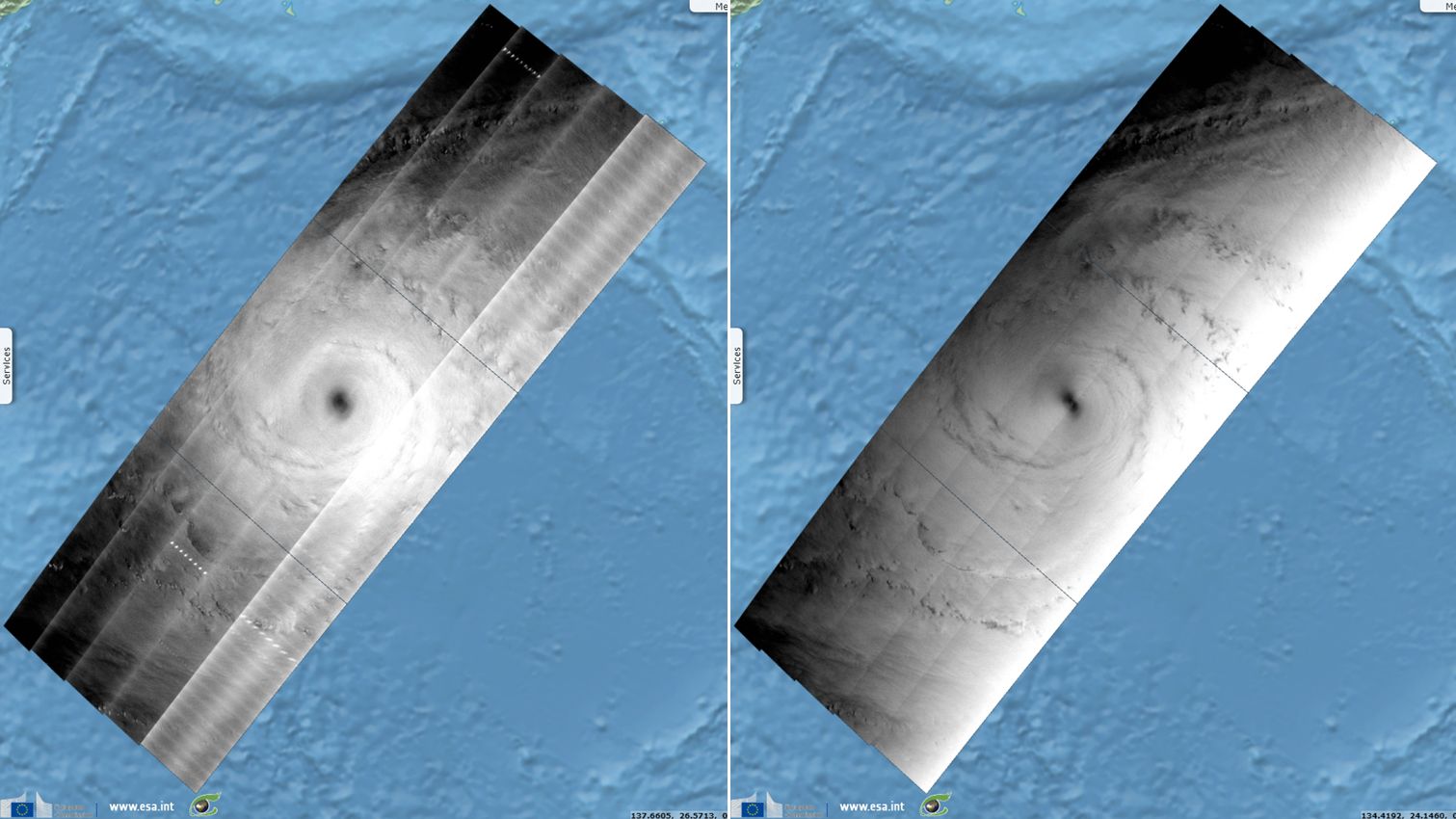
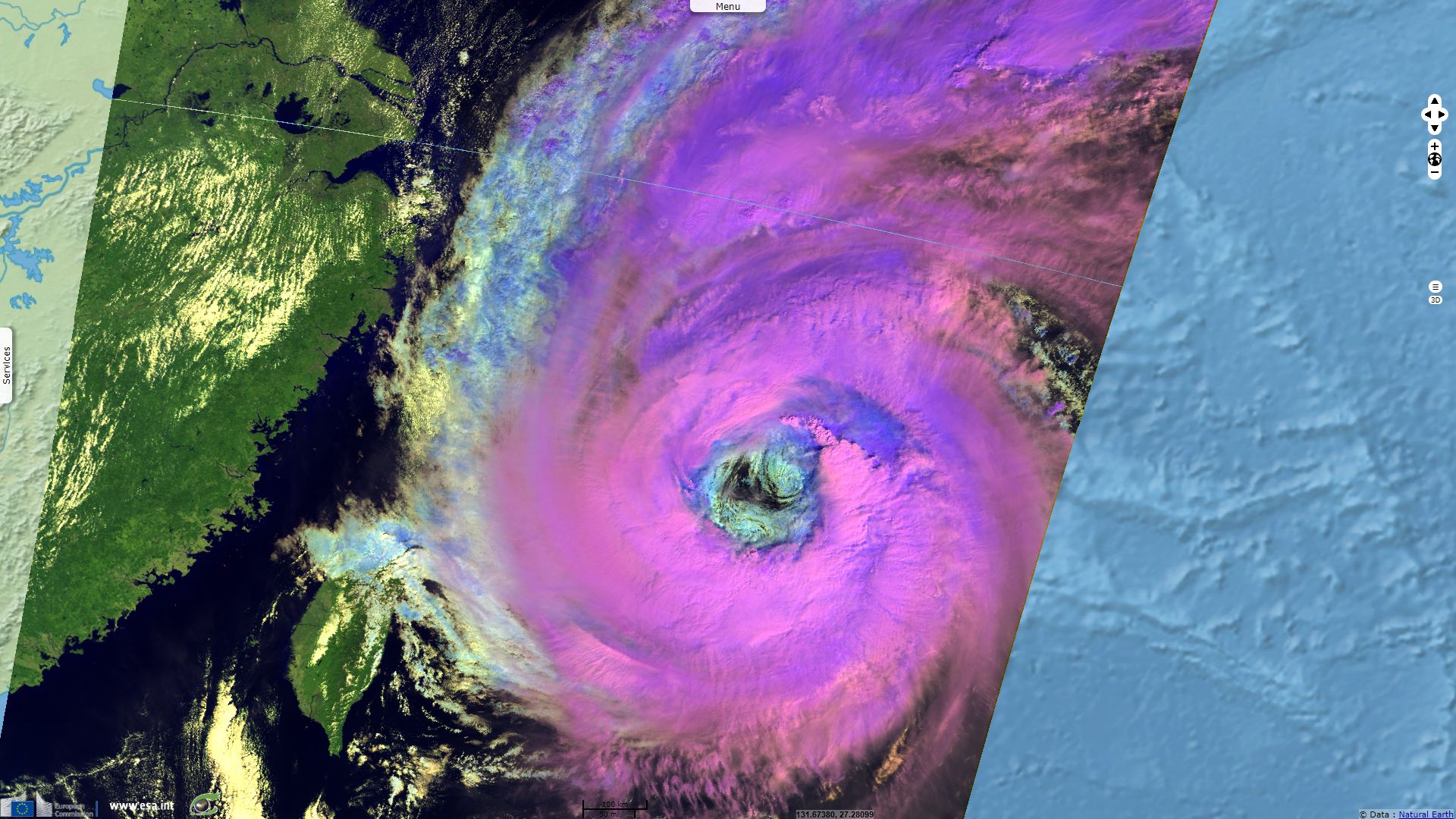
Sentinel-1 CSAR EW acquired on 25 September 2018 from 21:19:06 to 21:21:10 UTC
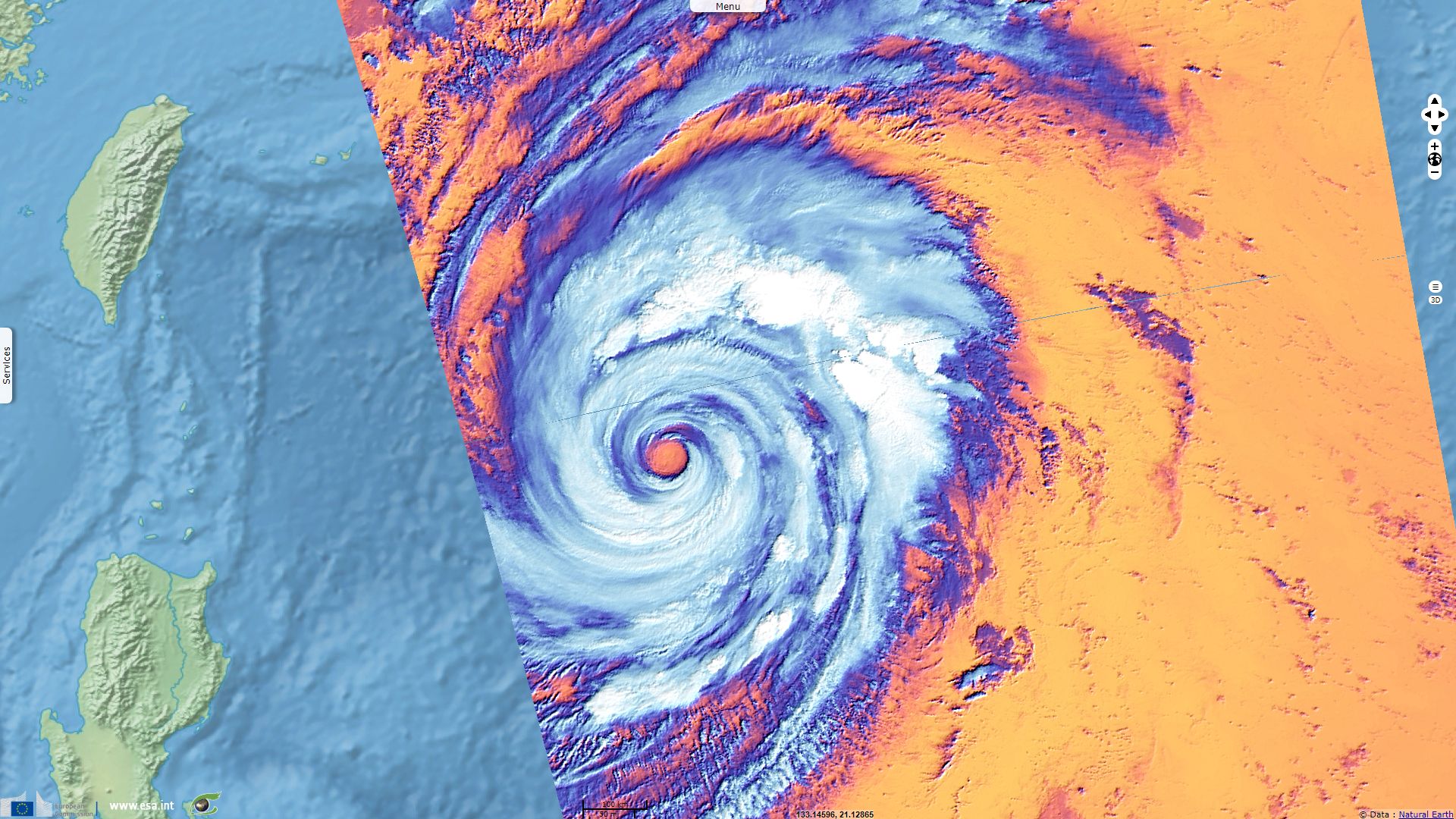
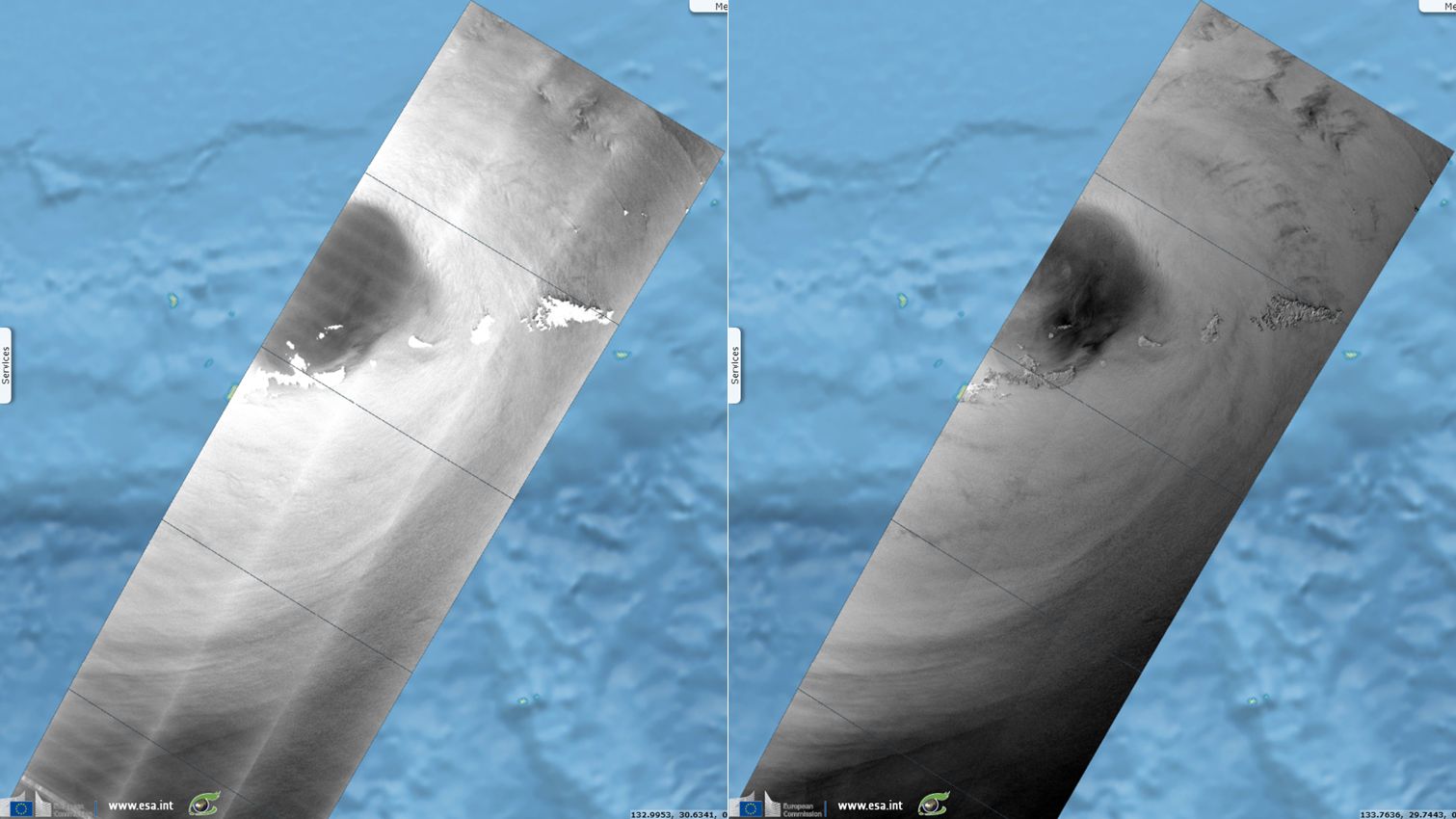
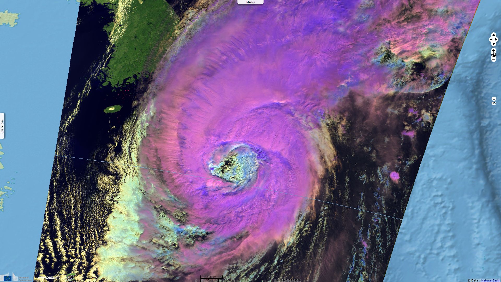
Sentinel-3 SLSTR RBT acquired on 01 October 2018 from 00:51:58 to 00:54:58 UTC
Sentinel-3 SLSTR RBT acquired on 25 September 2018 from 01:51:03 to 01:57:03 UTC
Sentinel-3 SLSTR RBT acquired on 25 September 2018 from 13:01:58 to 13:04:58 UTC
Sentinel-1 CSAR EW acquired on 25 September 2018 from 21:19:06 to 21:21:10 UTC
Sentinel-3 SLSTR RBT acquired on 01 October 2018 from 00:51:58 to 00:54:58 UTC
Keyword(s): Emergency, natural disaster, atmosphere, storm, climate, wind, rain, cyclone, hurricane, Japan, Pacific Ocean
Harold F. Pierce and Rob Gutro of NASA’s Godard Space Flight Center wrote: "GPM, a joint satellite mission between NASA and the Japan Aerospace Exploration Agency, JAXA, flew over Trami on Sept. 24, 2018 at 12:03 UTC. At that time Trami had maximum sustained winds estimated at [240 km/h]. Rainfall measurements were made using data collected by GPM’s Microwave Imager (GMI) and Dual-Frequency Precipitation Radar (DPR) instruments. GPM’s GMI showed the locations of extremely heavy rainfall in the super typhoon’s well defined circular eye."
"The Joint Typhoon Warning Center (JTWC) used that GPM pass in an evaluation of super typhoon Trami. JTWC’s summary and analysis said that, 'A 241201Z (Sept 24 at 12:01 UTC) GPM 89GHZ microwave image clearly reveals an ongoing eyewall replacement cycle with concentric rings and a moat feature evident.'"
In another report, Rob Gutro continued: "At 05:05 UTC on Sept. 28, Trami beginning to affect the Ryukyu Arc, a chain of Japanese islands that stretch southwest from Kyushu to Taiwan. Infrared satellite imagery shows Trami continues to have a wide eye with convection around the eye beginning to re-intensify."
"At 11 a.m. EDT (1500 UTC) on Sunday, Sept. 30, the Joint Typhoon Warning Center issued the final advisory on the system. At that time, Typhoon Trami was located about 157 miles west-southwest of Camp Fuji, Japan and moving northeast at 28 knots (32 mph/52 kph). Maximum sustained winds were near 75 knots (86 mph/139 kph). Trami was weakening rapidly and becoming extra-tropical as it tracked very rapidly over Honshu."
Track followed by Trami in the Pacific - source: Weather Underground
theweathernetwork.com reports the final advance of Trami over Japan before it disintegrated: "Typhoon Trami made landfall in western Japan on Sunday 30 evening and threatened heavy rains, strong winds and landslides on the northern-most main island of Hokkaido, the Japan Meteorological Agency said. The island was hit by a deadly earthquake last month."
The views expressed herein can in no way be taken to reflect the official opinion of the European Space Agency or the European Union.
Contains modified Copernicus Sentinel data 2026, processed by VisioTerra.
Contains modified Copernicus Sentinel data 2026, processed by VisioTerra.
| More on European Commission space: |  |
 |
 |
||||
| More on ESA: | |
|
|
S-1 website | S-2 website | S-3 website | |
| More on Copernicus program: | |
|
|
Scihub portal | Cophub portal | Inthub portal | Colhub portal |
| More on VisioTerra: | |
|
|
Sentinel Vision Portal | Envisat+ERS portal | Swarm+GOCE portal | CryoSat portal |