Water resources in Zakouma (Chad)
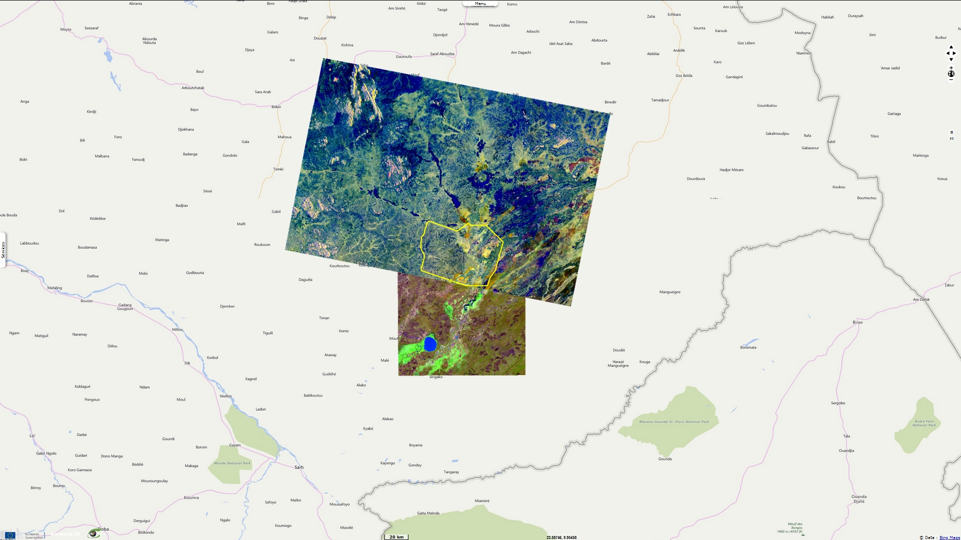
Sentinel-1 CSAR IW acquired from August 2019 to August 2020
Sentinel-2 MSI acquired from August 2019 to August 2020
Sentinel-2 MSI acquired from August 2019 to August 2020
Keyword(s): Water, Zakouma NP, Chad
"Zakouma National Park has experienced one of the most spectacular transformations in all of Africa. The national park is part of the Greater Zakouma Ecosystem—the primary safe haven for Central and West African wildlife—but between 2002 and 2010, poachers on horseback ransacked the park, decimating its natural resources while stirring fear and insecurity in local communities. In total, 4,000 elephants—95% of Zakouma’s population—were slaughtered for their ivory in this eight-year period.
In 2010, the park’s trajectory shifted when the Chadian Government invited African Parks to sign a long-term agreement to restore and manage Zakouma before it was too late. By overhauling law enforcement, providing expert training, and creating communication networks, we restored security to the park and paved the way for a total transformation. Poaching plummeted and wildlife is returning. Giraffe, buffalo and other species have experienced little to no poaching during the past 10 years, and only 24 known elephants have been killed since 2010, with none since January 2016. For the first time in decades, population numbers started increasing, and after years of trauma, elephants resumed breeding. In 2011, we counted one calf under the age of five; in 2018, we documented 127. The elephant population has now surpassed 559 individuals and is on the rise for the first time in a decade" - Source: African Parks .
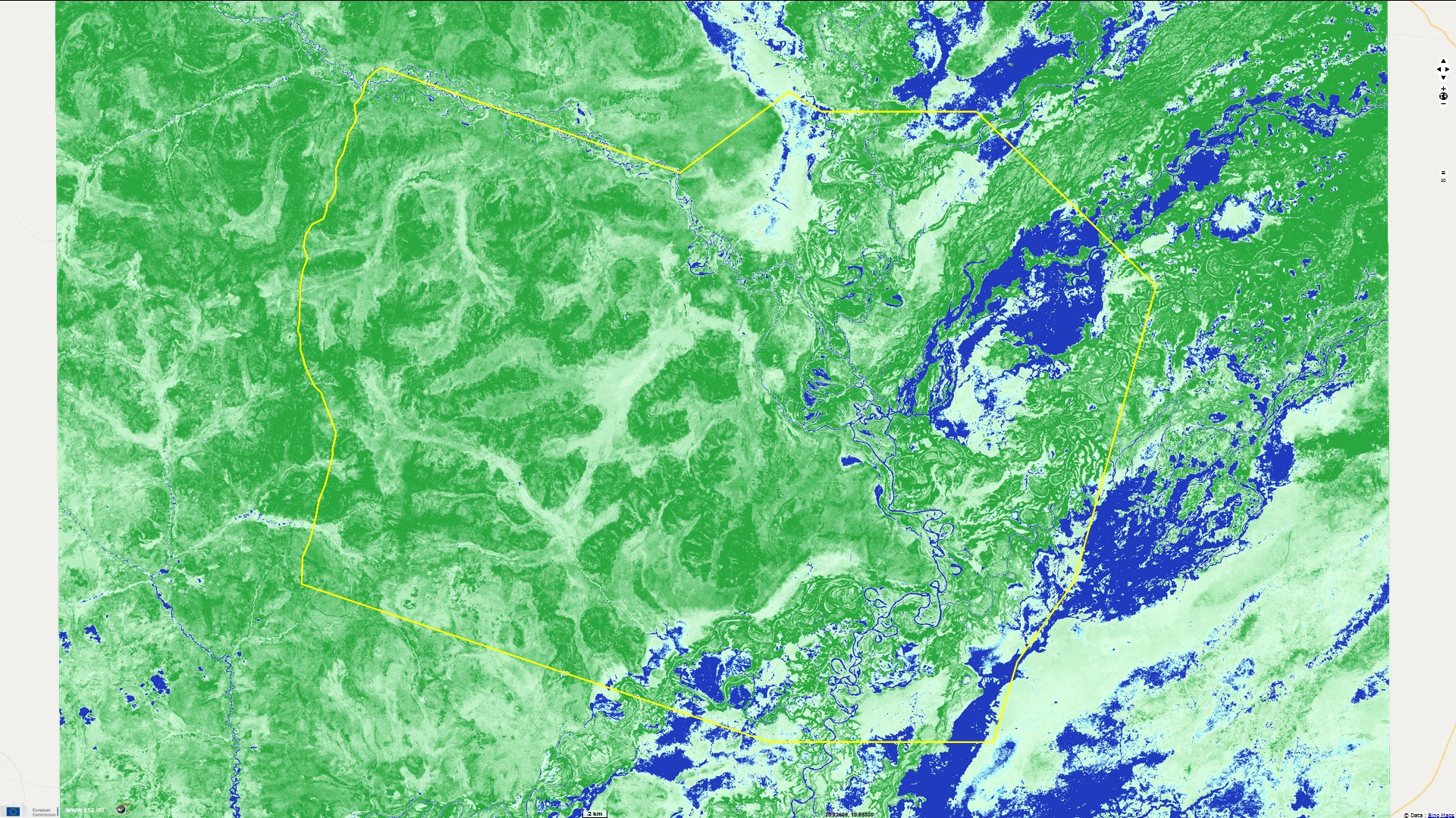
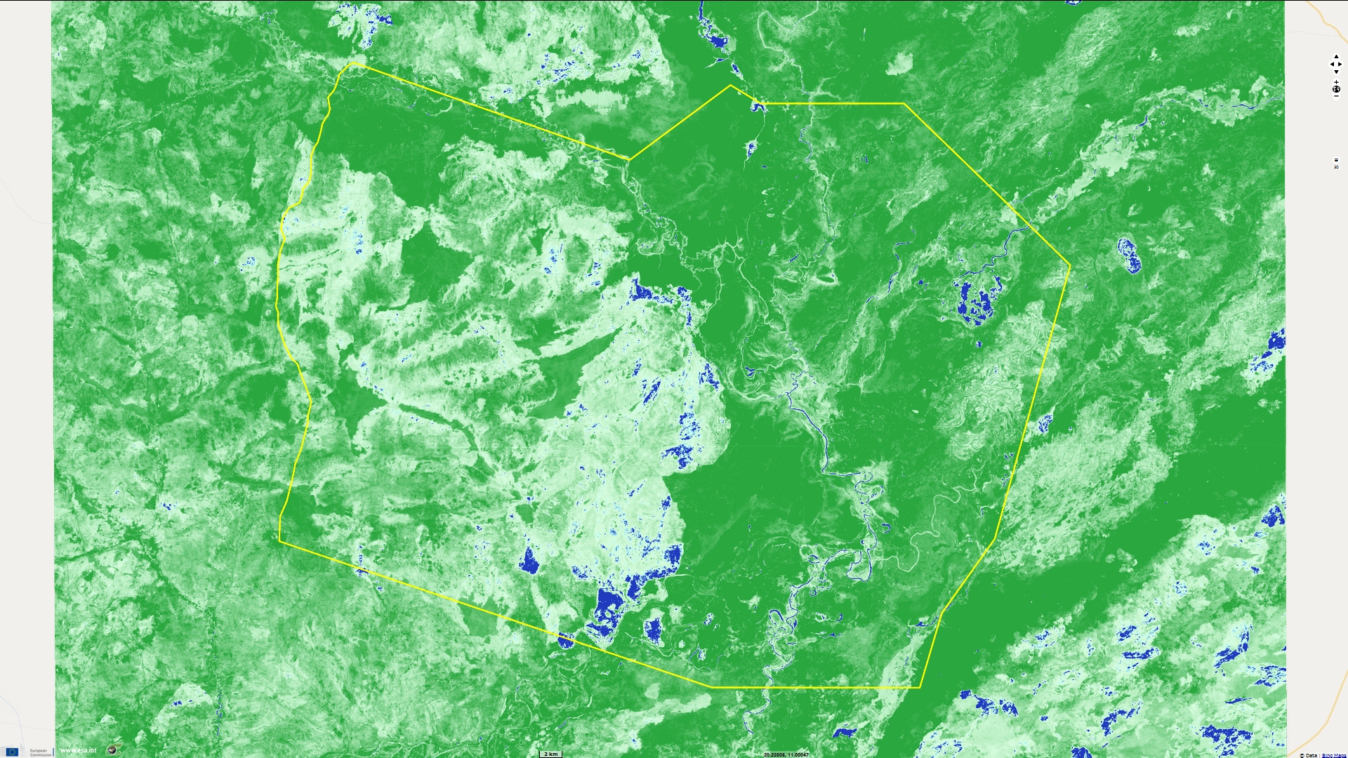
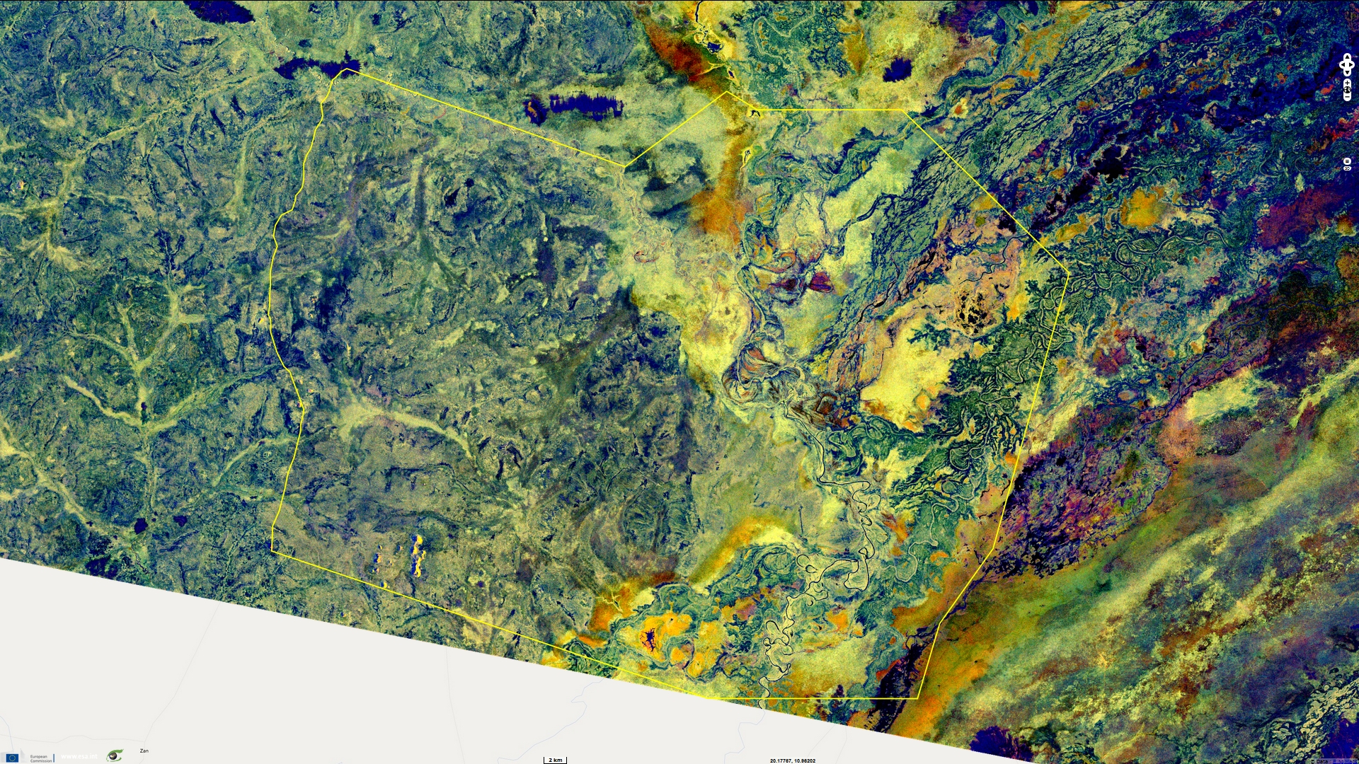
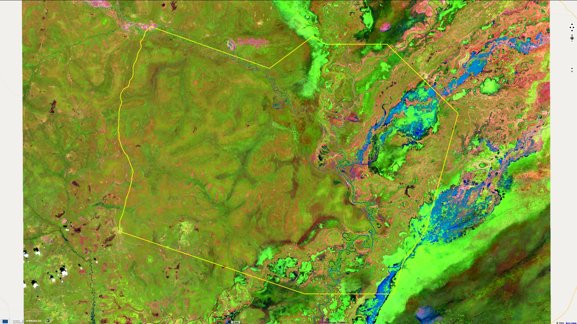
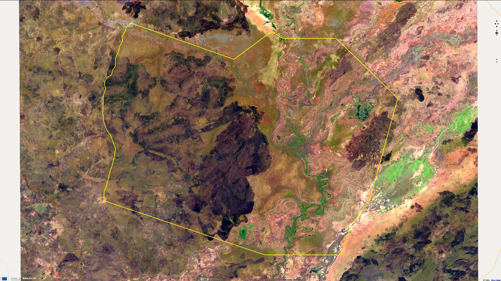
The contrast between the wet and dry seasons in the National Park of Zakouma is so extreme as showen by figures 5 and 6.
Figures 7 and 8 show the output of a study performed by VisioTerra aiming to monitor water resources in the National Park of Zakouma from satellite data. This study was carried out over one year: from August 2019 to August 2020. The images used come from two missions of the European Space Agency: Sentinel-1 and Sentinel-2.
Figure 7 shows the surface water points while Figure 8 shows the persistant vegetation between wet and dry seasons. The persistant vegetation may be an index of presence of sub-surface water.
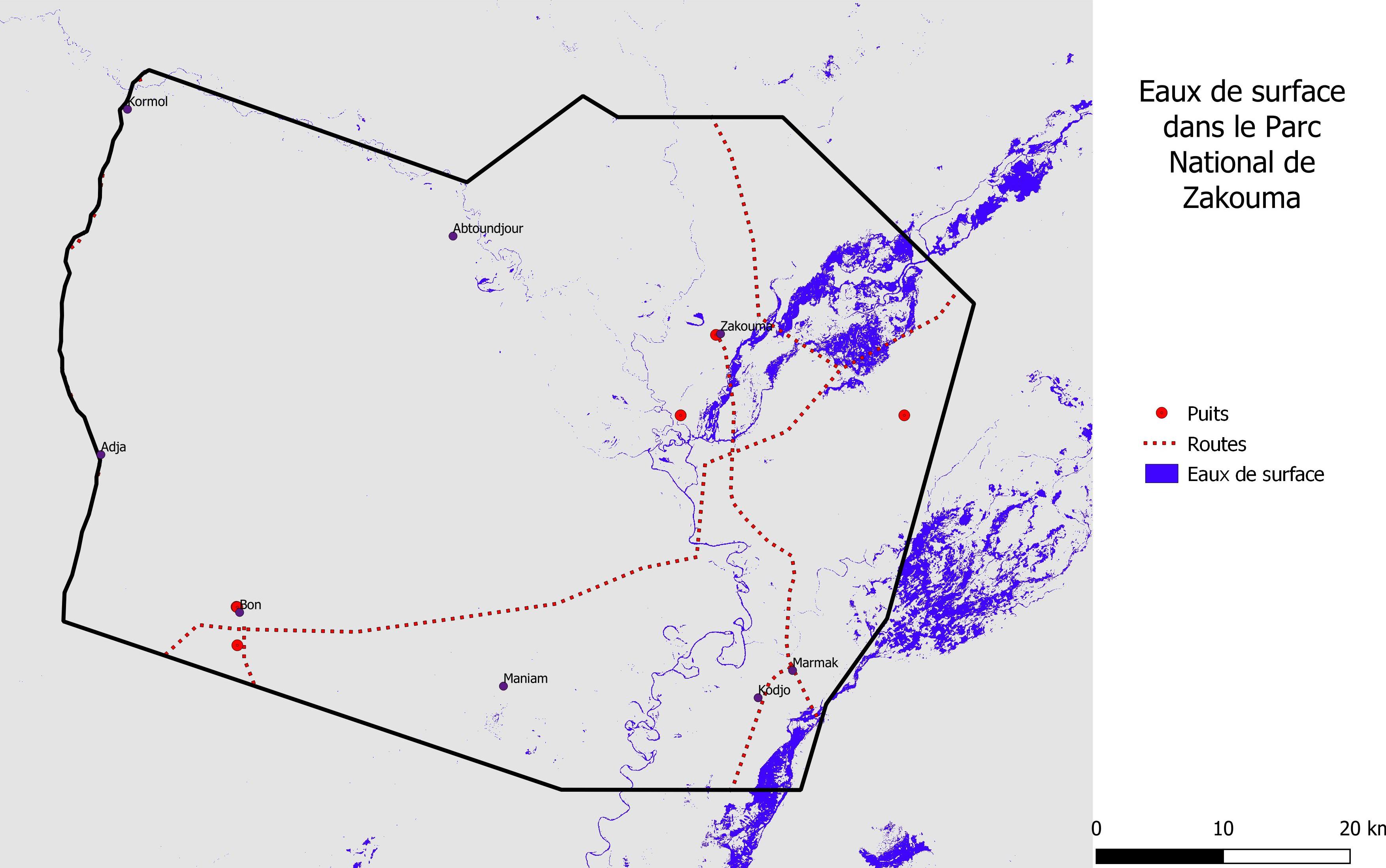
Surface water in the National Park of Zakouma - Source: VisioTerra
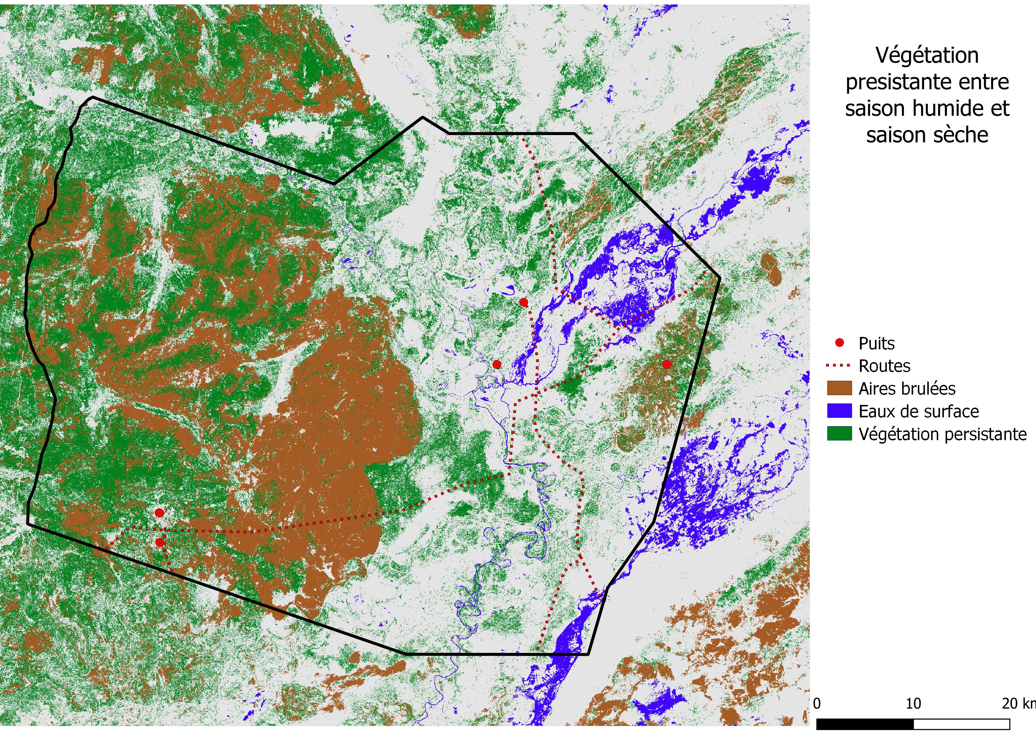
Persistant vegetation between wet and dry seasons in the National Park of Zakouma - Source: VisioTerra
The views expressed herein can in no way be taken to reflect the official opinion of the European Space Agency or the European Union.
Contains modified Copernicus Sentinel data 2026, processed by VisioTerra.
Contains modified Copernicus Sentinel data 2026, processed by VisioTerra.
| More on European Commission space: |  |
 |
 |
||||
| More on ESA: | |
|
|
S-1 website | S-2 website | S-3 website | |
| More on Copernicus program: | |
|
|
Scihub portal | Cophub portal | Inthub portal | Colhub portal |
| More on VisioTerra: | |
|
|
Sentinel Vision Portal | Envisat+ERS portal | Swarm+GOCE portal | CryoSat portal |