Oil vs wildlife in National Petroleum Reserve in Alaska
Sentinel-3 OLCI FR acquired on 13 July 2016 at 20:57:38 UTC
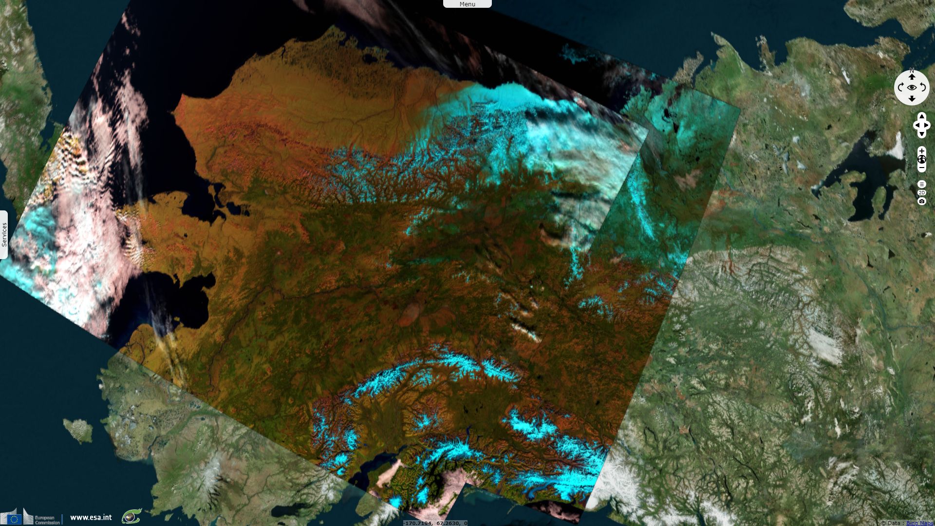
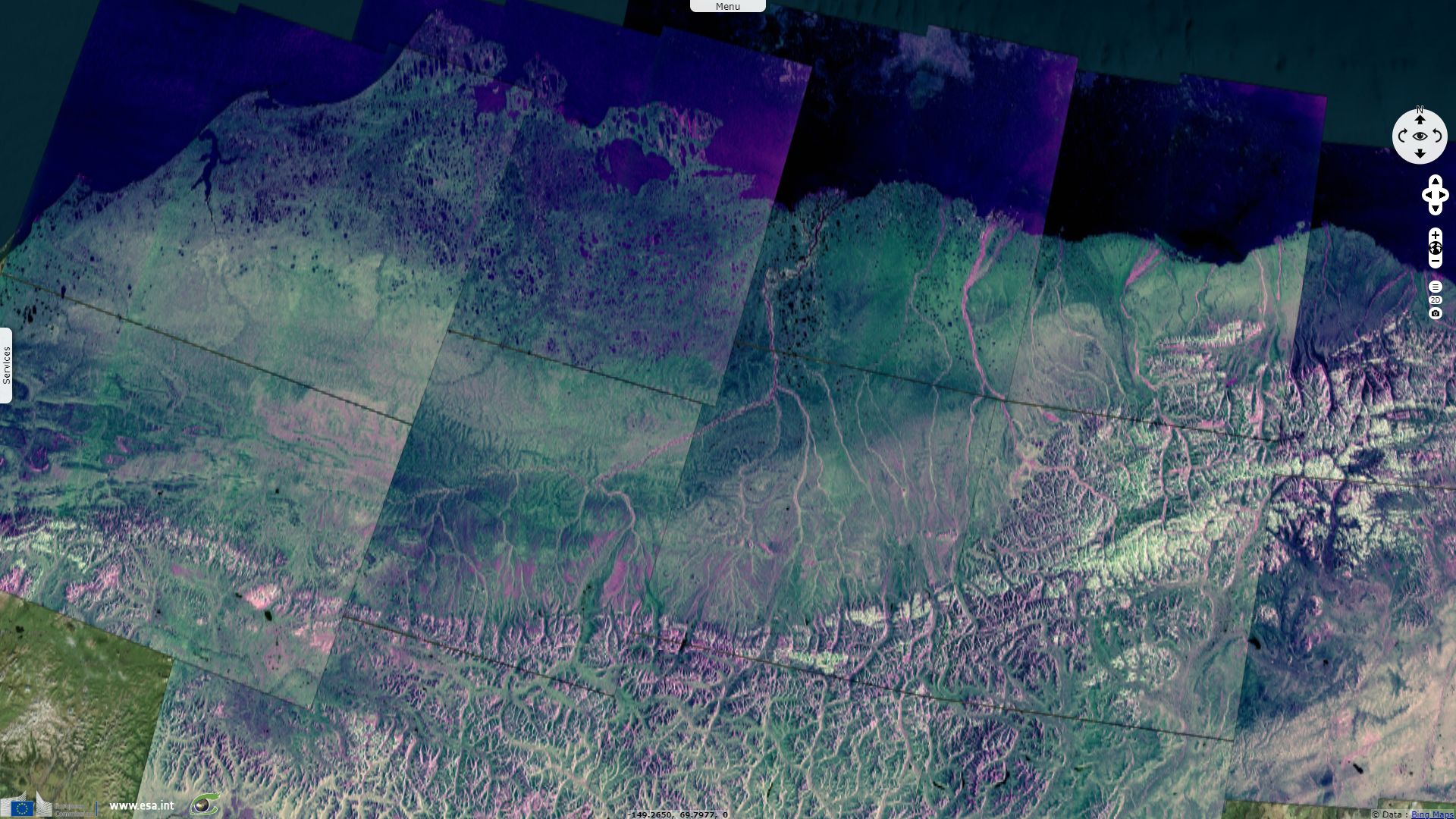
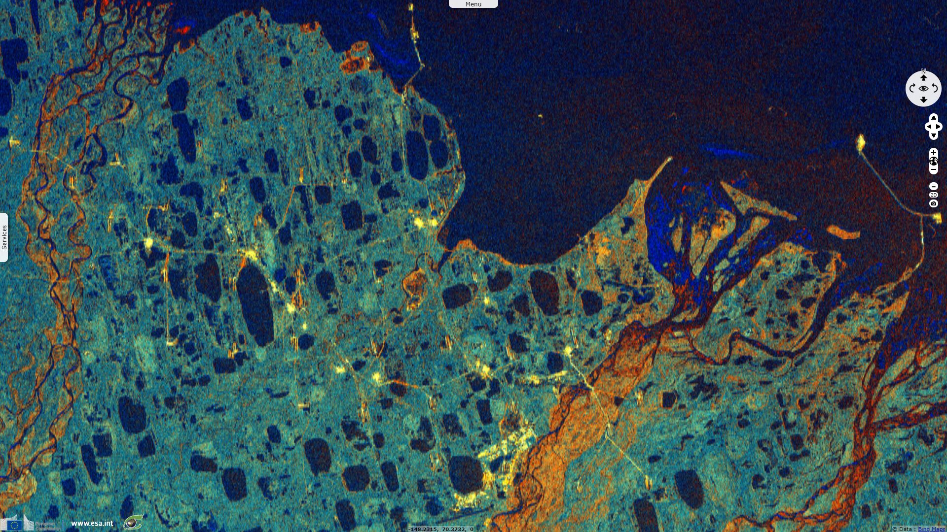
Sentinel-1 CSAR IW acquired on 28 August 2018 from 16:43:09 to 16:44:03 UTC
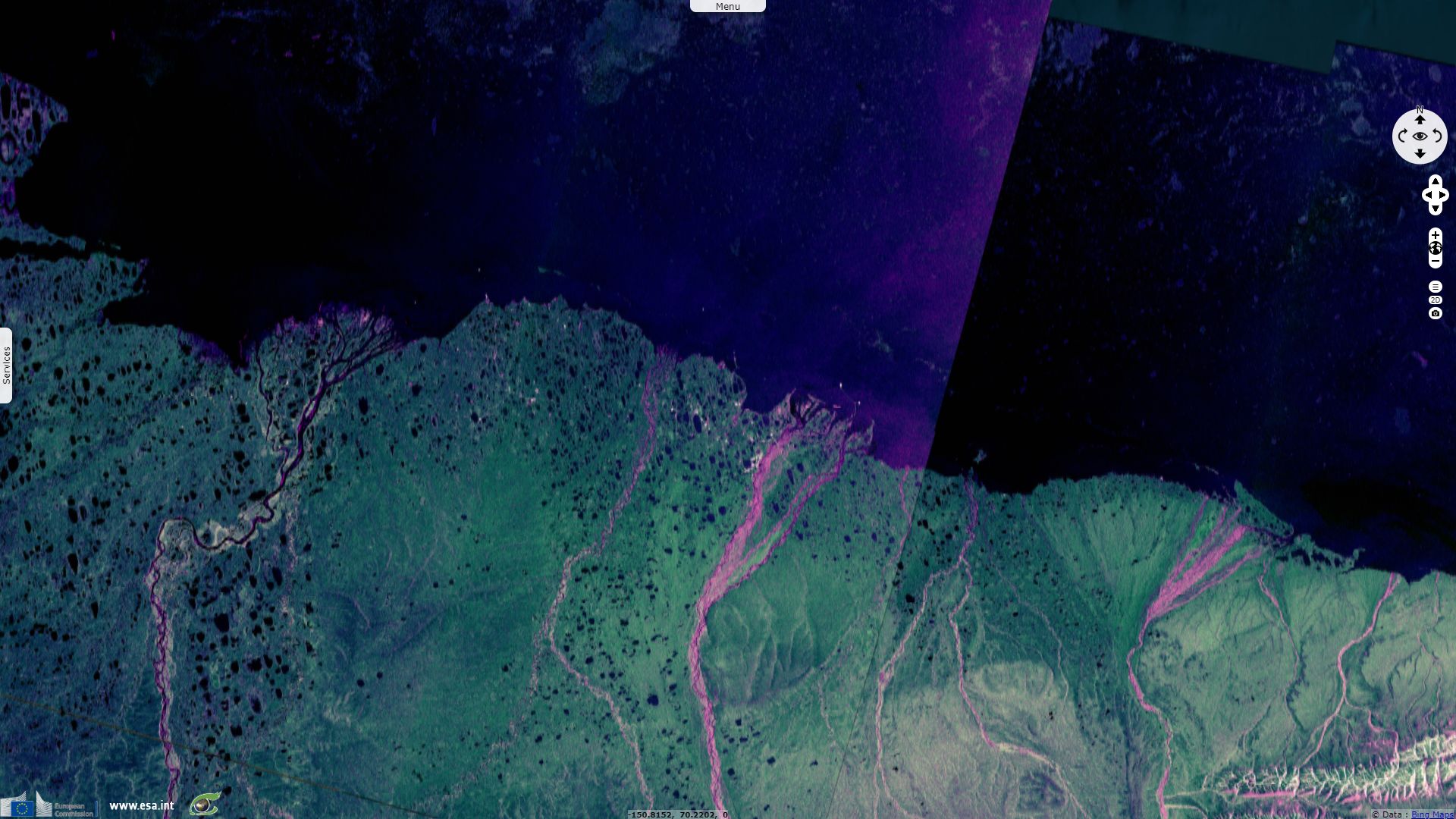
Sentinel-1 CSAR IW acquired on 30 August 2018 from 16:26:47 to 16:27:41 UTC
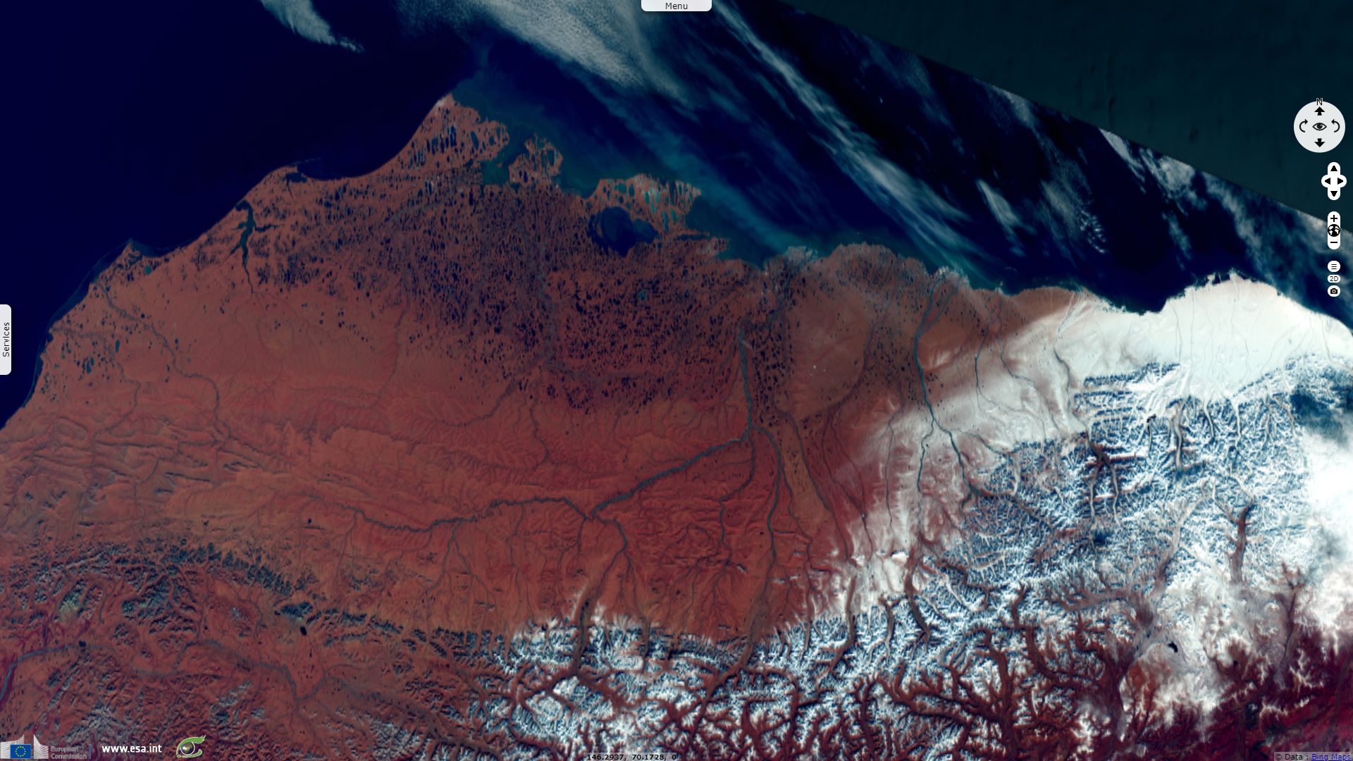
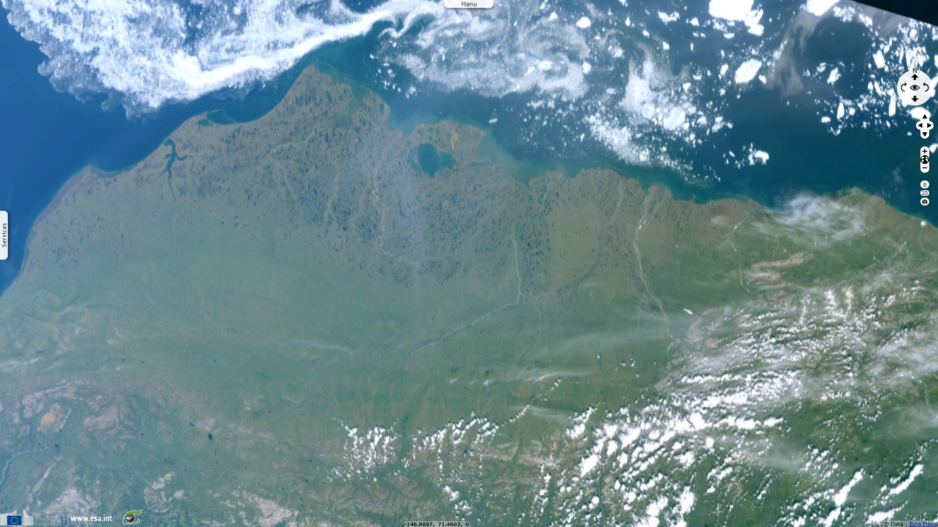
Sentinel-2 MSI acquired on 19 September 2018 at 22:05:31 UTC
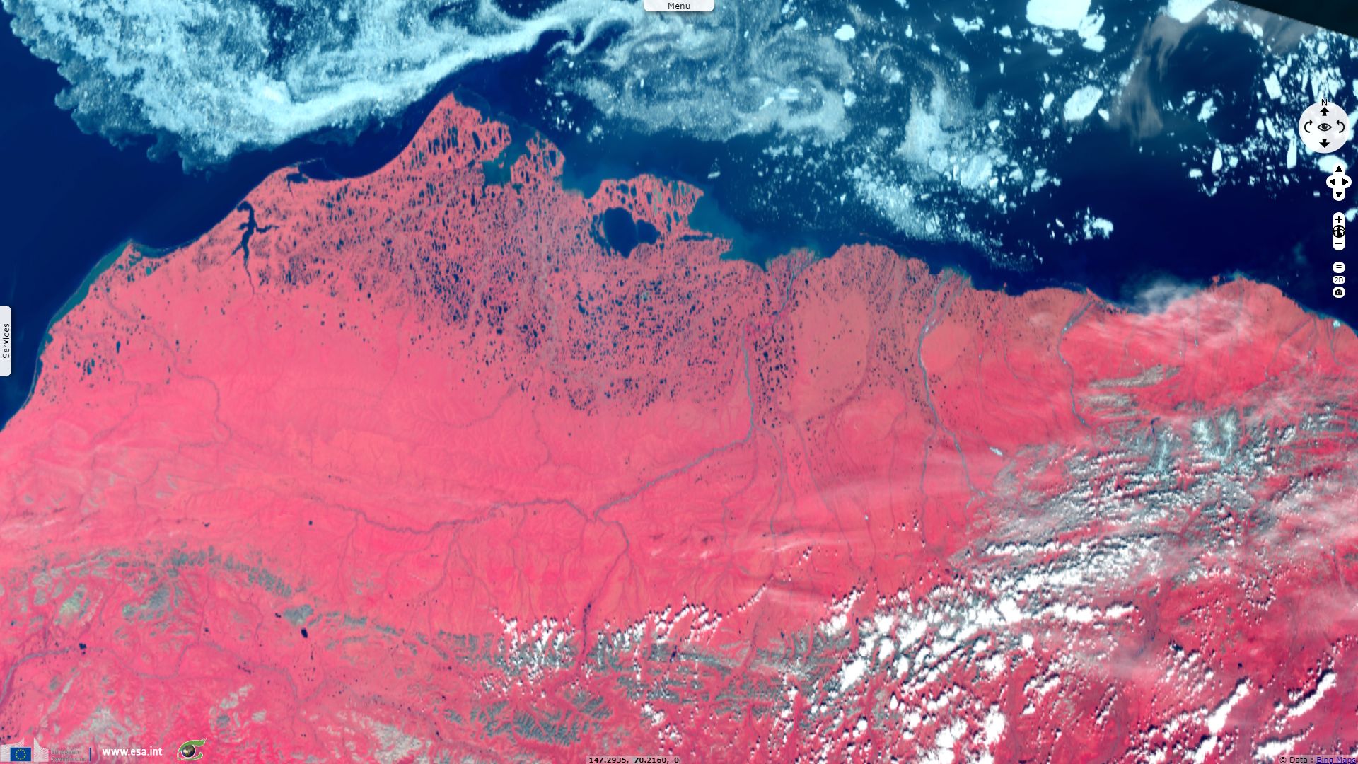
Sentinel-3 SLSTR RBT & OLCI FR acquired on 30 September 2018 at 21:24:00 UTC
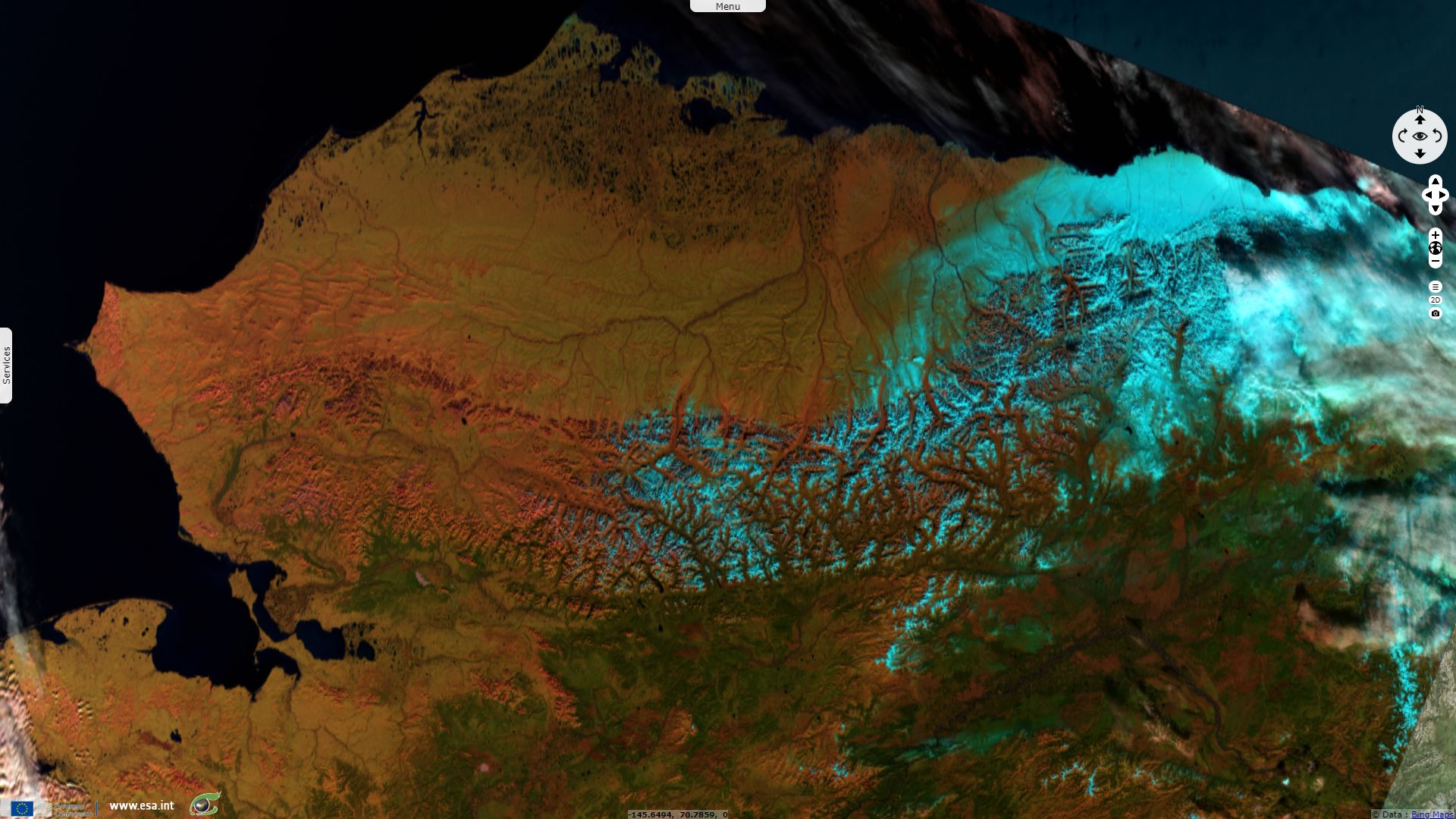
Sentinel-1 CSAR IW acquired on 28 August 2018 from 16:43:09 to 16:44:03 UTC
Sentinel-1 CSAR IW acquired on 30 August 2018 from 16:26:47 to 16:27:41 UTC
Sentinel-2 MSI acquired on 19 September 2018 at 22:05:31 UTC
Sentinel-3 SLSTR RBT & OLCI FR acquired on 30 September 2018 at 21:24:00 UTC
Keyword(s): Polar, cryosphere, coastal, wetland, lakes, mountain range, tundra, biodiversity, natural resources, energy, Canada, Arctic Ocean
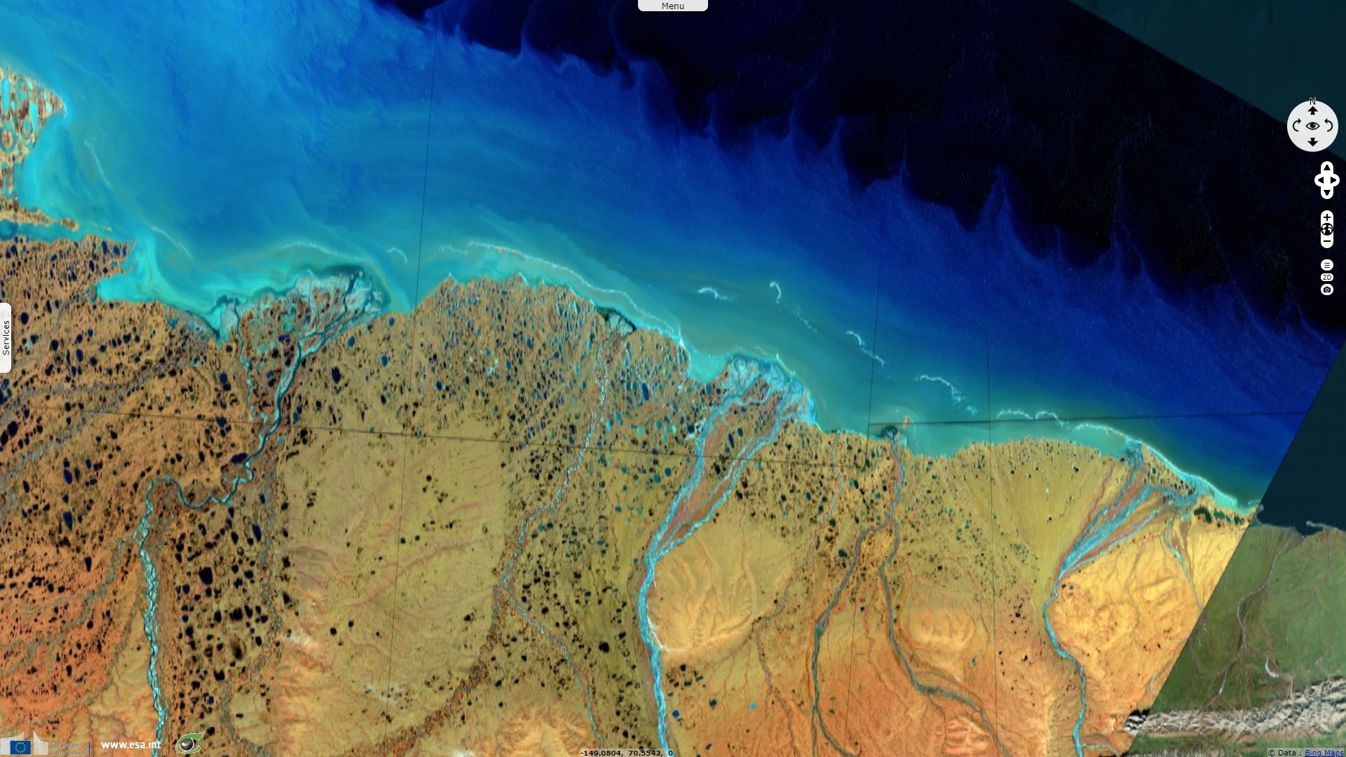
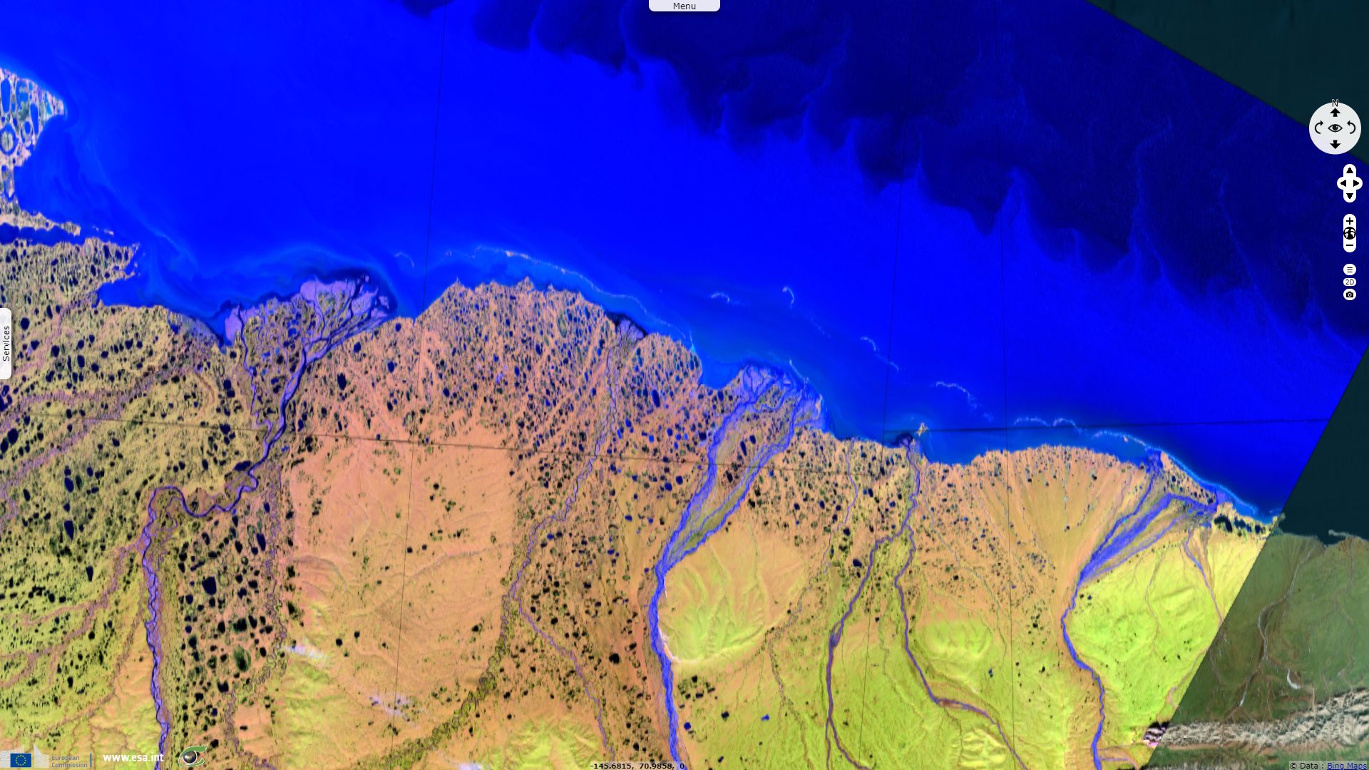
The Brooks range in far northern North America that separates the North Slope of Alaska and Yukon from the rest of the continent. It forms an mountain arc 1100 km long and 240 km wide. Peter Canby wrote in The Specter Haunting Alaska: "The Brooks Range effectively forms Alaska’s tree line and its rivers drain northward down onto a vast tundra plain dominated by a cotton grass that is the favorite food of the millions of caribou that migrate to the region during the summer months." The Brooks Range forms the northernmost drainage divide in North America, separating streams flowing into the Arctic Ocean and the North Pacific. The range roughly delineates the summer position of the Arctic front.
"The Alaska North Slope is the region of the U.S. state of Alaska located on the northern slope of the Brooks Range along the coast of two marginal seas of the Arctic Ocean, the Chukchi Sea being on the western side of Point Barrow, and the Beaufort Sea on the eastern." "The North Slope is huge —[230 000 km²], slightly larger than the state of Minnesota— but in many ways it’s a world apart, even from the rest of Alaska.", wrote Peter Canby. "One of the curiosities of the North Slope is that even though it receives only between five and eight inches of rain a year (similar to some deserts in the Southwest), the underlying permafrost can’t be penetrated by water and the surface remains constantly saturated."
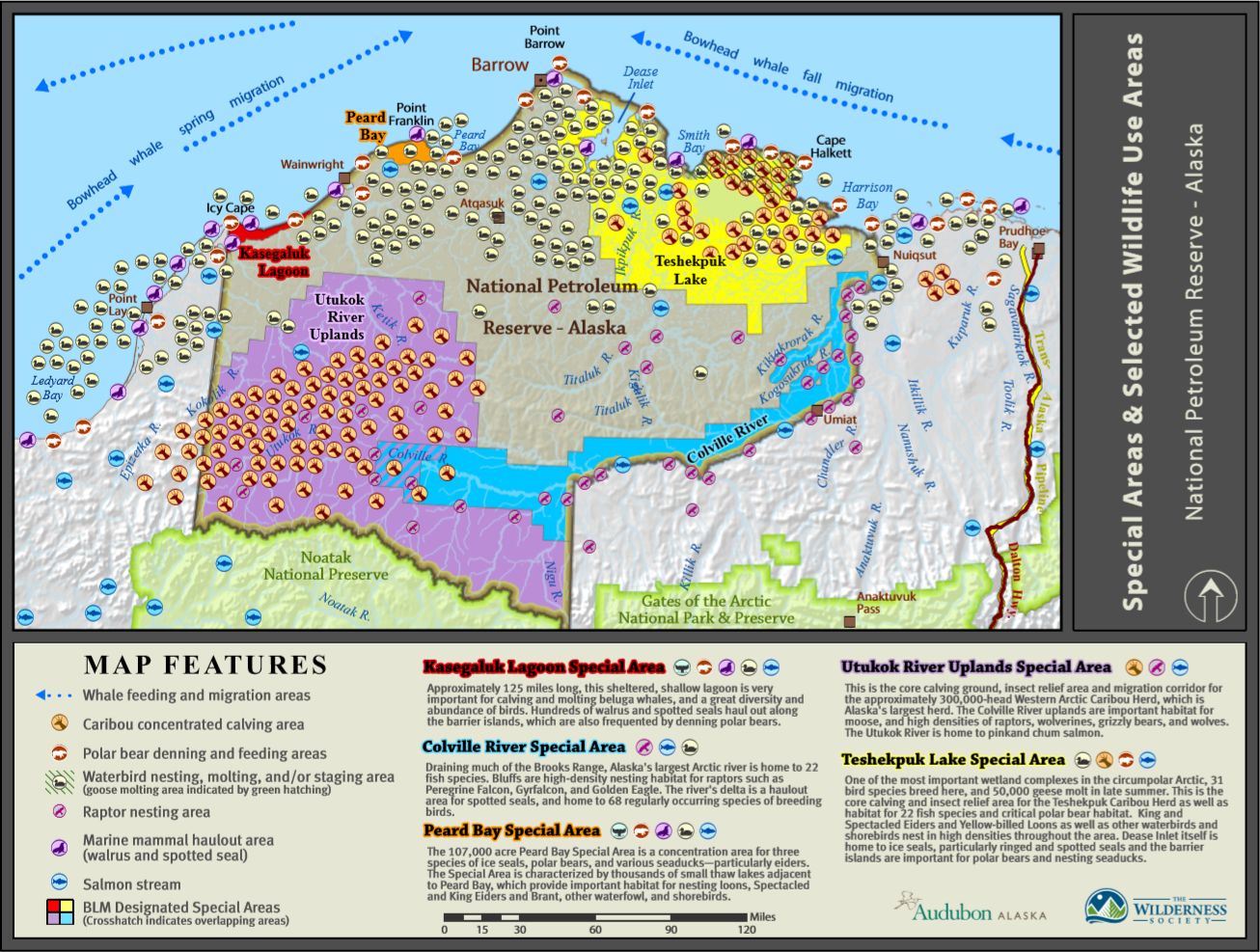
National Petroleum Reserve in Alaska - Source: Audubon Alaska
Encompassed in the Alaska North Slope, the National Petroleum Reserve in Alaska (NPRA) is an area of land on the Alaska North Slope owned by the United States federal government and managed by the Department of the Interior, Bureau of Land Management. It lies to the west of the Arctic National Wildlife Refuge. Long managed as a wilderness area, it is its oil potential that caused its designation as a special area. An assessment by the United States Geological Survey (USGS) in 2010 estimated that the amount of oil yet to be discovered in the NPRA is approximately 896 million barrels of conventional oil. The estimates of the amount of undiscovered natural gas in the region was estimated around 1500 km3 in the 2010 survey.
Several special areas have been designated in the National Petroleum Reserve in Alaska. At south-east of the reserve are Utukok River Uplands, the bird conservation National Audubon Society introduces the area: "These higher elevation foothills and uplands are the headwaters for the Utukok River as well as the Meade and Colville rivers. This excellent wolverine habitat has one of the highest densities of this hard-to-find species anywhere. The area is the primary calving ground for the Western Arctic Caribou Herd, Alaska's largest caribou herd, currently numbering about 490 000 animals. This area is also home to unusually large populations of wolves, wolverine, and grizzly bears. The uplands are also inhabited by moose, raptors, and anadromous fish."
At north, eastward from Icy Cape is Kasegaluk Lagoon: "a highly productive shallow coastal lagoon and barrier island system spanning 125 miles of the Chukchi Sea coast. This is a very important area for coastal marine mammals and nesting, staging, and migrating waterbirds. Belugas whales calve and molt in the lagoon, and up to 35 000 walrus haul out near Point Lay."
Further norther-east around Point Franklin: "Peard Bay and the surrounding wetland complex is a concentration area for three species of ice seals, polar bears, and various seaducks—particularly eiders. The habitat adjacent to Peard Bay is characterized by thousands of small thaw lakes, which provide important habitat for nesting loons, waterfowl, and shorebirds."
Following the coast to the east, lies Teshekpuk Lake around which most of the oil is supposed to be located. It is another special area: "The Teshekpuk Lake region is a globally significant Important Bird Area for its very high density of many bird species of concern, such as Spectacled, Steller’s, and King eiders; Yellow-billed and Red-throated loons; and Black Brant. The Teshekpuk Wetlands are the most significant goose molting area in the circumpolar Arctic and are used by up to 30 percent of the Brant population in the Pacific Flyway. The 67 000-animal Teshekpuk Caribou Herd migrates to this area each year to calve their young and forage on abundant sedges. A several-mile-wide coastal band is designated critical habitat for denning polar bears."
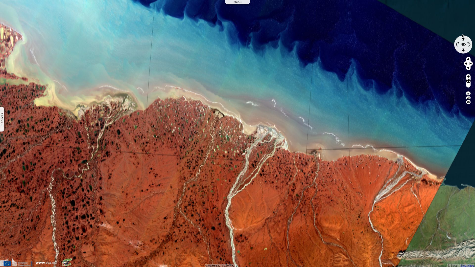
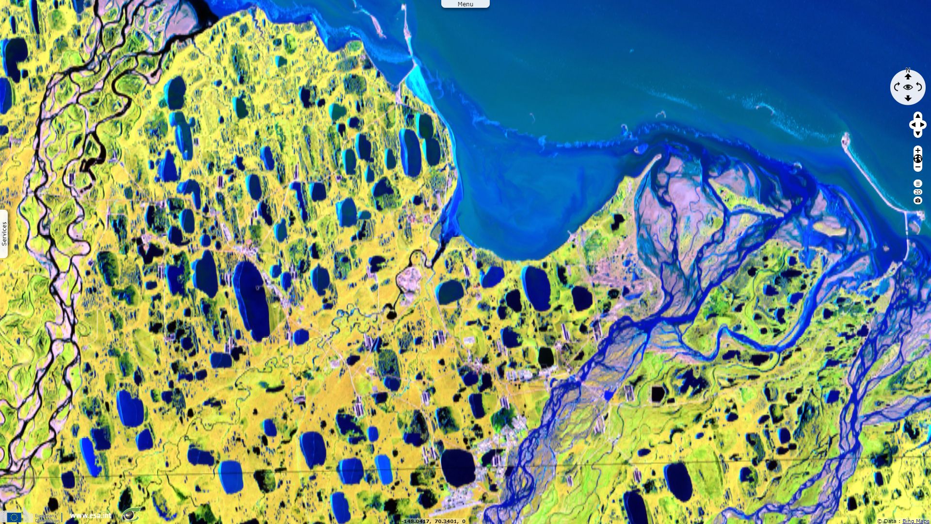
Finally, not far east toward Prudhoe bay and its pipeline, one has to cross Colville River and its delta: "The Colville River begins at headwaters in the Brooks Range and ends over 300 miles downstream in a massive alluvial fan and delta plain fingering out toward the Beaufort Sea. The river itself marks an invisible but important boundary: a transition from the developed State of Alaska oil production lands to the federal NPRA which is just beginning to see its first oil production footprint. Known for its high density of raptors, the exposed Lower Cretaceous cliff banks of the Colville are tenanted by nesting peregrine falcons, golden eagles, rough-legged hawks, and gyrfalcons. The delta is a globally recognized Important Bird Area where a world-class gathering of shorebirds and waterfowl raise their chicks. Black brant, Steller’s eiders, stilt sandpipers, and over 60 other species breed there. Arctic foxes, musk oxen, wolves, caribou, and the occasional land-locked polar bear wander through the Delta."
In an article written in July 2010 for National Geographic, Molly Loomis put in perspective the conflict between energy development and conservation in National Petroleum Reserve: "President Warren Harding established the 93 000 square kilometers National Petroleum Reserve-Alaska (NPR-A) in 1923, intending that it would serve as an emergency oil supply for the U.S. Navy. But environmentalists have long sought protection for the rich diversity of life in and around Teshekpuk Lake, and the job of balancing both energy and environmental imperatives was put into BLM’s hands by Congress in 1976. The agency designated the lake a 'special area' and it was left undeveloped even after the BLM began a series of lease sales in 1999."
"The U.S. Department of the Interior’s Bureau of Land Management (BLM) is set to conduct a lease sale on August 11 of about 7284 km² of oil and natural gas parcels in the northeast section of the reserve—but the plan protects from development 688 km² of critical habitat in buffer zones south of the biologically rich Teshekpuk Lake."
"But in 2006, during President George W. Bush’s administration, the BLM initiated an oil and gas lease sale that would take in much of the protected Teshekpuk area, except for the lakebed itself and associated islands. The move alarmed environmentalists and scientists." "A lawsuit filed by conservation groups—arguing the environmental impact analysis had been incomplete—halted the proposed 2006 lease sale. And indeed, after further court-ordered study, the BLM agreed to greater protection, filing an amended environmental impact statement in the final year of the Bush administration that deferred leasing for ten years in the 1740 km² north and east of Teshekpuk Lake. But the fate of the area south of the lake was unsure until the July 9 announcement that the first NPR-A lease sale of President Barack Obama’s administration would keep it off limits—at least for now."
"But Eric Myers, policy director for Audubon Alaska, says he believes the decision shows both energy and environmental concerns were weighed. His group and seven other conservation groups had submitted a letter of concern to the Obama administration’s BLM after an early draft map made the protected area unclear; they said that the entirety of the caribou calving grounds should be kept free of development. 'I greatly appreciated the fact that they had taken these concerns into account,' says Myers. He saw 'a serious reflection of the issues that had been raised and a willingness to balance the decision.'"
Issued in 2010, the 10-years moratorium on leasing in this area should thus expire next year, possibly jeopardizing the fate of the wildlife if unrestricted oil exploration was to be allowed.
The views expressed herein can in no way be taken to reflect the official opinion of the European Space Agency or the European Union.
Contains modified Copernicus Sentinel data 2026, processed by VisioTerra.
Contains modified Copernicus Sentinel data 2026, processed by VisioTerra.
| More on European Commission space: |  |
 |
 |
||||
| More on ESA: | |
|
|
S-1 website | S-2 website | S-3 website | |
| More on Copernicus program: | |
|
|
Scihub portal | Cophub portal | Inthub portal | Colhub portal |
| More on VisioTerra: | |
|
|
Sentinel Vision Portal | Envisat+ERS portal | Swarm+GOCE portal | CryoSat portal |