The Siliguri Corridor, the bottleneck of north-east India
Sentinel-3 SLSTR RBT & OLCI FR acquired on 09 November 2020 at 04:18:03 UTC
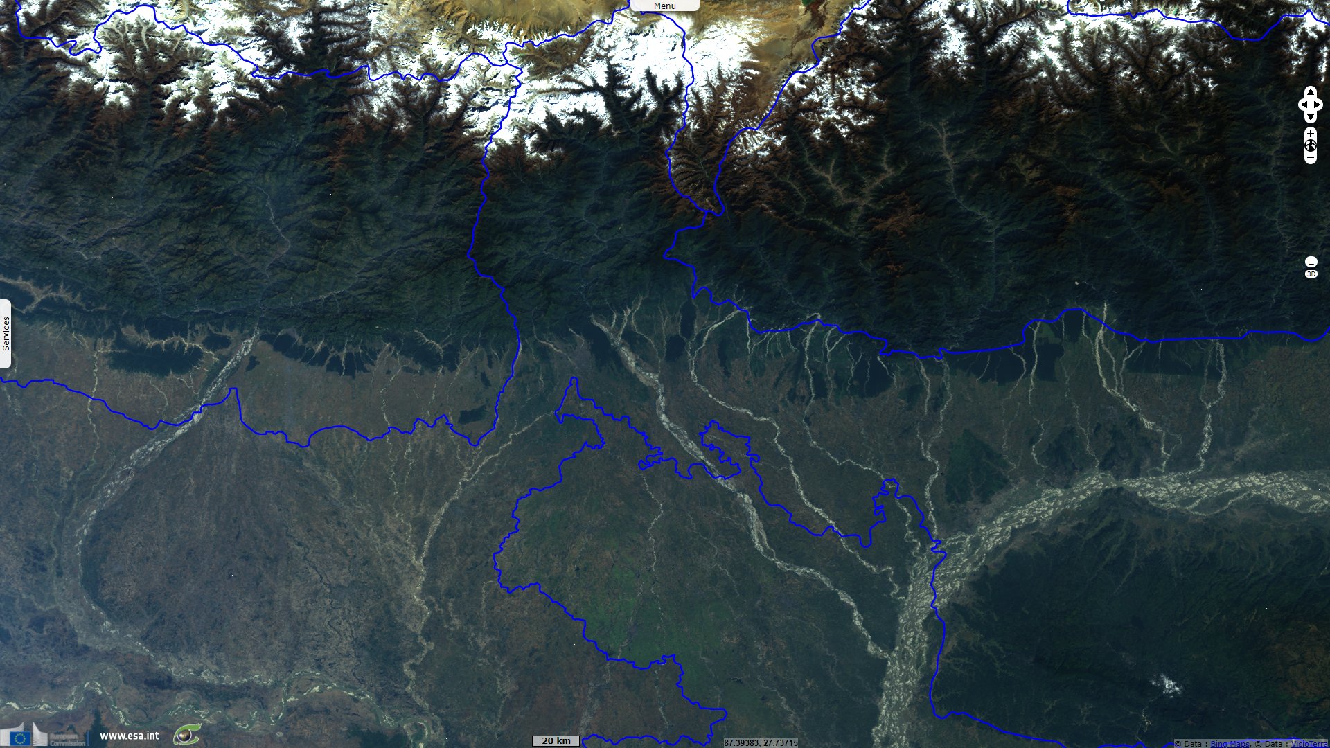
Sentinel-1 CSAR IW acquired on 26 October 2021 from 23:55:10 to 23:55:35 UTC
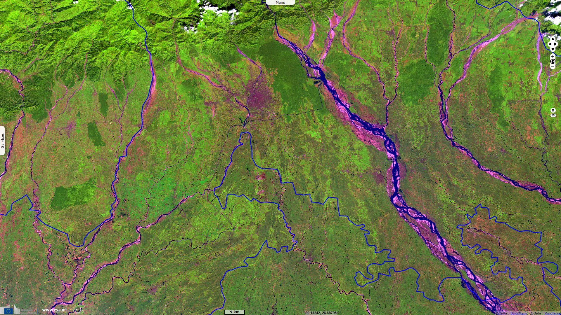
Sentinel-2 MSI acquired on 31 October 2021 at 04:39:31 UTC
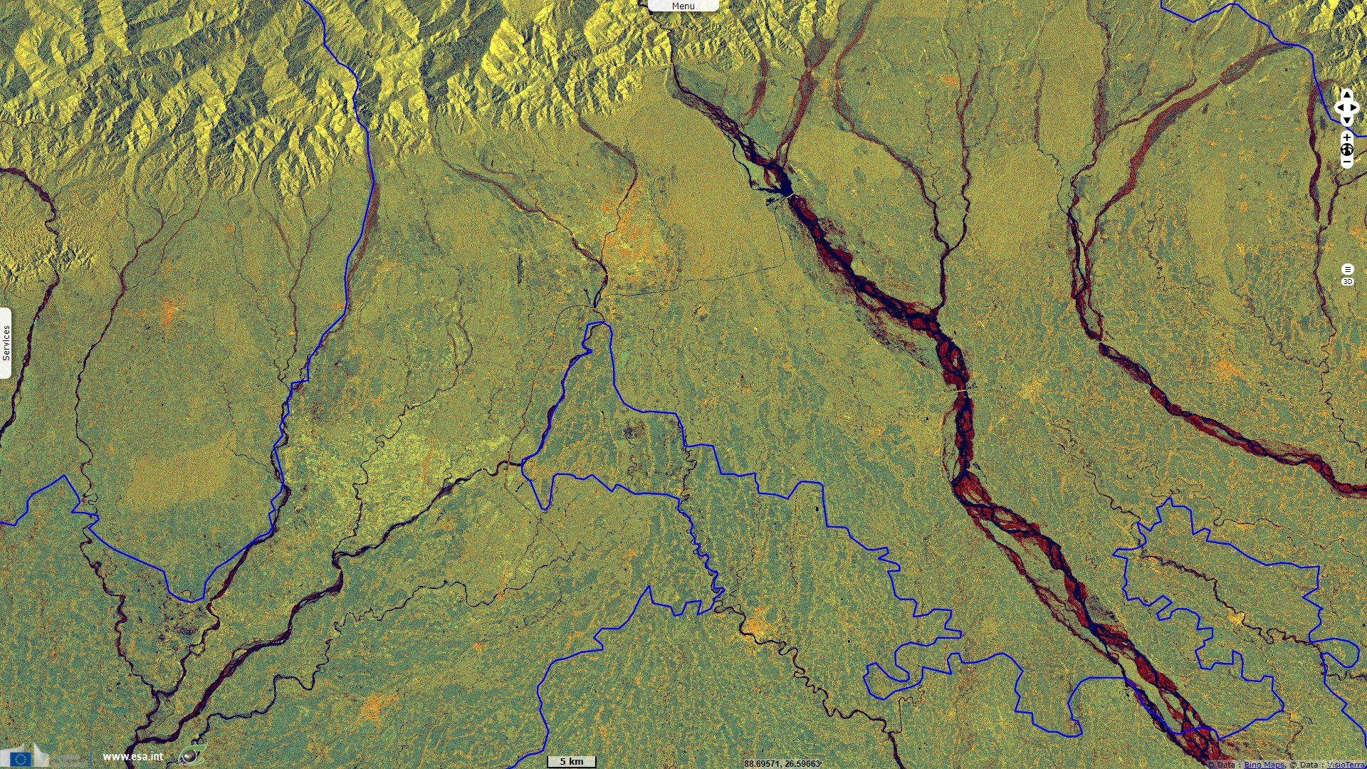
Sentinel-1 CSAR IW acquired on 01 November 2021 from 00:03:17 to 00:03:42 UTC
Sentinel-1 CSAR IW acquired on 26 October 2021 from 23:55:10 to 23:55:35 UTC
Sentinel-2 MSI acquired on 31 October 2021 at 04:39:31 UTC
Sentinel-1 CSAR IW acquired on 01 November 2021 from 00:03:17 to 00:03:42 UTC
Keyword(s): Transport, security, India, Bangladesh, Nepal, Bhoutan, China
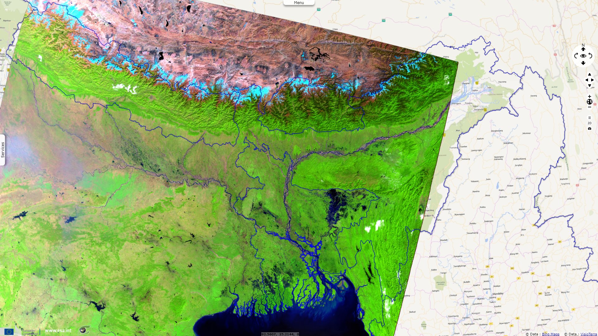
Wedged between Bangladesh to the south and west and China to the north, East India has no access to the sea closer than Kolkata, on the other side of the corridor.
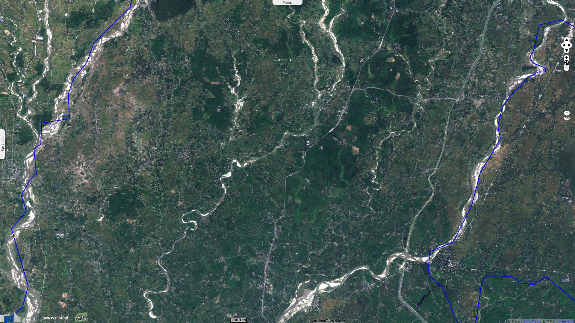
A Chinese military advance of less than 130 km would cut off Bhutan, part of West Bengal and all of North-East India, an area containing almost 50 million people. This situation arose during the war between India and China in 1962
The views expressed herein can in no way be taken to reflect the official opinion of the European Space Agency or the European Union.
Contains modified Copernicus Sentinel data 2026, processed by VisioTerra.
Contains modified Copernicus Sentinel data 2026, processed by VisioTerra.
| More on European Commission space: |  |
 |
 |
||||
| More on ESA: | |
|
|
S-1 website | S-2 website | S-3 website | |
| More on Copernicus program: | |
|
|
Scihub portal | Cophub portal | Inthub portal | Colhub portal |
| More on VisioTerra: | |
|
|
Sentinel Vision Portal | Envisat+ERS portal | Swarm+GOCE portal | CryoSat portal |