Geology field trip to Lake District national park, UK
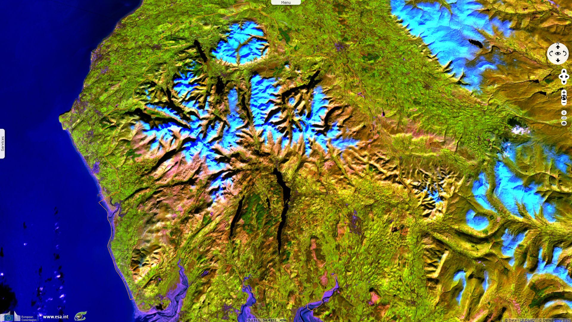
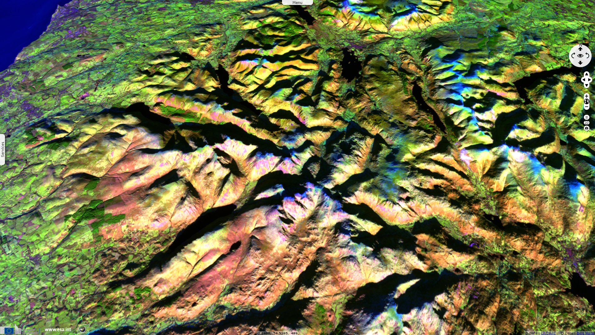
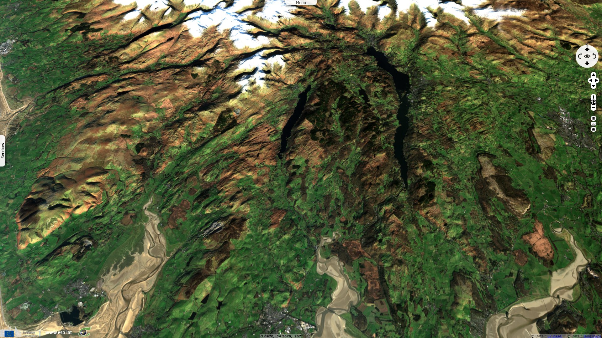
Sentinel-2 MSI acquired on 28 January 2019 at 11:33:31 UTC
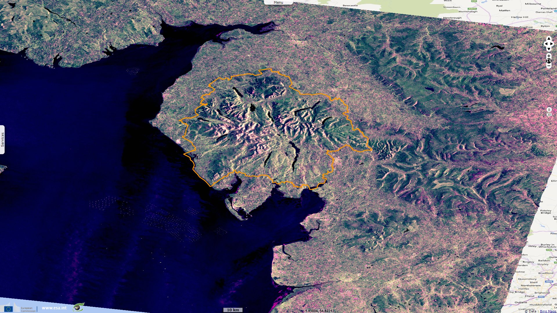
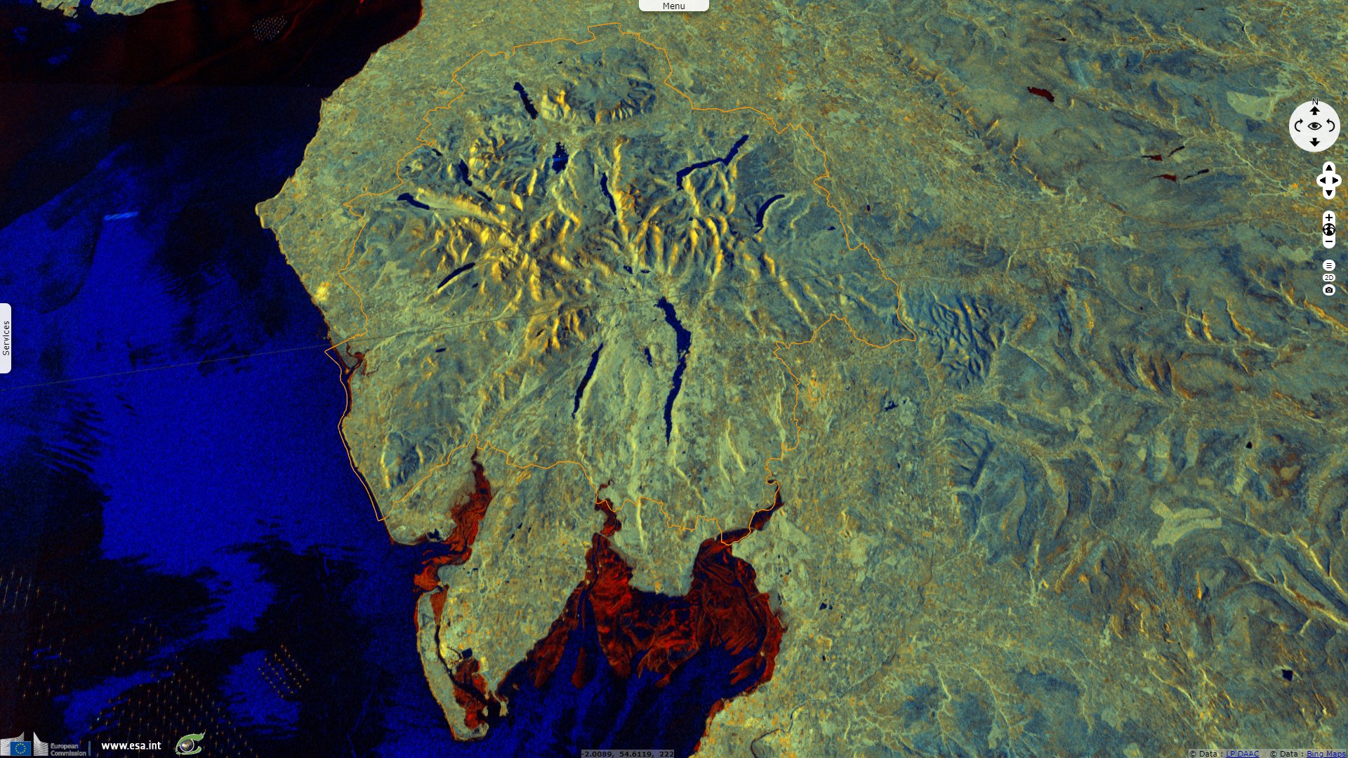
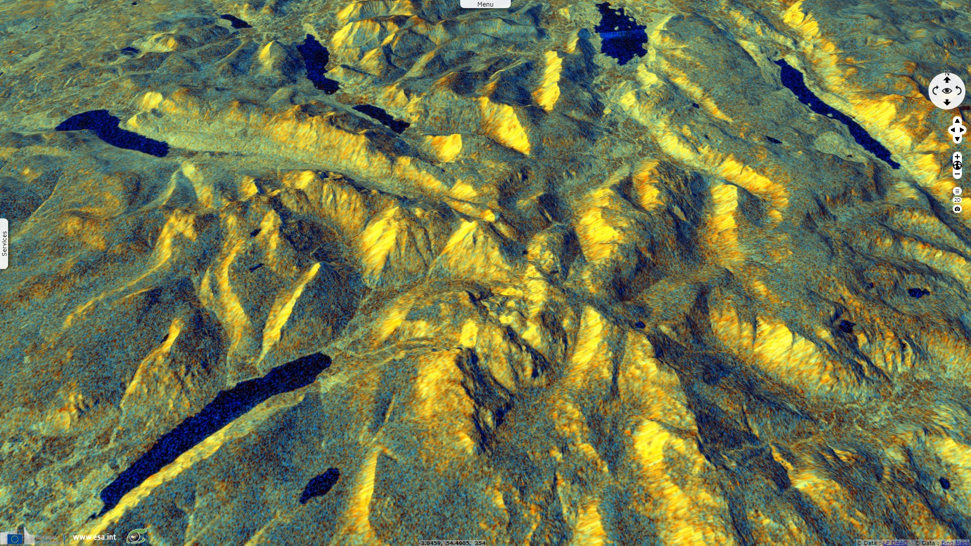
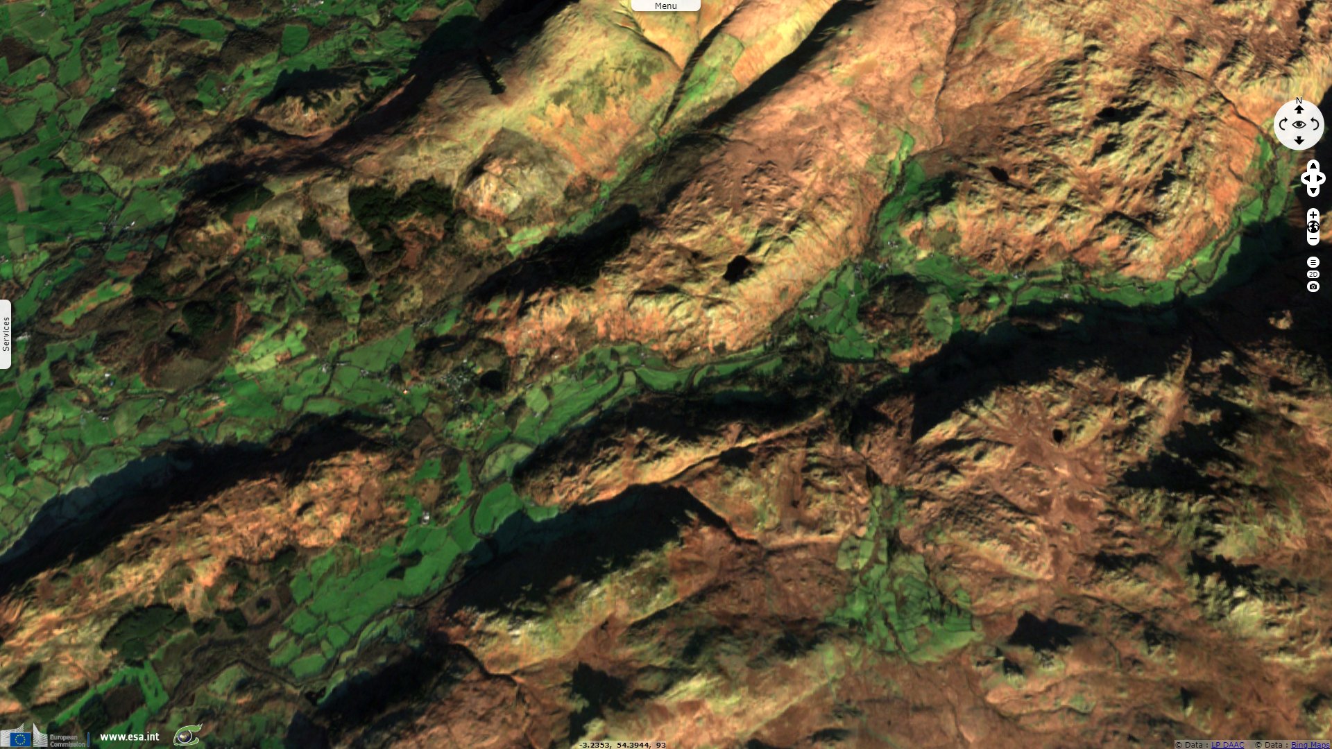
Sentinel-1 CSAR IW acquired on 09 August 2019 at 06:21:46 UTC
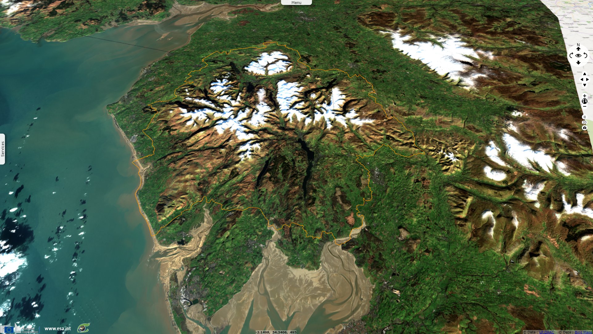
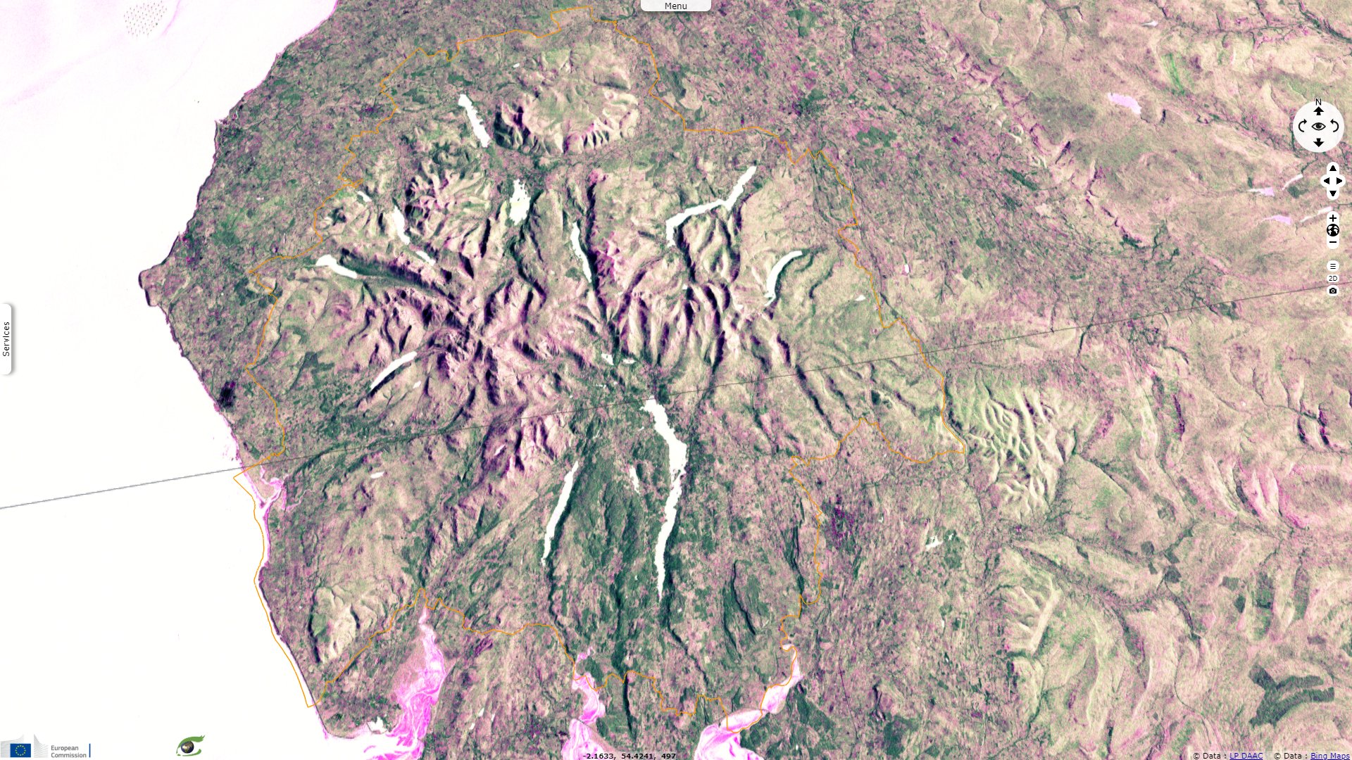
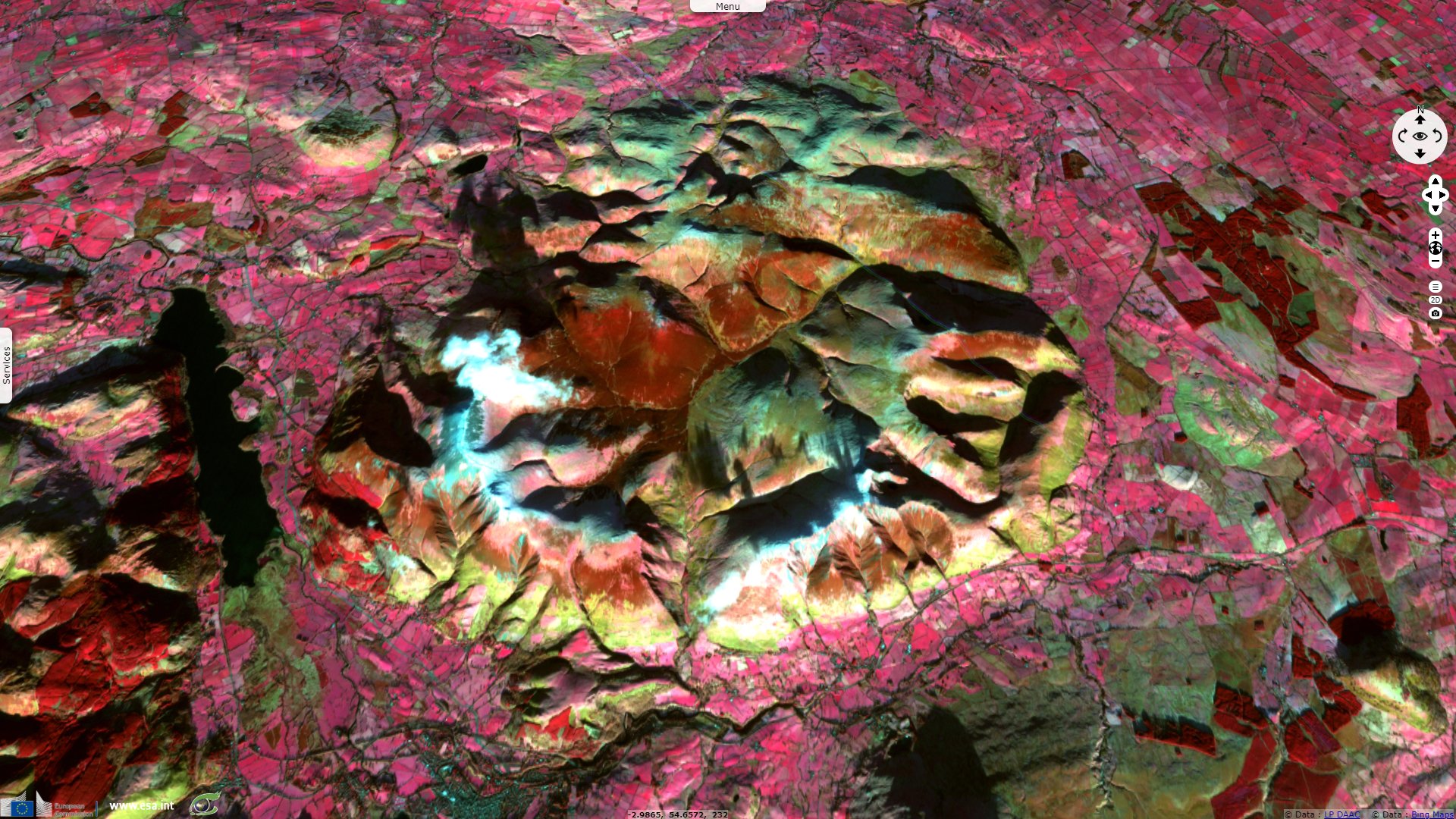
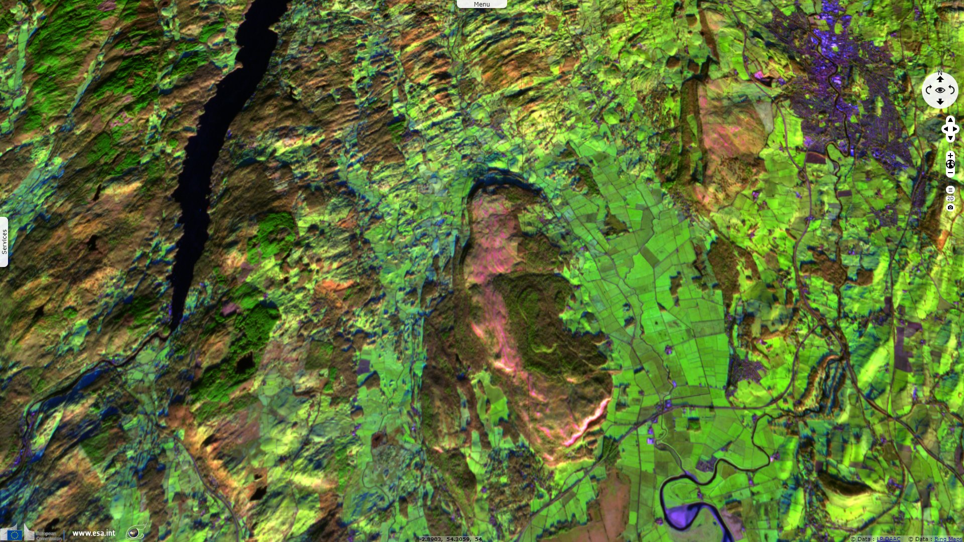
Sentinel-2 MSI acquired on 29 November 2019 at 11:33:29 UTC
...
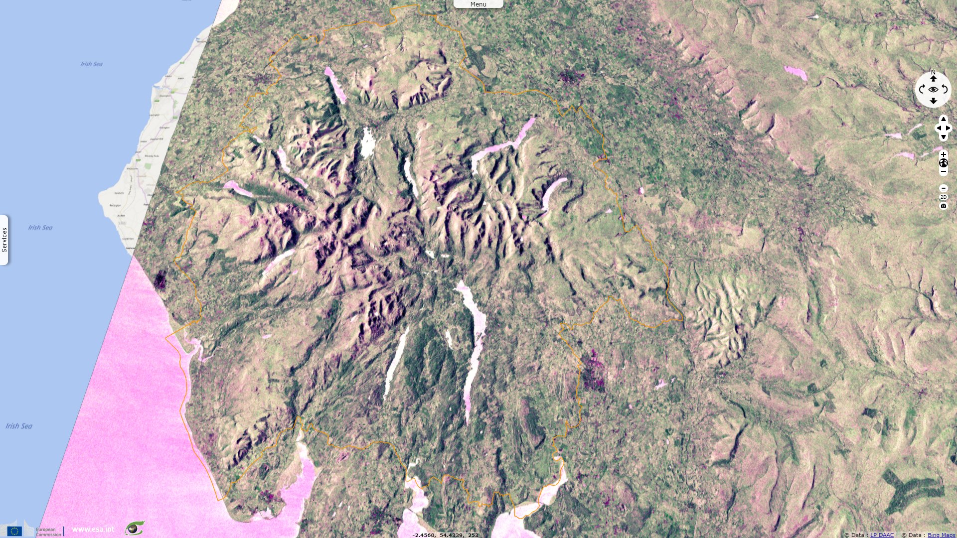
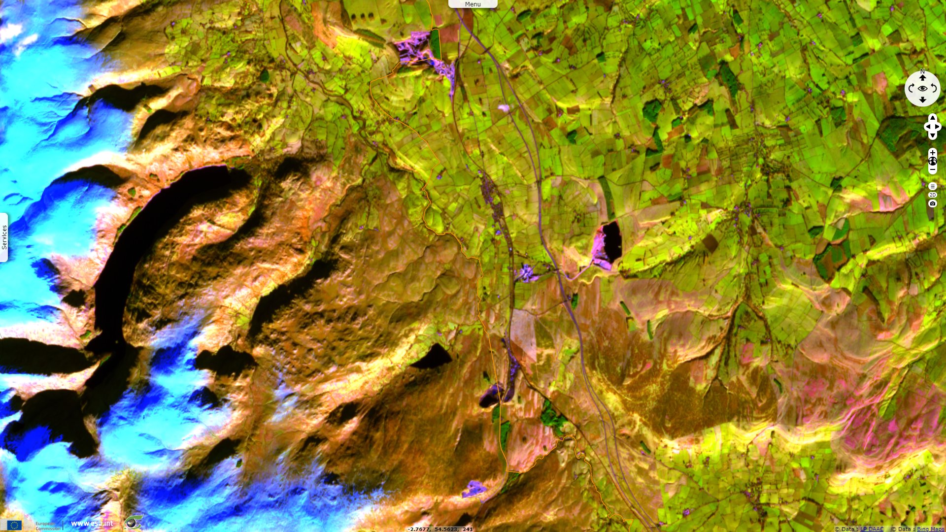
Sentinel-1 CSAR IW acquired on 26 January 2020 from 18:05:42 to 18:07:51 UTC
Sentinel-1 CSAR IW acquired on 09 August 2019 at 06:21:46 UTC
Sentinel-2 MSI acquired on 29 November 2019 at 11:33:29 UTC
...
Sentinel-1 CSAR IW acquired on 26 January 2020 from 18:05:42 to 18:07:51 UTC
Keyword(s): Land, national park, geology, mountain, glacial lake, valley, snow, mine, England, United Kingdom
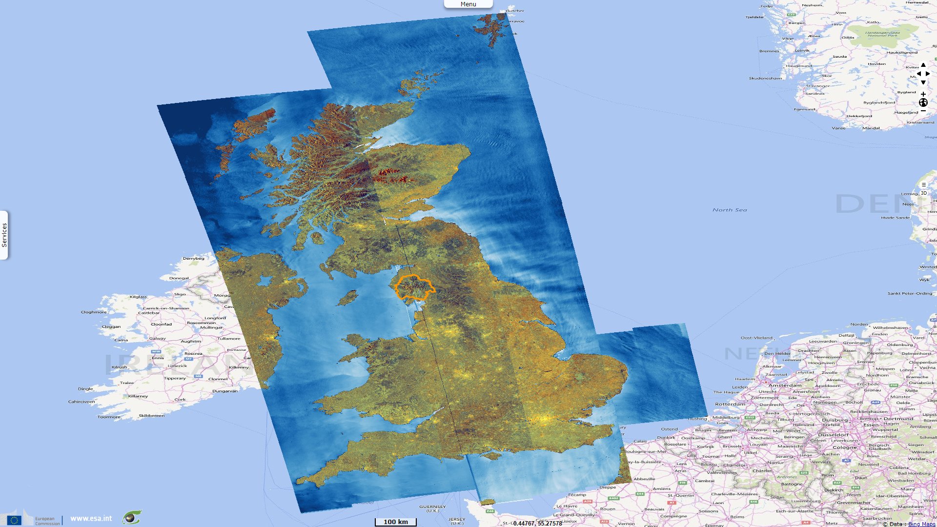
The Lake District national park is England's largest national park, it covers 2362 square kilometres. Its dedicated website notes: "In the Lake District, 500 million years of geological processes have produced a physical landscape of mountains and lakes of great scenic beauty. Slate developed from sediments in oceans and seas, volcanoes erupted, limestone was formed by the deposition of dead crustaceans and sandstone was created in desert conditions. Various minerals were also formed in joints and faults in the bedrock."
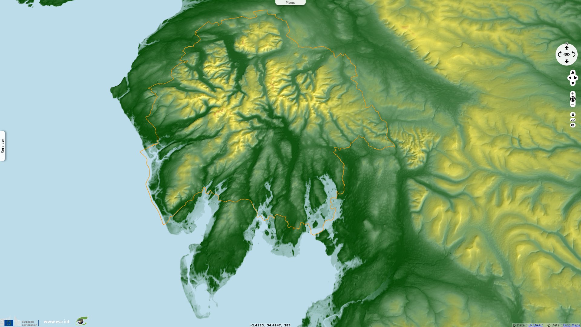
"The layers of rock formed were shifted and sculpted - first through different stages of folding and uplifting and then by the actions of glaciers and meltwater. As a result the topography of the Lake District includes smooth U-shaped valleys and steep and sharp ridges, England’s highest mountain and deepest and longest lakes."
"The climate, together with the geology of the area has made the Lake District what it is today. In the last 2 million years a series of ice ages have left the area buried under glaciers. These rivers of ice carved deep lakes and u shaped valleys between the hills. If you look at a map of the Lake District you can see how the long, narrow lakes radiate outwards from the high mountains of the central area."
"The prevailing westerly winds cross the Atlantic Ocean picking up large amounts of moisture. The air hits the Lake District hills and is forced to rise where it cools and the moisture condenses to form rain. This is called relief or orographic rainfall." Annual rainfalls reach 2061mm in Ambleside, near the central area and go as high as 3552mm in Seathwaite, the wettest inhabited place in England, in a valley among the highest elevations.
"The Lake District has over fourteen lakes and tarns. The Lake District’s volcanic rock does not allow water to seep away. The high rainfall, combined with the extra deep glacial valleys, means that the valleys are able to store large volumes of water."
"The main agricultural use of the land in the Lake District is sheep farming. The weather plays a large part in this. Plants have a short growing season from mid April through to November due to the temperature. This makes growing of arable crops very difficult. The steep rocky terrain also makes access to the land difficult for modern farm machinery. Hill sheep however are extremely hardy and can tolerate the changeable weather.
The famous Herdwick sheep thrive in this environment. They have the unique ability to return to the farm where they were born despite being left to wander on the unfenced fells during the summer. They can even survive snow storms due to their thick fleeces."
"Woodland covers 12 percent of the Lake District National Park, around 28,500 hectares. 40 478 people live within the boundaries of the National Park which represents 18 people per square kilometre."
"The bulk of the National Park is made up of three broad bands of rock trending from SW to NE. The rocks which form the mountains and hills are not necessarily ‘harder’ than those which form adjacent lower land. The Lake District rocks are ‘buoyed up’ by sitting ‘astride’ a ‘batholith’ or ‘raft’ of low density granite. The granite underlies the whole area and small protruding parts of it are seen at the surface as the Eskdale, Ennerdale, Skiddaw and Shap granites."
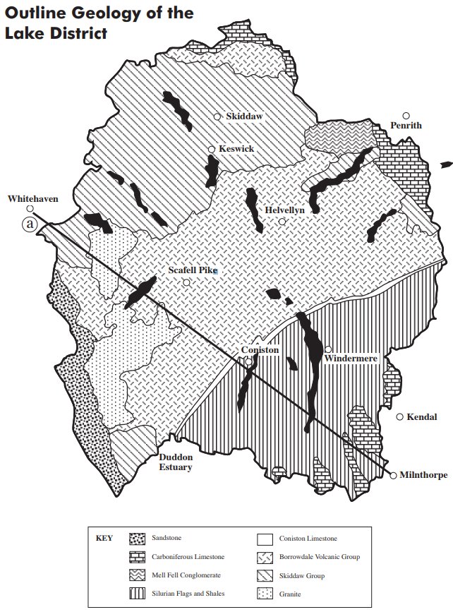
Outline Geology of the Lake District - Source: Lake District national park Authority
In a factsheet dedicated to the geoglogy of Lake District national park, the park authorities detail: "The SKIDDAW GROUP is the oldest group of rocks in the Lake District. They were formed during the ORDOVICIAN period, about 500 million years ago, as black mud settling on the sea bed in relatively deep water where occasional layers of coarser silt and sand were also deposited." They have since been raised up and crumpled and squeezed. "The Skiddaw Group forms a roughly triangular mountainous zone in the north of the Park, reaching a maximum height of 931m on Skiddaw itself. Despite their slatey appearance, they are not suitable for roofing because they easily break into small pieces. Although there are some rugged areas developed on rocks unaffected by thermal metamorphism, such as on the south face of Blencathra, the mountains developed on SKIDDAW GROUP rocks are more typically smooth in outline."
"South of the Skiddaw Group lies the BORROWDALE VOLCANIC GROUP (BVG). These rocks are volcanic lavas and ash flows (pyroclastics) erupted during a phase of cataclysmic volcanism 450 million years ago. This volcanism was caused as the Iapetus ocean SUBDUCTED beneath the continent on which present-day England was to form. The BVG lavas are mainly ANDESITES, with some BASALTS and RHYOLITES.
Ash and lava fragments thrown up by the volcano settle out in the encircling waters to form TUFFS and AGGLOMERATES. The BVG rocks underlie the highest and craggiest central part of the Lake District, including the well known peaks of Scafell (964m) and Scafell Pike (978m), Helvellyn (950m), Coniston Old Man (803m) and the Langdale Pikes (736m)." These peaks are not the remains of the original volcanoes - they are the harder volcanic rocks that have withstood erosion. "The ruggedness of the terrain makes this the most popular area with fell walkers and rock climbers."
"About 2 million years ago the Earth’s climate cooled, allowing the development of glaciers and ice sheets which, at their maximum covered most of mainland Britain. These cold episodes were called GLACIALS and were separated by warmer INTERGLACIALS supporting broadleaved forests. It is believed that there may have been as many as 10 such climatic oscillations. It is the action of glaciers and meltwater, frost conditions and slope action during this period which have shaped most of the surface detail of the Lake District and made the area a text book example of such landforms."
"Further south again is a zone of slates, siltstones and sandstones, also formed in the sea, during the SILURIAN period about 420 million years ago. These rocks are known to geologists as THE WINDERMERE GROUP." These were later folded and faulted, pushed up, and eroded down to their present levels former the gentler scenery of southern Lakeland. "These rocks are less resistant than the BVG and form a belt of foothills stretching from the Duddon estuary to Kendal. They are possibly the most familiar part of the Lake District to many visitors as they lie across the A591, the main tourist route into the National Park, and include the lakes of Windermere and Coniston Water."
"About 400 million years ago all these rocks were folded, faulted, intruded by molten magma and pushed up to form a very high mountain range. These events are known as the CALEDONIAN OROGENY (mountain building episode) and they were caused by the collision of two continents. 400 million years ago the Lake District mountains looked something like the Himalayas today. The Himalayas are still being formed by India colliding with Asia to build a high mountain range. The Caledonian orogeny compressed many of the BVG tuffs and turned them into the famous Westmorland green slates. Millions of years of erosion have worn down these mountains to their present size, but the folds and faults can still be seen and the igneous intrusions, which cooled and crystallised hundreds of metres below the surface, are now exposed around Eskdale, Ennerdale, Shap, Skiddaw and Carrock Fell. They all form part of a very large granite ‘batholith’ at depth and this tends to ‘buoy up’ the whole area."
"During the DEVONIAN period the high mountains were eroded to low hills and about 350 million years ago most of the land sank beneath a tropical sea. This teemed with life and the sea floor became covered with a thick layer of sediment, made up of the broken remains of shells, to form the pale grey Carboniferous Limestone. Some shells survived intact and so fossil corals, brachiopods and snails are sometimes found in the limestone. During the latter part of the CARBONIFEROUS period this sea was eventually filled in with mud and sand and was colonised by swampy forests whose remains now form coal. Most of these rocks lie on or just outside the National Park boundary.
About 280 million years ago the Carboniferous rocks were uplifted and folded into a broad dome by another orogeny, the VARISCAN OROGENY (its most severe effects were felt in what is now Devon, Cornwall, South Wales and South West Ireland). After the Hercynian mountain building episode the Carboniferous Limestone was left as a broken rim girdling the higher mountainous core. The limestone takes the form of a long curved cuesta around the northern edge of the National Park and a more broken zone in the south, lying only partly within the National Park. It contains two very prominent west facing scarps, Whitbarrow Scar and Scout Scar, both situated to the west of Kendal."
"Since the formation of the Skiddaw Slates Group during the Ordovician period, the part of the Earth’s crust we now call the Lake District has been slowly drifting north, starting from a position well south of the equator. During the late Devonian, or early Carboniferous, it crossed the equator and by about 250 million years ago it reached the latitude of the present day Sahara Desert. A landscape of sand dunes and salt lakes developed, with seasonal downpours of rain washing rock debris from nearby uplands onto stony plains. These conditions persisted throughout the PERMIAN and TRIASSIC periods and ended about 190 million years ago."
"The St. Bees and Kirklinton Sandstones to the west and north of the National Park were formed at this time and are thought to be the result of ‘flash floods’, whereby a mass of sand or larger debris is deposited in a sudden downpour or storm. By contrast, the Penrith and Lazonby Sandstones of the Eden Valley (east of the National Park), although deposited in the same eras, are desert sandstones of aeolian origin showing dune bedding and rounded grains. Since the formation of the Triassic rocks, many more rocks have formed in what is now the British Isles, but none of them are now found in the Lake District. The drift northwards, however, continued, bringing us to our present latitude."
The views expressed herein can in no way be taken to reflect the official opinion of the European Space Agency or the European Union.
Contains modified Copernicus Sentinel data 2026, processed by VisioTerra.
Contains modified Copernicus Sentinel data 2026, processed by VisioTerra.
| More on European Commission space: |  |
 |
 |
||||
| More on ESA: | |
|
|
S-1 website | S-2 website | S-3 website | |
| More on Copernicus program: | |
|
|
Scihub portal | Cophub portal | Inthub portal | Colhub portal |
| More on VisioTerra: | |
|
|
Sentinel Vision Portal | Envisat+ERS portal | Swarm+GOCE portal | CryoSat portal |