Sinkholes of Imotsko karstic field, Croatia and Bosnia
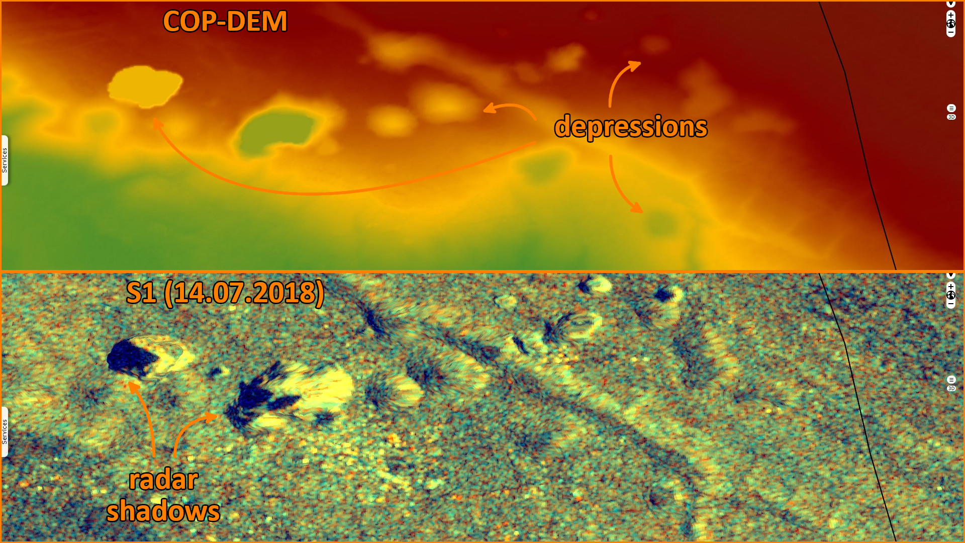
Sentinel-1 CSAR IW acquired on 14 July 2018 at 16:49:36 UTC
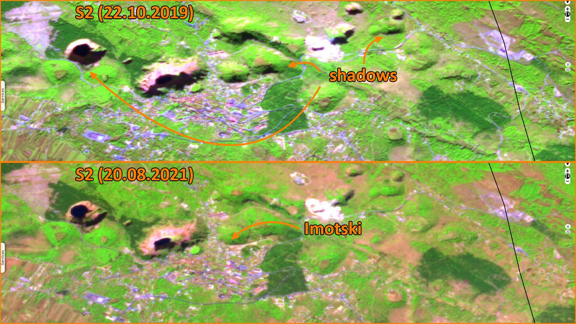
Sentinel-2 MSI acquired on 22 October 2019 at 09:40:41 UTC
...
Sentinel-2 MSI acquired on 21 June 2022 at 09:50:41 UTC
Sentinel-1 CSAR IW acquired on 26 December 2022 at 04:55:14 UTC
Sentinel-2 MSI acquired on 22 October 2019 at 09:40:41 UTC
...
Sentinel-2 MSI acquired on 21 June 2022 at 09:50:41 UTC
Sentinel-1 CSAR IW acquired on 26 December 2022 at 04:55:14 UTC
Keyword(s): Land, geology, hydrology, karst, sinkhole, erosion, depression, lakes, Croatia, Bosnia
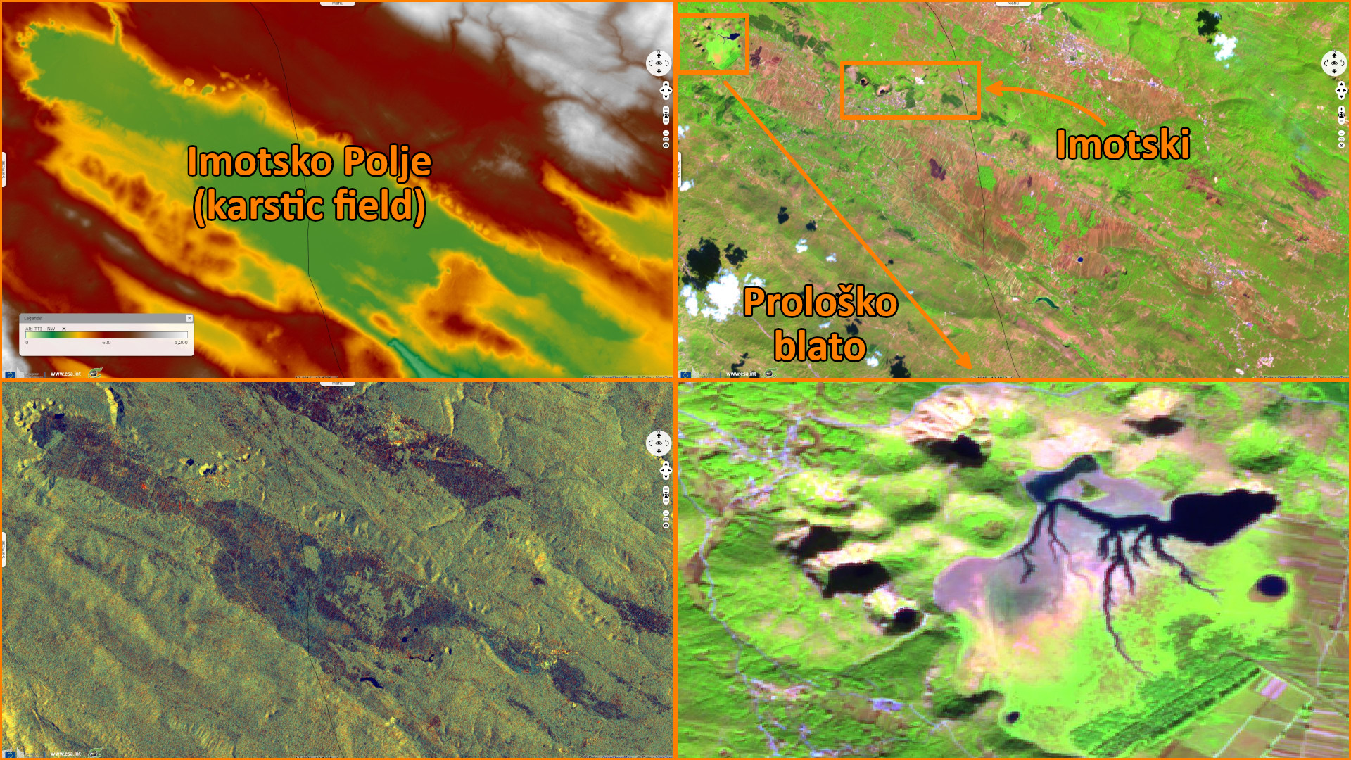
Imotsko Polje is a polje located on the border of Croatia and Bosnia and Herzegovina near the city of Imotski. It has an area of 95 km², it is 33.3 km long and 1-6 km wide. It extends in the northwest-southeast direction. It has a dolomite floor with an elevation between 248 and 283 m. Several rivers flow through the field. At west of the polje, Prološko blato is a protected zone of nature of which only one part is always underwater.
It is presumed these karst lakes emerged when the ceiling of large cave halls collapsed. The collapse of limestone rocks over time created numerous ravines, which today are filled with water and represent lakes. The two most important are Red Lake and Blue Lake.
Red Lake is a sinkhole reaching over 241 m above normal water level and continuing below the water level. This sinkhole is approximately 534 m deep with a volume of roughly 25–30 million m3, thus it is the third largest sinkhole in the world. Water drains out of the basin through underground waterways that descend below the level of the lake floor. The deepest known point of the lake is 4 m below sea level.
The sinkhole is named after the reddish-brown colour of the surrounding cliffs, coloured by iron oxides. In the dry period of the year, fish can be occasionally seen in surrounding springs, rivers and lakes, suggesting that there is an underground connection between Red Lake and other water bodies.
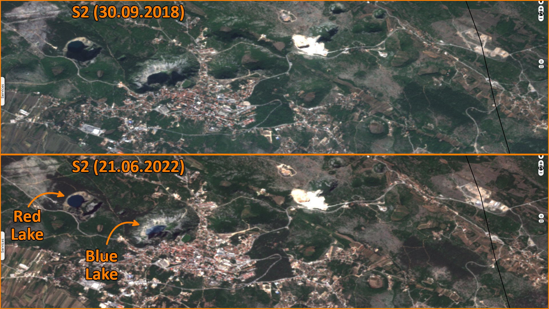
Maximum dimensions of Blue Lake are around 800 m × 500 m. The total depth from the upper rim is around 220 m, while water depth varies with season. It can reach 90 m, it reached 114 m in 1914, overflowing the southern rim but the lake may completely disappear.
The views expressed herein can in no way be taken to reflect the official opinion of the European Space Agency or the European Union.
Contains modified Copernicus Sentinel data 2026, processed by VisioTerra.
Contains modified Copernicus Sentinel data 2026, processed by VisioTerra.
| More on European Commission space: |  |
 |
 |
||||
| More on ESA: | |
|
|
S-1 website | S-2 website | S-3 website | |
| More on Copernicus program: | |
|
|
Scihub portal | Cophub portal | Inthub portal | Colhub portal |
| More on VisioTerra: | |
|
|
Sentinel Vision Portal | Envisat+ERS portal | Swarm+GOCE portal | CryoSat portal |