Niger River Flooding in Niamey, Niger
Sentinel-1 CSAR IW acquired on 28 August 2019 at 18:03:54 UTC
Sentinel-1 CSAR IW acquired on 09 September 2019 at 18:03:55 UTC
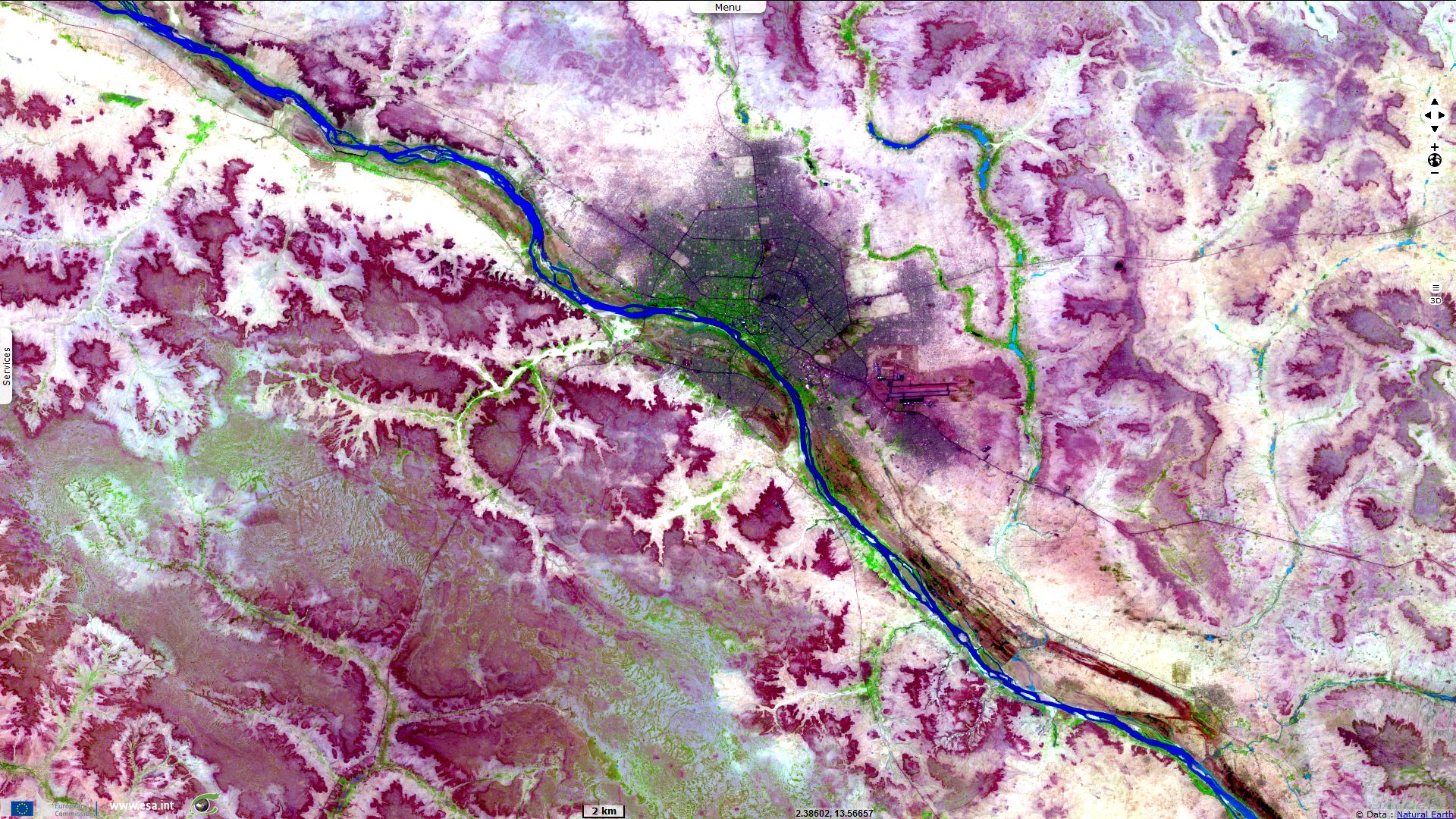
Sentinel-2 MSI acquired on 23 June 2019 at 10:10:31 UTC
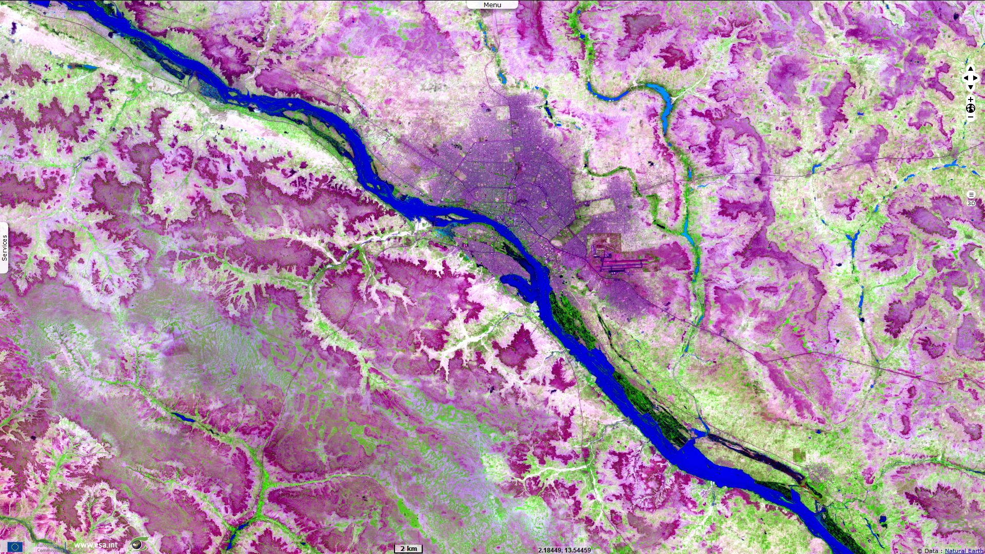
Sentinel-2 MSI acquired on 06 September 2019 at 10:10:29 UTC
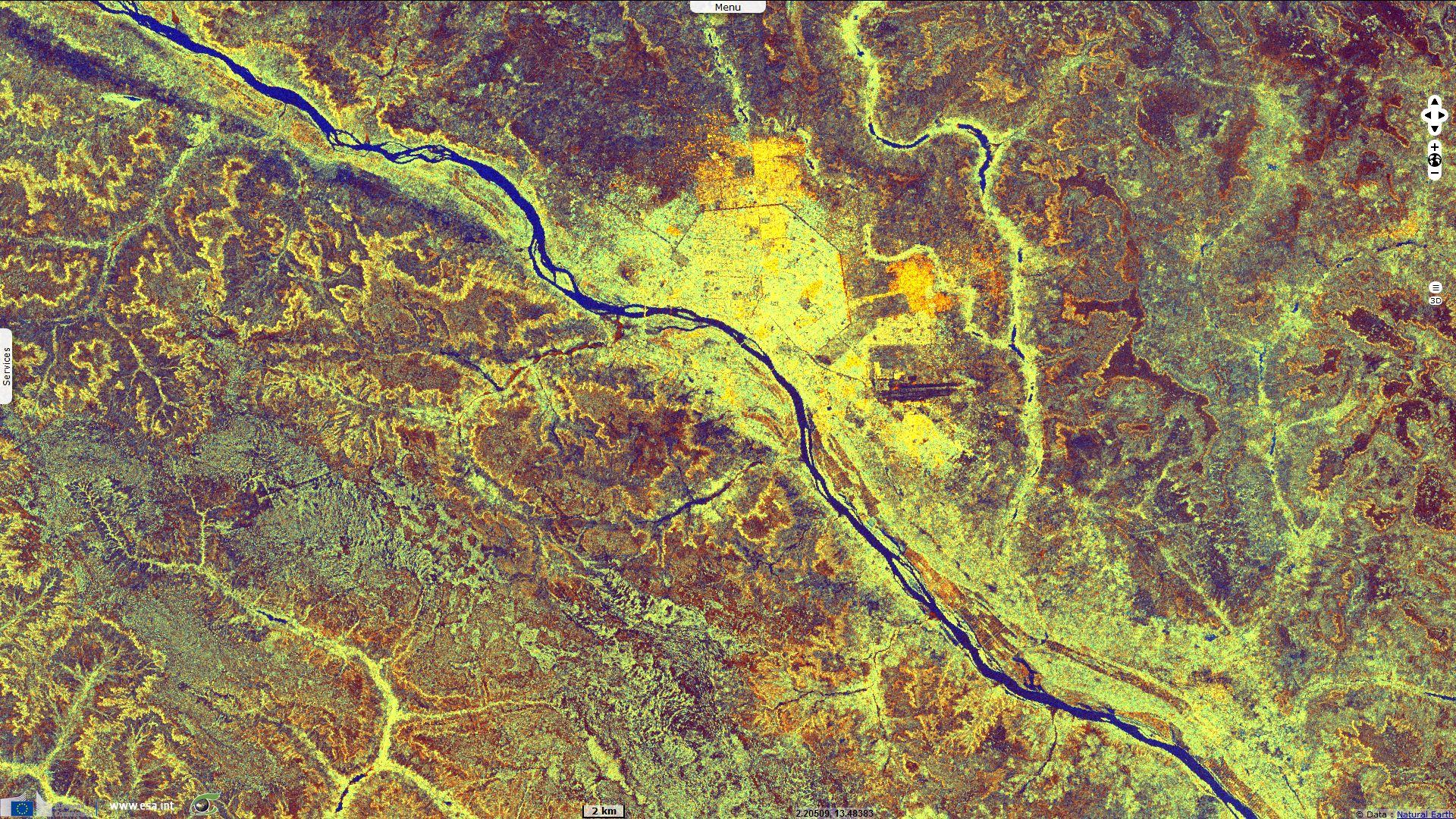
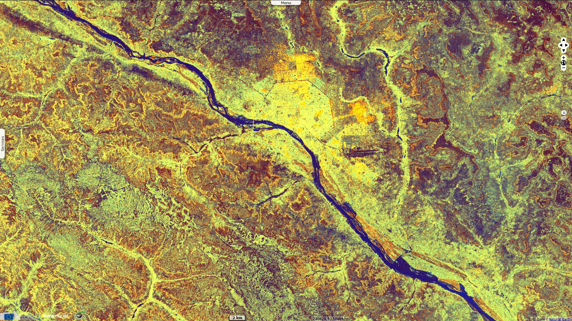
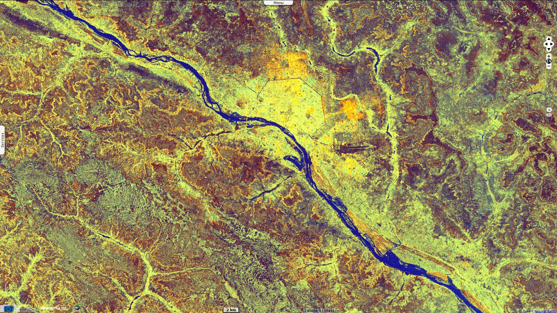
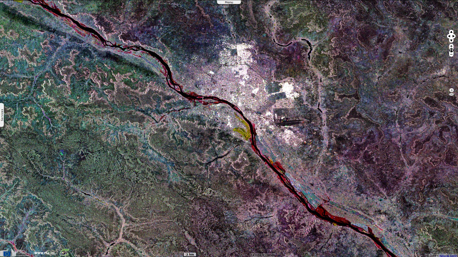
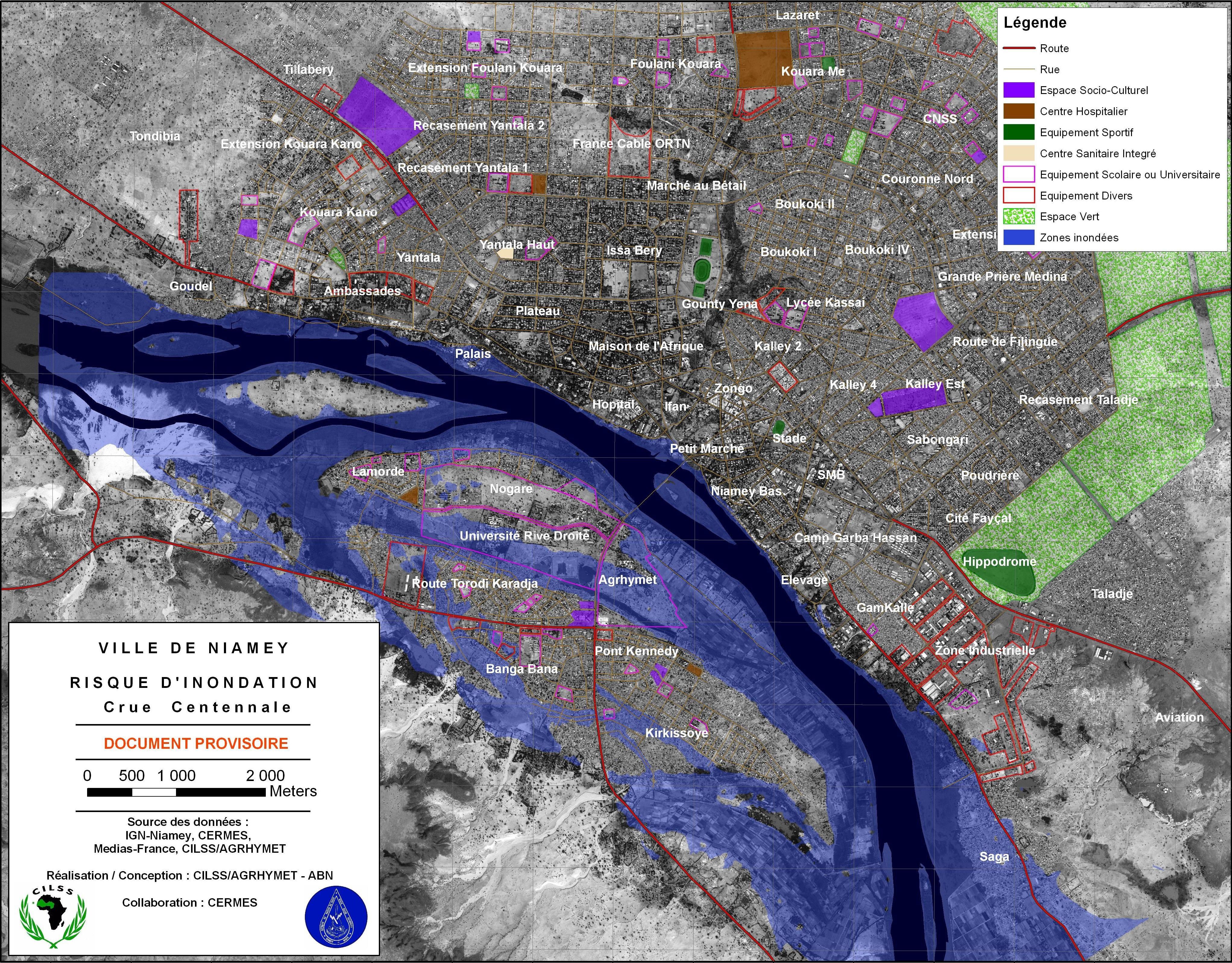
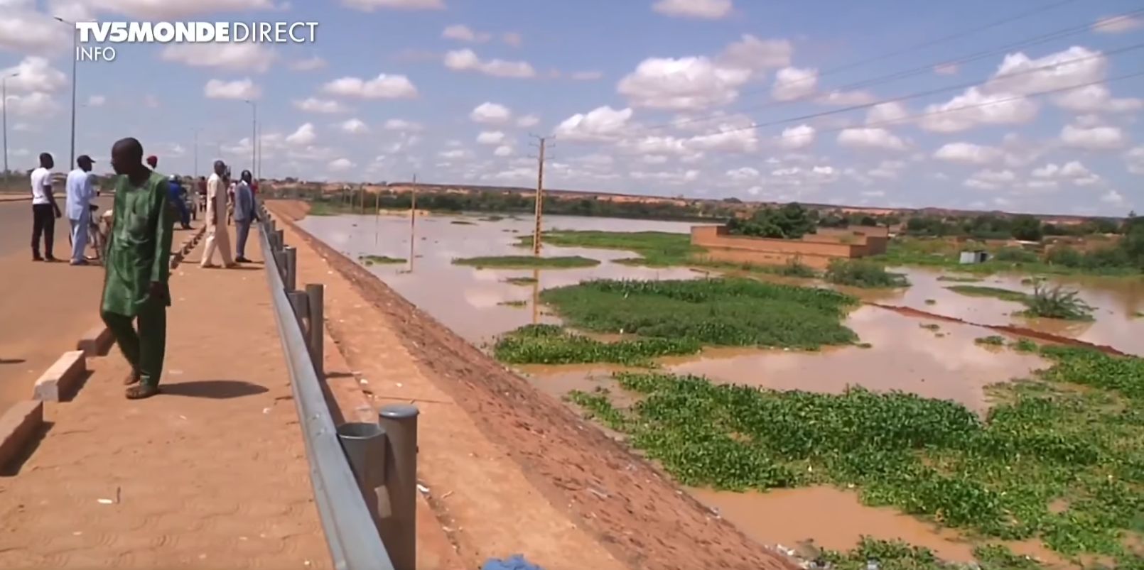
Hervé TREBOSSEN is an expert working on floods in Niamey since 2007 in the framework of flood prevention and production of prevention maps as a part of an intellectual work convenience by AGRHYMET and the Niger Basin Authority (ABN). TREBOSSEN details in Trebossen and al., 2008 "The hydrological regime of the Niger River in Niamey is characterized on the one hand by the flows from the high Niger basin whose peak arrives in Niamey during the dry season during the period December - January and on the other hand by the flows from tributaries of the right bank during the rainy season. The hydrograph in Niamey is thus characterized by two main flood peaks. The flood associated with the tributaries from Burkina is called local flood (or black flood) because of its localized character in time and space, as opposed to the second flood called Malian flood (or white, or Sudanian, or Guinean) which is generated by distant inputs from the upper Niger Basin: Guinea, Ivory Coast and Mali. Part of the city of Niamey is located in floodplain by overflow of the river, in any case for a secular event. In particular the alluvial zone of right bank (former river bed), is protected by various embankment only for a threshold of limited flow ". Since 2012, several major floods events mostly due to local tributaries has occurred in Niamey. The last one observed during the first week of September was the most important one ever measured in Niamey.
As stated by Mr. Hervé TREBOSSEN, "In 2007, the AGRHYMET Regional Center and the Niger Basin Authority joined their efforts to warn Niamey of the risk of overflow flooding of the Niger River.
The specific objectives were: -Characterize hydrological events with significant flood risk, -Construct the reference water lines associated with these events, -Mapping the corresponding flood events (right-of-way, water depths and even duration of flooding), -Mapping the risk by confronting the hazard to the vulnerability (land use)".
Still according to Mr. Hervé TREBOSSEN "The measures to be taken to prevent floods for example for the city of Niamey are: -Dikes should be regularly inspected and maintained, including their foundations, -The upstream flood expansion zones must absolutely be preserved, -The possibility of exceptionally using Kandadji's work (by preserving a slice of capping in the bowl, possibly by preventive releases) could be examined."
Contains modified Copernicus Sentinel data 2026, processed by VisioTerra.
| More on European Commission space: |  |
 |
 |
||||
| More on ESA: | |
|
|
S-1 website | S-2 website | S-3 website | |
| More on Copernicus program: | |
|
|
Scihub portal | Cophub portal | Inthub portal | Colhub portal |
| More on VisioTerra: | |
|
|
Sentinel Vision Portal | Envisat+ERS portal | Swarm+GOCE portal | CryoSat portal |