Sentinel-3 satellites follow Cyclone Freddy from Oceania to Africa
Sentinel-3 SLSTR RBT acquired on 06 February 2023 from 13:42:47 to 14:44:36 UTC
...
Sentinel-3 SLSTR RBT acquired on 22 February 2023 from 19:29:37 to 19:32:37 UTC
...
Sentinel-3 SLSTR RBT acquired on 22 February 2023 from 19:29:37 to 19:32:37 UTC
Keyword(s): Emergency, natural disaster, climate change, cyclone, hurricane, Indian Ocean, Madagascar
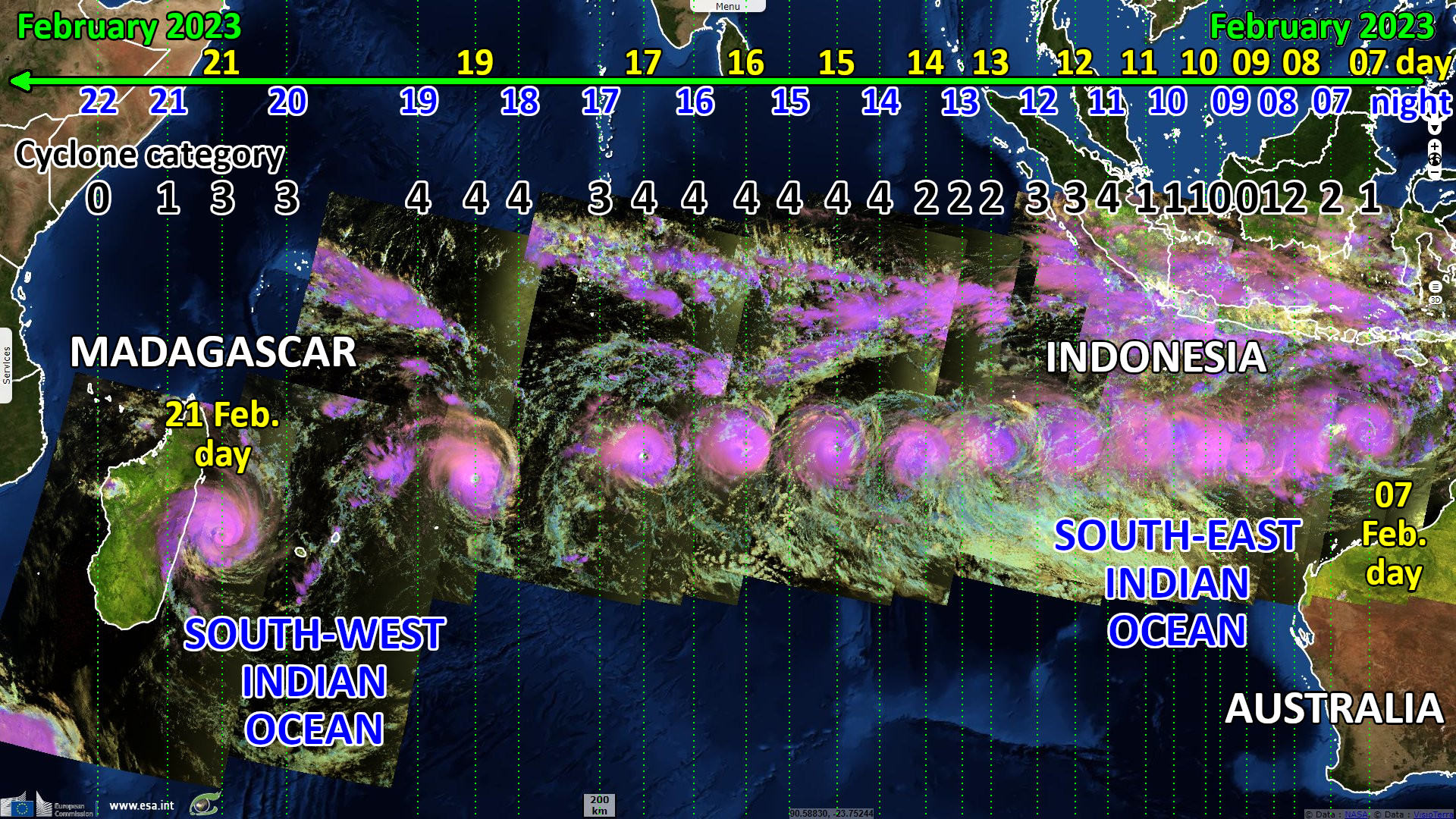
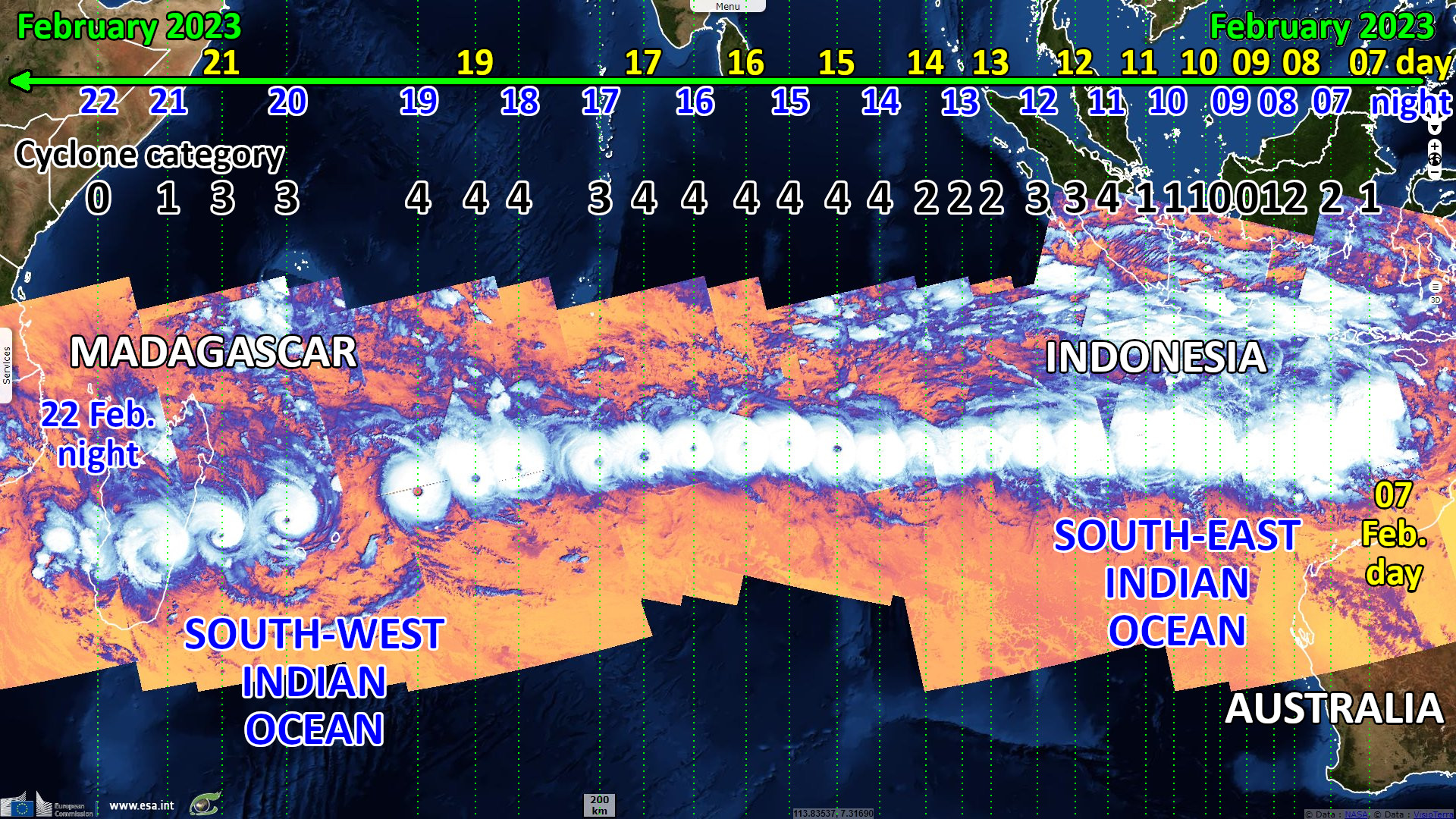
Freddy was the first system in over 20 years to traverse the entirety of the southern Indian Ocean from east to west. It is the only known tropical cyclone to achieve four separate rapid intensification cycles, reaching 270 km/h (category 5) at peak strength. Cyclone Freddy holds the record for the all-time highest accumulated cyclone energy of a tropical cyclone in the Southern hemisphere.
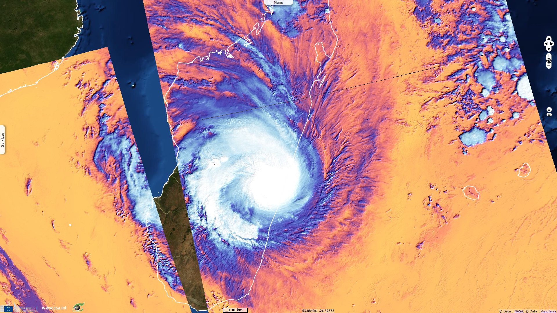
On 21 February, Tropical Cyclone Freddy made landfall as a category 3 cyclone on the southeastern coasts of Madagascar. The cyclone hit four of the six provinces in the country. More than ten million residents have been exposed to the cyclone’s maximum intensity.
The views expressed herein can in no way be taken to reflect the official opinion of the European Space Agency or the European Union.
Contains modified Copernicus Sentinel data 2026, processed by VisioTerra.
Contains modified Copernicus Sentinel data 2026, processed by VisioTerra.
| More on European Commission space: |  |
 |
 |
||||
| More on ESA: | |
|
|
S-1 website | S-2 website | S-3 website | |
| More on Copernicus program: | |
|
|
Scihub portal | Cophub portal | Inthub portal | Colhub portal |
| More on VisioTerra: | |
|
|
Sentinel Vision Portal | Envisat+ERS portal | Swarm+GOCE portal | CryoSat portal |