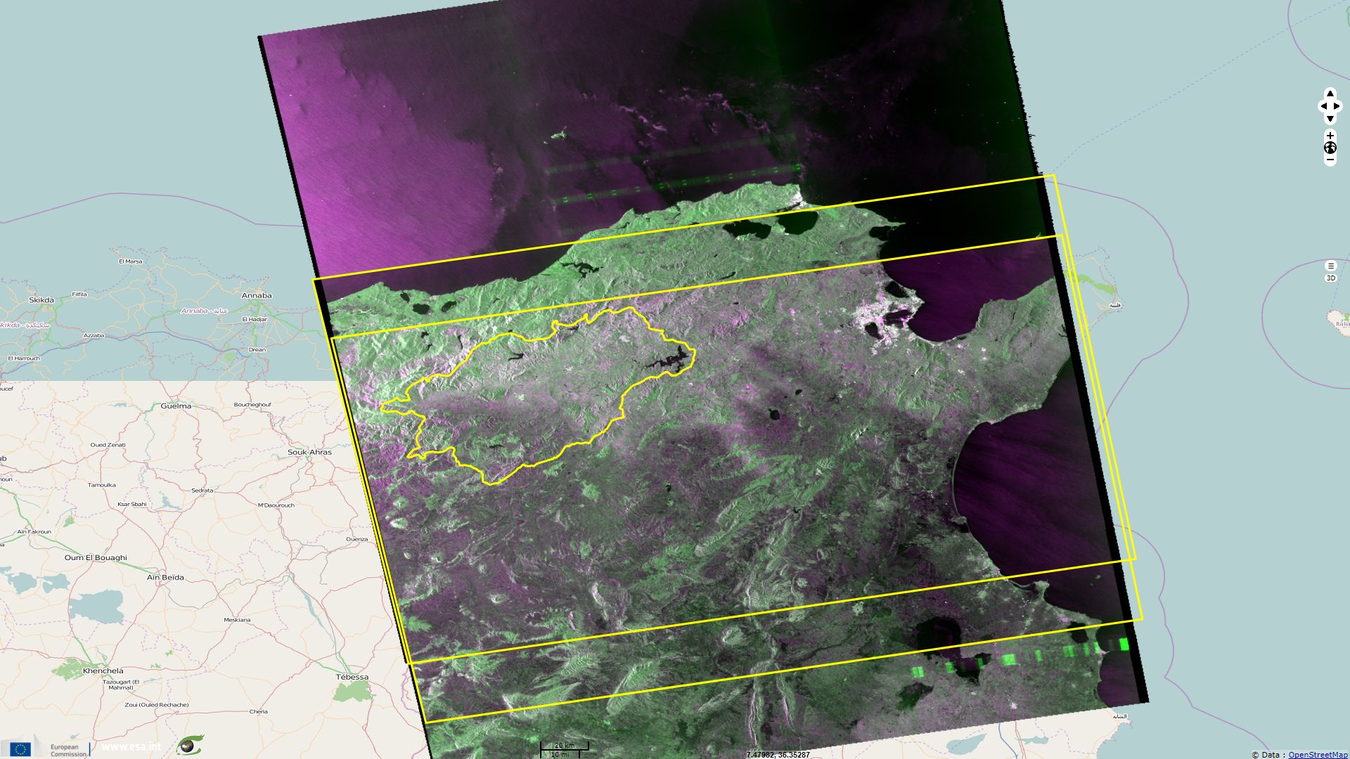
Flood monitoring in Medjerda Wadi (Tunisia)
Sentinel-1 CSAR IW acquired on 08 February 2015 at 17:20:06 UTC
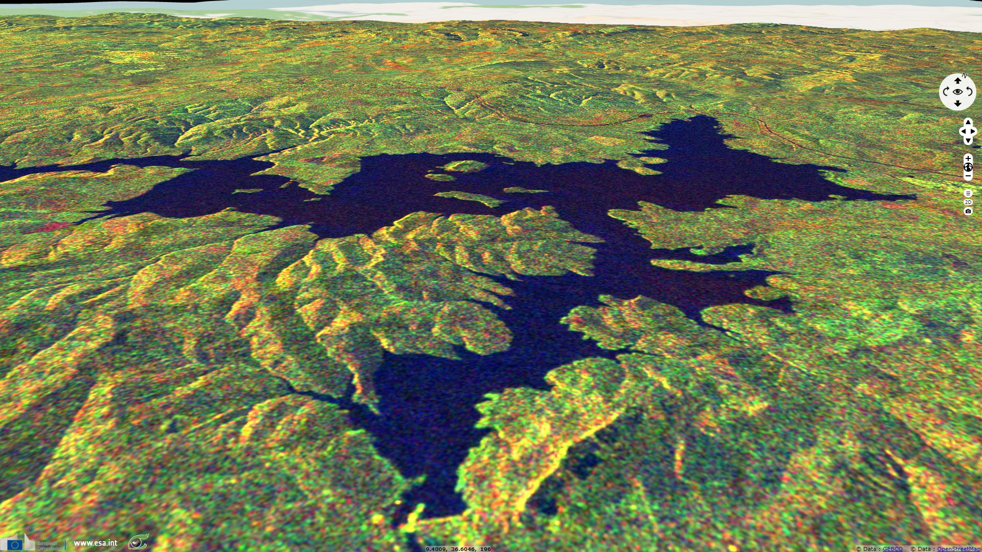
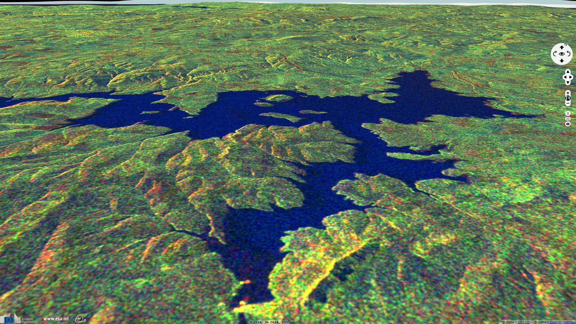
Sentinel-1 CSAR IW acquired on 15 February 2016 at 17:20:16 UTC
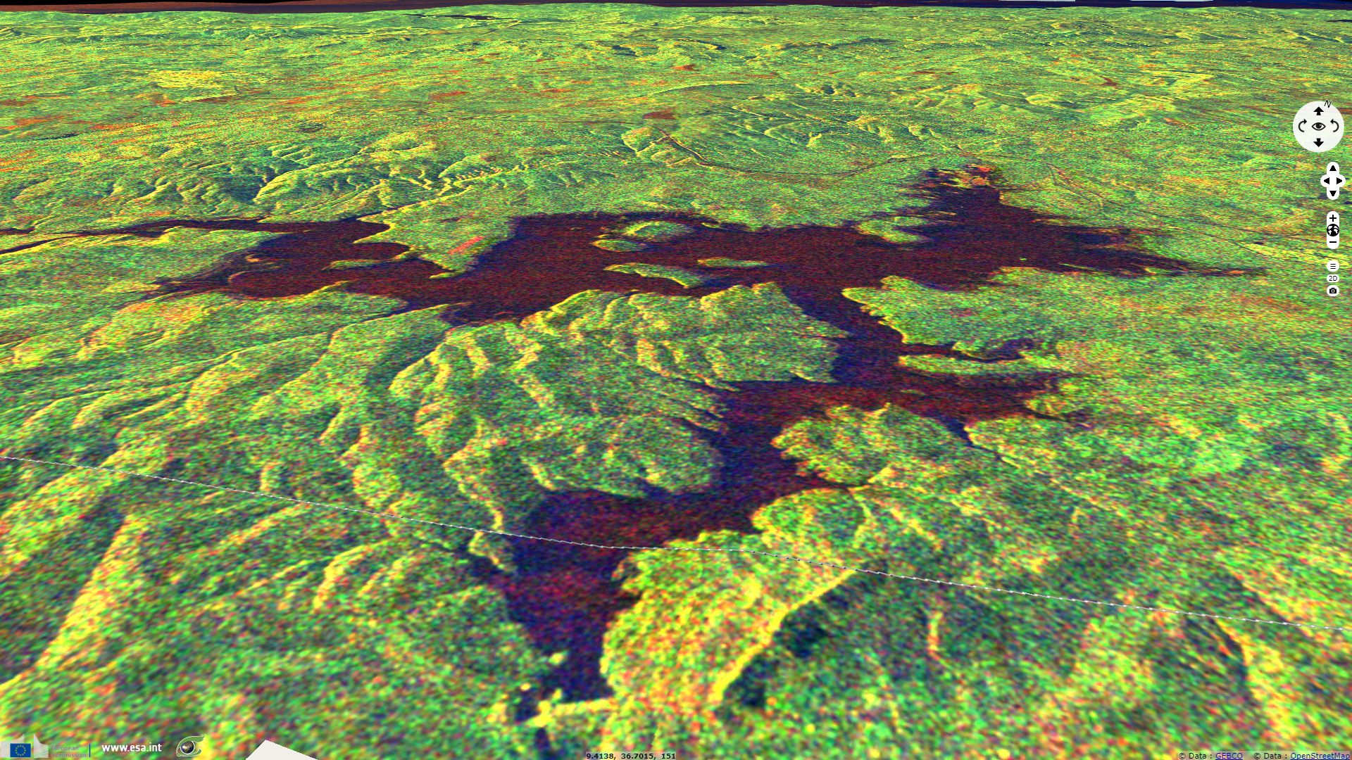
Sentinel-1 CSAR IW acquired on 09 February 2017 at 17:20:13 UTC
Sentinel-1 CSAR IW acquired on 09 February 2017 at 17:20:38 UTC
Sentinel-1 CSAR IW acquired on 15 February 2016 at 17:20:16 UTC
Sentinel-1 CSAR IW acquired on 09 February 2017 at 17:20:13 UTC
Sentinel-1 CSAR IW acquired on 09 February 2017 at 17:20:38 UTC
Keyword(s): land, hydrology, renewable energy, flooding, dam, lake, Tunisia
The views expressed herein can in no way be taken to reflect the official opinion of the European Space Agency or the European Union.
Contains modified Copernicus Sentinel data 2026, processed by VisioTerra.
Contains modified Copernicus Sentinel data 2026, processed by VisioTerra.
| More on European Commission space: |  |
 |
 |
||||
| More on ESA: | |
|
|
S-1 website | S-2 website | S-3 website | |
| More on Copernicus program: | |
|
|
Scihub portal | Cophub portal | Inthub portal | Colhub portal |
| More on VisioTerra: | |
|
|
Sentinel Vision Portal | Envisat+ERS portal | Swarm+GOCE portal | CryoSat portal |