Galapagos Islands marine sanctuary
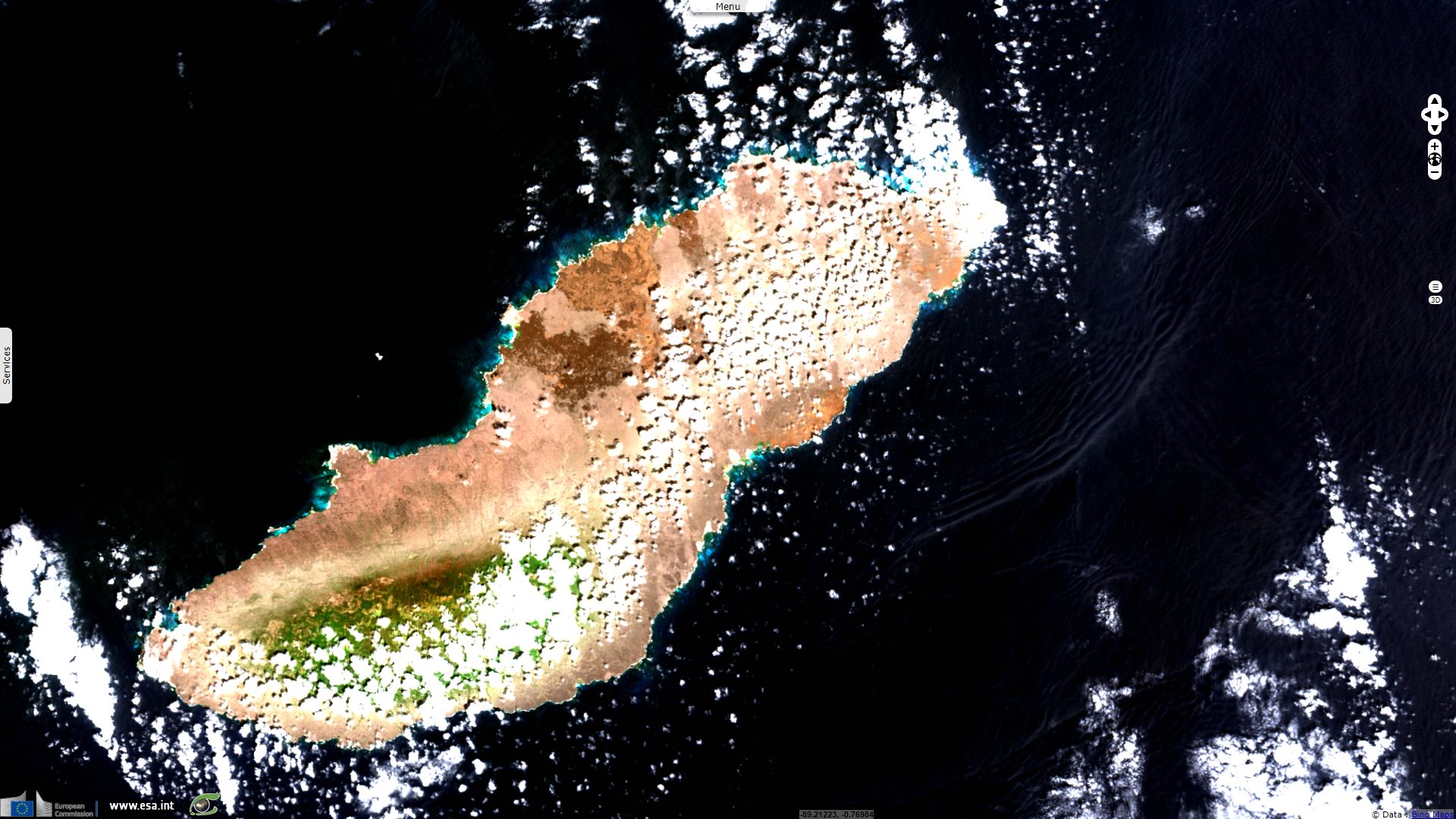
Sentinel-2 MSI acquired on 21 October 2016 at 16:23:12 UTC
...
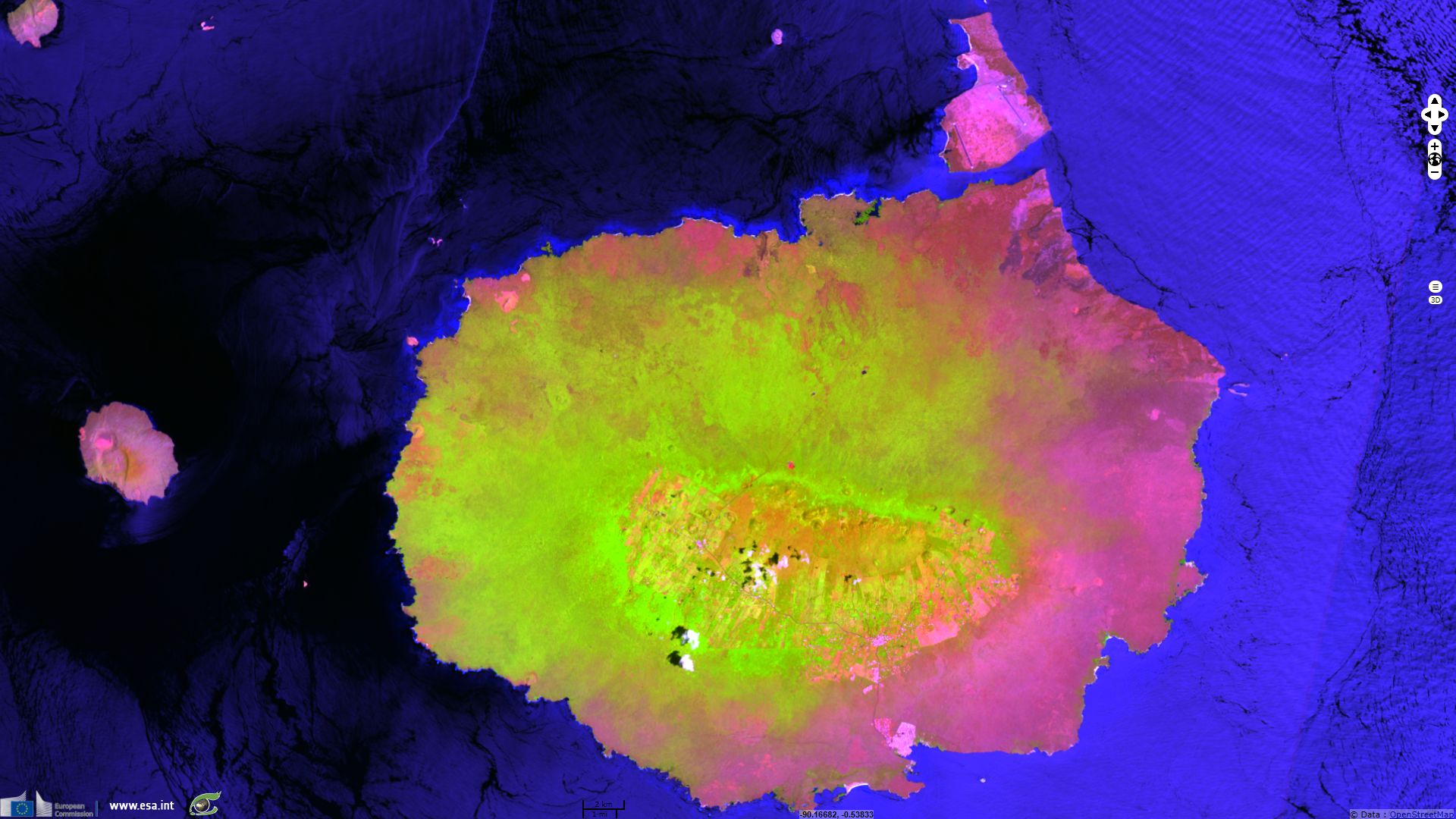
Sentinel-2 MSI acquired on 21 February 2017 at 16:33:01 UTC
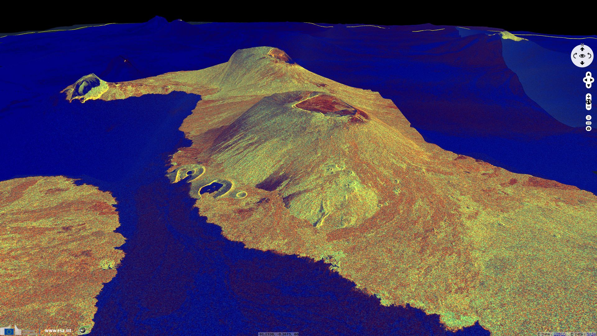
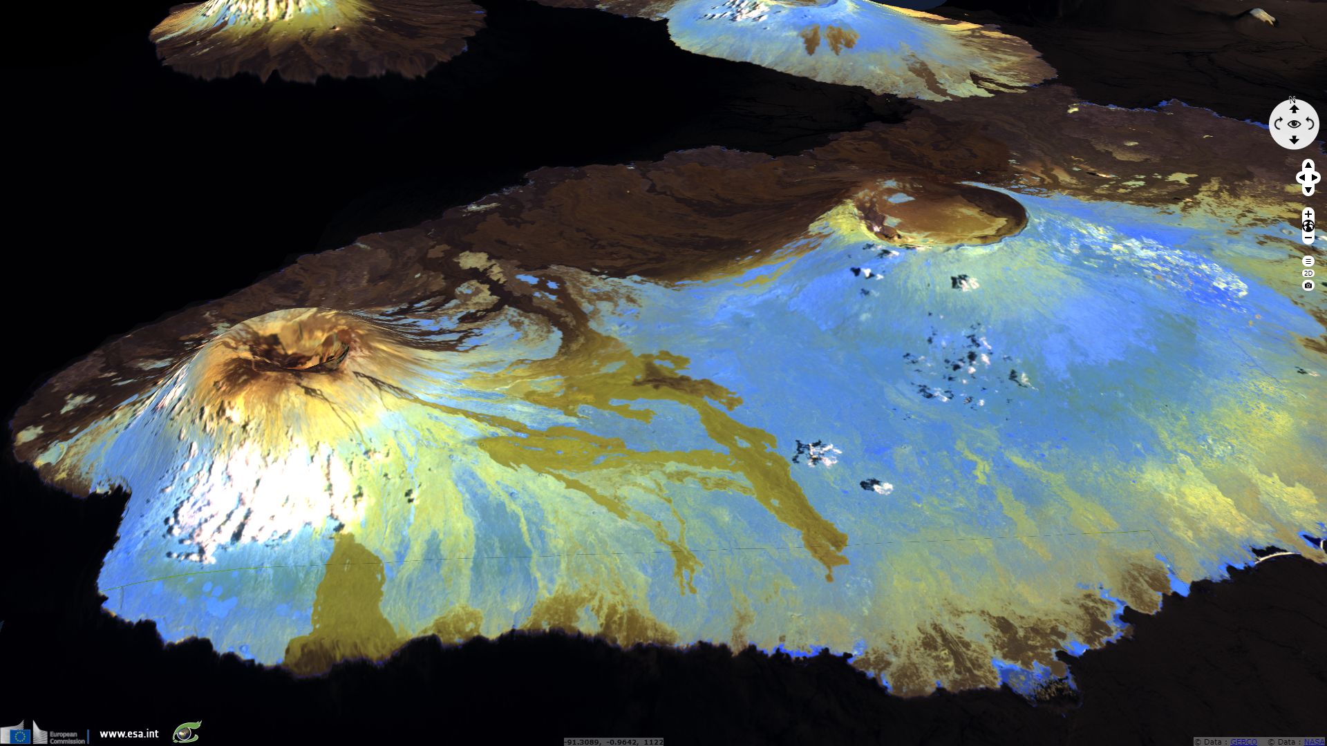
Sentinel-1 CSAR IW acquired on 24 February 2017 from 11:49:28 to 11:49:57 UTC
...
Sentinel-2 MSI acquired on 21 February 2017 at 16:33:01 UTC
Sentinel-1 CSAR IW acquired on 24 February 2017 from 11:49:28 to 11:49:57 UTC
Keyword(s): UNESCO World heritage, hotpot, volcano, reserve, national park, Galapagos, Ecuador
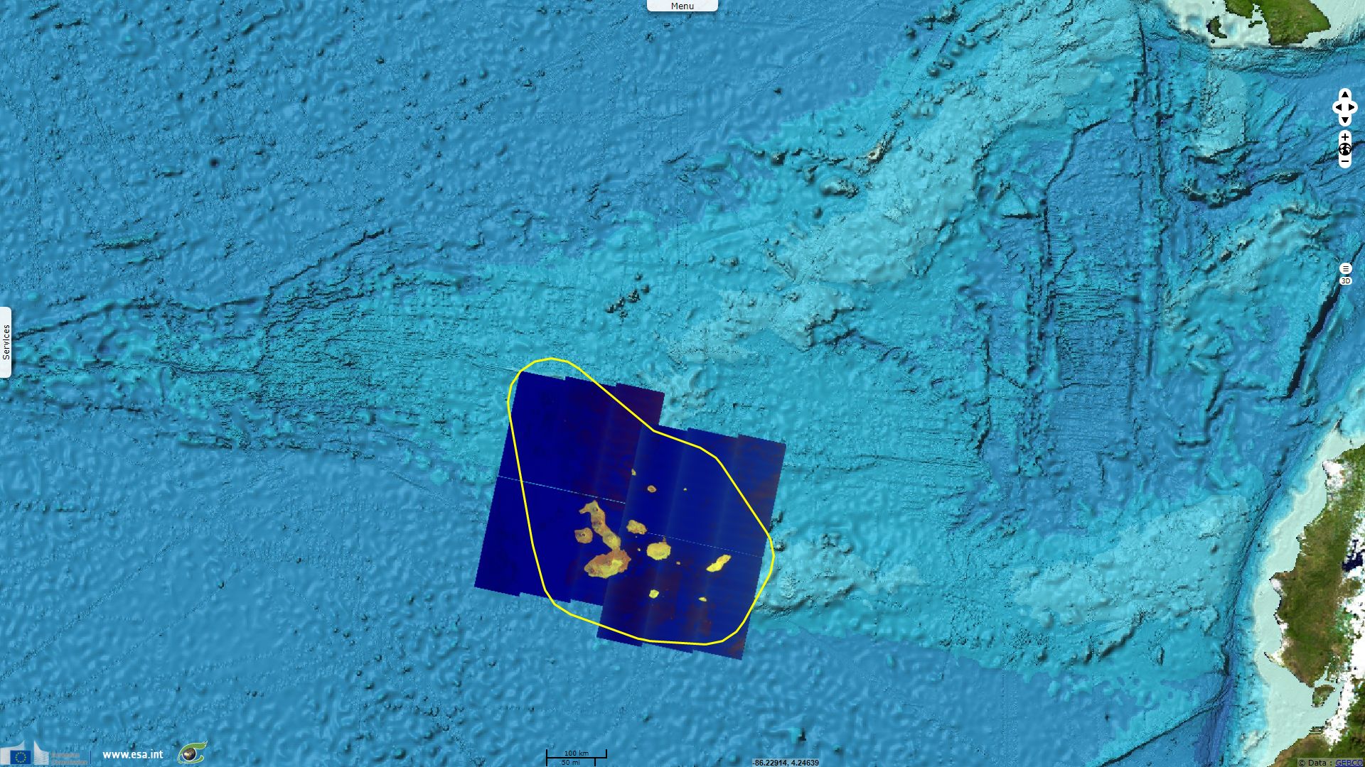
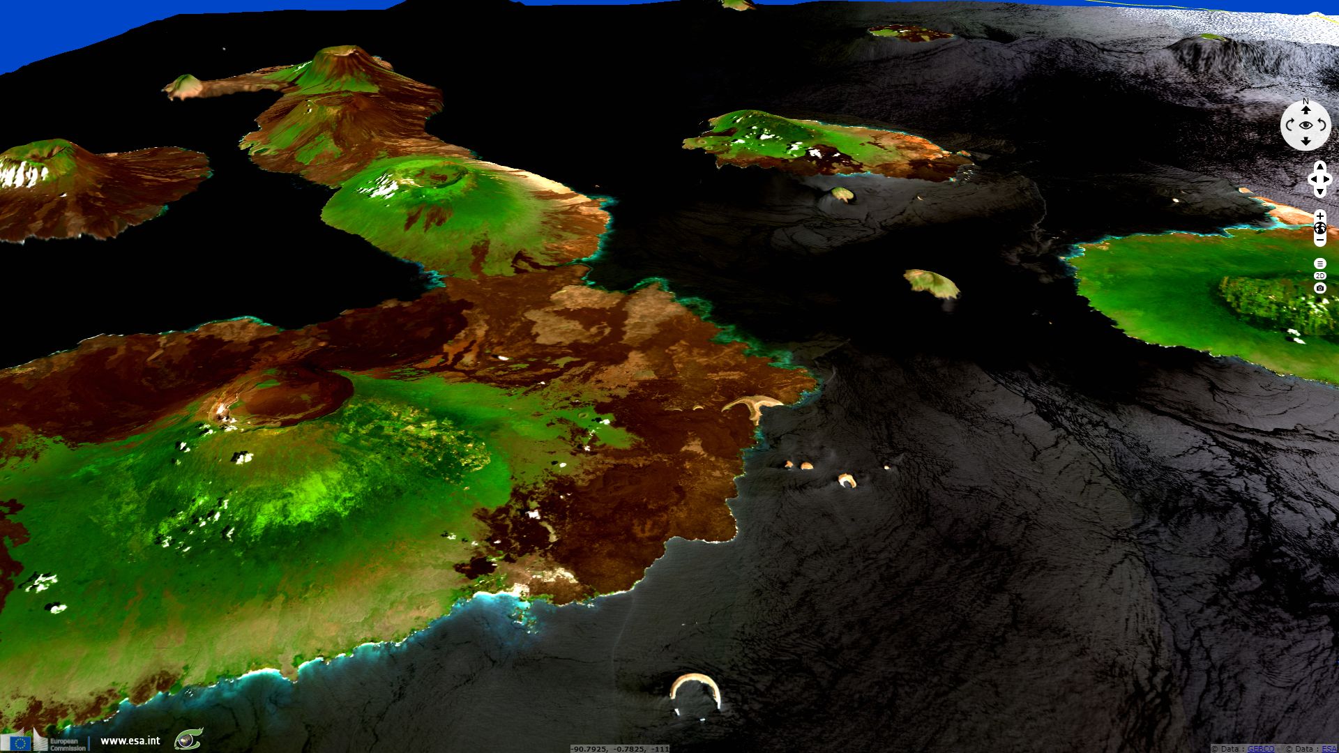
The Galapagos Islands are located 1000 km away from the mainland, on the Galapagos Microplate and the Northern Galapagos Microplate, near the Galapagos Triple Junction. They formed over a hotspot, the Galapagos mantle plume, which could be as old as 90 million years. Oldest islands (San Cristóbal) could be 5 to 9 millions years old while the youngest and most active islands (Fernandina) are estimated to be around 50,000 years old.

Map of the topography and bathymetry of the Galapagos Islands.
UNESCO describes the geology of the Galapagos, writing "the archipelago´s geology begins at the sea floor and emerges above sea level where biological processes continue. Three major tectonic plates —Nazca, Cocos and Pacific— meet at the basis of the ocean, which is of significant geological interest. In comparison with most oceanic archipelagos, the Galapagos are very young [...]. The site demonstrates the evolution of the younger volcanic areas in the west and the older islands in the east. On-going geological and geomorphological processes, including recent volcanic eruptions, small seismic movements, and erosion provide key insights to the puzzle of the origin of the Galapagos Islands. Almost no other site in the world offers protection of such a complete continuum of geological and geomorphological features."
As reminded by the UNESCO Heritage List, "Ongoing seismic and volcanic activity reflects the processes that formed the islands. These processes, together with the extreme isolation of the islands," created ecologic niches depending on the altitude/depth, wind/current confluence, rain/current shadow. Various coastal habitats can be found within the Galapagos waters such as the rocky seabed, vertical rock faces, sandy beaches, lagoons, mangrove swamps and coral reefs.
The website of Galapagos Marine Reserve adds "The strategic location of the islands on the confluence of several marine currents, generates a mix of cold and hot water which have allowed the arrival and establishment of species that come from different areas of the Pacific ocean. This makes the reserve an important marine life sanctuary. The presence of the marine mounts and nutrient blooms caused by the Cromwell submarine current generate an unbelievable abundance of plankton that sustain sea birds, sea lions, and other species as whales, sharks and sea turtles that are difficult to observe in other parts of the world."

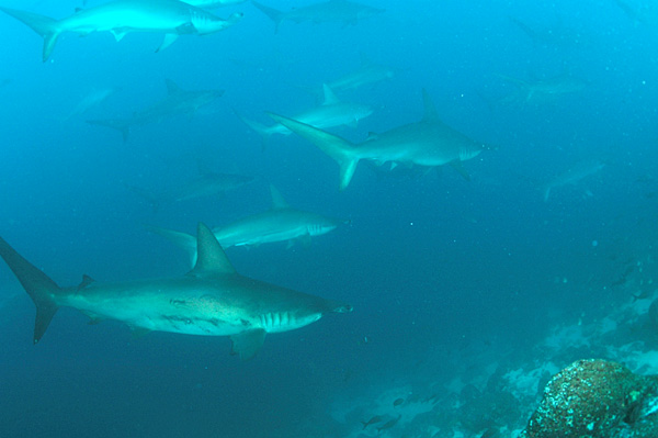 Left: A seal lion chases a school of Salema fish off Isabela Island in the Galápagos by Enric Sala for National Geographic. Right: School of Hammerhead Sharks off Wolf Island, Galapagos Islands, Ecuador by Clark Anderson.
There are large variations in precipitation from one place to another, not only with altitude, but also depending on the location of the islands, and also with the seasons. On the larger islands, the pattern of generally wet highlands and drier lowlands impacts the flora. The vegetation in the highlands tends to be green and lush, with tropical woodland in places. The lowland areas tend to have arid and semi-arid vegetation, with many thorny shrubs and cacti, and almost bare volcanic rock elsewhere. All theses factors contributed "led to the development of unusual animal life [...] that inspired Charles Darwin’s theory of evolution by natural selection following his visit in 1835", published in the 1859 book On the Origin of Species."
Left: A seal lion chases a school of Salema fish off Isabela Island in the Galápagos by Enric Sala for National Geographic. Right: School of Hammerhead Sharks off Wolf Island, Galapagos Islands, Ecuador by Clark Anderson.
There are large variations in precipitation from one place to another, not only with altitude, but also depending on the location of the islands, and also with the seasons. On the larger islands, the pattern of generally wet highlands and drier lowlands impacts the flora. The vegetation in the highlands tends to be green and lush, with tropical woodland in places. The lowland areas tend to have arid and semi-arid vegetation, with many thorny shrubs and cacti, and almost bare volcanic rock elsewhere. All theses factors contributed "led to the development of unusual animal life [...] that inspired Charles Darwin’s theory of evolution by natural selection following his visit in 1835", published in the 1859 book On the Origin of Species."
These ecosystems allowed numerous species to specialize differently than in the mainland, creating a rich endemic ecosystem in addition to the species that can be found elsewhere.
National Geographic lists the following marine species: "whales, dolphins, albatrosses, sharks, sea lions, penguins, fur seals, rays, cormorants, marine iguanas, sea turtles, and tropical fishes." One could also list the endemic galápagos tortoise, Land Iguana, crabs, boobies, gulls, ducks, frigatebirds, swordfishs, flamingoes, herons, finches, mockingbirds, hawks, doves, pelicans, bats...
"More than 2,900 marine species have been monitored, according to the Galapagos National Park Administration. Several different habitats exist in the reserve. Underwater volcanoes or mountains, known as seamounts, rise to near the water’s surface and provide feeding grounds for some fish, such as tuna and sharks, as well as birds, sea lions, and turtles. There are also reefs, underwater cliffs, wetlands, and lagoons."
In 1959, the government of Ecuador created Galapagos National Park. Galapagos Islands were added to the UNESCO List of World Heritage in 1978. However, wildlife being seen as a resource for tourism and fishing industry, it was endangered which led to adding Galapagos Islands to the World Heritage in Danger from 2007 to 2010. National Geographic reminds, "the diversity in the Galápagos has been under siege from pirate fishers, who often sell shark fins on the Asian black market. Sharks have shown declines in some areas of the islands, as have groupers and sea cucumbers, which have also been targeted."
The Guardian lists several other man-induced threats, "a permanent human population which doubled to about 30,000 in the past decade, swollen by more than 190,000 tourists annually, triggered concern about pollution, fuel spills and poaching. Human settlers have also brought invasive species such as insects, cats, rats, cattle and fire ants threatening a habitat which evolved in isolation over millennia." Finally, another threat is the increased mortality of marine species during El Niño episodes because of the significant rise in rise of sea water temperature.
Ecuador decided the creation of the Galápagos Marine Reserve in 1998. National Geographic wrote "The MPA (marine protected area) is designed to protect the biodiversity of the islands and the surrounding waters. The park was also created to ensure the sustainable use of natural resources by local residents. Tens of thousands of people live on the Galapagos Islands, which include an Ecuadorian military base. Some agriculture and fishing are allowed in the MPA, and tourism is the area’s most important economic activity. More than 100,000 people visit the Galapagos Islands every year. The sustainable use practices of the MPA seek to balance the demands of the tourist industry and the pristine habitats tourists seek."
Despite this reserve, the Galapagos ecosystem was not safe yet in 2011, "The Galapagos Islands are threatened by growing tourism, invasive species, illegal fishing, and undocumented immigration leading to a human population the islands and marine area cannot support. Poaching, or illegal fishing and hunting, is a threat to marine species in the MPA. It is legal to hunt many animals in the MPA. Sometimes, poachers are fishermen who overfish, or harvest more than the MPA allows. Tuna and sharks are often overfished. Some of the most overfished animals are lobsters and sea cucumbers. It is always illegal to hunt some animals in the Galapagos MPA. Sea turtles are illegally hunted for their meat. Sea lions are poached for their teeth and genitals, which are used in Asian medicines. Non-native plants and animals also threaten the Galapagos marine ecosystem. Dogs and cats prey on tortoises, marine birds, and marine iguanas. Cockroaches feed on native insects, destroying an important part of the marine food web."
In March 2016, National Geographic reported that, to ensure the conservation of Galapagos Islands, "Ecuador’s president, Rafael Correa, announced creation of the marine sanctuary, together with 21 smaller conservation areas scattered through the volcanic archipelago, protecting over 47,000 square kilometers, or about one third of the water around the Galápagos Islands (which Ecuador administers). The new sanctuary alone encompasses 40,000 square kilometers and extends around the northern Galápagos islands of Darwin and Wolf. [...] The Galápagos Islands already had 97 percent of their landmass protected as a national park. However, less than one percent of the surrounding water was fully protected. As a result, legal and illegal fishing have been taking a rising toll on wildlife over the past few years, says Enric Sala, a National Geographic Explorer-in-Residence who led a Pristine Seas expedition to the area in December. [...] Fishing will no longer be allowed in the new sanctuary and conservation zones. Mining or oil drilling also won’t be allowed, although there hasn’t been recent interest from industry in the area."
"Further, the large no-fishing zone will benefit the fishermen who will still be allowed to fish waters outside the sanctuary. [...] We know that well enforced no-take zones result in spillover of fish that increases fishermen’s incomes. [...] All this makes the new sanctuary a win-win” says Enric Sala."
The views expressed herein can in no way be taken to reflect the official opinion of the European Space Agency or the European Union.
Contains modified Copernicus Sentinel data 2026, processed by VisioTerra.
Contains modified Copernicus Sentinel data 2026, processed by VisioTerra.
| More on European Commission space: |  |
 |
 |
||||
| More on ESA: | |
|
|
S-1 website | S-2 website | S-3 website | |
| More on Copernicus program: | |
|
|
Scihub portal | Cophub portal | Inthub portal | Colhub portal |
| More on VisioTerra: | |
|
|
Sentinel Vision Portal | Envisat+ERS portal | Swarm+GOCE portal | CryoSat portal |