Why the Colorado river runs dry
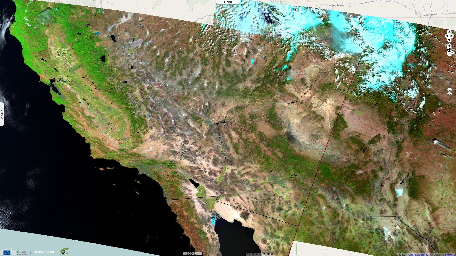
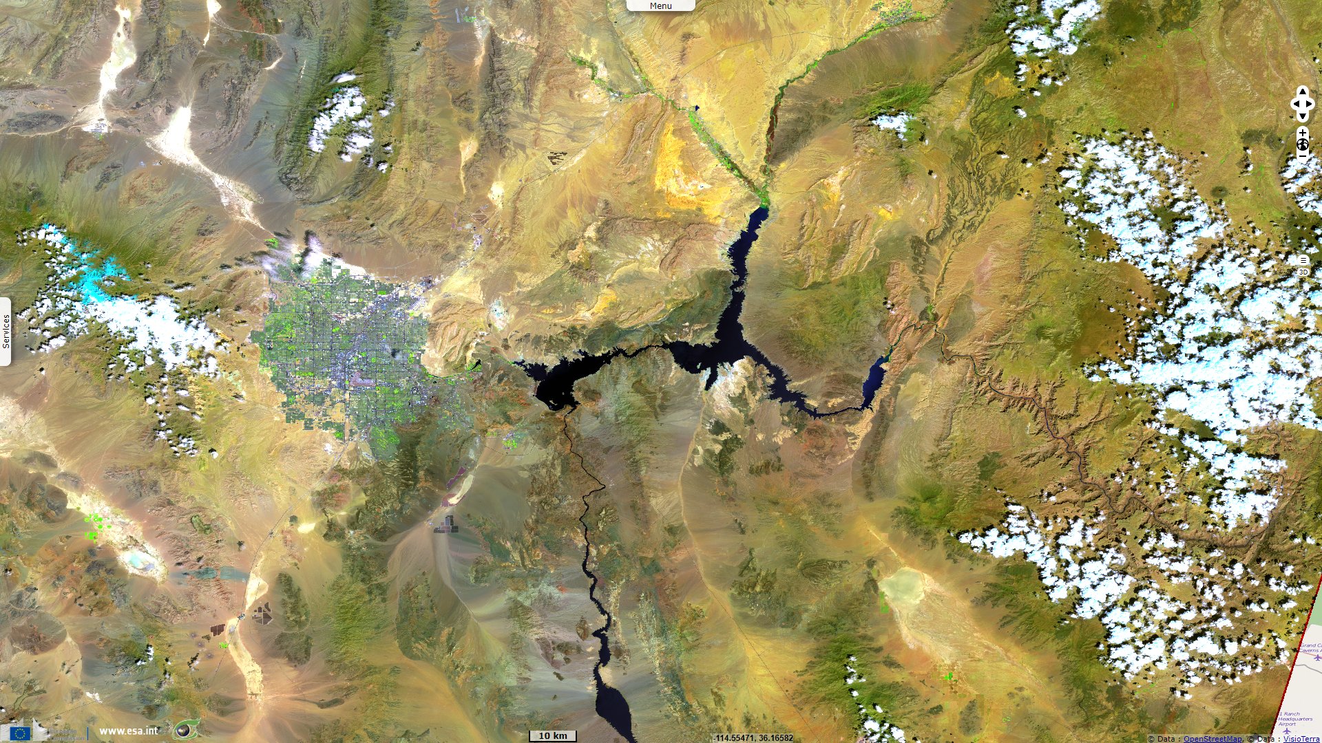
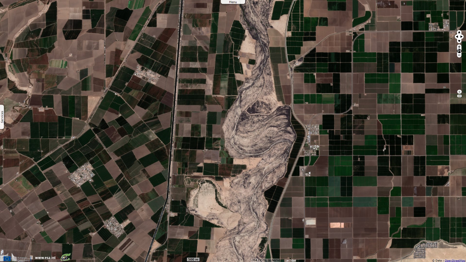
Sentinel-2 MSI acquired on 01 May 2019 at 18:19:21 UTC
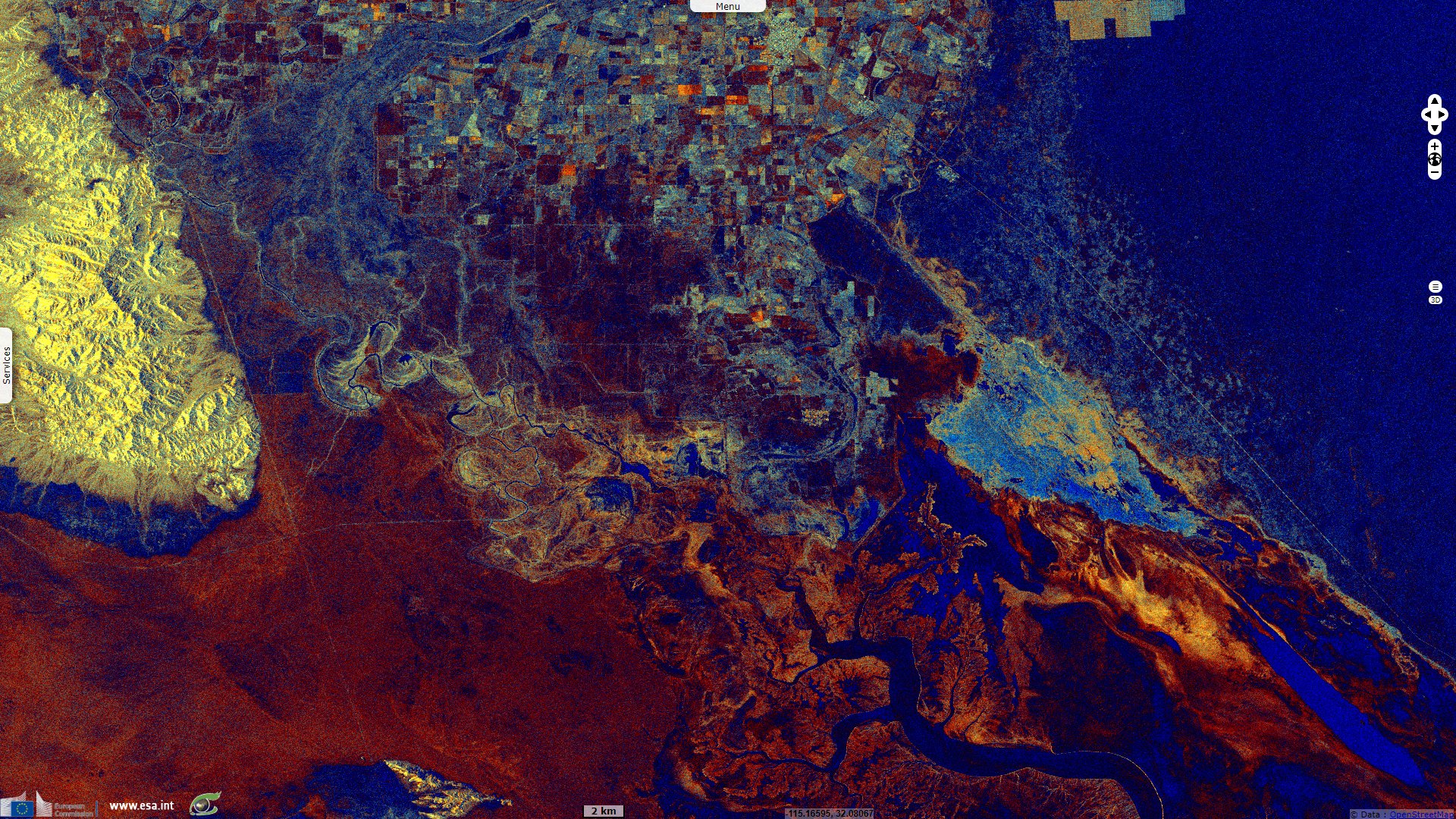
Sentinel-1 CSAR IW acquired on 06 May 2019 from 01:40:37 to 01:41:02 UTC
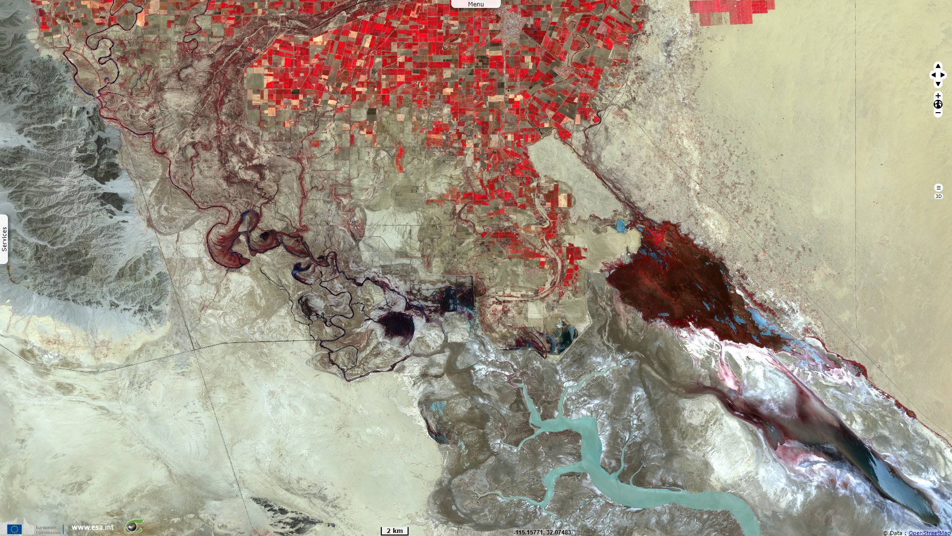
Sentinel-3 OLCI FR acquired on 21 October 2019 at 17:23:58 & 18:03:36 UTC
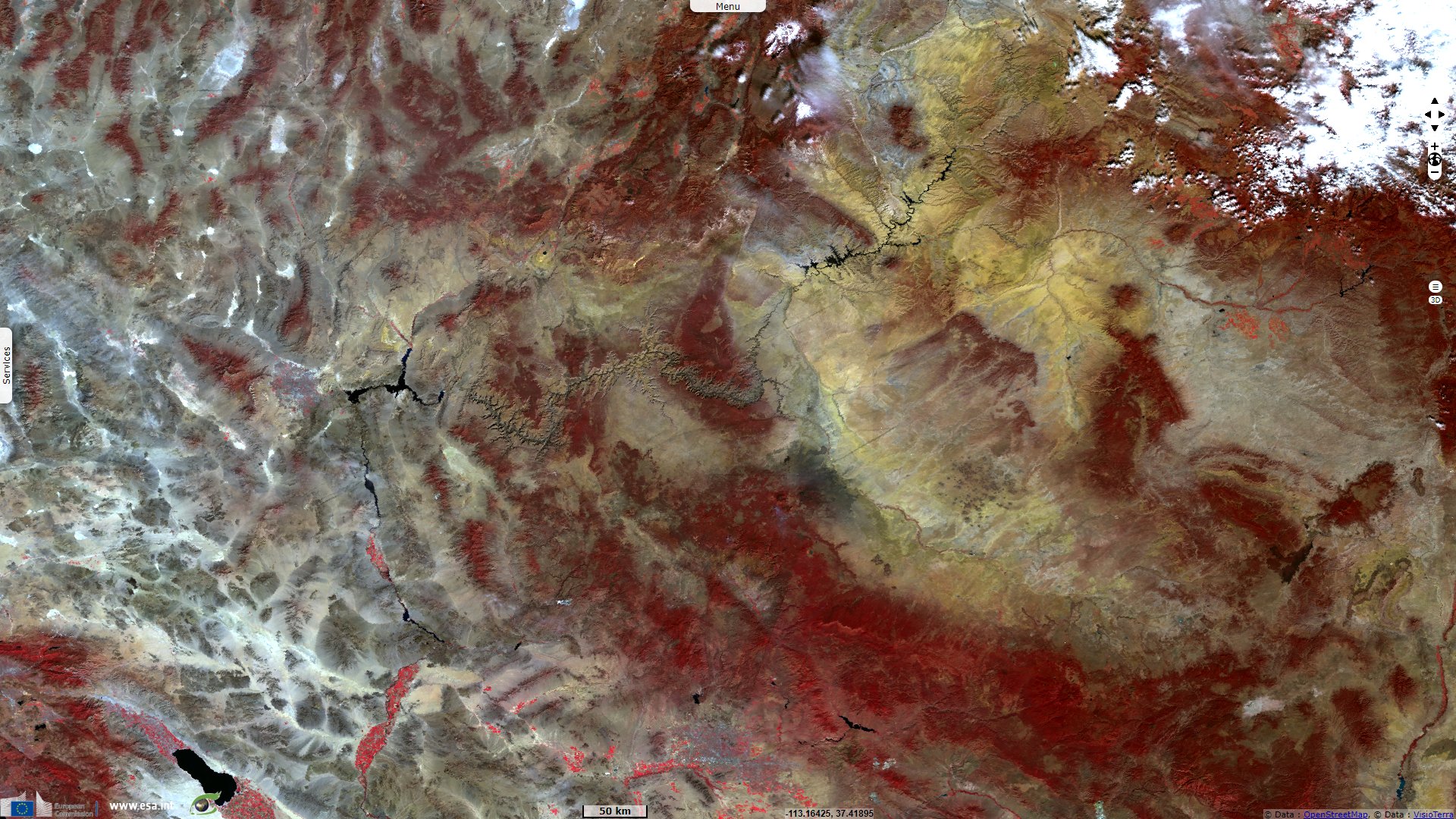
Sentinel-3 SLSTR RBT acquired on 21 October 2019 at 17:23:58 & 18:03:36 UTC
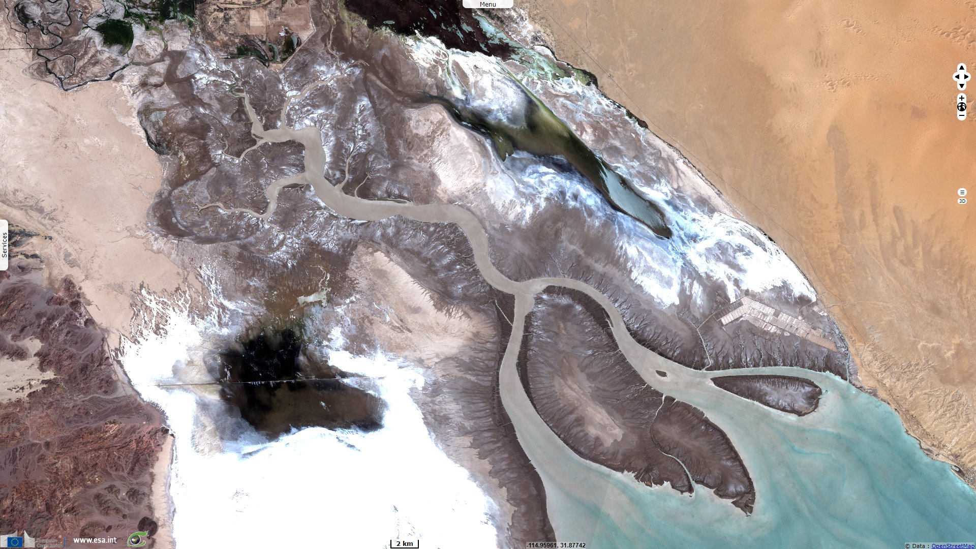
Sentinel-1 CSAR IW acquired on 06 May 2019 from 01:40:37 to 01:41:02 UTC
Sentinel-3 OLCI FR acquired on 21 October 2019 at 17:23:58 & 18:03:36 UTC
Sentinel-3 SLSTR RBT acquired on 21 October 2019 at 17:23:58 & 18:03:36 UTC
Keyword(s): Hydrology, urban planning, irrigated agriculture, cropland, desert, canyon, wetland, USA, United States, Mexico.
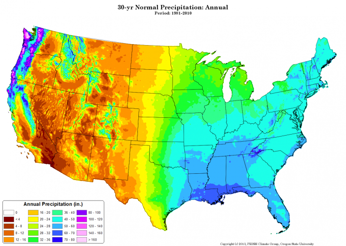
Map of average annual precipitations for the U.S. for 1981-2010 - Source: PRISM Climate Group, Oregon State University
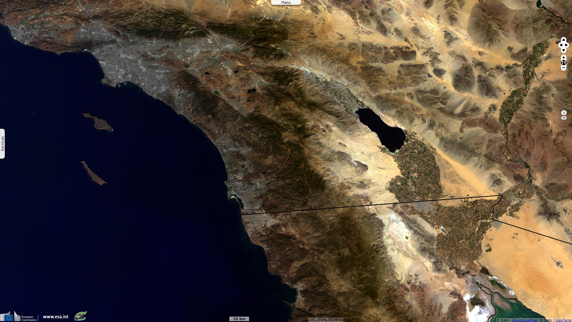
The Colorado, this mighty river known for carving the Great Canyon does not usually reach the Pacific Ocean anymore and only a fraction of it reaches Mexico. It is due to overallocation of water to feed desert cities and irrigated agriculture. Matt Weiser raises the subject in an article published in NewsDeeply on May 16, 2017: "California’s largest lake, the Salton Sea, is an accident. It was created in 1905 when a levee broke on an irrigation canal, flooding a giant desert playa. Today it has become a sticking point in negotiations between three states over the future of the Colorado River. The three states – California, Arizona and Nevada – are in the midst of negotiating a drought contingency plan (DCP). It would commit each state to reducing diversions from the Colorado River in order to prevent Lake Mead from shrinking to disastrously low levels."
"Michael Cohen, a senior research associate at the Pacific Institute, specialised in Salton Sea and Colorado River issues added: 'The DCP is important because, essentially, the Colorado River is over-allocated. Particularly in the lower basin, they have what’s called a structural deficit: In normal years, 1.5 billion cubic meters more water flows out of Lake Mead than flows in. So Lake Mead drops by roughly 3.6m per year. Given that trajectory, it pretty quickly reaches dead pool, meaning there’s no water left in Mead, which then means no water for Southern California and the Central Arizona Project, and 90 percent of the Las Vegas metro area’s water supply dries up. So you’re talking about 30 million people who depend on Lake Mead. Not to mention 400,000 hectares of irrigated land. And it’s a major hydropower producer.'"
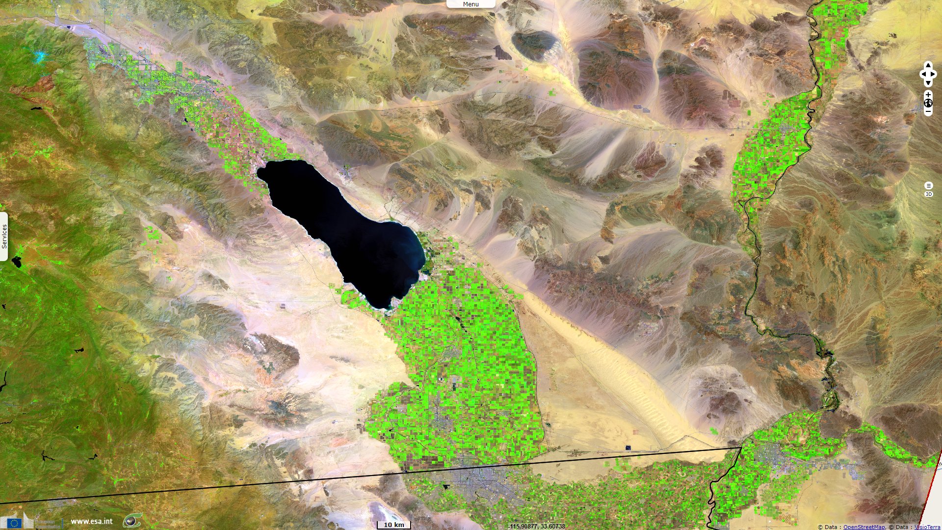
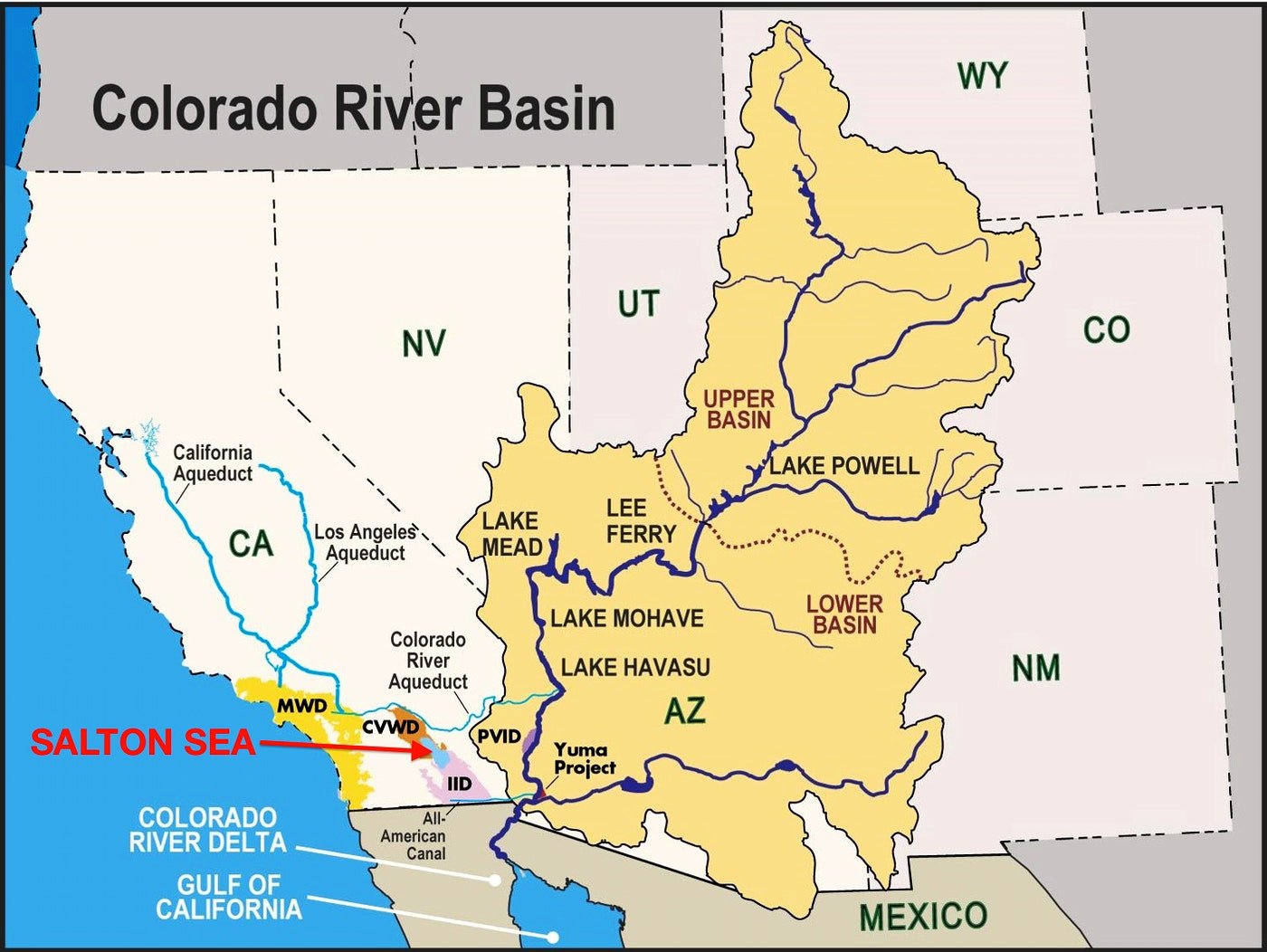
A map shows the location of the Salton Sea and the Colorado River Basin. Source: Central Basin Water District
David Owen explains the roots of this situation in an article published in the NewYorker on May 18, 2015: "As moisture-laden weather systems move eastward across the western United States, they pile up over the Rockies, dumping snow and rain. Eighty per cent of Colorado’s precipitation falls on the western half of the state, yet eighty-five per cent of the population lives to the east, in what’s known as the mountains’ rain shadow. If transporting water from one side to the other were impossible, most of the people who live in Denver and other Eastern Slope cities would have to move."
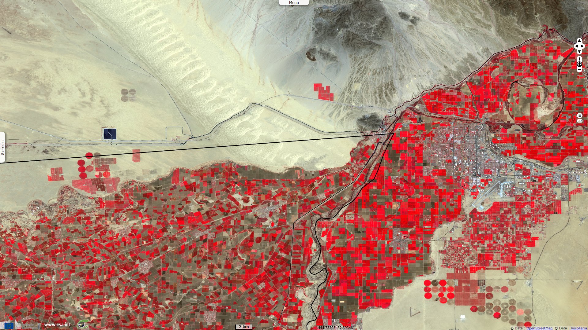
"It and its tributaries flow through or alongside seven Western states—Colorado, Wyoming, Utah, New Mexico, Nevada, Arizona, and California—before crossing into Mexico near Yuma, Arizona. It supplies water to approximately thirty-six million people, including residents not just of Boulder and Denver but also of Salt Lake City, Las Vegas, Phoenix, Tucson, San Diego, and Los Angeles, several of which are hundreds of miles from its banks. It irrigates close to six million acres of farmland, much of which it also created, through eons of silt deposition. It powers the hydroelectric plants at the Hoover and Glen Canyon dams, is the principal source for the country’s two biggest man-made reservoirs, and supports recreational activities that are said to be worth twenty-six billion dollars a year. Some of its southern sections attract so many transient residents during the winter that you could almost believe it had overflowed its banks and left dense alluvial deposits of motorboats, Jet Skis, dirt bikes, all-terrain vehicles, trailers, mobile homes, fifth wheels, and R.V.s."
"'Water law in Colorado and most states in the West is based on what’s called the doctrine of prior appropriation'. That doctrine holds that the first person to make 'beneficial use' of water gains the right to use that quantity for that purpose forever, and that the claim takes precedence over every claim made later. The prior-appropriation doctrine originated during the California gold rush, which began in 1849, and during a similar gold rush in Colorado a decade later. The most common mining technique in that era involved shovelling earth into a wooden trough, called a sluice box, then directing a swiftly moving stream of water over it, in the hope of washing away everything but gold. Disputes arose when newcomers made diversions upstream from existing operations, because water was so scarce that dividing the flow among multiple miners could make it useless to all. Early farmers faced identical conflicts. The solution, through much of the West, was a new conception of water rights whose central tenet was 'first in time, first in right.' Proximity to the source counted for nothing, because miners and farmers sometimes had to move water long distances. The critical factor was the date of first use."
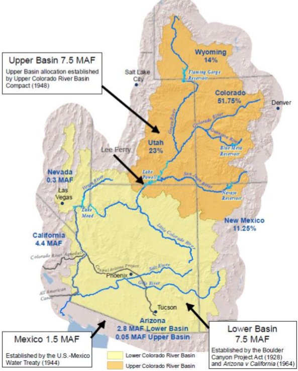
Colorado River Basin Allocations, Percentages of overall allocation and million acre-feet (MAF) - Source: Congressional Research Service, using data from USGS, ESRI Data & Maps, 2017, Central Arizona Project
"People who live on farms and in small towns in western Colorado often accuse people who live in cities in eastern Colorado of taking water that doesn’t belong to them, but throughout the West the main water consumers are farms. Jim Lochhead, who is the chief executive officer of Denver Water, the biggest water utility in Colorado, told me, 'We serve a quarter of the state’s population and well over a quarter of the state’s economic activity, yet we use less than two per cent of the state’s water.' Agriculture accounts for roughly eighty per cent of all Colorado River water consumption. That means that cities could cut back by double-digit percentages without having much impact on overuse, and that most serious conservation efforts necessarily focus on agriculture."
The views expressed herein can in no way be taken to reflect the official opinion of the European Space Agency or the European Union.
Contains modified Copernicus Sentinel data 2026, processed by VisioTerra.
Contains modified Copernicus Sentinel data 2026, processed by VisioTerra.
| More on European Commission space: |  |
 |
 |
||||
| More on ESA: | |
|
|
S-1 website | S-2 website | S-3 website | |
| More on Copernicus program: | |
|
|
Scihub portal | Cophub portal | Inthub portal | Colhub portal |
| More on VisioTerra: | |
|
|
Sentinel Vision Portal | Envisat+ERS portal | Swarm+GOCE portal | CryoSat portal |