Agriculture in Central Asia
Sentinel-3 SLSTR RBT acquired on 02 May 2017 at 05:55:32 UTC
...
Sentinel-3 SLSTR RBT acquired on 28 August 2017 at 06:39:40 UTC
Sentinel-3 OLCI FR acquired on 28 August 2017 at 06:39:40 UTC
...
Sentinel-3 SLSTR RBT acquired on 28 August 2017 at 06:39:40 UTC
Sentinel-3 OLCI FR acquired on 28 August 2017 at 06:39:40 UTC
Keyword(s): Land use, agriculture, irrigation, erosion, monoculture, pollution, saline lakes, endorheic basin, steppe, desert, mountain range, continental climate, Central Asia, Kazakhstan, Kyrgyzstan, Uzbekistan
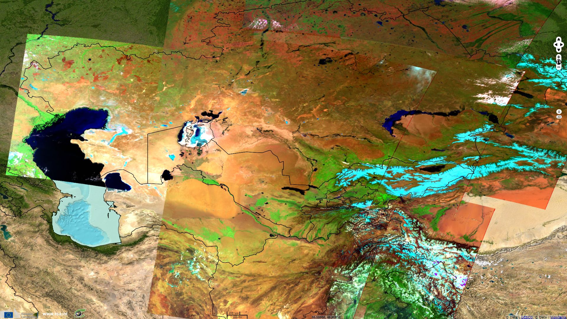
Kazakhstan proclamed its contitution the 30th August 1995, while Kyrgyzstan and Uzbekistan declared their independance respectively the 31st August 1991, 1st September 1991. These adjacent ex-Soviet republics share a landlocked position in a larges endorheic basin, mainly the Aral–Caspian Depression and the Balkhash-Alakol depression. The collision of the Arabian plate with the Eurasian and Iranian Plate caused the rise of Caucasus at the west and Alborz at the south-west of this region, while the Indian subcontinent colliding, elevated Hindu Kush at the south, Pamir-Alay and Tian Shan ranges at the south-east and Altai Mountains at the east of the region, the closest ocean, the Arctic, is separated from Kazakhstan by over 1000 km of Siberian plains.
Due to this remoteness and the very high surrounding ranges, the climate of the Central-Asia region has very little maritime or oceanic influence. Exemplified by desertic areas such as the Kazakh Steppe (which occupies the northernmost third of Kazakhstan), Turan Lowland, Ryn Desert or Kyzylkum Desert, Central Asia dry to arid and very continental climate with 40 degrees Celcius spread in monthly means makes the region harsh for men and most vegetals. Outside oil and gas, these three countries are are still very reliant on agriculture, especially pastoralism.
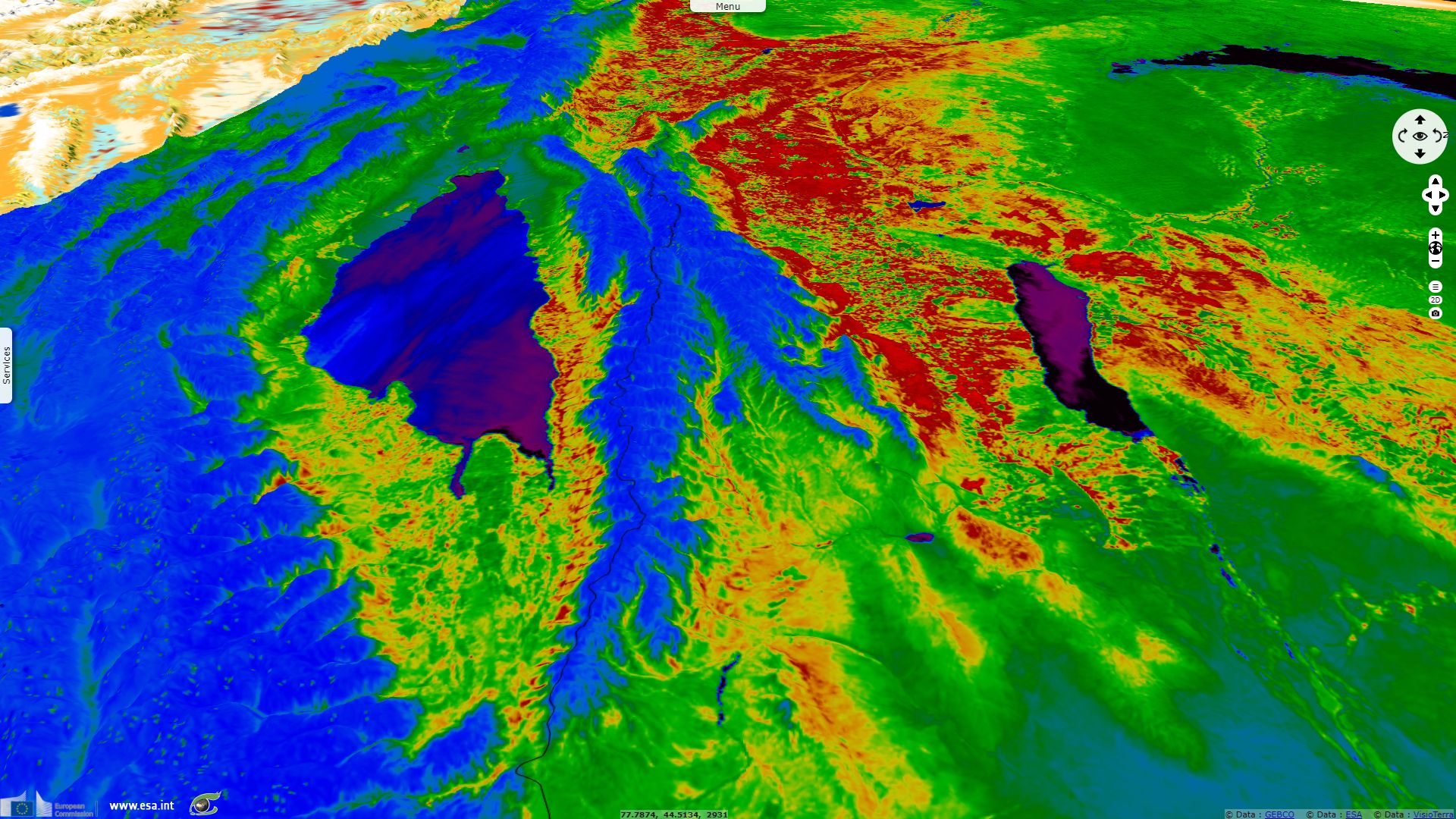
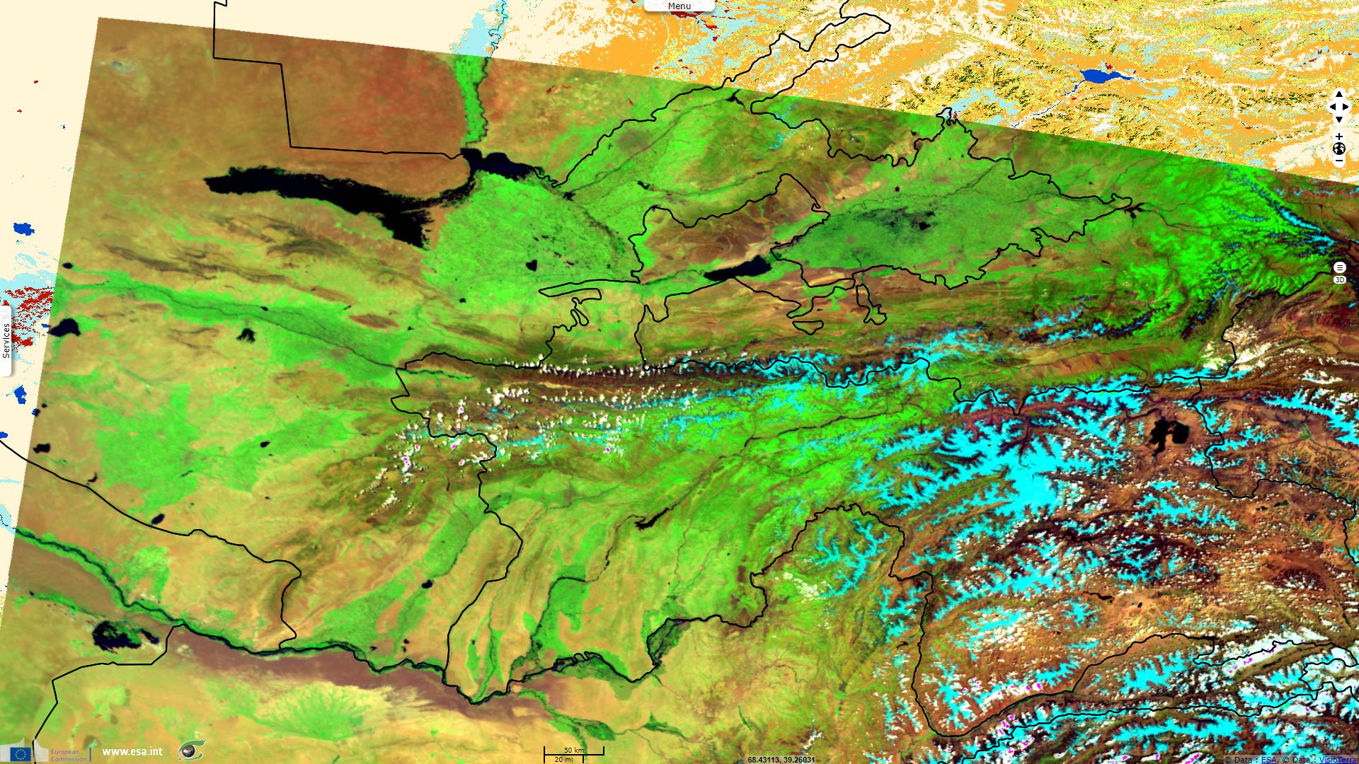
With a mean elevation nearing 3000m, a large fraction of Kyrgyzstan is occupied by mountain ranges which feed numerous endorheic lakes of the region. During melt season, river discharge increase and snow cover decrease, allowing irrigation of vegetation on mountains flanks and downstream seasonal cropland.
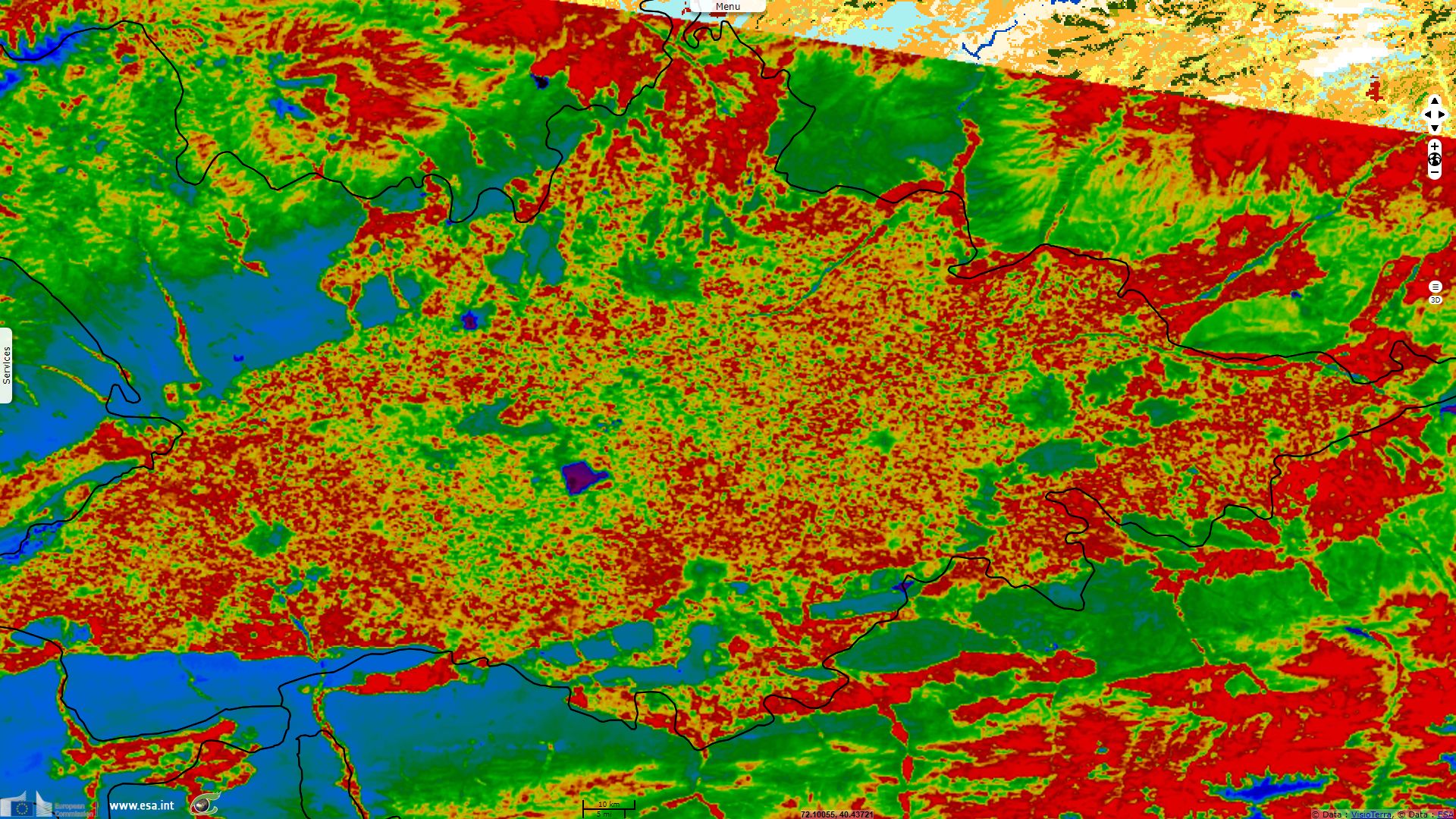
Several valleys of Kyrgyzstan and Uzbekistan are densely populated, but hardly 10% of the land are considered arable with 80% of it is now irrigated, often in delta features or alluvial fans.
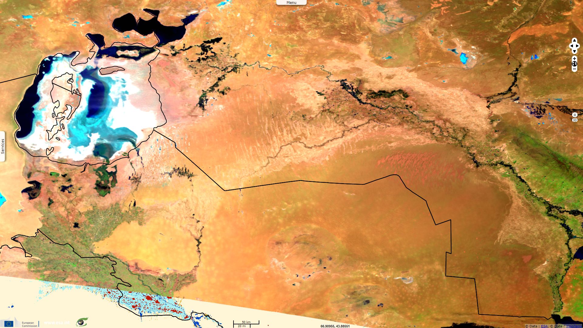
In order to increase the cultivated surfaces, USSR decided to divert affluents of the Aral to allow a large program of irrigation. The selected monocultures required massive quantities of pesticides and fertilizer as soils progressively impoverished. With the divertion and massive evaporation, Syr Darya and Amu Darya rivers soon ran dry or near dry before reaching the Aral and some of their own major affluents also dried out.
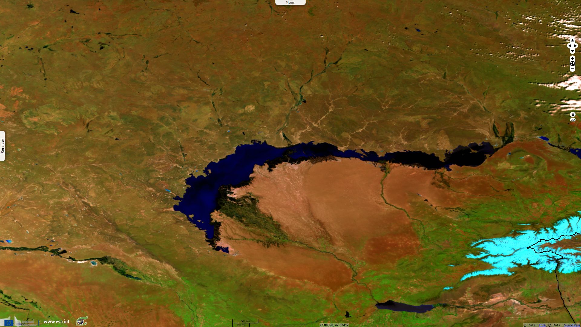
While it met its short term objective, this decision caused the Aral sea surface area to shrink by about 60%, and its volume by 80% from 1960 to 1998. Another consequence was that the salinity and the pollutant concentration in Aral Sea and Lake Balkhash skyrocketted, salinity reaching levels comparable to that of the Dead Sea and making fishing impossible.
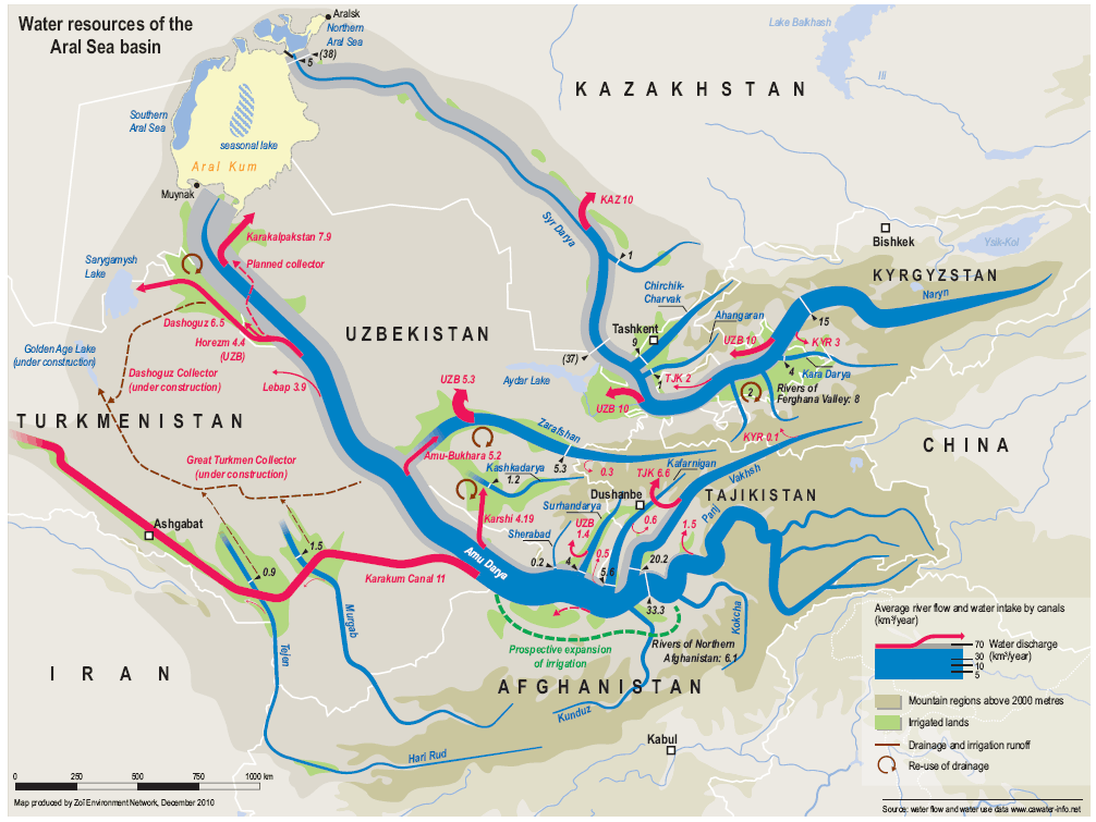
Water resources of the Aral Sea basin.
Kazakhstan is sparcely populated with only 6 inhabitants / km². According to CIA factbook, While 68% of its land is dedicated to pasture, less than 10% of its territory comprises arable land but its main crop, wheat (of which it is among world's largest producers), runs largely without irrigation. Kazakhstan is less dependant on water-hungry cotton and rice than Kyrgyzstan and Uzbekistan are.

In 1953, Nikita Khrushchev decided to launch the Virgin Lands Campaign. Its goal was a large increase of the cropland surface by a recruitment of hundreds of thousands of agricole workers to work in large wheat monoculture.
This politic succeeded on the short term to increase the production but its effect slowly decreased. While poor living conditions may have contributed to a decrease of the number of workers, depletion of soil nutriments due to monocultures was aggravated by the soil erosion caused by desert winds.
The effect of these two programs are still felt today. Since their independance, these countries launched replinishing programs of its endorheic lakes and crops diversification (such as tobacco and grain) which improved the situation.
The views expressed herein can in no way be taken to reflect the official opinion of the European Space Agency or the European Union.
Contains modified Copernicus Sentinel data 2026, processed by VisioTerra.
Contains modified Copernicus Sentinel data 2026, processed by VisioTerra.
| More on European Commission space: |  |
 |
 |
||||
| More on ESA: | |
|
|
S-1 website | S-2 website | S-3 website | |
| More on Copernicus program: | |
|
|
Scihub portal | Cophub portal | Inthub portal | Colhub portal |
| More on VisioTerra: | |
|
|
Sentinel Vision Portal | Envisat+ERS portal | Swarm+GOCE portal | CryoSat portal |