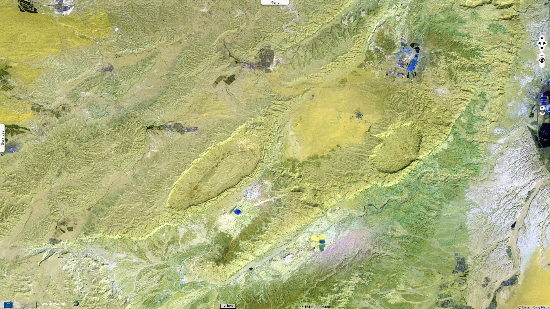
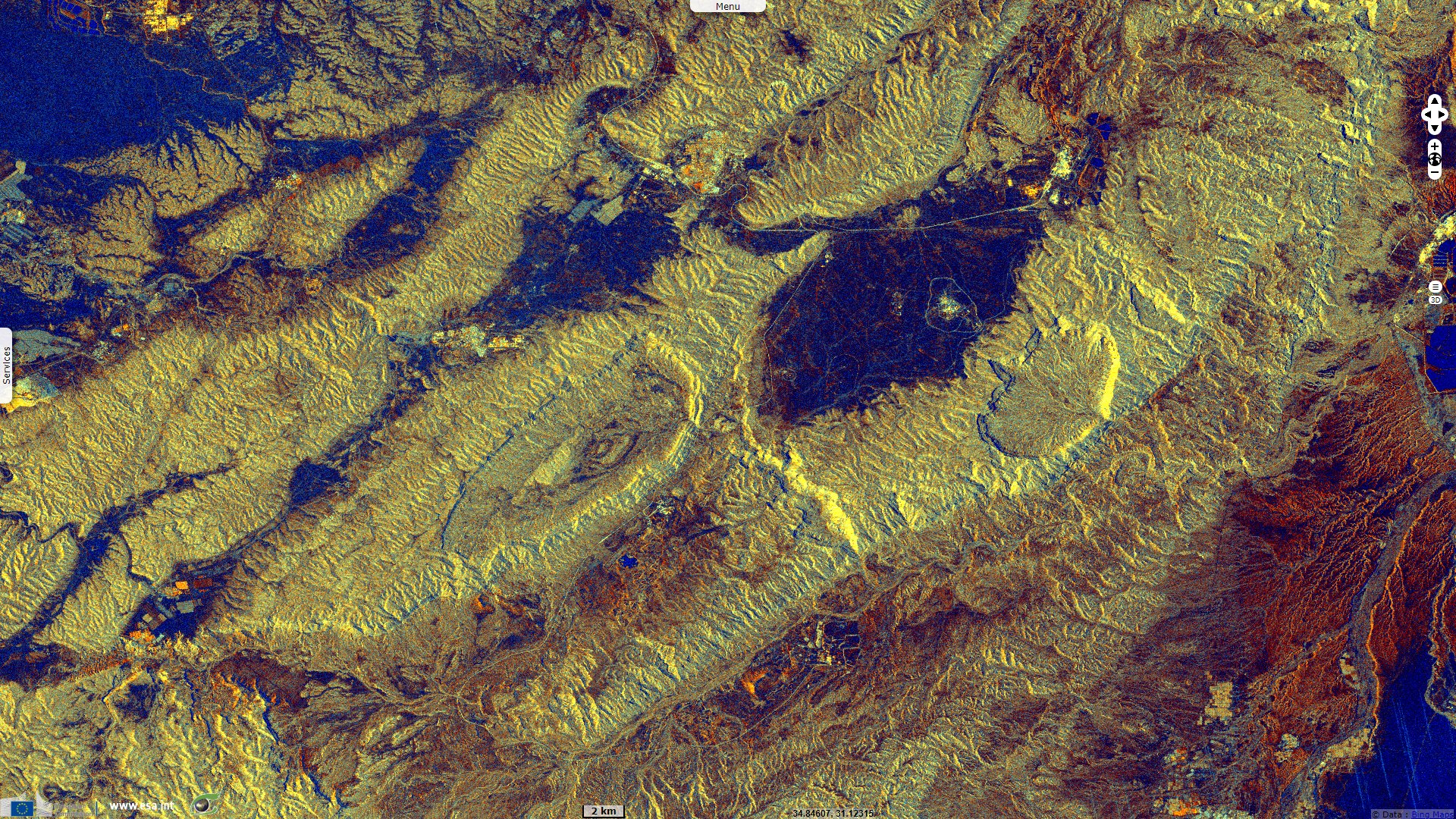
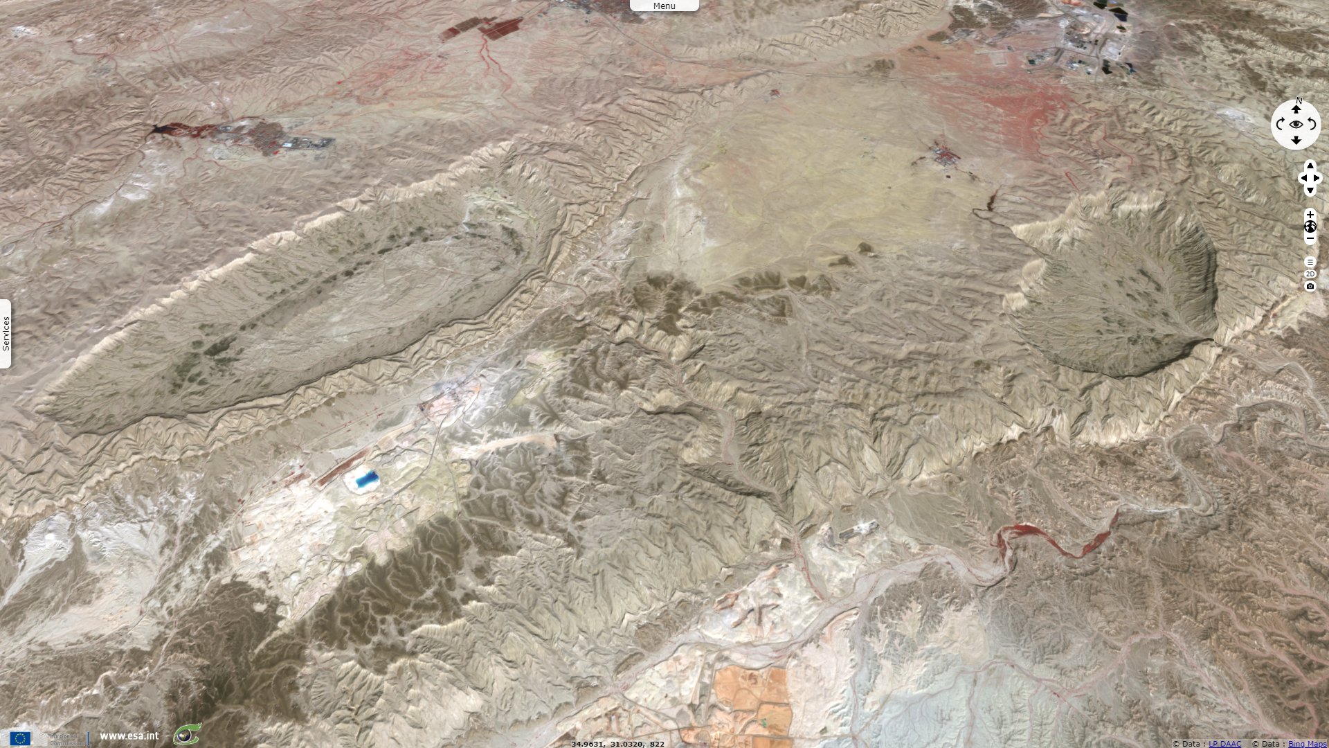
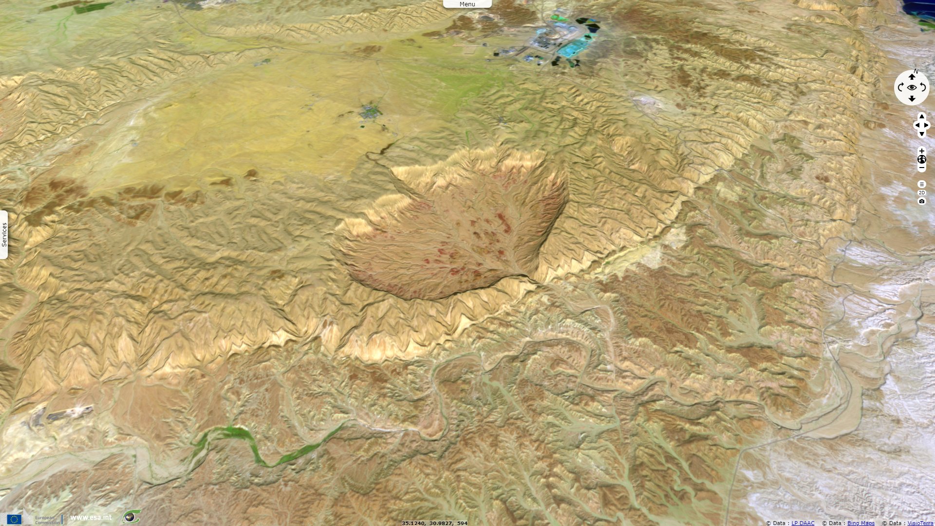
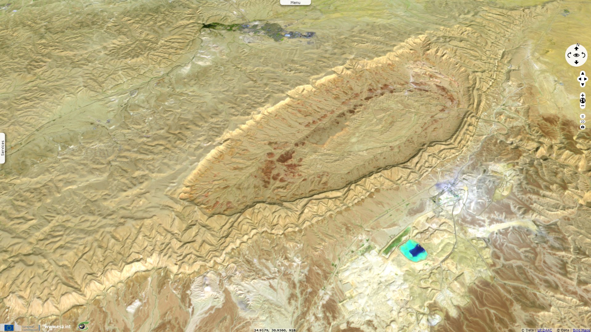
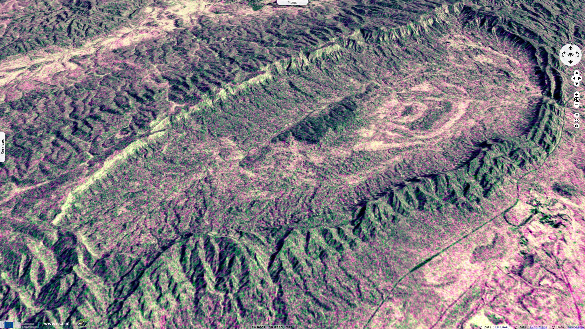
Makhtesh Gadol and Makhtesh Katan, 'big crater' and 'small crater' in the Negev desert, Israel
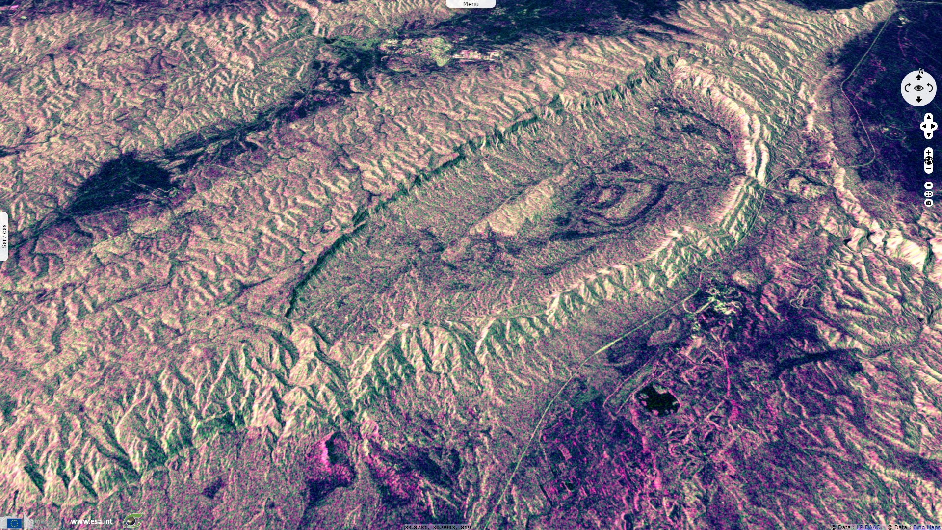
Sentinel-1 CSAR IW acquired on 06 November 2017 at 15:39:38 UTC
Sentinel-2 MSI acquired on 25 February 2019 at 08:19:19 UTC
Sentinel-2 MSI acquired on 25 February 2019 at 08:19:19 UTC
Keyword(s): Landform, geology, erosion, river, national park, biodiversity, Israel, Negev desert
A makhtesh is an erosion cirque made of steep walls of resistant rock surrounding a deep closed valley, it is usually drained by a single wadi. All of the seven known makhteshim are located in the Negev and the Sinai deserts.
The five located in Israel are all on the tentative list of UNESCO World Heritage where the makhteshim country is described as follows: "The Negev, Israel's southern half, is a colorful rocky desert, and its center is dominated by north-east south-west anticlinal ridges. The crests of four of these ridges host five deep, breathtaking valleys, that have in common unique features: they are surrounded by steep walls, built of hard limestone and dolomite at the upper half and friable sandstone at the bottom."
"Each of these valleys is drained by a single narrow river bed. Such a unique closed valley is called makhtesh (plural makhteshim), the Hebrew word for mortar. The term crater describes the rather common feature of a valley at the top of a volcano, but the steep valleys of the Negev are different - they were carved by erosion. The term makhtesh has been adopted internationally, and the geological dictionaries reher to the Negev examples." Both Makhtesh Katan and Makhtesh Gadol are drained by a stream passing through an opening in the southeastern wall of the crater (known as the Ashmadai Gate or the Devil's Gate in Makhtesh Katan's case). These small streams finally reach the Dead Sea, the lowest dry point on Earth.
"Valleys eroded into mountainous ridges are found elsewhere, but they are irregular, cut by faults, open to various directions, and covered by soil and vegetation. In contrast, the makhteshim are deep closed valleys, bare of soil and vegetation, and the rocks are displayed in a feast of colors. The five makhteshim are geological windows, peeping into the Earth's crust and each exposing a different geological display. The makhtesim are unique assets of nature, the only complete exemplars of their kind in the world. The rock strata are inclined, disclosing the anticlinal structure of the hosting ridges, and the visitors driving or walking through the up to 220 million years old pages of the most vivid geology books exhibited by nature. These formations are geographically well defined shelters in which the original flora and fauna of the Negev Highland are best preserved."
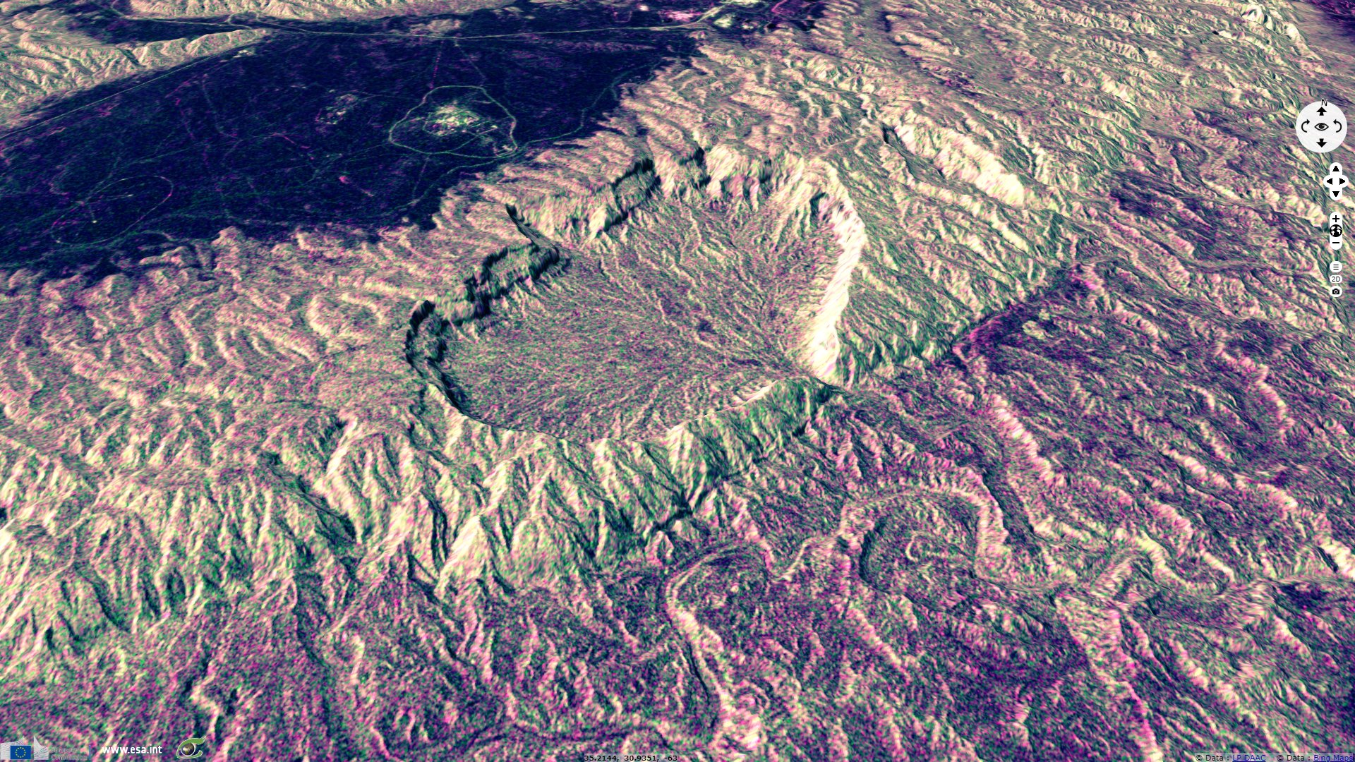
Makhtesh Katan, "Small Crater" was first charted in 1942 by Jewish explorers. It is 8 x 6 km large and 400 m deep. The Makhtesh Katan is known for its colourful sandstone. The colour of the sandstone varies between white, gray, brown, yellow, red, purple and white. The stone colours are due to tiny amounts of iron oxides. One of its specificity is its biodiversity: flights over the area are forbidden be cause of nearby infrastructures. Benefiting from this tranquillity, storks and endangered eagles can be found within the crater. It even became a natural reserve in June 2019.
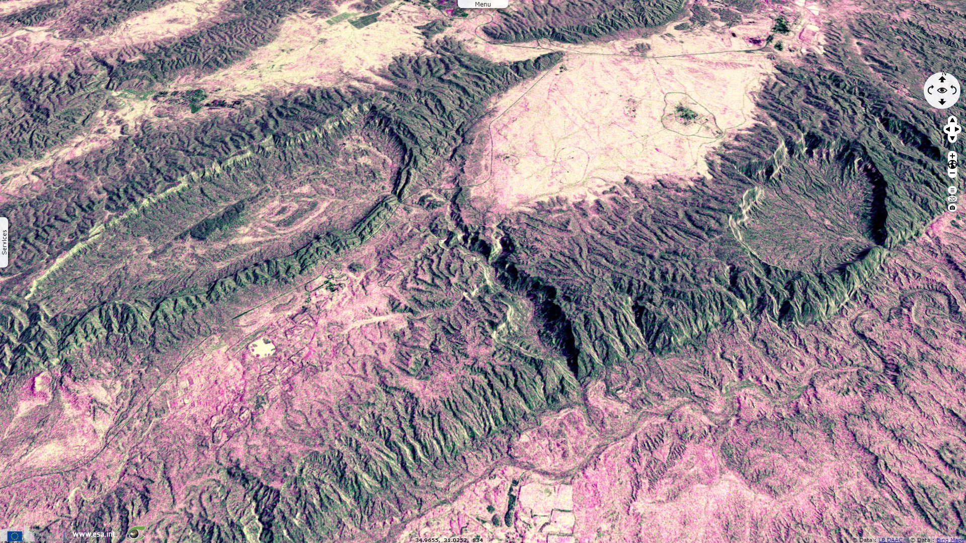
Today the makhteshim are believed to have been formed by erosion of soft rock layers that are under harder layers - the crater's center used to be the head of a mountain, the crater's lips still face the head of the mountain that no longer exists, and the face of the mountain erodes and becomes a crater. Ofira Gal of the Center of Educational Technology wrote that to create a makhtesh, a combination of several conditions is required: asymmetric arches, rock layers that are not uniform in hardness (hard rock layers on top of soft rock layers), a low erosion process that includes a stream that sweeps the crater's contents, and desert climate, as dryness protects crater walls from weathering.
Ofira Gal explains the main steps in a makhtesh's development: The location of a makhtesh was once a continental area covered in sandstone (a relatively soft sedimentary rock) formed 160-220 million years ago during the Jurassic and Triassic ages. It sunk under a marginal sea where calcite-rich marine fauna thrived. This caused an accumulation of limestone (a relatively hard material). Telluric forces then elevated the area above the sea, formed a ridge and created asymmetrical arches with one side much steeper than the other. As it stood out in the surrounding landscape, the arch head underwent weathering. As a result of the weathering process, the top of the vault was destroyed: the upper layers (which were relatively hard and composed of limestone) were removed, the soft sandstone inside the vault was also exposed. Later on, a system of rivers developed. The stream that ran over the ridge removed the interior of the vault and opened a large valley - it is the makhtesh: a valley surrounded by upright walls and drained by one stream.
The size of the crater is determined by the size of the ridge peak present at the beginning of the process. The craters have not changed their depth and very little in their width for four million years. Recent studies have shown that there is no connection between the age of the crater and its size (Ramon makhtesh is both the youngest and largest crater of the seven). The weathering processes that created the craters have slowed to a halt as the streams today are narrow and small and unable to continue the weathering processes that led to the craters' development.
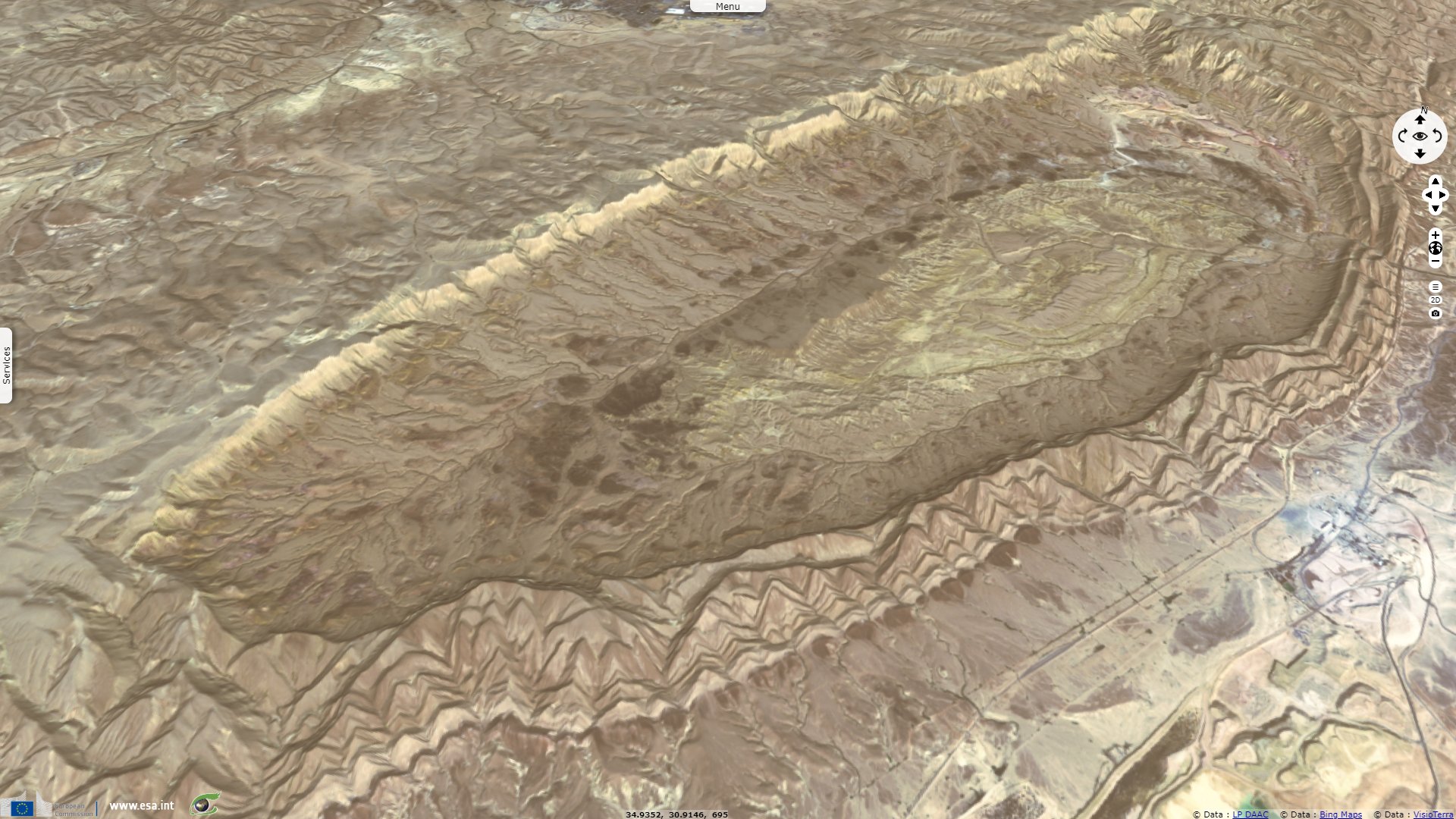
Makhtesh Gadol is 14 x 6 km large and 410 m deep. It is the second largest makhtesh after Makhtesh Ramon shown in a previous story.
The views expressed herein can in no way be taken to reflect the official opinion of the European Space Agency or the European Union.
Contains modified Copernicus Sentinel data 2026, processed by VisioTerra.
Contains modified Copernicus Sentinel data 2026, processed by VisioTerra.
| More on European Commission space: |  |
 |
 |
||||
| More on ESA: | |
|
|
S-1 website | S-2 website | S-3 website | |
| More on Copernicus program: | |
|
|
Scihub portal | Cophub portal | Inthub portal | Colhub portal |
| More on VisioTerra: | |
|
|
Sentinel Vision Portal | Envisat+ERS portal | Swarm+GOCE portal | CryoSat portal |