Biodiversity conservation in Eswatini
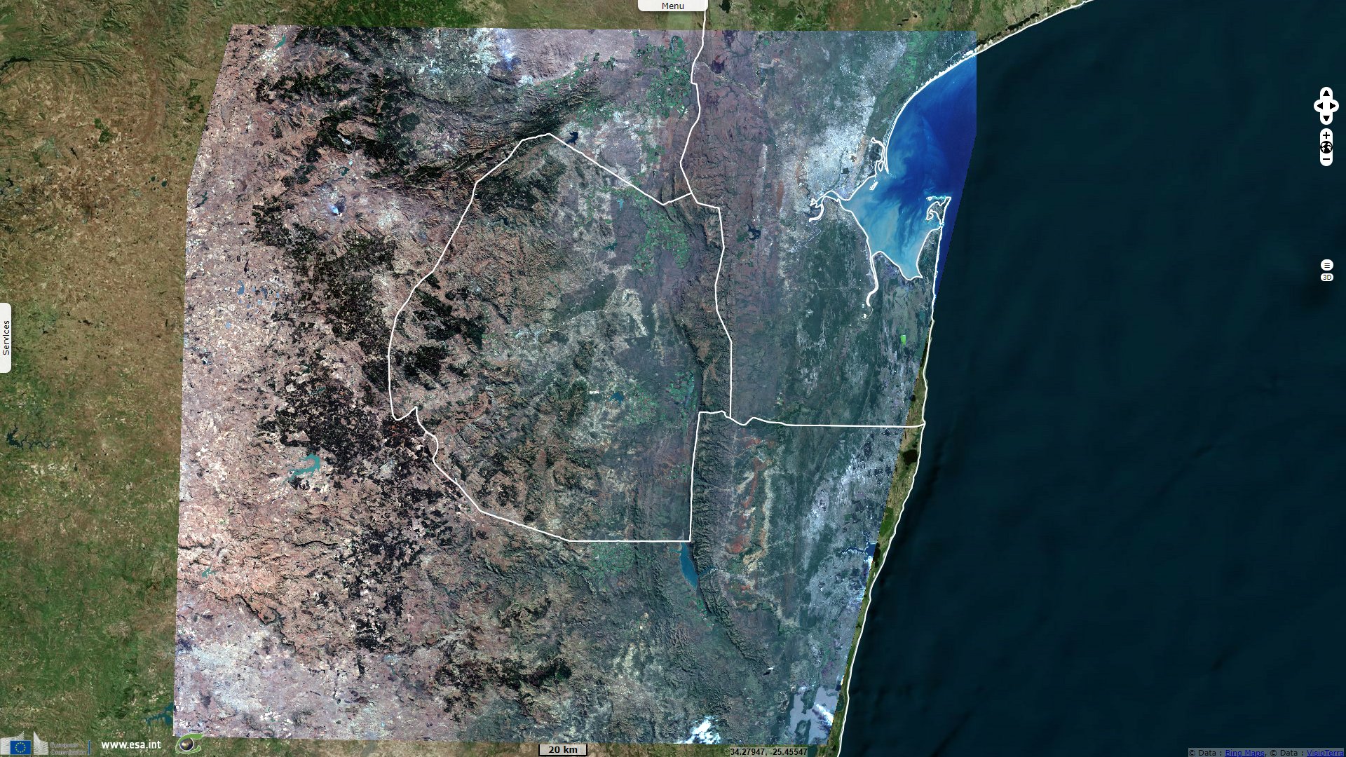
Sentinel-2 MSI acquired on 19 March 2020 at 07:36:19 UTC
Sentinel-2 MSI acquired on 12 July 2020 at 07:36:21 UTC
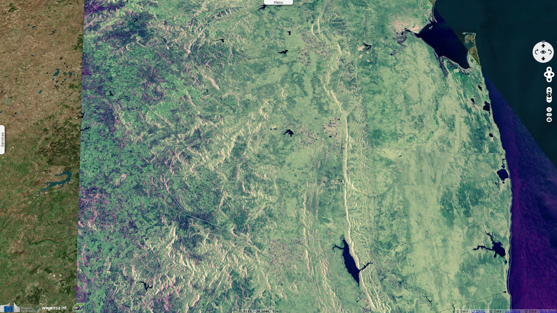
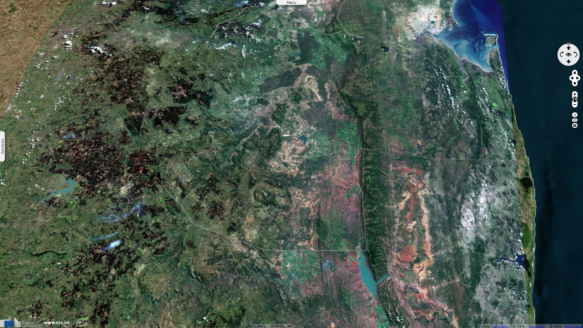
Sentinel-1 CSAR IW acquired on 15 July 2020 from 16:29:56 to 16:30:46 UTC
Sentinel-1 CSAR IW acquired on 17 July 2020 from 03:18:22 to 03:18:47 UTC
Sentinel-2 MSI acquired on 12 July 2020 at 07:36:21 UTC
Sentinel-1 CSAR IW acquired on 15 July 2020 from 16:29:56 to 16:30:46 UTC
Sentinel-1 CSAR IW acquired on 17 July 2020 from 03:18:22 to 03:18:47 UTC
Keyword(s): Land, lakes, mountain range, reservoir dam, national park, nature reserve, Ramsar wetland, Swaziland
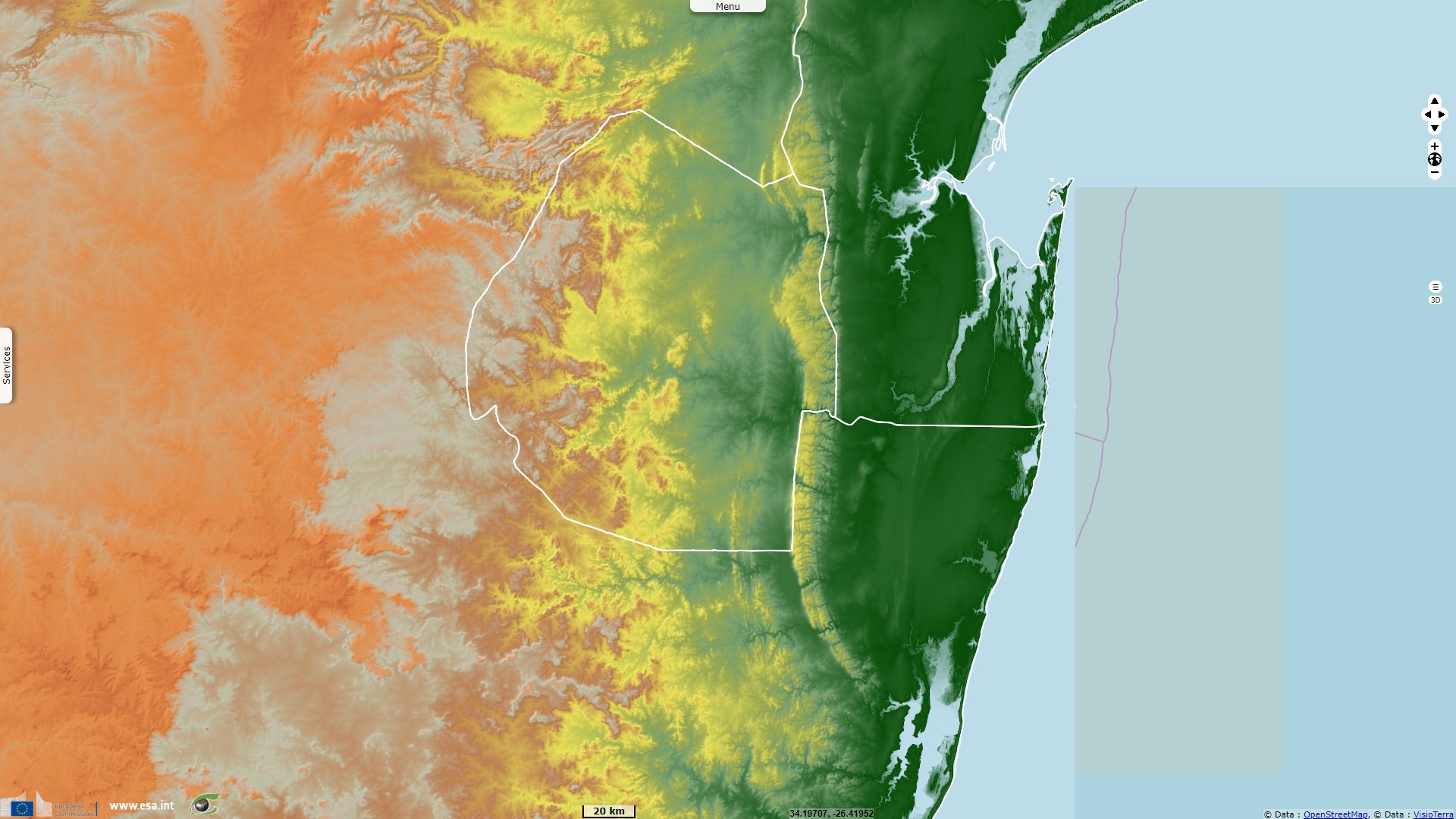
Eswatini (Swaziland until 2018) is a landlocked country lying between Mozambique (at east & N-E) and South Africa (all the rest from north to S-E).
Eswatini has an area of 17 363 square kilometres, making it one of the smallest countries in Africa. Its climate and topography are diverse, ranging from a cool and mountainous highveld to a hot and dry lowveld:
- The western border of Eswatini, the highveld, with an average altitude of 1200 metres, lies on the edge of an escarpment. Between the mountains rivers rush through deep gorges.
- The Middleveld, lying at an average 700 metres above sea level is the most densely populated region of Eswatini with a lower rainfall than the mountains.
- The Lowveld of Eswatini, at around 250 metres, is less populated than other areas and presents a typical African bush country of thorn trees and grasslands.
- Along the eastern border with Mozambique is the Lubombo, a mountain ridge, at an altitude of around 600 metres. The mountains are broken by the canyons of three rivers, the Ngwavuma, the Usutu and the Mbuluzi River.
According to the Offical Eswatini tourism website: "Along the eastern border, forming a 800km natural barrier between Swaziland and Mozambique, is a line of rugged volcanic hills known as the Lubombos, which rise abruptly from the lowveld to some 600m. This range extends far beyond Swaziland, following the Mozambique border north through the Kruger National Park and south into KwaZulu-Natal.".
The College of Agriculture, Engineering and Science of University of KwaZulu-Natal complements: "Dramatic outpourings of lava spread across much of Gondwana about 180 million years ago heralding the start of Gondwana breakup. Remnants of these once extensive lavas now form the Lesotho highlands and Lebombo mountains. In the Lebombo mountain the eruption of basalt was followed by another phase of volcanic activity involving the explosive eruption of rhyolites and huge quantities of volcanic ash. About 4800 m of volcanic material accumulated during this second phase of activity which now froms the Lebombo mountains. These volcanic events were followed by uplift and faulting that eventually separated Africa and Antarctica."
UNESCO documents the Lubombo biosphere reserve as: "Lubombo is the first biosphere reserve in the Kingdom of Eswatini. The country is landlocked, bounded by South Africa in the North, West and South and by Mozambique on the East. The Lubombo region is the largest of the four administrative regions of Eswatini, it represents 34.24% of the country area. The region however has the second smallest population in the country. Economic activities in the region are mainly sugar cane growing and processing, with all country´s sugar mills based in the Lowveld part of the Lubombo and this is the main contributor to the country’s GDP."
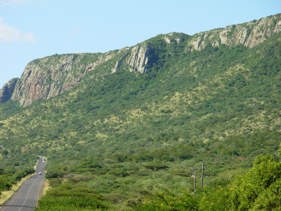
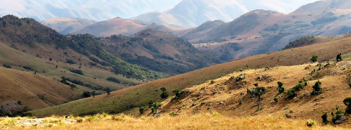
Lebombo Mountain south of Jozini - Source: College of Agriculture, Engineering and Science of University of KwaZulu-Natal
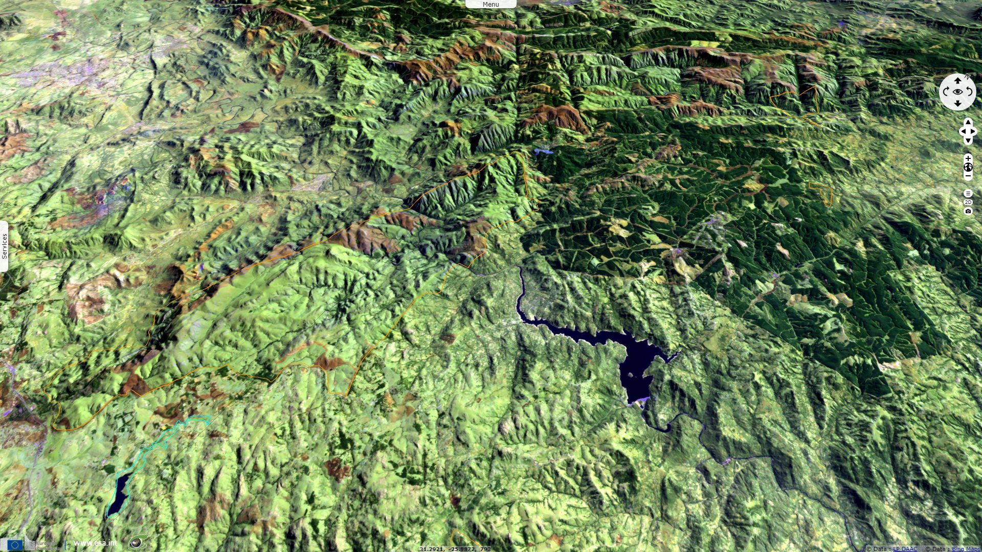
"The 2940 km² site, in the Lubombo Mountain Range, which straddles Mozambique and South Africa, is part of the Maputoland-Phondoland-Albany Biodiversity Hotspot and consists of forest, wetland and savannah ecosystems. Local Flora species include the Lubombo Ironwoods, Lubombo Cycads, the recently discovered Barleria species and the Jilobi forest. Twenty of the 88 mammals identified in the area are only to be found only in the Lumomba region. Notable among these mammals are the White Rhinoceros, Cape Buffalo, Roan Antelope, Tsessebe and the Suni, as well as threatened species such as the Leopard. ". It also includes important populations of globally threatened black rhinoceros.
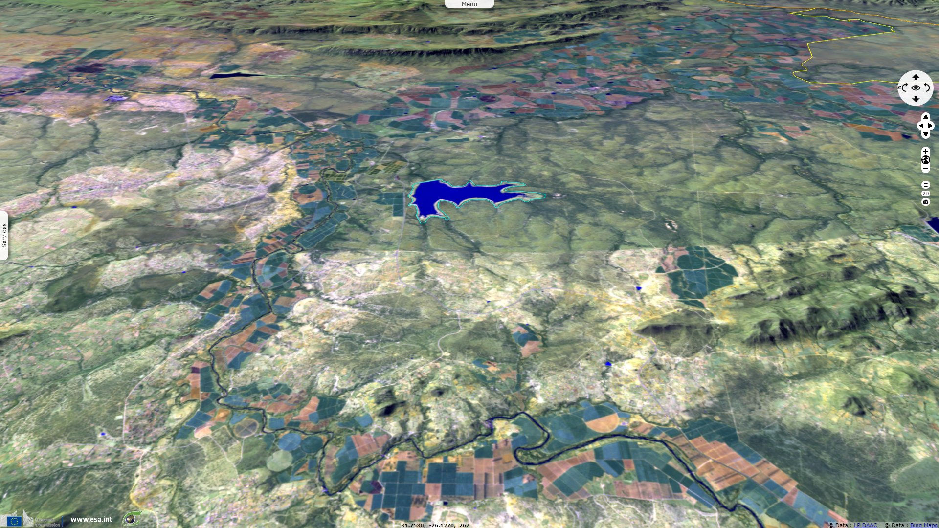
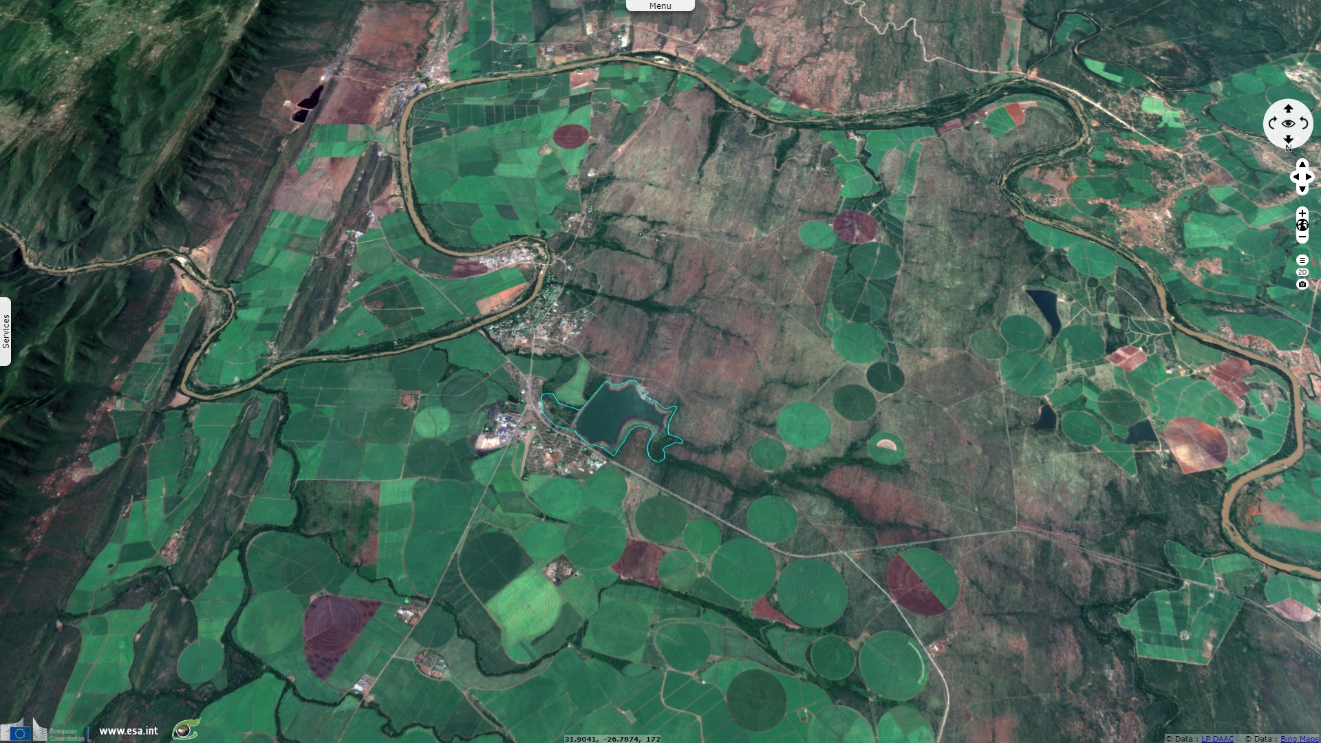
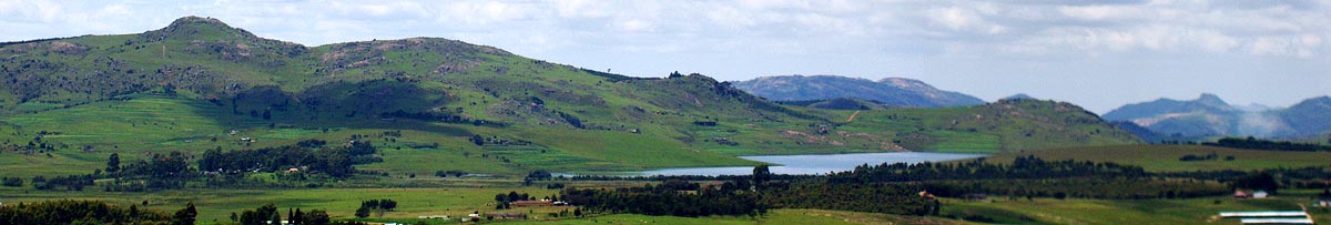
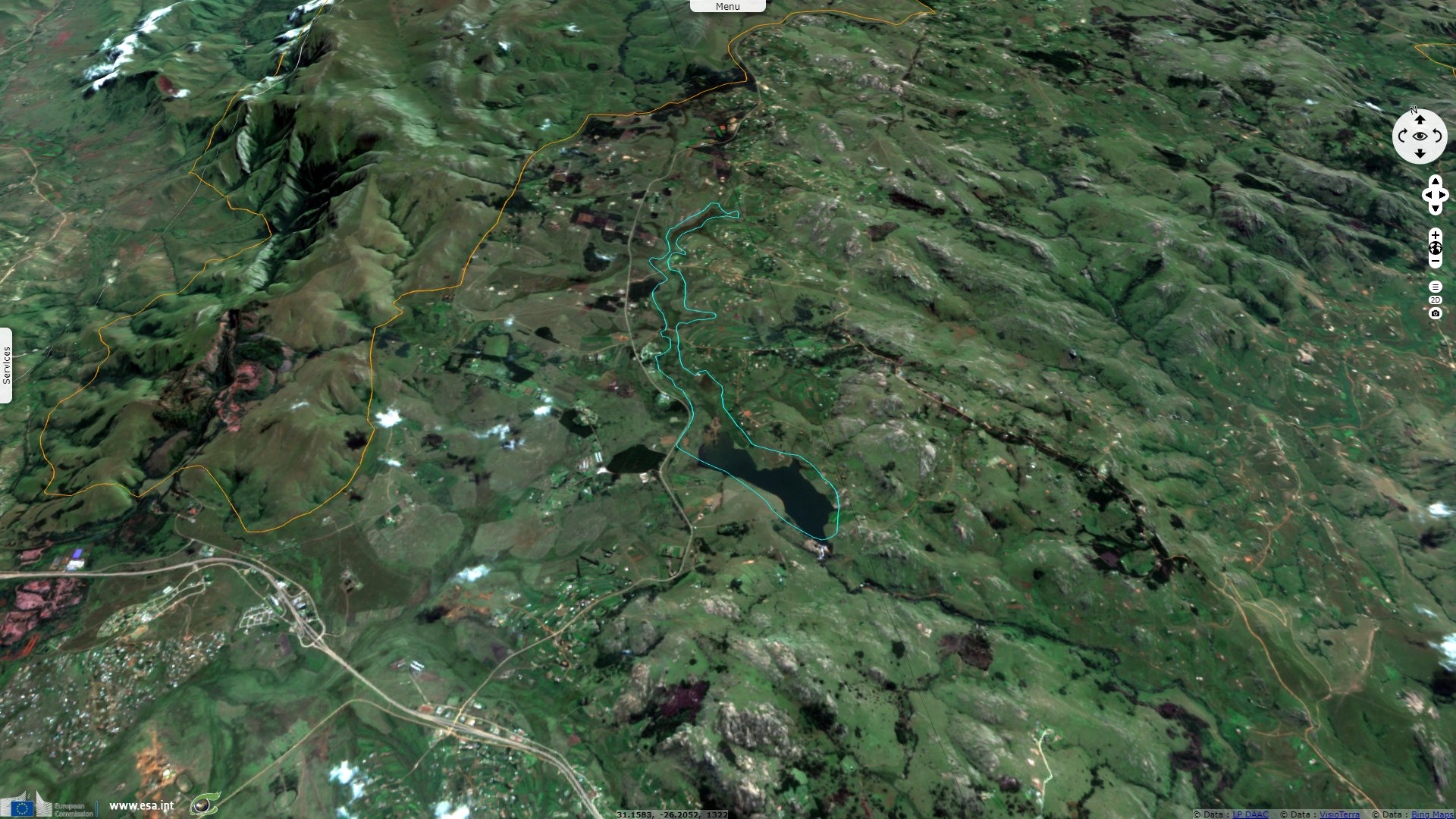
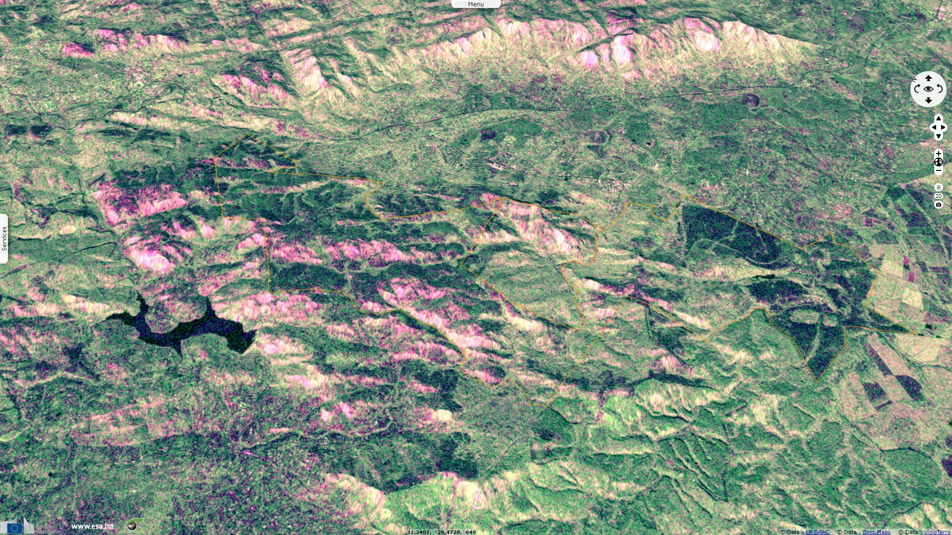
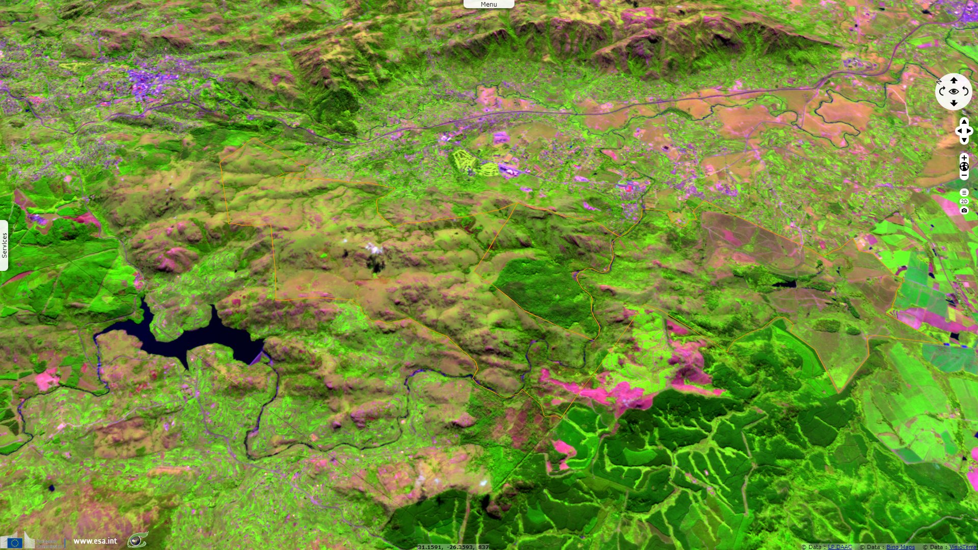
Located North of the Lebombos, Sand River Dam is an important wetland described by Ramsar as: "Sand River Dam is situated in the Lubombo district within the IYSIS cattle ranch which is privately owned by Royal Swaziland Sugar Corporation (RSSC). The reservoir is a major magnet for waterfowl and other waterbirds, particularly when water levels are low. The lowveld of Swaziland is relatively arid with few naturally-occurring wetlands other than riparian strips along rivers. The waterbird community of this region, therefore, relies heavily on a handful of artificial wetlands. Sand River Dam is one such site, and plays an important role in maintaining waterbird abundance and diversity within the region.
The surrounding hillsides are heavily overgrazed by goats and domestic cattle and crop residues are burned every winter. The Site regularly supports over 20 waterbird species and regularly harbours more than 500 individual birds. This makes it the second most important wetland in the country in terms of waterbird abundance. It is a critical site for a number of threatened species."
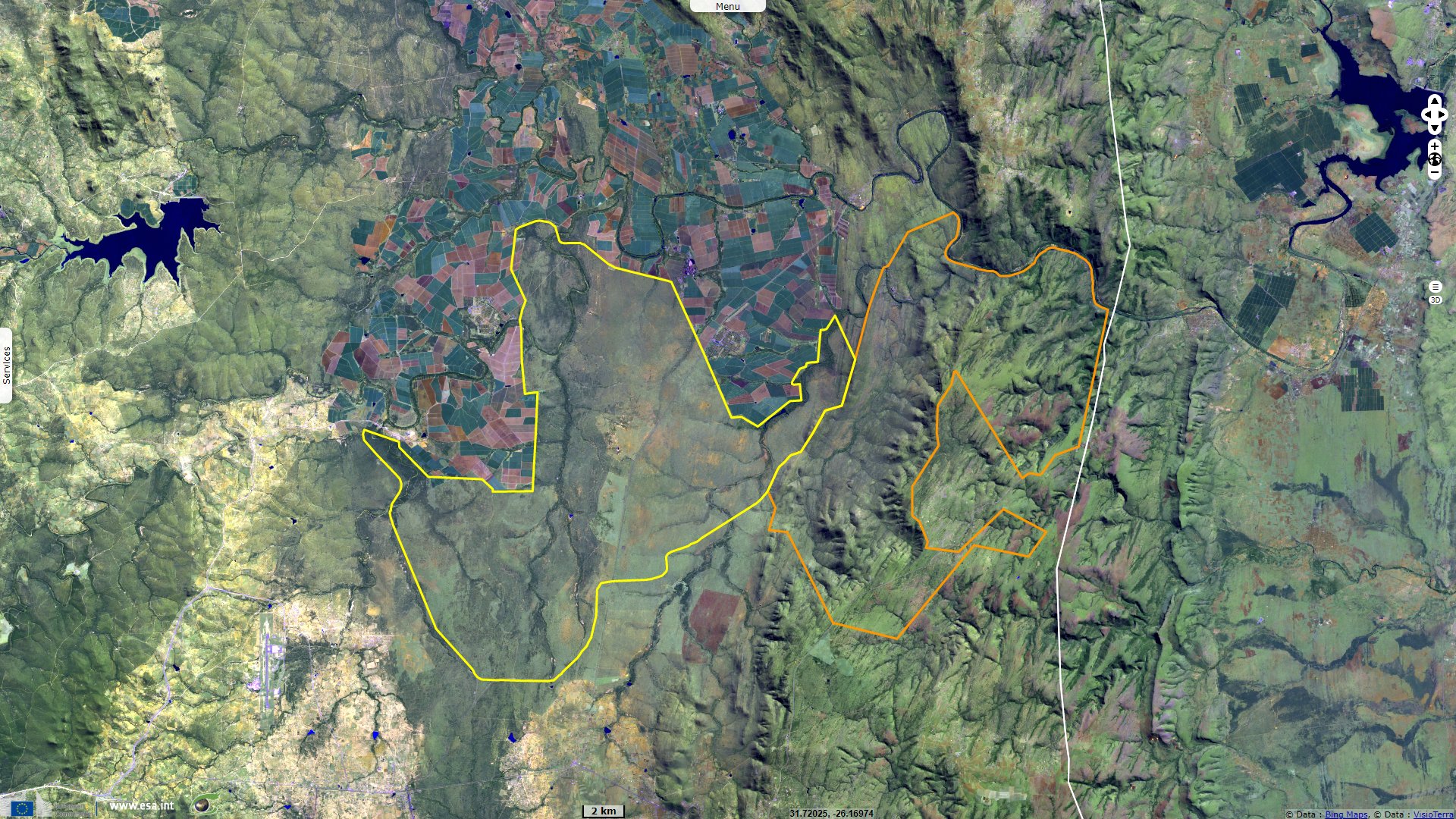
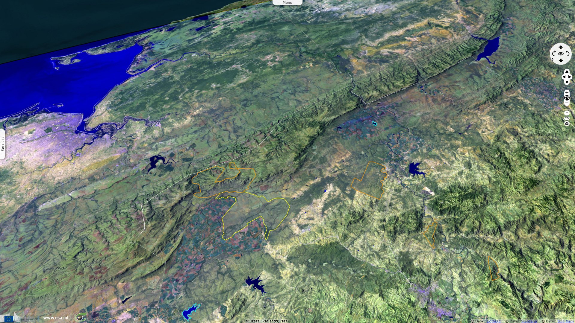
Lying along the Lebombo range, south of the previous feature, are Mlawula resserve and Hlane Royal National Park. Swaziland National Trust Commission details the former as follows: "The reserve lies within the transitional zone between two biogeographic regions, the dry thorn savannas of the west, and the moister coastal thickets of the east. The reserve consists of three distinct ecological zones, the Ndzindza plateau, the Siphiso Valley and the rhyolite ridges of the western boundary. Although small, the reserve is contiguous with other protected areas (Mbuluzi and Simunye Nature Reserves, Hlane Wildlife Sanctuary), and other areas of natural vegetation (north bank of the Mbuluzi River, Mhlumeni area, adjacent area in Mozambique).
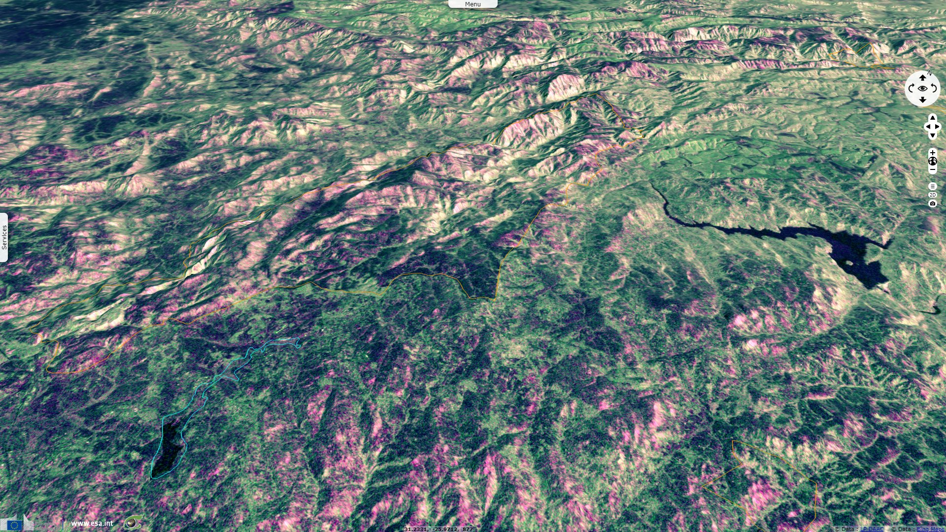
The Lubombo mountains are the most impressive natural feature of the reserve; they are a rhyolite ridge running from south to north along the border with Mozambique, volcanic in origin and geologically young. The perennial Mbuluzi river runs along the northern boundary of the reserve, passing through an impressive river valley in the north-east. The much smaller Mlawula stream flows through the west of the reserve. West of and parallel to the Lubombos is the basaltic Siphiso valley, a low-lying savanna area with abundant game, flanked on the west by a chain of low rhyolite ridges.".
Bordering the Lebombo moutains, Van Eck Dam is another ramsar site located further south. Its sheet indicates: "Van Eck Dam is situated within the Mhlosinga Nature Reserve in the Lubombo district, about a kilometre north-west of Big Bend. When water levels are low, the reservoir is a major magnet for waterfowl and other waterbirds. A number of globally threatened and near-threatened species have been recorded at Van Eck Dam, including the martial eagle and the critically endangered African white-backed vulture, both of which have bred on or very close to Mhlosinga Nature Reserve. Several other raptor species regularly breed at Mhlosinga, including the African fish eagle Haliaeetus vocifer and African goshawk Accipiter tachiro. Nile crocodile and South African rock python, both of which are listed as threatened nationally, are found at Van Eck Dam, as well as the globally threatened hippopotamus.
The boundaries of Mhlosinga Nature Reserve have been changed. The area to the west of the reservoir has been removed from the Reserve and sugarcane irrigation pivots have been installed, transforming the savannah habitat. The area to the south of Van Eck Dam was previously used as a cattle ranch, but has now been incorporated into the Reserve."
Malolotja is Eswatini's largest highveld reserve, and a transfrontier park - Source: Swaziland National Trust Commission.
The Swaziland National Trust Commission wrote about Malolotja reserve: "Malolotja Nature Reserve is one of the most impressive mountain parks in Southern Africa. The spectacular scenery and the variety of fauna and flora makes it a prime highveld conservation area. It is the last unspoilt mountain wilderness left in Swaziland. The reserve extends over an area of 180 km² hectares in north-west Swaziland, making it the largest proclaimed protected area in the Kingdom. The range in altitude from the top of Ngwenya Mountain, Swaziland's second highest mountain (1829 m), to the deep Nkomati River Valley (640 m) accounts both for the mild temperate climate and great variety of habitats; from short grassland, to thick riverine scrub, bushveld and moist Afro-montane forest. The Malolotja River rises in the east of the reserve and meanders its way through some fragile highveld bog systems before tumbling over numerous waterfalls, including Swaziland's highest waterfall, the Malolotja Falls, and cutting its way through a steep sided gorge to meet the Nkomati River, some 900 m below."
The third and last Ramsar site lying withing Eswatini is Hawane Dam and Nature Reserve. It is described as "a protected area along the Mbuluzi River which covers the whole Hawane reservoir (which supplies water to the city of Mbabane) and its surroundings. The surface area covered by the reservoir and the Nature Reserve is 232ha. The shoreline is typically composed of a narrow belt of sand which varies with water level, beyond which lies the montane grassland ecosystem indigenous to this area. The main swamp/marsh, called the Hawane swamp, is situated upstream of the reservoir where the Black Mbuluzi river enters the system."
Hawane Nature Reserve - Source: Swaziland National Trust Commission.
"The reservoir is host to a variety of waterbirds, whereas the swamp supports a small but critical population of the endemic and regionally critically endangered plant. The reserve’s main attraction is its wealth of birdlife, and a trail is provided for bird-watching. Overgrazing by livestock and transformation of grasslands to agricultural fields is increasingly affecting the area, while the lack of proper solid waste management systems may be resulting in effluent discharge into the reservoir."
The Swaziland National Trust Commission highlights a fourth and last of Eswatini's nature reserve, Mantenga: "The various portions making up Mantenga were purchased by the Swaziland National Trust Commission between 1979 and 1994. In the latter year work began on infrastructure. Despite Mantenga's small size, a large number of medium-sized mammals are flourishing there. There are vervet monkey and baboon, bushpig and porcupine, otter, rock dassie and bushbaby. One predator that has been sighted is the serval; leopards are possibly present. Buck include kudu, nyala, klipspringer, grey and red duiker. Birdlife abounds, including the endangered bald ibis."
The views expressed herein can in no way be taken to reflect the official opinion of the European Space Agency or the European Union.
Contains modified Copernicus Sentinel data 2026, processed by VisioTerra.
Contains modified Copernicus Sentinel data 2026, processed by VisioTerra.
| More on European Commission space: |  |
 |
 |
||||
| More on ESA: | |
|
|
S-1 website | S-2 website | S-3 website | |
| More on Copernicus program: | |
|
|
Scihub portal | Cophub portal | Inthub portal | Colhub portal |
| More on VisioTerra: | |
|
|
Sentinel Vision Portal | Envisat+ERS portal | Swarm+GOCE portal | CryoSat portal |