Sentinels combine efforts to monitor Hurricane Michael
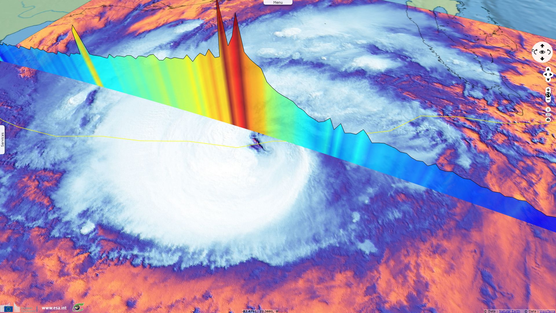
Sentinel-3 SRAL LAND acquired on 09 October 2018 at 15:58:33 UTC
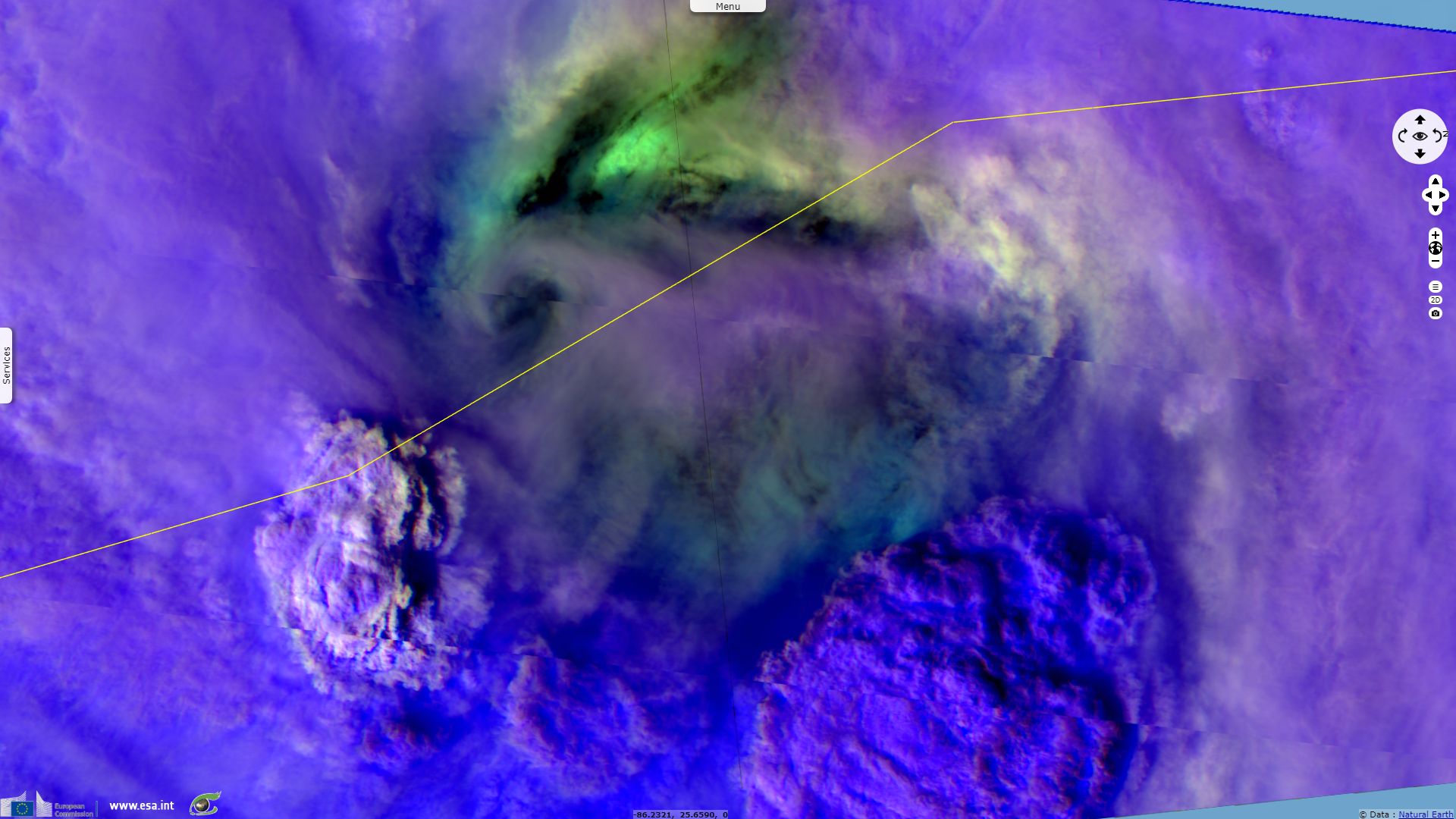
Sentinel-3 SLSTR RBT acquired on 09 October 2018 at 15:59:23 UTC
Sentinel-2 MSI acquired on 09 October 2018 at 16:11:49 UTC
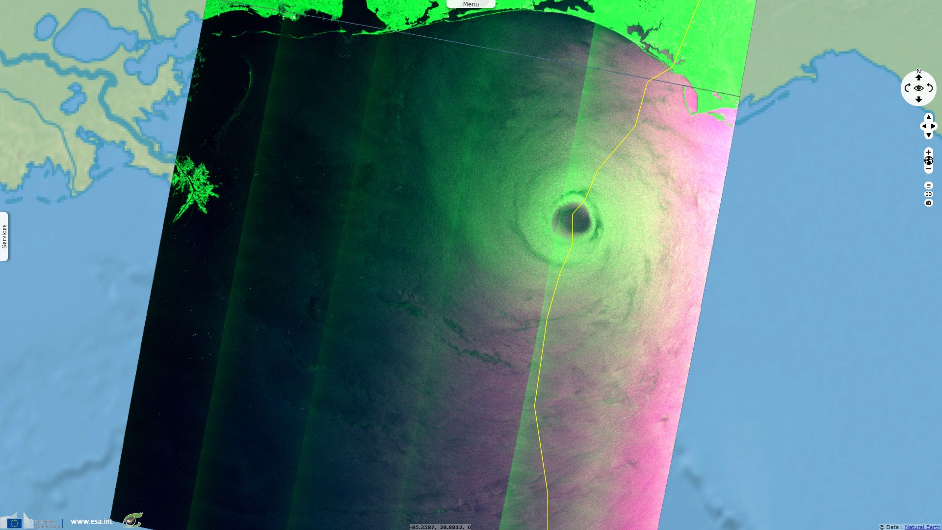
Sentinel-1 CSAR EW acquired on 10 October 2018 from 11:49:07 to 11:50:11 UTC
Sentinel-3 OLCI FR acquired on 13 October 2018 from 15:52:39 to 15:55:39 UTC
Sentinel-3 SLSTR RBT acquired on 09 October 2018 at 15:59:23 UTC
Sentinel-2 MSI acquired on 09 October 2018 at 16:11:49 UTC
Sentinel-1 CSAR EW acquired on 10 October 2018 from 11:49:07 to 11:50:11 UTC
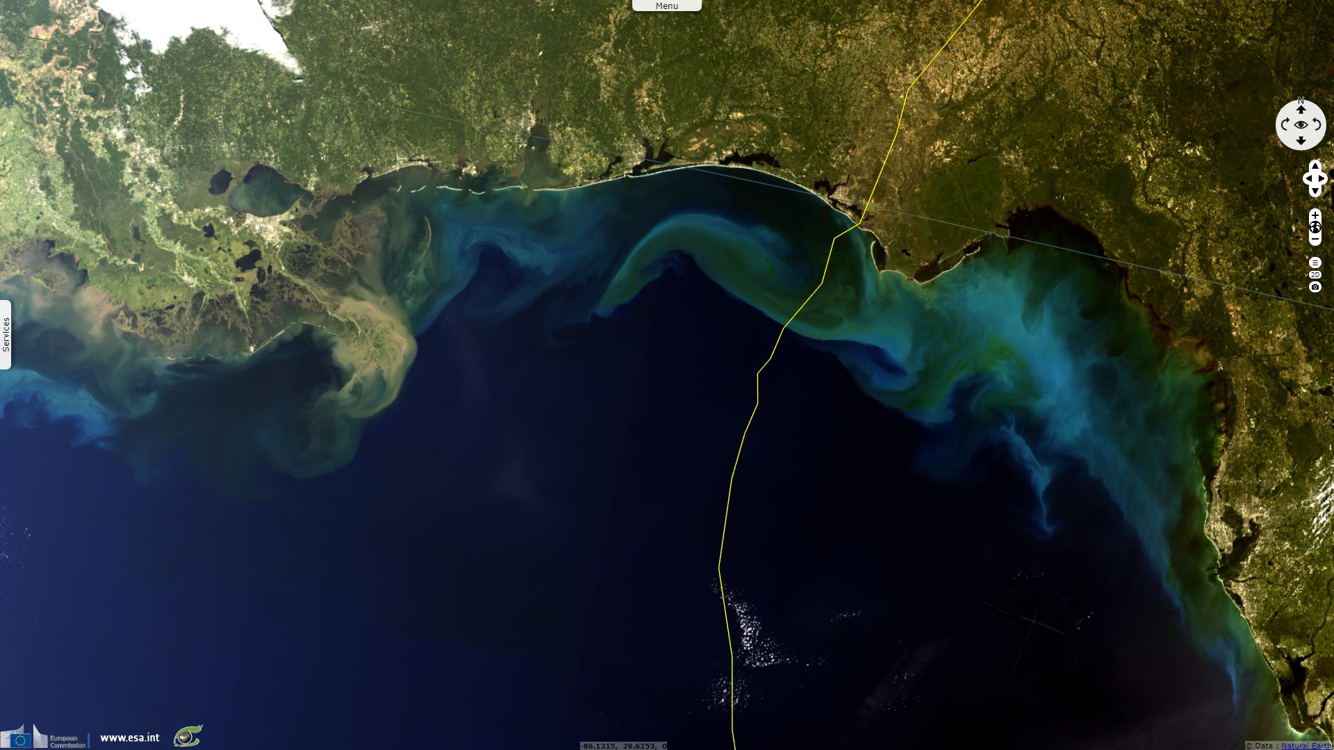
Sentinel-3 OLCI FR acquired on 13 October 2018 from 15:52:39 to 15:55:39 UTC
Keyword(s): Emergency, natural disaster, atmosphere, storm, climate, wind, rain, precipitations, cyclone, USA, United States
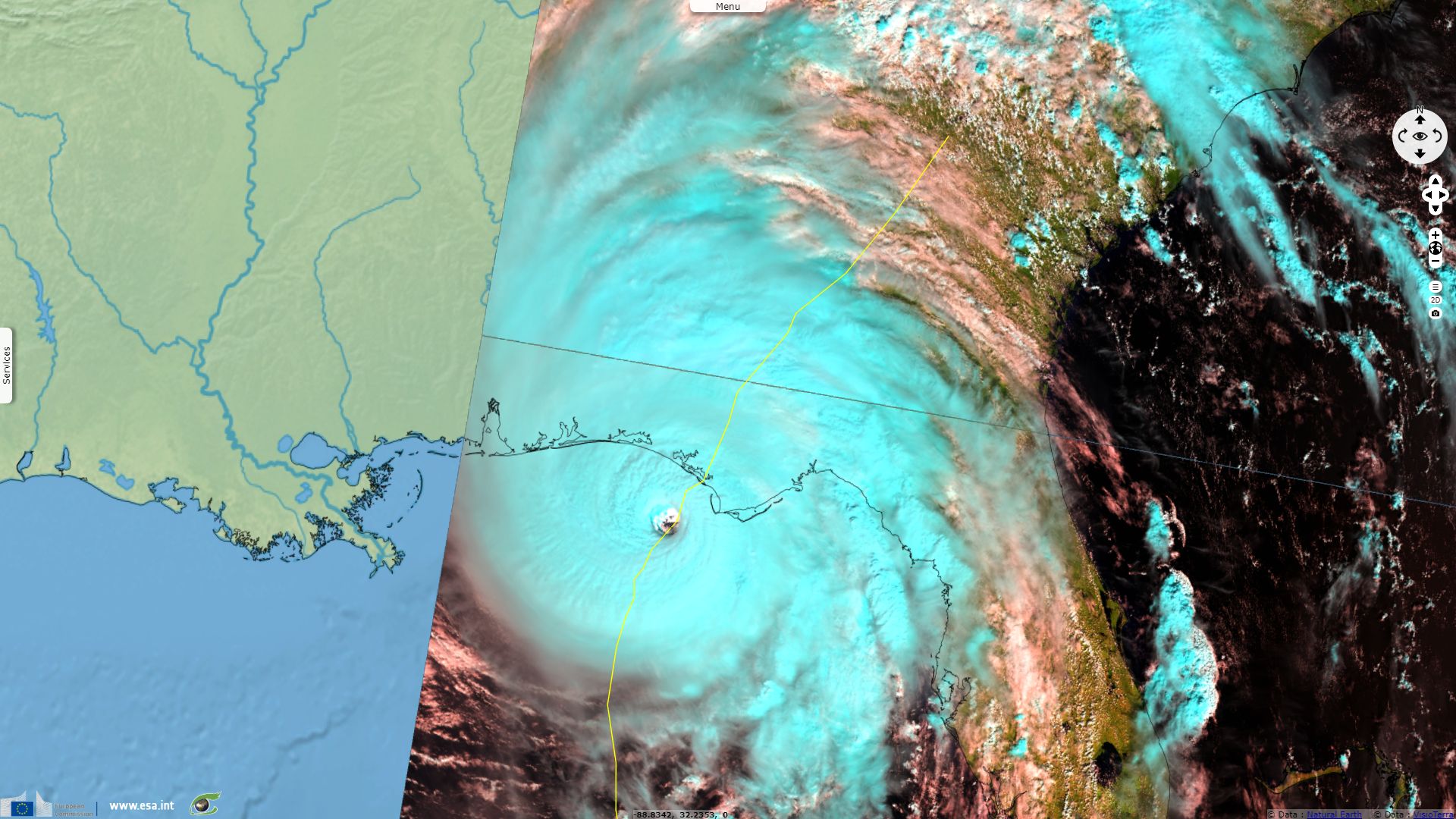
Finding warm waters on its path, Michael reached it apex at 18:00, just before making landfall, blowing 250 km/h winds.
The views expressed herein can in no way be taken to reflect the official opinion of the European Space Agency or the European Union.
Contains modified Copernicus Sentinel data 2026, processed by VisioTerra.
Contains modified Copernicus Sentinel data 2026, processed by VisioTerra.
| More on European Commission space: |  |
 |
 |
||||
| More on ESA: | |
|
|
S-1 website | S-2 website | S-3 website | |
| More on Copernicus program: | |
|
|
Scihub portal | Cophub portal | Inthub portal | Colhub portal |
| More on VisioTerra: | |
|
|
Sentinel Vision Portal | Envisat+ERS portal | Swarm+GOCE portal | CryoSat portal |