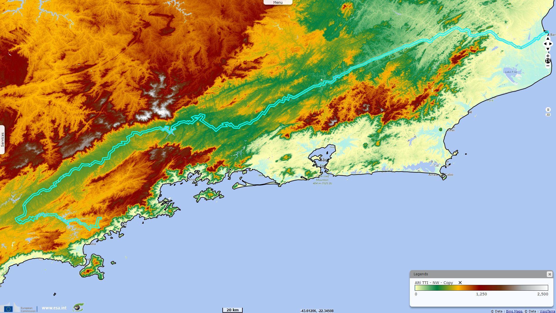
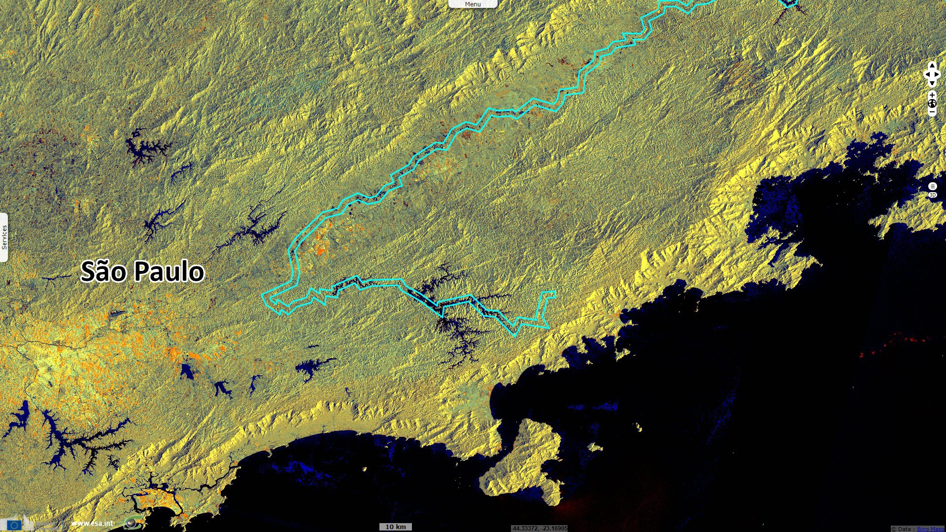
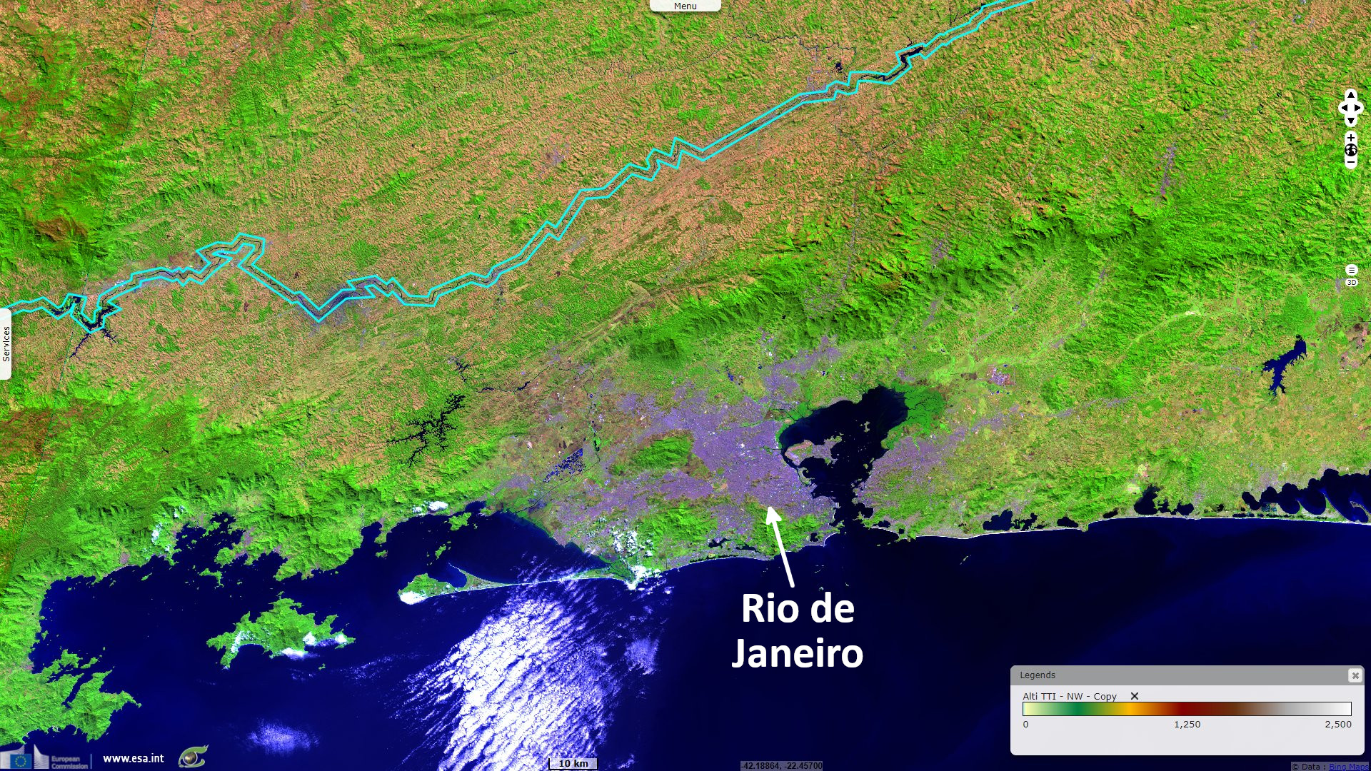
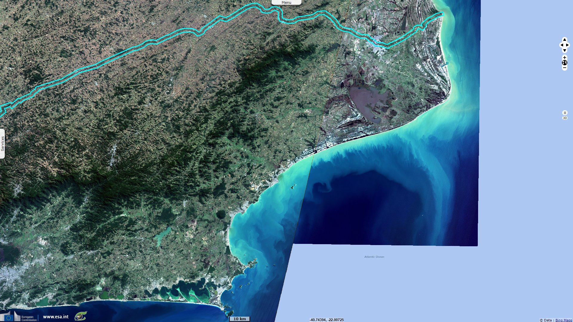
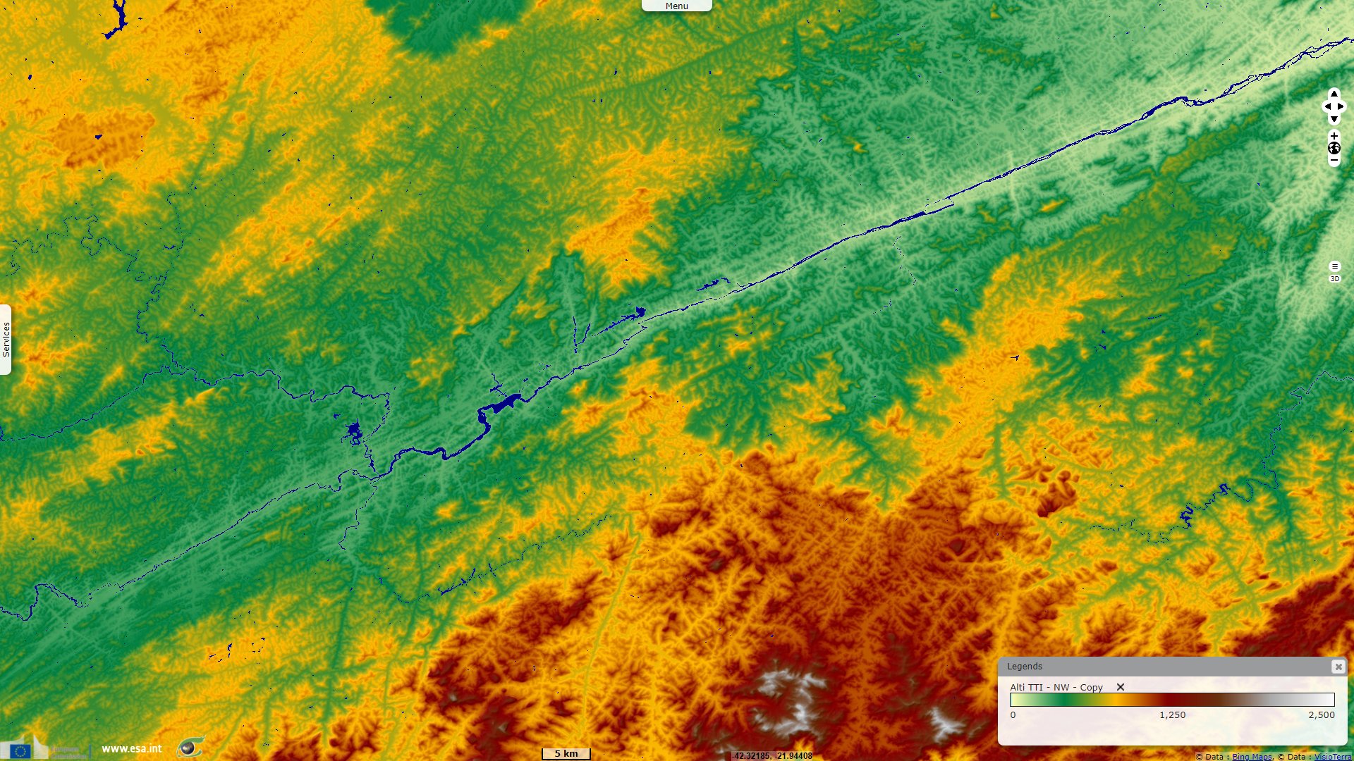
The long detour of Rio Paraiba do Sul, Brazil
Sentinel-2 MSI acquired on 19 August 2021 at 13:12:51 UTC
...
Sentinel-2 MSI acquired on 23 August 2021 at 12:53:11 UTC
Sentinel-1 CSAR IW acquired on 13 December 2021 from 08:29:50 to 08:30:40 UTC
Sentinel-1 CSAR IW acquired on 20 December 2021 from 08:21:28 to 08:22:18 UTC
...
Sentinel-2 MSI acquired on 23 August 2021 at 12:53:11 UTC
Sentinel-1 CSAR IW acquired on 13 December 2021 from 08:29:50 to 08:30:40 UTC
Sentinel-1 CSAR IW acquired on 20 December 2021 from 08:21:28 to 08:22:18 UTC
Keyword(s): River, hydrology, mountain range, Brazil
The views expressed herein can in no way be taken to reflect the official opinion of the European Space Agency or the European Union.
Contains modified Copernicus Sentinel data 2026, processed by VisioTerra.
Contains modified Copernicus Sentinel data 2026, processed by VisioTerra.
| More on European Commission space: |  |
 |
 |
||||
| More on ESA: | |
|
|
S-1 website | S-2 website | S-3 website | |
| More on Copernicus program: | |
|
|
Scihub portal | Cophub portal | Inthub portal | Colhub portal |
| More on VisioTerra: | |
|
|
Sentinel Vision Portal | Envisat+ERS portal | Swarm+GOCE portal | CryoSat portal |