Lake Titicaca weakened by pollution, Bolivia
Sentinel-2 MSI acquired on 07 May 2016 at 14:57:22 UTC
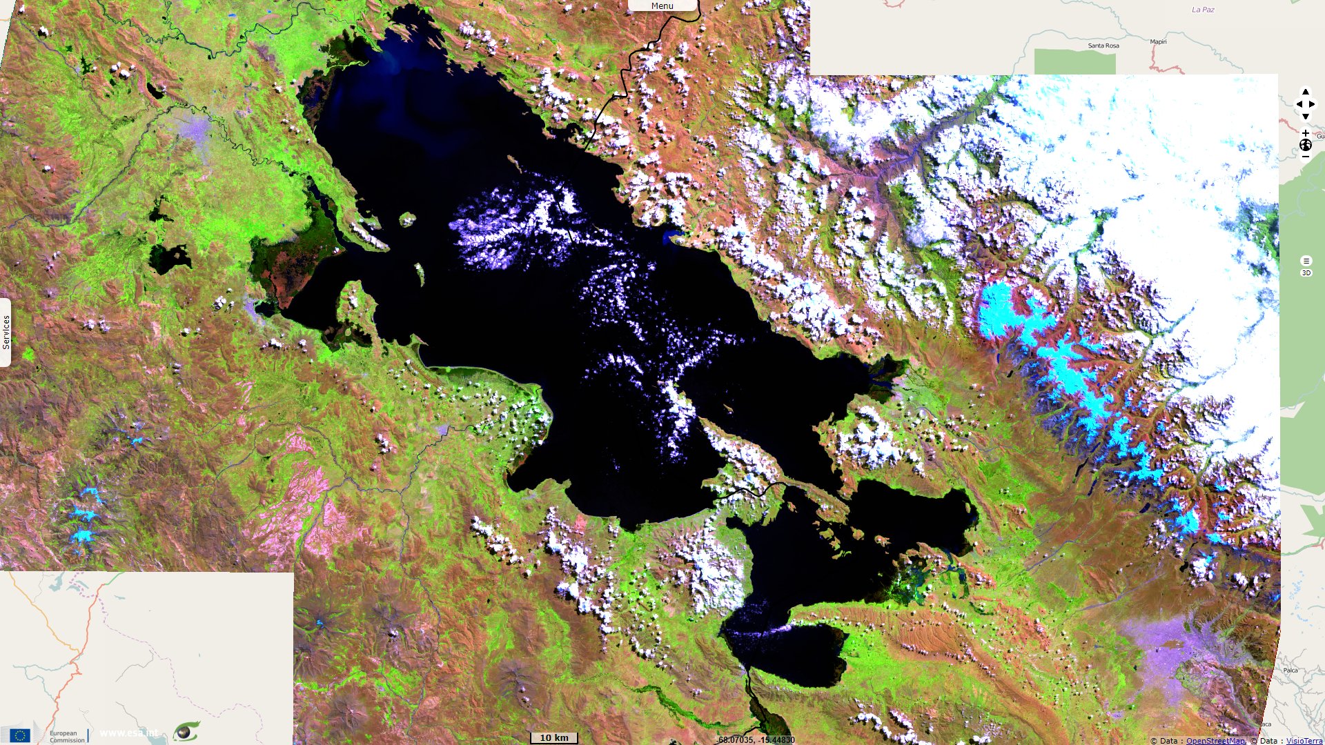
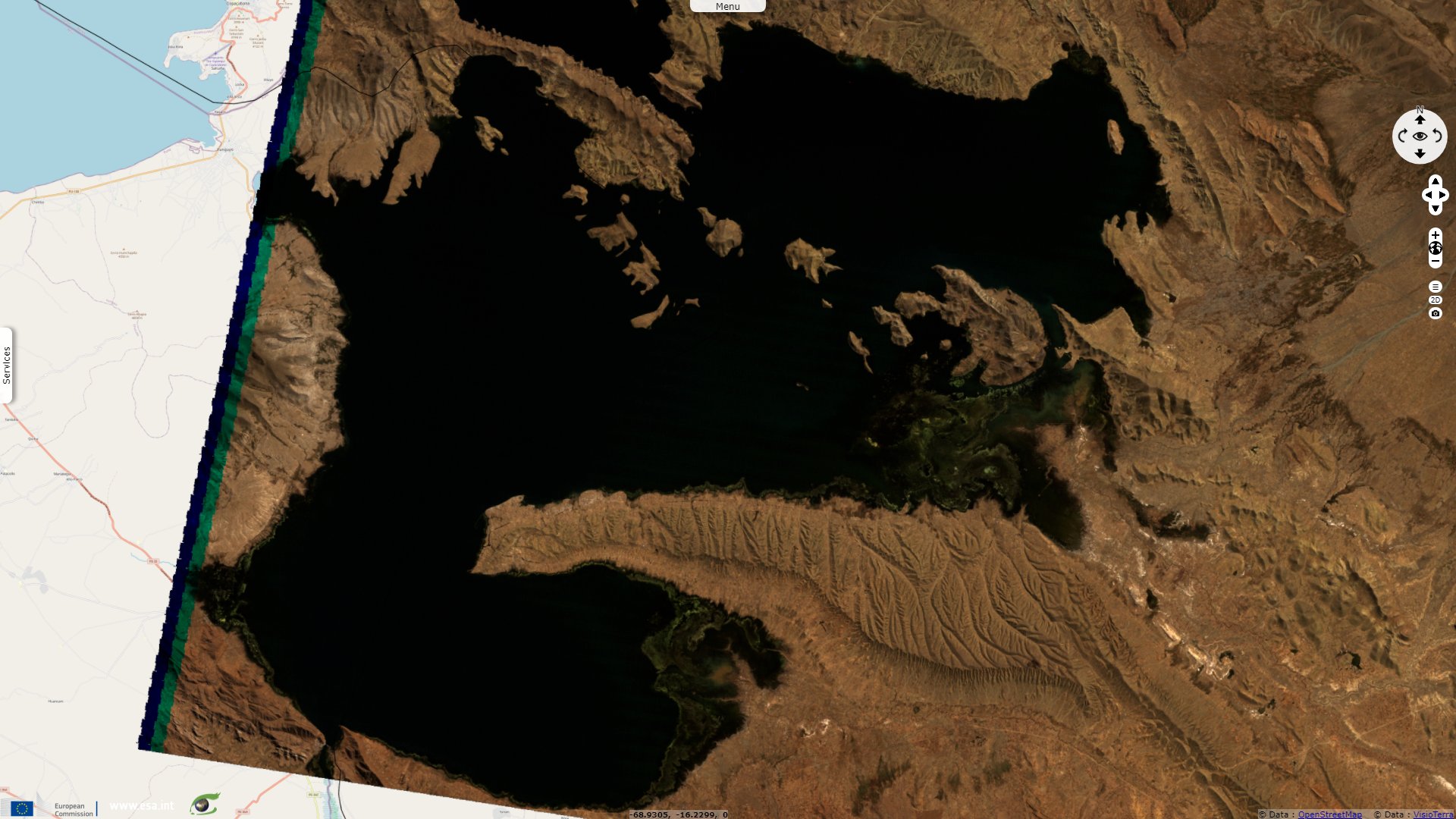
Sentinel-2 MSI acquired on 16 April 2021 at 14:47:19 UTC
Sentinel-2 MSI acquired on 16 April 2021 at 14:47:19 UTC
Keyword(s): Urban growth, water colour, pollution, agriculture, biodiversity, wetland, Ramsar, mountain range, Andes Cordillera
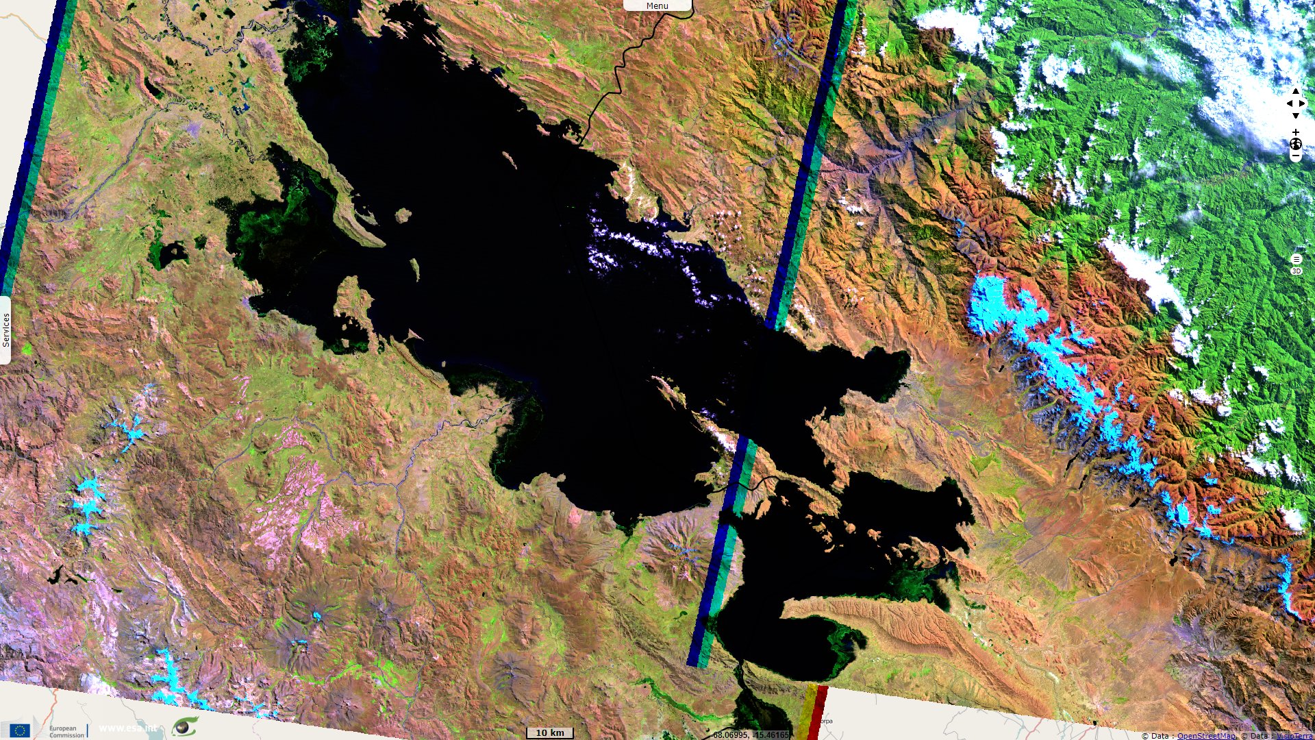
In its sheet dedicated to Lake Titicaca, UNESCO reminds why it is an exceptionnal site: "Lake Titicaca is the biggest aquatic mass within the Southern Continent. It is also the highest navigable lake in the world. It has a surface of 8400 km², of which 3690 km² are on Bolivian territory. Its altitude is 3810 meters above sea level."
"Several rivers, primarily born on the mountain range, nourish the lake. On the other hand, only one river drains the waters of this great lake into the Poopó Lake, the Desaguadero River. Lake Titicaca has various levels of depth, the maximum being 283 meters. The water is sweet, transparent and non-colored and is also good for drinking."
"Lake Titicaca is divided in two parts, divided by the Copacabana peninsula and that of Achacachi or Huata, forming this way the Tiquina Strait. The section to the North is called Great Lake or Chucuito and is six times as large as the other section, called Small Lake or Huiñaimarca. The main islands on the Bolivian side are the Island of the Sun and the Island of the Moon, or Coati. In Perú, the main islands are Taquile and Amantani."
On the topic of biodiversity, Ramsar completes: "The site is characterized by a mixture of freshwater permanent lakes, rivers, associated marshes and high Andean peatlands. It harbours several rare species and threatened fish, birds and invertebrate species endemic to the high Andes. The area is used for agriculture, fishing, sheep and cattle ranching. Small-scale tourism is becoming more important."
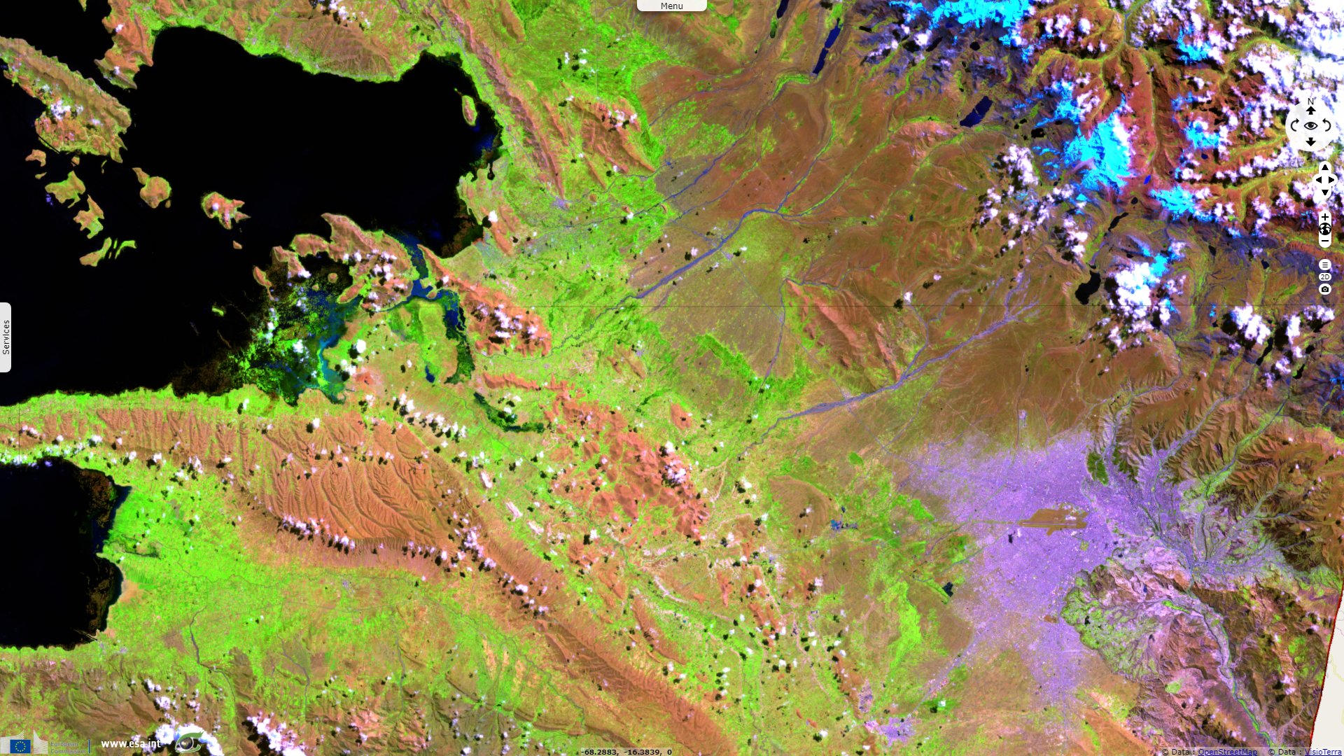
Giv Anquetil warns that this large lake is endangered by urban growth and agriculture: The Titicaca is what remains of a gigantic interior sea of which the Popoo lake and the Uyuni desert are the evaporated traces. A high altitude lake that does not freeze because it is under the tropics, with toads that breathe through their skin because of the lack of oxygen and ducks that do not fly anymore. And rushes, the totoras, which used to provide everything to the inhabitants of the lake: to eat rushes on artificial islands made of rushes, with houses made of rushes, boats made of rushes with sails made of rushes.
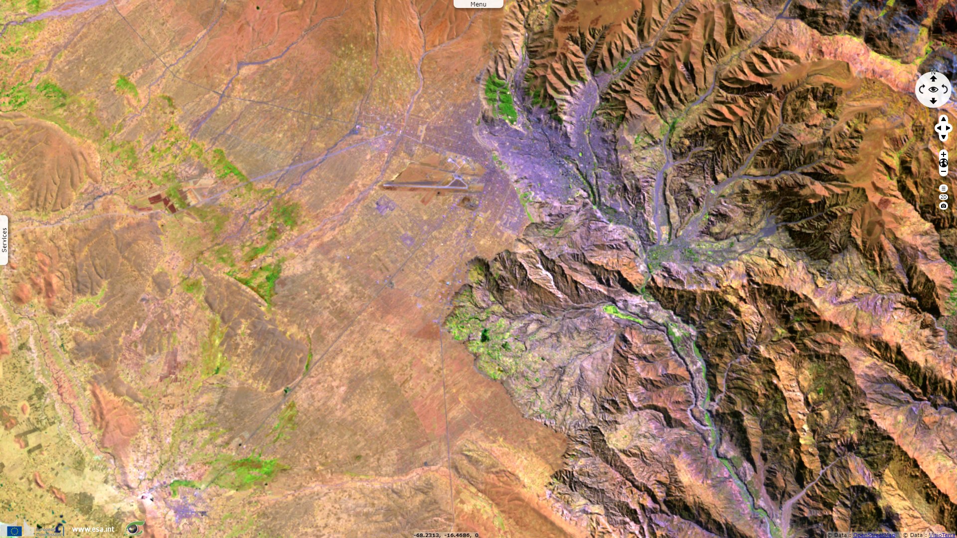
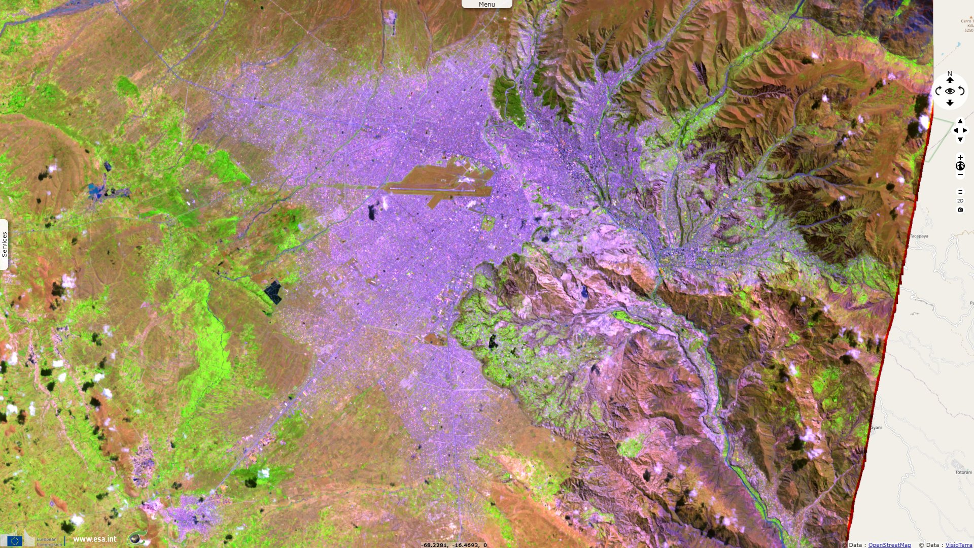
But if these boats are only used to make dream the rare tourists, today a part of the Titicaca is going bad. With the rise of the temperatures (which in the Andes is twice more important than elsewhere), and the fast development of El Alto (originally a suburb of La Paz which makes today more than one million inhabitants) for only one station of waste water treatment, on this part of the littoral, the lake Titicaca suffocates...
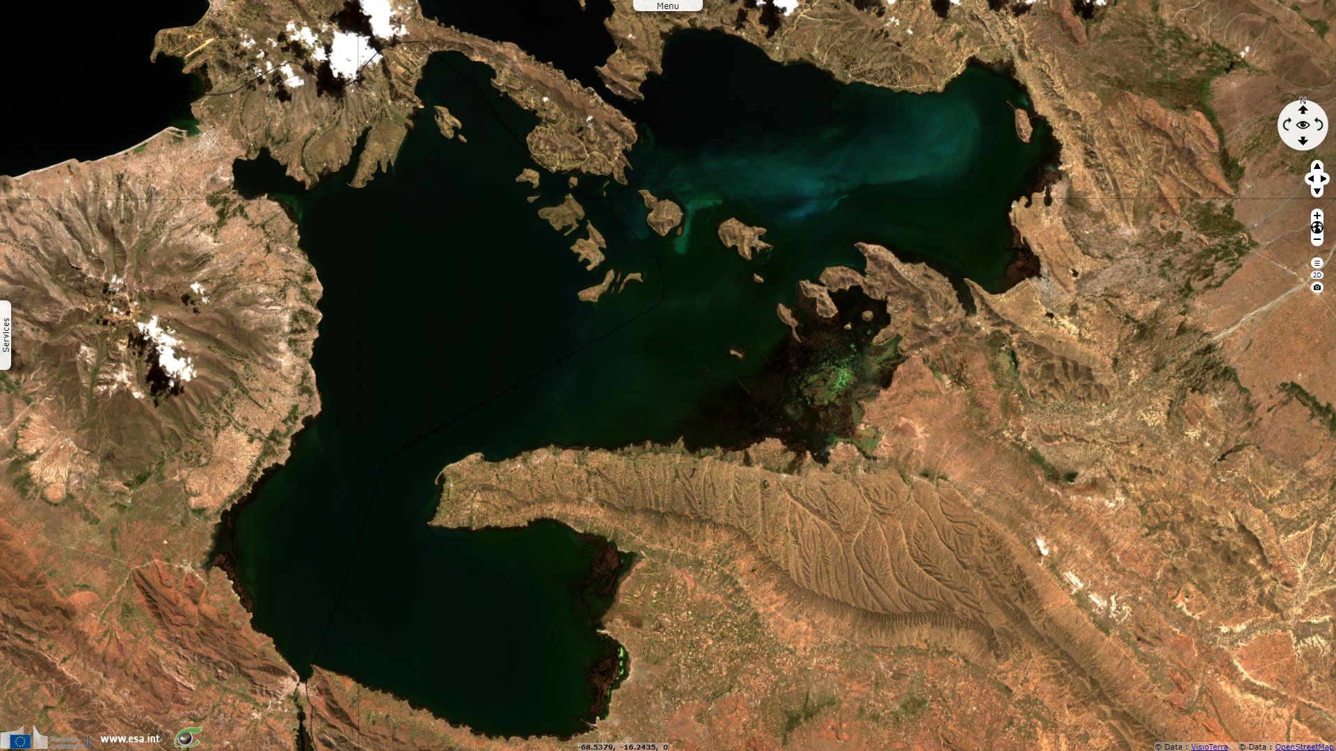
At an elevation of roughly 3650 m above sea level, La Paz is the highest capital city in the world. The municipality of El Alto constitutes, according to 2020 estimates, the second largest city in Bolivia in terms of population, after Santa Cruz de la Sierra but before La Paz. Eutrophisation of the Bay Kumana is partly caused by the increase of agriculture. Fish catches have decreased and it is said two species of fish have disappeared.
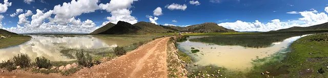
Murky waters of Bay Kumana, esternmost part of Lake Titicaca downstream of La Paz and El Alto - Source: Giv Anquetil.
The views expressed herein can in no way be taken to reflect the official opinion of the European Space Agency or the European Union.
Contains modified Copernicus Sentinel data 2026, processed by VisioTerra.
Contains modified Copernicus Sentinel data 2026, processed by VisioTerra.
| More on European Commission space: |  |
 |
 |
||||
| More on ESA: | |
|
|
S-1 website | S-2 website | S-3 website | |
| More on Copernicus program: | |
|
|
Scihub portal | Cophub portal | Inthub portal | Colhub portal |
| More on VisioTerra: | |
|
|
Sentinel Vision Portal | Envisat+ERS portal | Swarm+GOCE portal | CryoSat portal |