Visit of Spain with Sentinel-2
Sentinel-2 MSI acquired in February 2017
Sentinel-2 MSI acquired in June 2017
Sentinel-2 MSI acquired in August 2017
Sentinel-2 MSI acquired in September 2017
Sentinel-2 MSI acquired in October 2017
Sentinel-2 MSI acquired in June 2017
Sentinel-2 MSI acquired in August 2017
Sentinel-2 MSI acquired in September 2017
Sentinel-2 MSI acquired in October 2017
Keyword(s): Agriculture, capital, water colour, islands, rivers, tourism, Madrid, Barcelona, Marbella, Ibiza, Marjorque, Seville, Catalonia, Spain
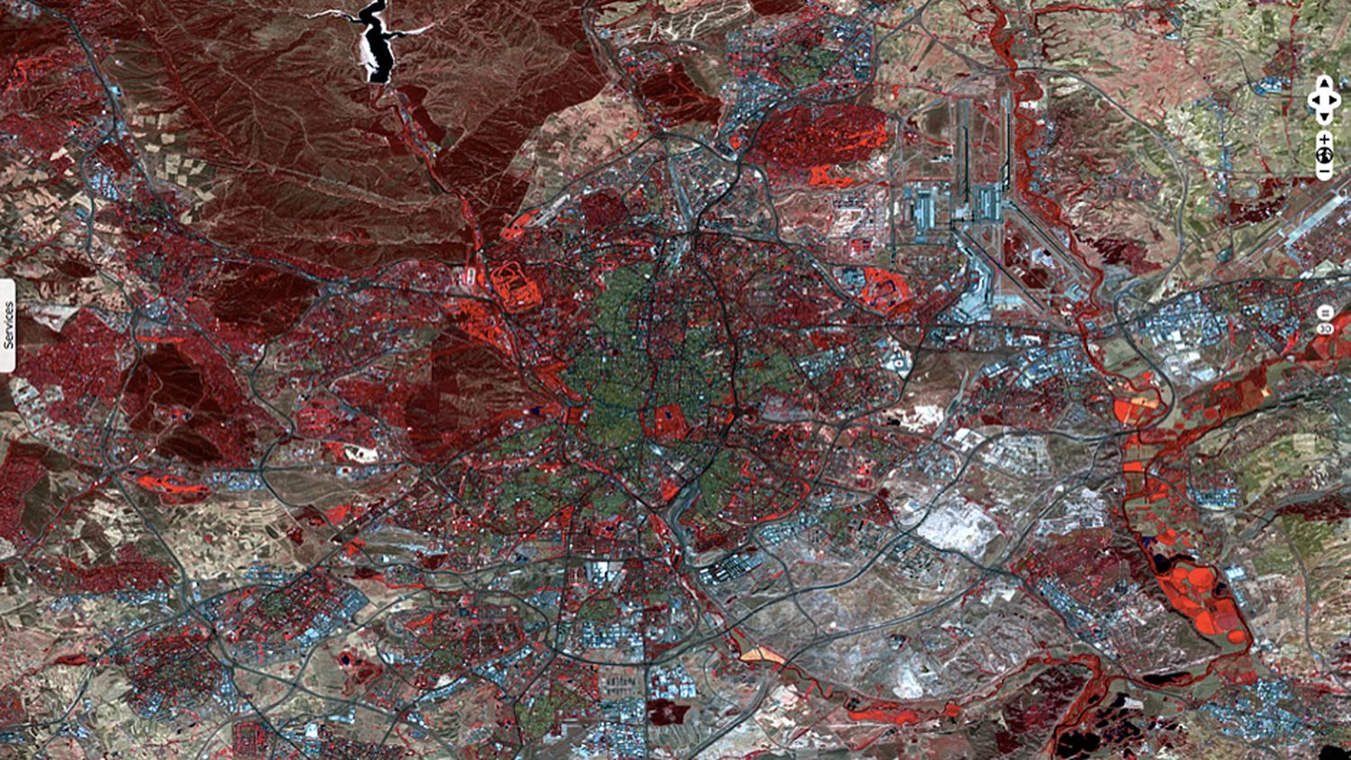
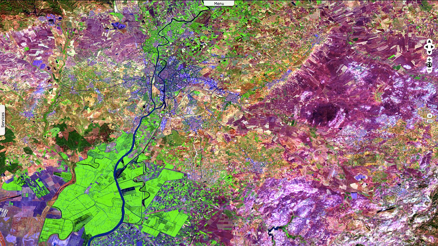
Madrid is the capital of Spain and the largest municipality of the country. The city has almost 3.166 million inhabitants with a metropolitan area population of approximately 6.5 million.
Madrid lies on the southern Meseta Central, 60 km south of the Guadarrama mountains and straddling the Jarama and Manzanares river basins. There is a considerable difference in altitude within city limits ranging from 543 m (1,781 ft) to 846 m (2,776 ft) above sea level. Over a quarter of the Madrid municipal area is covered by the largely forested protected area of El Pardo.
The image has been enhanced using a false-color technique : the grey and green areas correspond to the human-built infrastructure, and vegetated areas appear bright red. In the middle of the city center, the red colour corresponds to the gardens surrounding Palacio de Velazquez and Palacio de Cristal.
On the northwestern side of the image, we can see Fuencarral-El Pardo. Despite its being a part of a capital city, the northern part of El Pardo is an ecologically important landscape, having been preserved as a royal hunting estate.
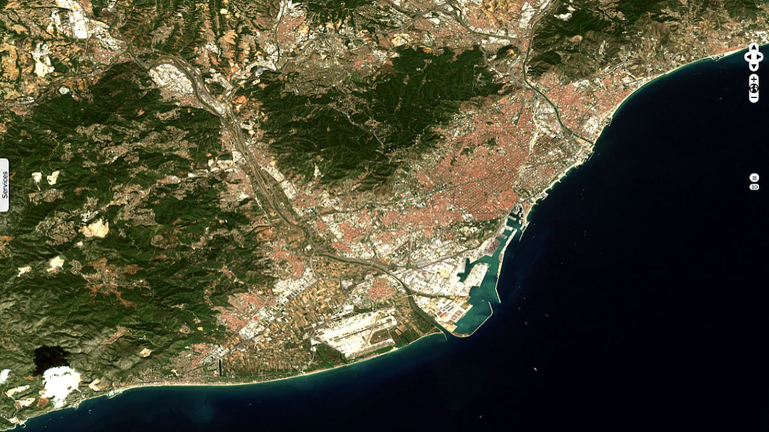
Barcelona, with a population of 1.6 million within city limits, is the second largest city of Spain and it is the capital and largest city of Catalonia.
It is a major cultural and economic centre in southwestern Europe, 24th in the world and a financial centre.
The city hosts the country’s largest seaport, visible in the image. The architectural design of the Eixample district is also visible on the north of the seaport. It is characterized by long straight streets, a strict grid pattern crossed by wide avenues, and square blocks with chamfered corners.
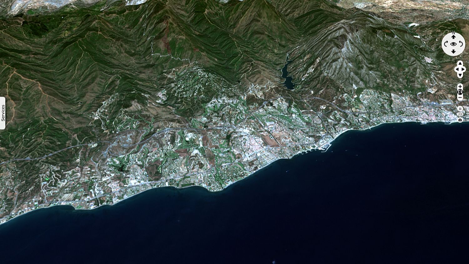
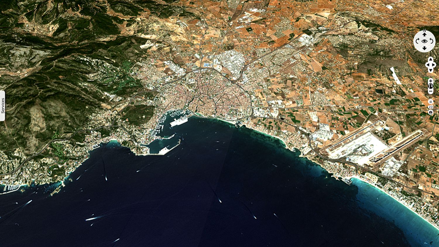
Marbella belongs to the province of Malaga. It is one of the most important touristic place of Costa del Sol due mainly to its climate and tourist infrastructures.
The mountains visible behind the city center belong to the Sierra Blanca, a mountain range of the Penibaetic System. Its name means 'White Range', due to the lack of vegetation on its slopes, which leaves the pale grey limestone rock exposed.
Ibiza is one of the Balearic Islands, in the Mediterranean Sea. It is located off the eastern coast of Spain.
On this image, most of the lowland interior is covered with agricultural fields (green to light pink colour) and the largest cities (Ibiza Town, Sant Antoni de Portmany, and Santa Eulària des Riu) appear in white colour.
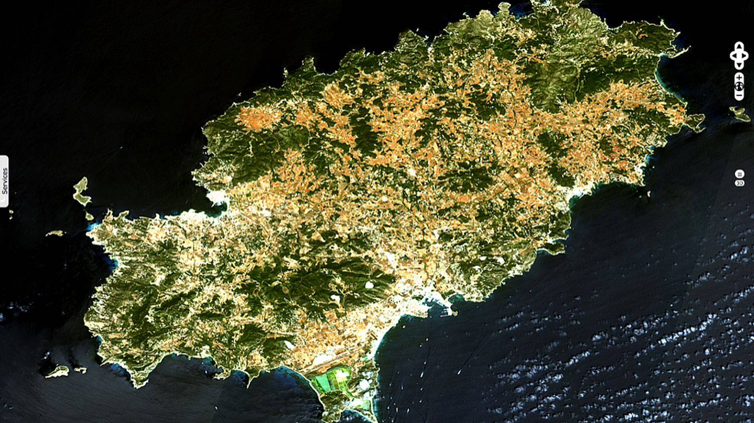
Majorca is located about midway between the southeastern coastline of Spain and the northern coastline of Algeria.
Palma de Majorca is the capital and largest city of the autonomous community of the Balearic Islands in Spain. Like Ibiza, Majorca is a popular destination for European tourists. The official languages are Catalan, the native tongue, and Spanish.
Seville is the capital and largest city of the autonomous community of Andalusia. The city has a metropolitan population of about 1.5 million, making it the fourth-largest city in Spain. Its Old Town contains three UNESCO World Heritage Sites: the Alcázar palace complex, the Cathedral and the General Archive of the Indies.
The Guadalquivir river crosses the region of Seville and makes it a fertile valley, as we can see regarding the numerous crops (green to violet colour) surrounding the city.
The natural site of Brazo del Este is easily visible in the southeastern part of this image (neon green). It is a flat relief that result of man-made modifications (agriculture structures). However, this site has become an essential wetland for birdlife.
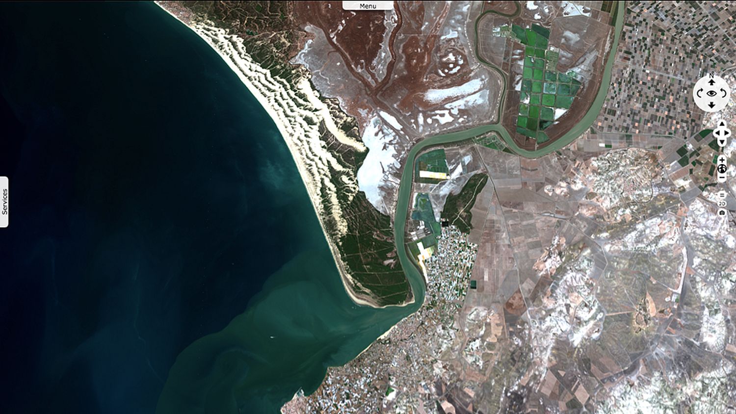
The Guadalquivir river is the second longest river with its entire length in Spain (657 km long). It begins at Cañada de lad Fuentes (village of Quesada) in the Cazorla mountain range (Jaén), passes through Córdoba and Seville (fig. 6) and ends at the fishing village of Bonanza (visible on the south of this image), in Sanlúcar de Barrameda.
The Guadiana River flows along the stretch of the Portugal-Spain border, separating Extremadura and Andalucia (Spain) from Alentejo and Algarve (Portugal).
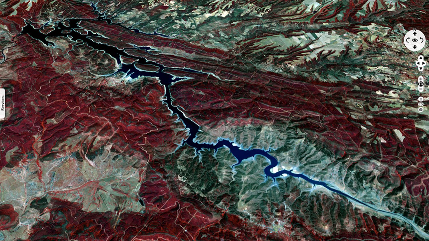
On this image, red colours correspond to vegetation and grey colours represent agriculture structures. In this region (Embalse de Cijara), many crops are implanted directly on the mountains.
The views expressed herein can in no way be taken to reflect the official opinion of the European Space Agency or the European Union.
Contains modified Copernicus Sentinel data 2026, processed by VisioTerra.
Contains modified Copernicus Sentinel data 2026, processed by VisioTerra.
| More on European Commission space: |  |
 |
 |
||||
| More on ESA: | |
|
|
S-1 website | S-2 website | S-3 website | |
| More on Copernicus program: | |
|
|
Scihub portal | Cophub portal | Inthub portal | Colhub portal |
| More on VisioTerra: | |
|
|
Sentinel Vision Portal | Envisat+ERS portal | Swarm+GOCE portal | CryoSat portal |