Storm Koguma destroys 200 km² of cropland, Vietnam
Sentinel-3 SLSTR RBT acquired on 11 June 2021 at 02:30:57 UTC
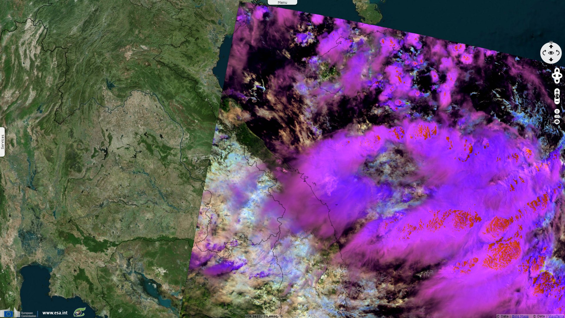
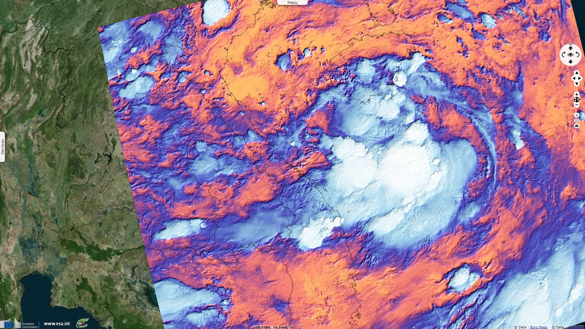
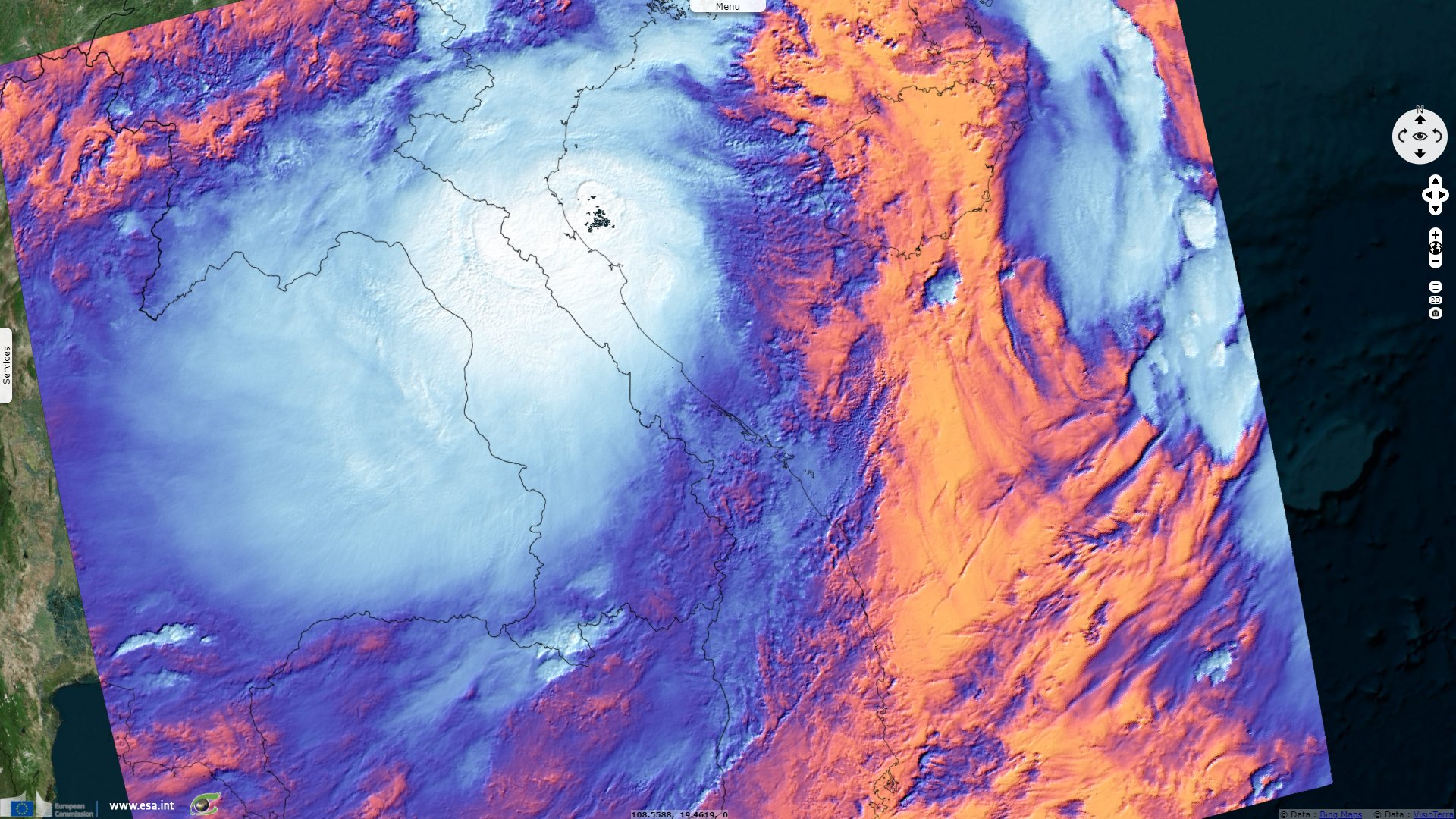
Sentinel-3 SLSTR RBT acquired on 11 June 2021 at 14:37:26 UTC
Sentinel-3 SLSTR RBT acquired on 12 June 2021 at 14:50:40 UTC
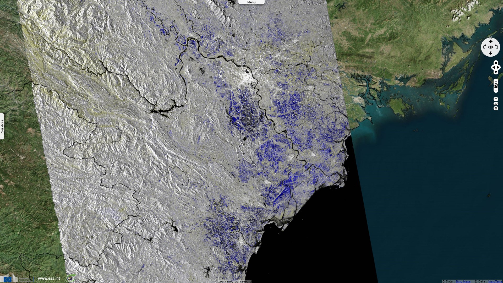
Sentinel-1 CSAR IW acquired on 12 June 2021 from 22:51:02 to 22:51:52 UTC
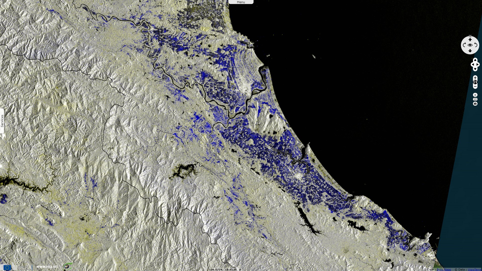
Sentinel-1 CSAR IW acquired on 15 June 2021 from 11:05:57 to 11:06:22 UTC
Sentinel-3 SLSTR RBT acquired on 11 June 2021 at 14:37:26 UTC
Sentinel-3 SLSTR RBT acquired on 12 June 2021 at 14:50:40 UTC
Sentinel-1 CSAR IW acquired on 12 June 2021 from 22:51:02 to 22:51:52 UTC
Sentinel-1 CSAR IW acquired on 15 June 2021 from 11:05:57 to 11:06:22 UTC
Keyword(s): Tropical storm, precipitations, flooding, natural disaster, agriculture, Gulf of Tonkin, Vietnam
The views expressed herein can in no way be taken to reflect the official opinion of the European Space Agency or the European Union.
Contains modified Copernicus Sentinel data 2026, processed by VisioTerra.
Contains modified Copernicus Sentinel data 2026, processed by VisioTerra.
| More on European Commission space: |  |
 |
 |
||||
| More on ESA: | |
|
|
S-1 website | S-2 website | S-3 website | |
| More on Copernicus program: | |
|
|
Scihub portal | Cophub portal | Inthub portal | Colhub portal |
| More on VisioTerra: | |
|
|
Sentinel Vision Portal | Envisat+ERS portal | Swarm+GOCE portal | CryoSat portal |