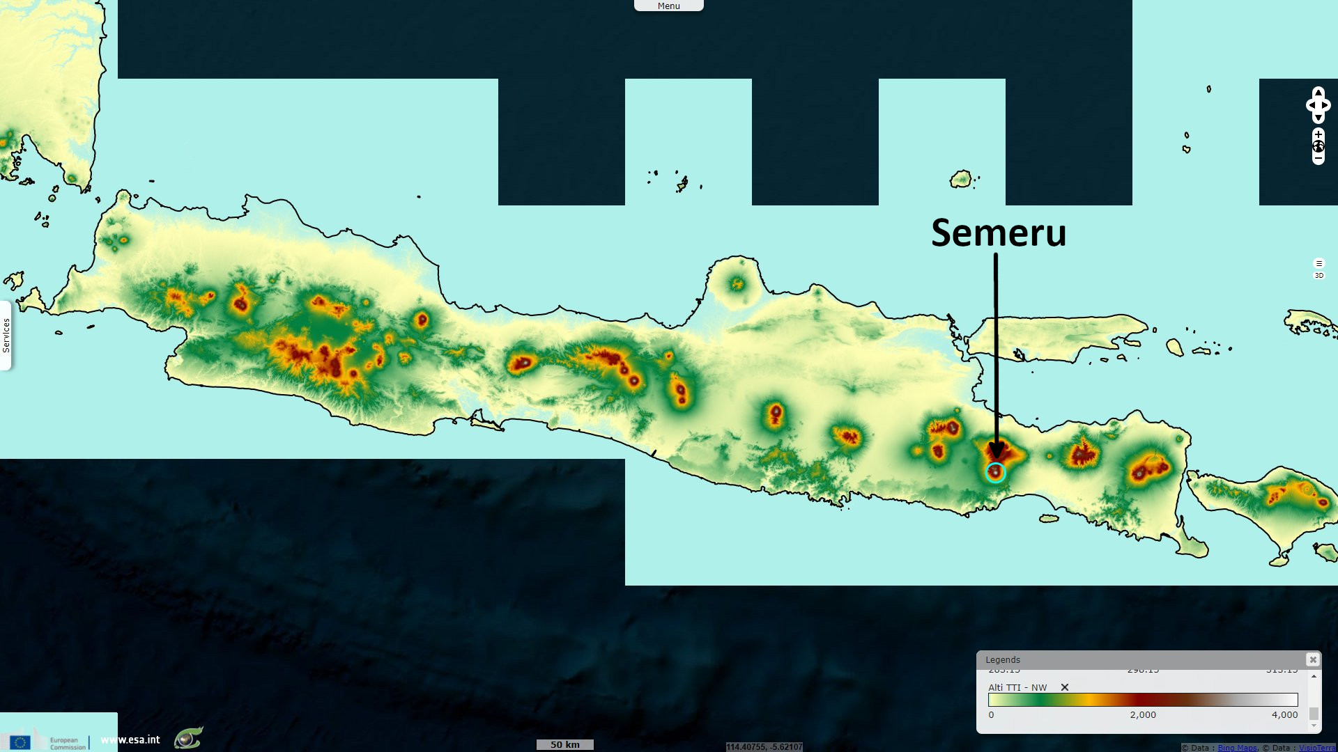
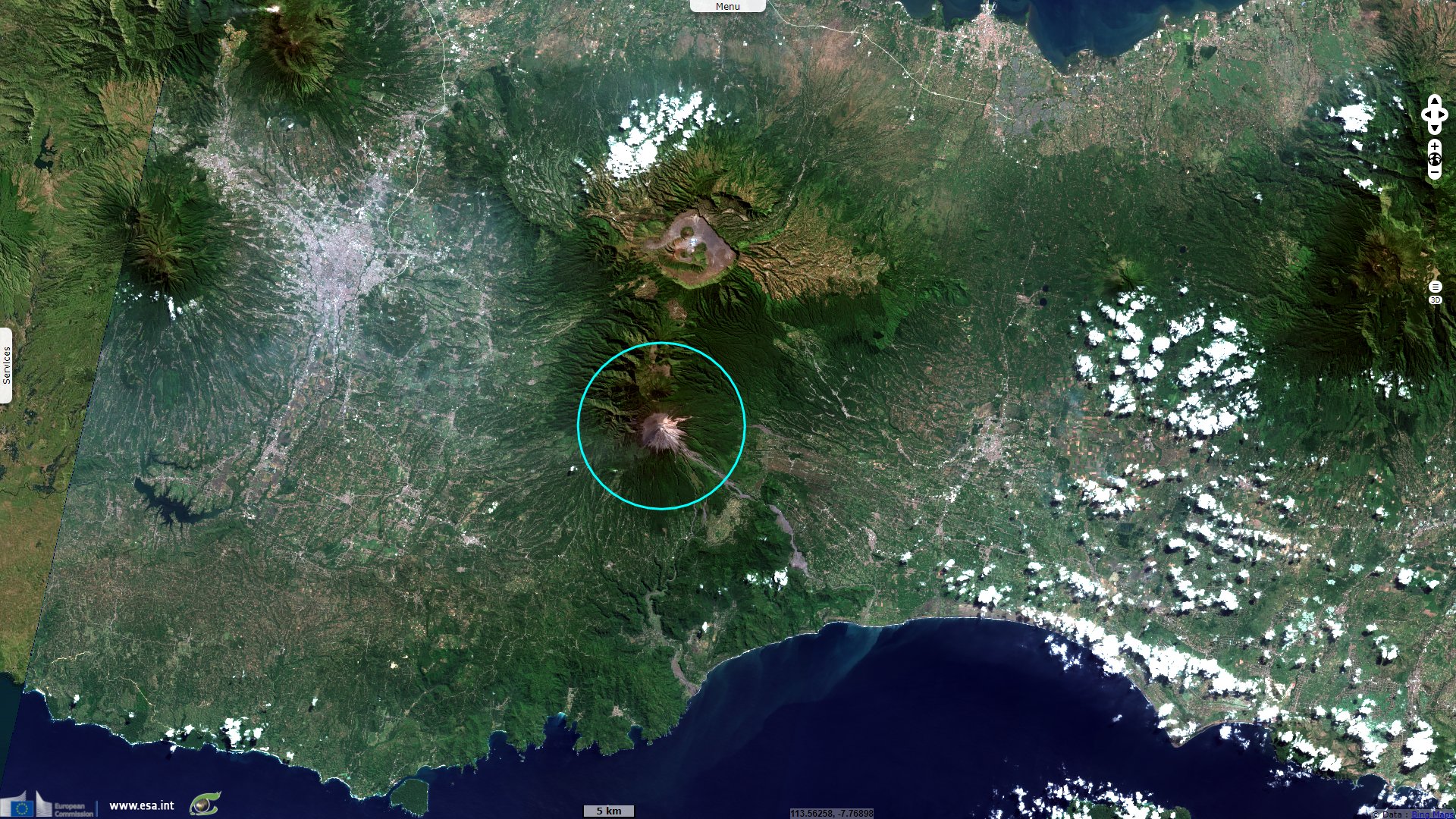
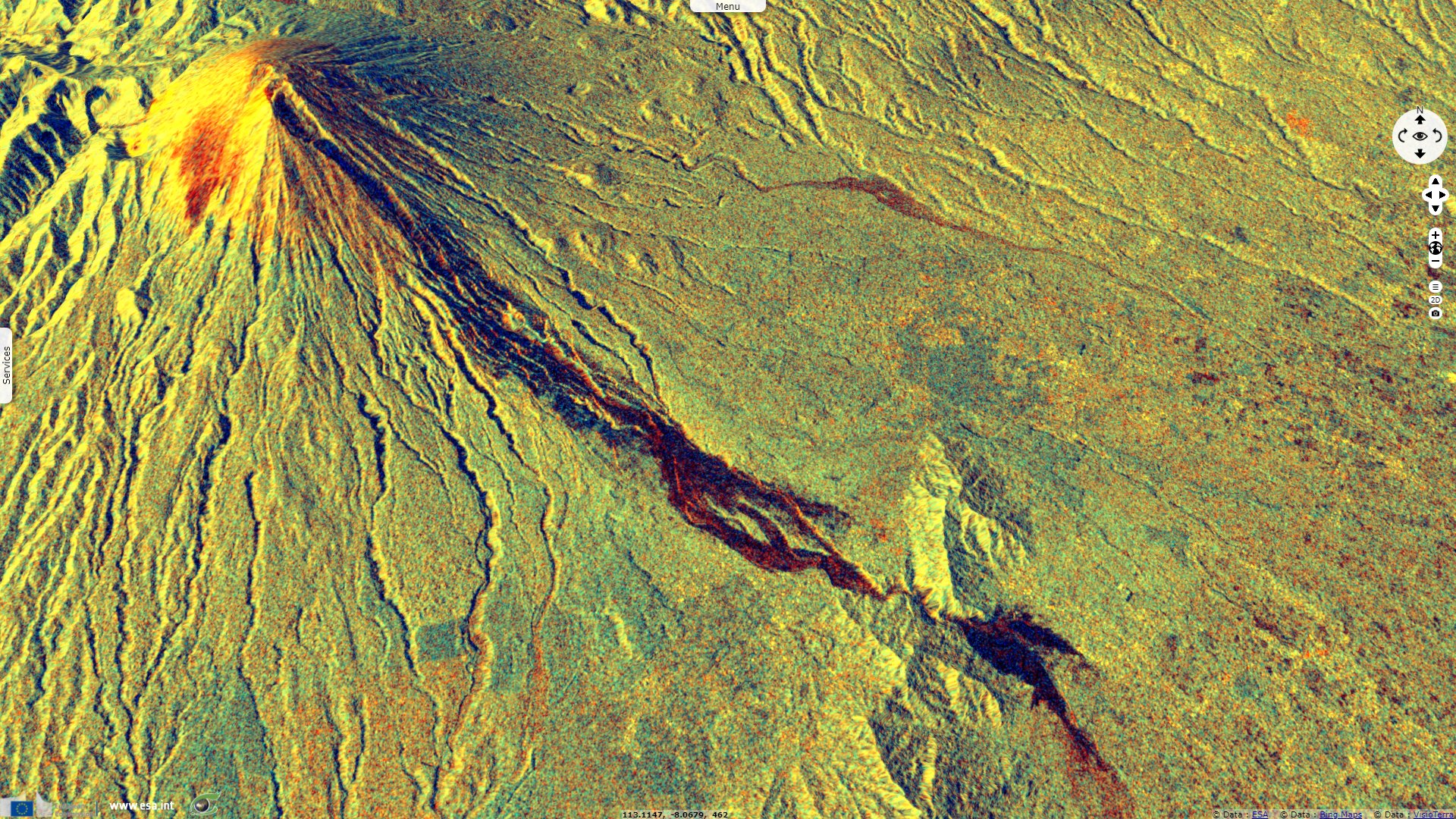
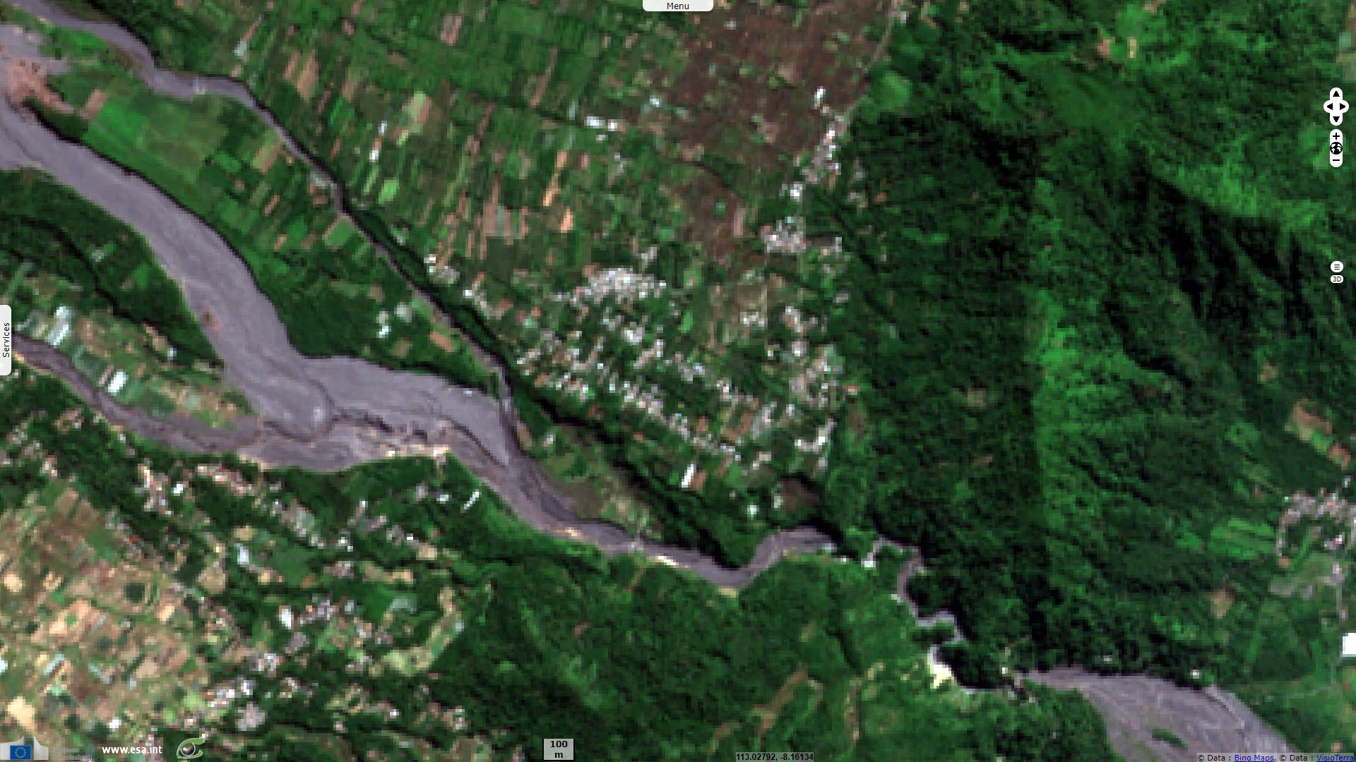
Semeru eruption destroys a miners village, Indonesia
Sentinel-2 MSI acquired on 24 July 2021 at 02:25:51 UTC
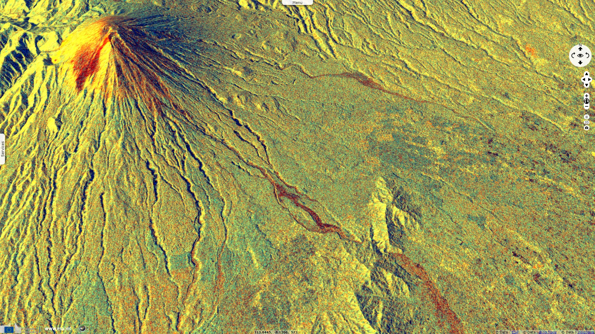
Sentinel-1 CSAR IW acquired on 25 November 2021 at 10:50:17 UTC
Sentinel-1 CSAR IW acquired on 07 December 2021 at 10:50:16 UTC
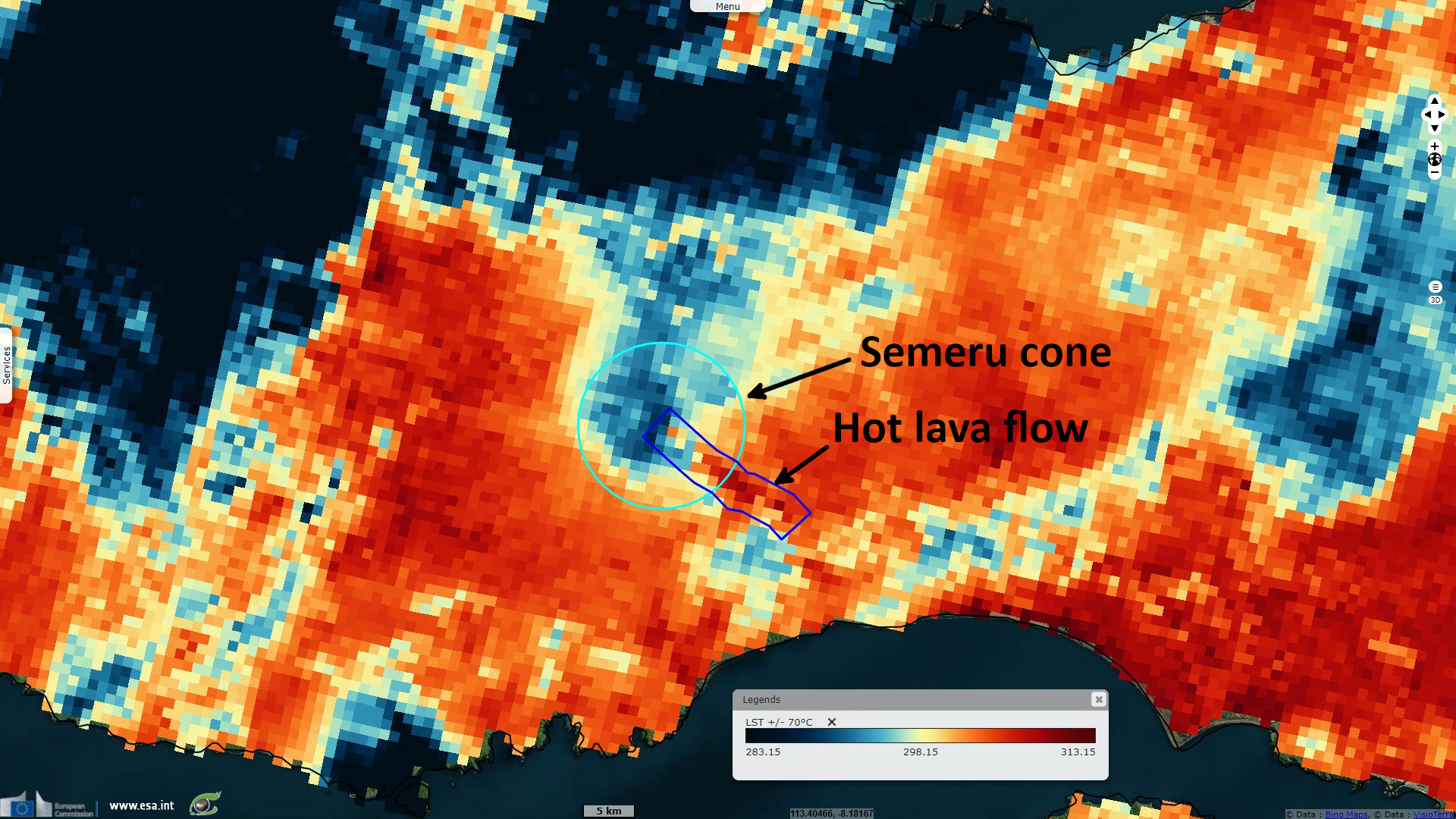
Sentinel-3 SLSTR RBT & LST acquired on 08 December 2021 at 02:31:12 UTC
Sentinel-1 CSAR IW acquired on 25 November 2021 at 10:50:17 UTC
Sentinel-1 CSAR IW acquired on 07 December 2021 at 10:50:16 UTC
Sentinel-3 SLSTR RBT & LST acquired on 08 December 2021 at 02:31:12 UTC
Keyword(s): Natural disaster, emergency, geohazard, volcano, eruption, mining, Indonesia, Pacific Ring of Fire
The views expressed herein can in no way be taken to reflect the official opinion of the European Space Agency or the European Union.
Contains modified Copernicus Sentinel data 2026, processed by VisioTerra.
Contains modified Copernicus Sentinel data 2026, processed by VisioTerra.
| More on European Commission space: |  |
 |
 |
||||
| More on ESA: | |
|
|
S-1 website | S-2 website | S-3 website | |
| More on Copernicus program: | |
|
|
Scihub portal | Cophub portal | Inthub portal | Colhub portal |
| More on VisioTerra: | |
|
|
Sentinel Vision Portal | Envisat+ERS portal | Swarm+GOCE portal | CryoSat portal |