Ice-free oases in McMurdo dry valleys, Antarctica
Sentinel-1 CSAR EW acquired on 03 July 2017 at 11:01:34 UTC
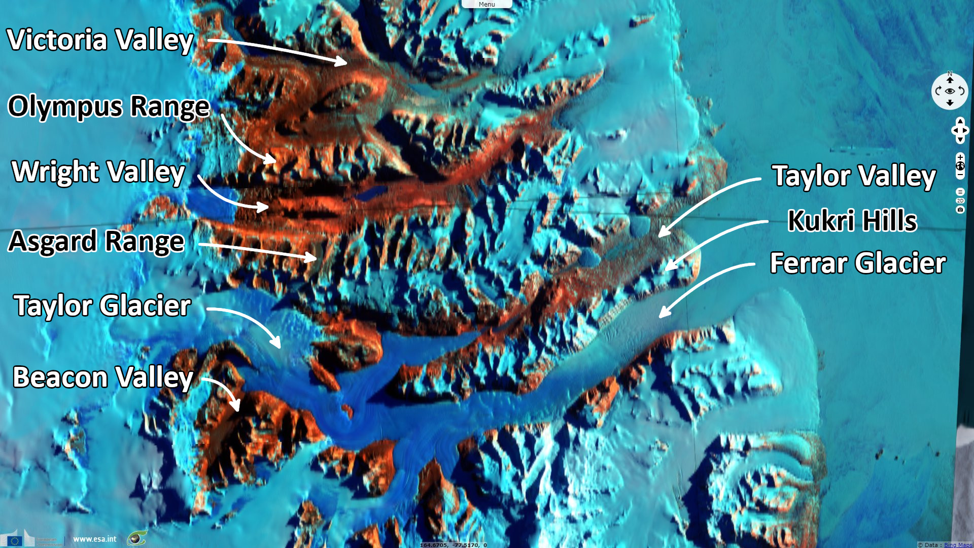
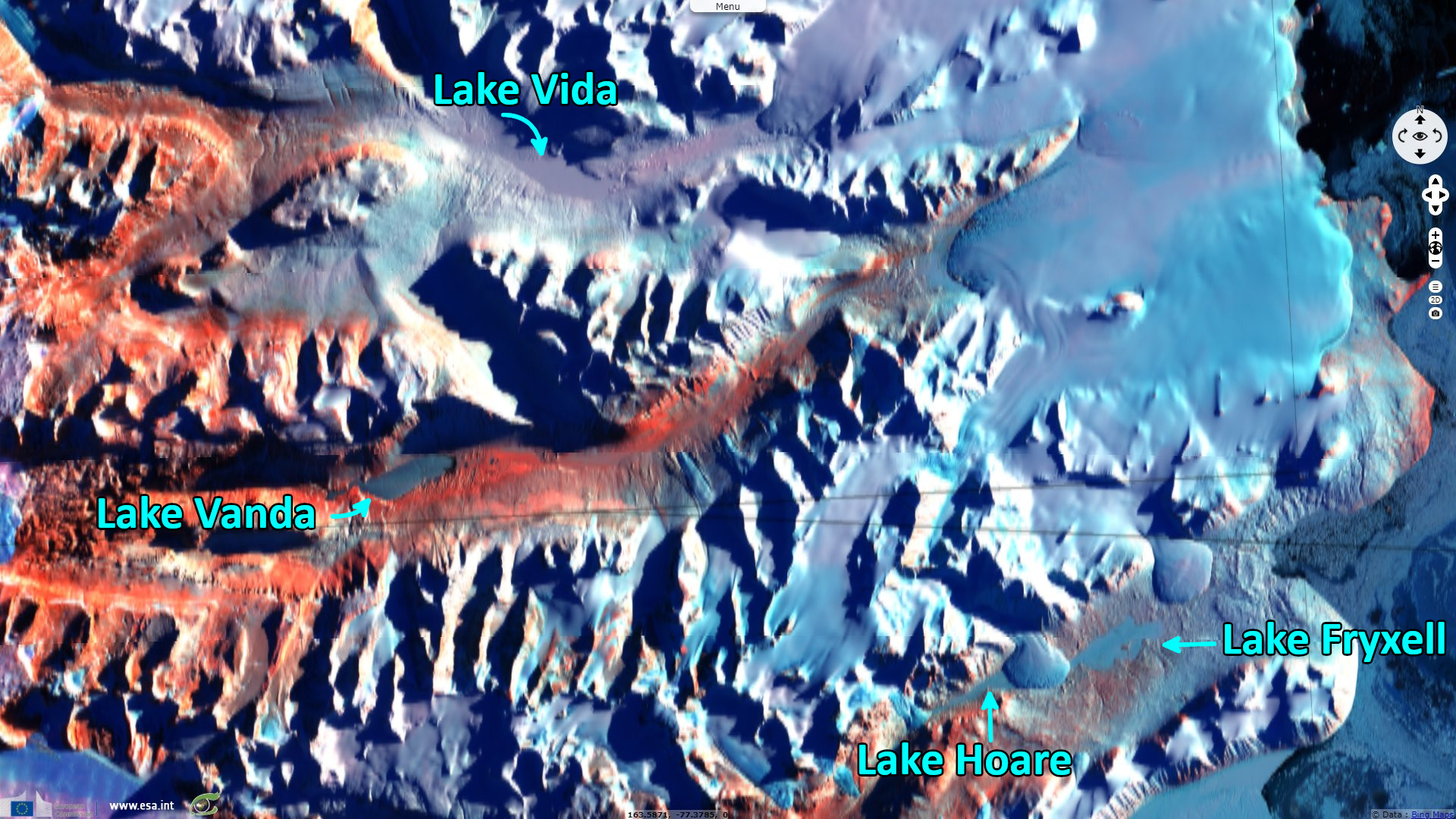
Sentinel-2 MSI acquired on 07 March 2020 at 21:05:29 UTC
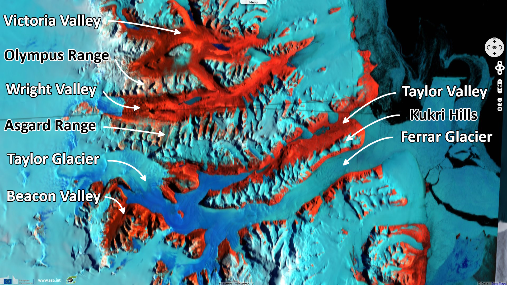
Sentinel-1 CSAR EW acquired on 23 July 2021 at 11:09:05 UTC
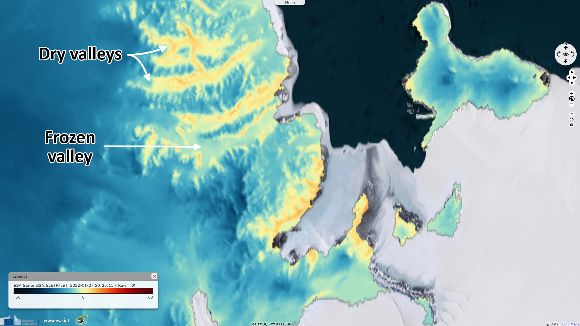
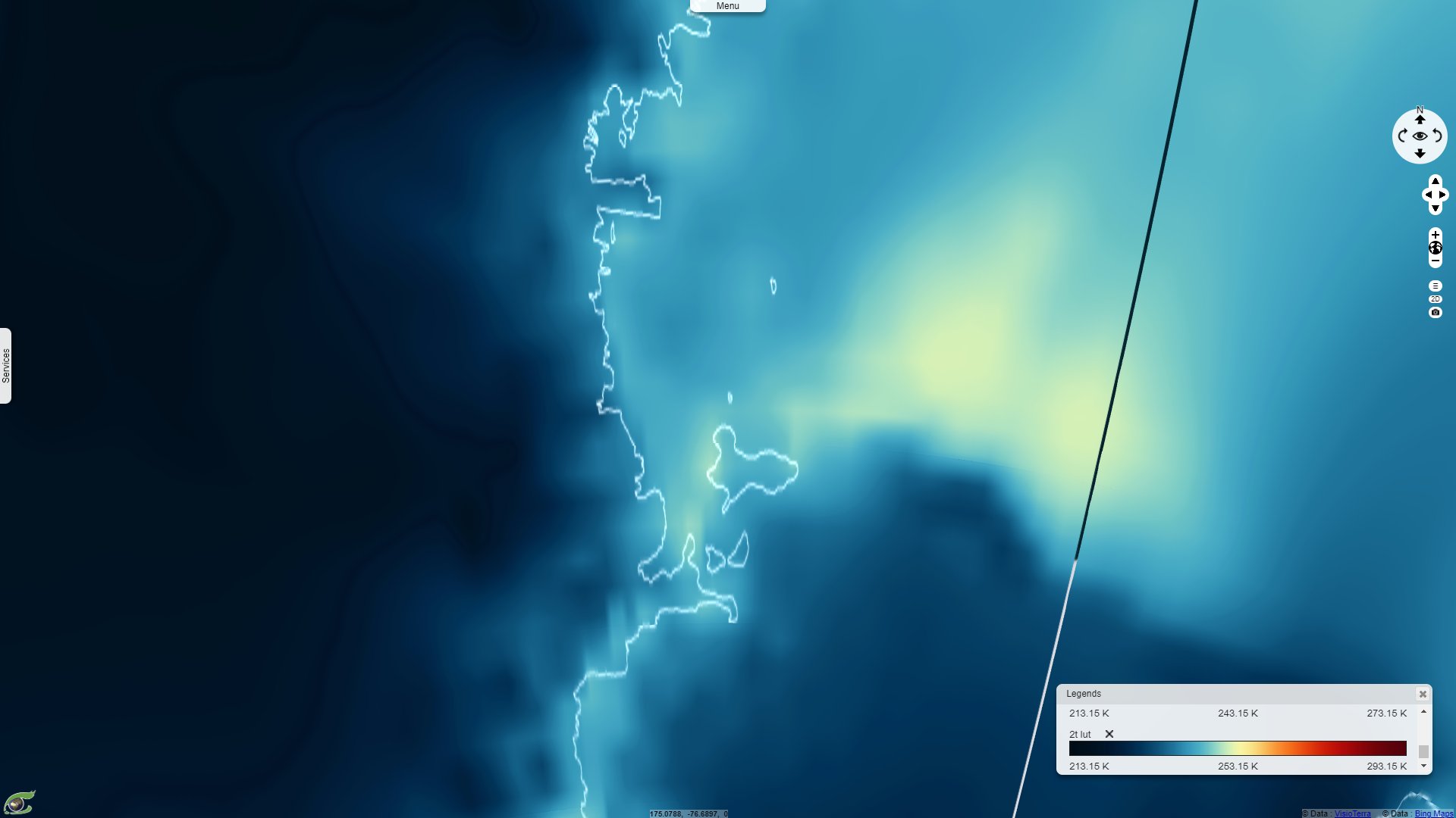
Sentinel-3 SLSTR LST acquired on 27 January 2022 at 20:25:15 UTC
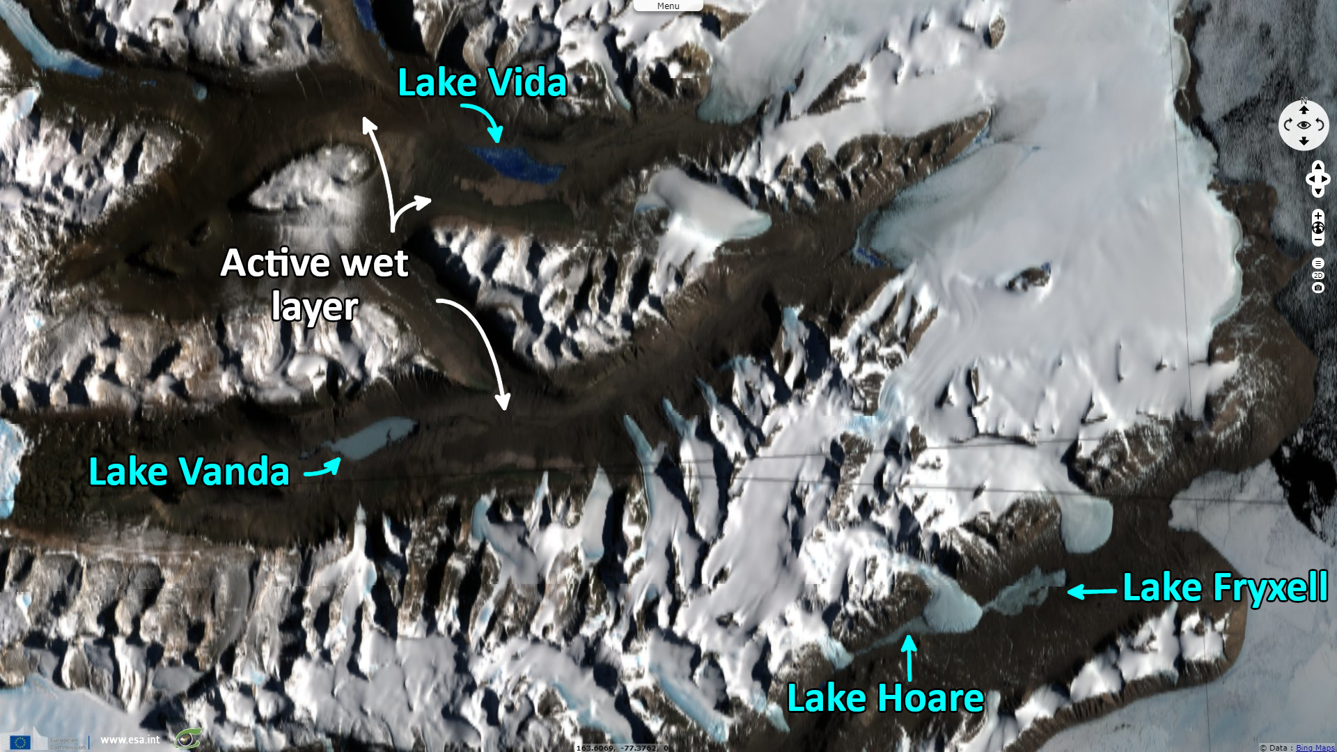
Sentinel-2 MSI acquired on 27 January 2022 at 20:36:19 UTC
Sentinel-2 MSI acquired on 07 March 2020 at 21:05:29 UTC
Sentinel-1 CSAR EW acquired on 23 July 2021 at 11:09:05 UTC
Sentinel-3 SLSTR LST acquired on 27 January 2022 at 20:25:15 UTC
Sentinel-2 MSI acquired on 27 January 2022 at 20:36:19 UTC
Keyword(s): Polar, cryosphere, climate, snow, ice, glacier, endorheic valleys, Antarctica
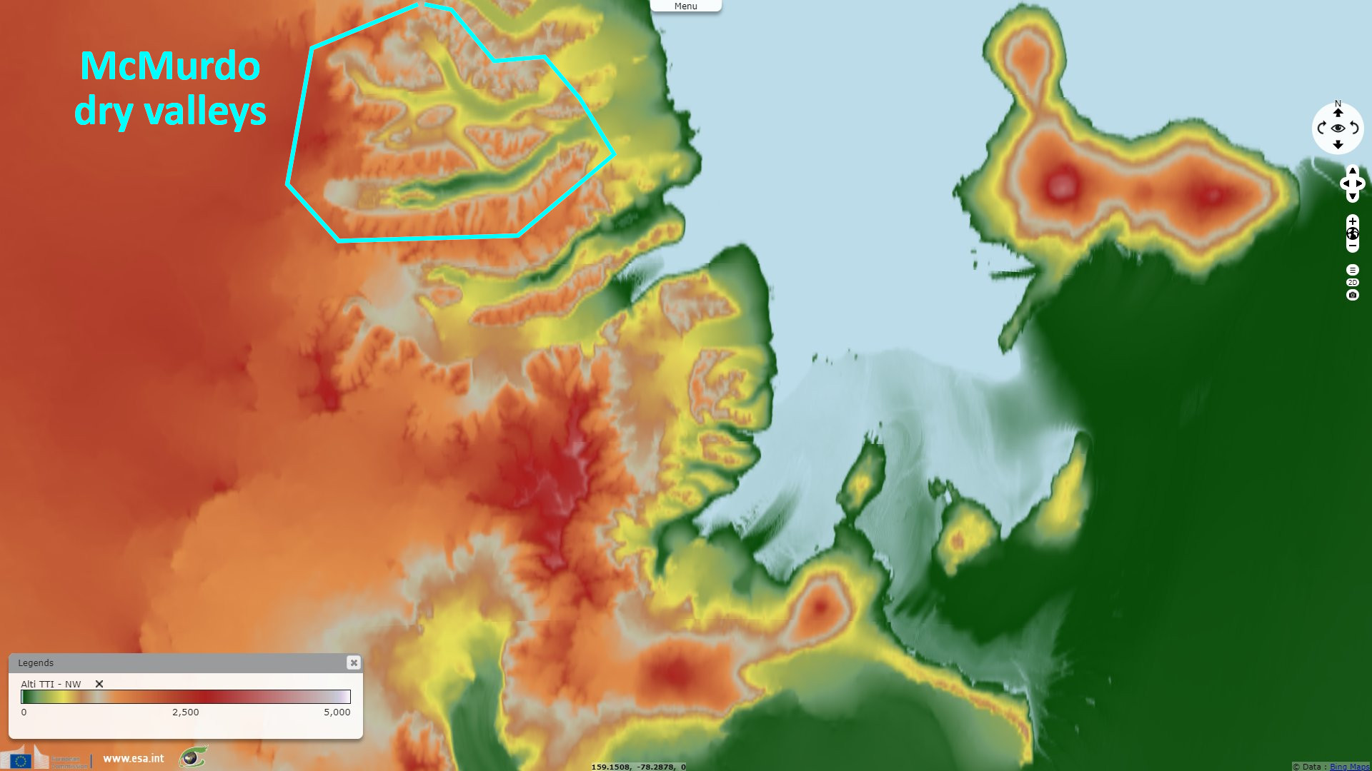
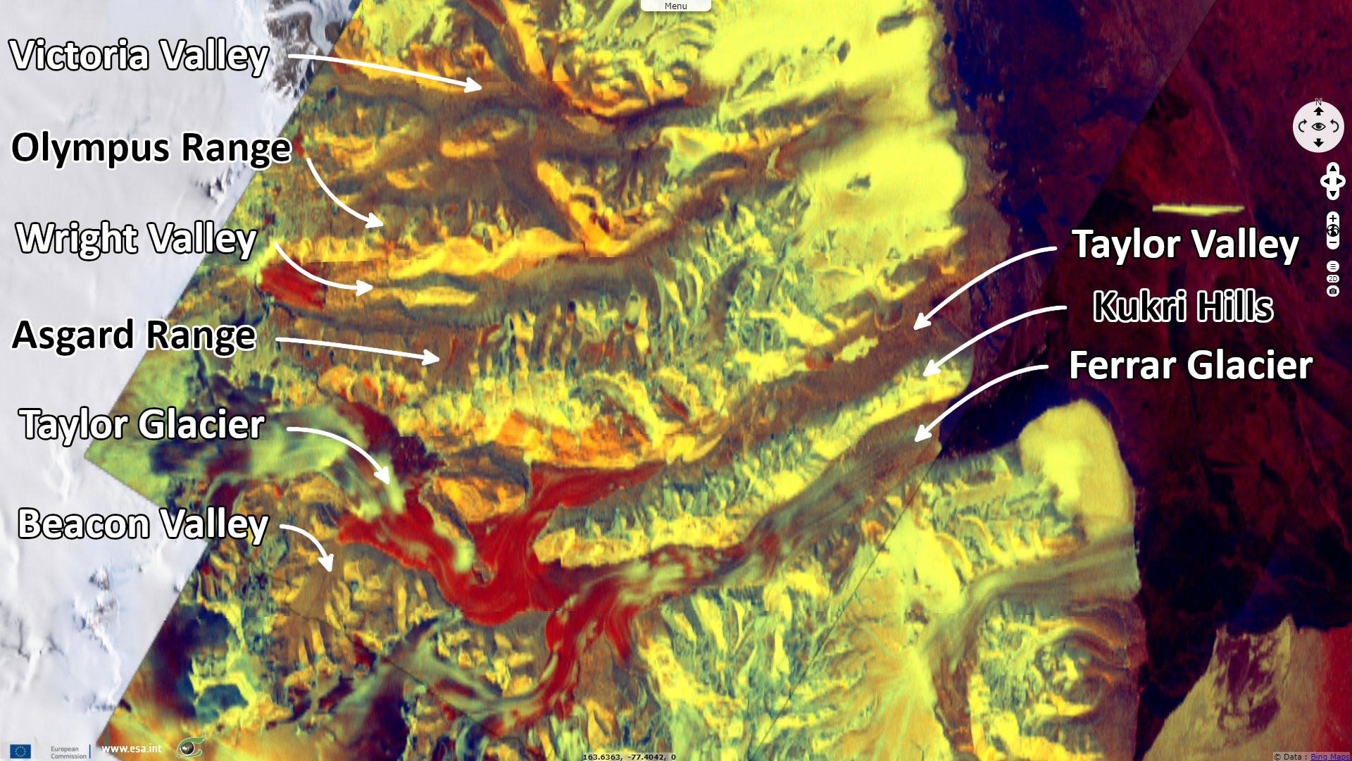
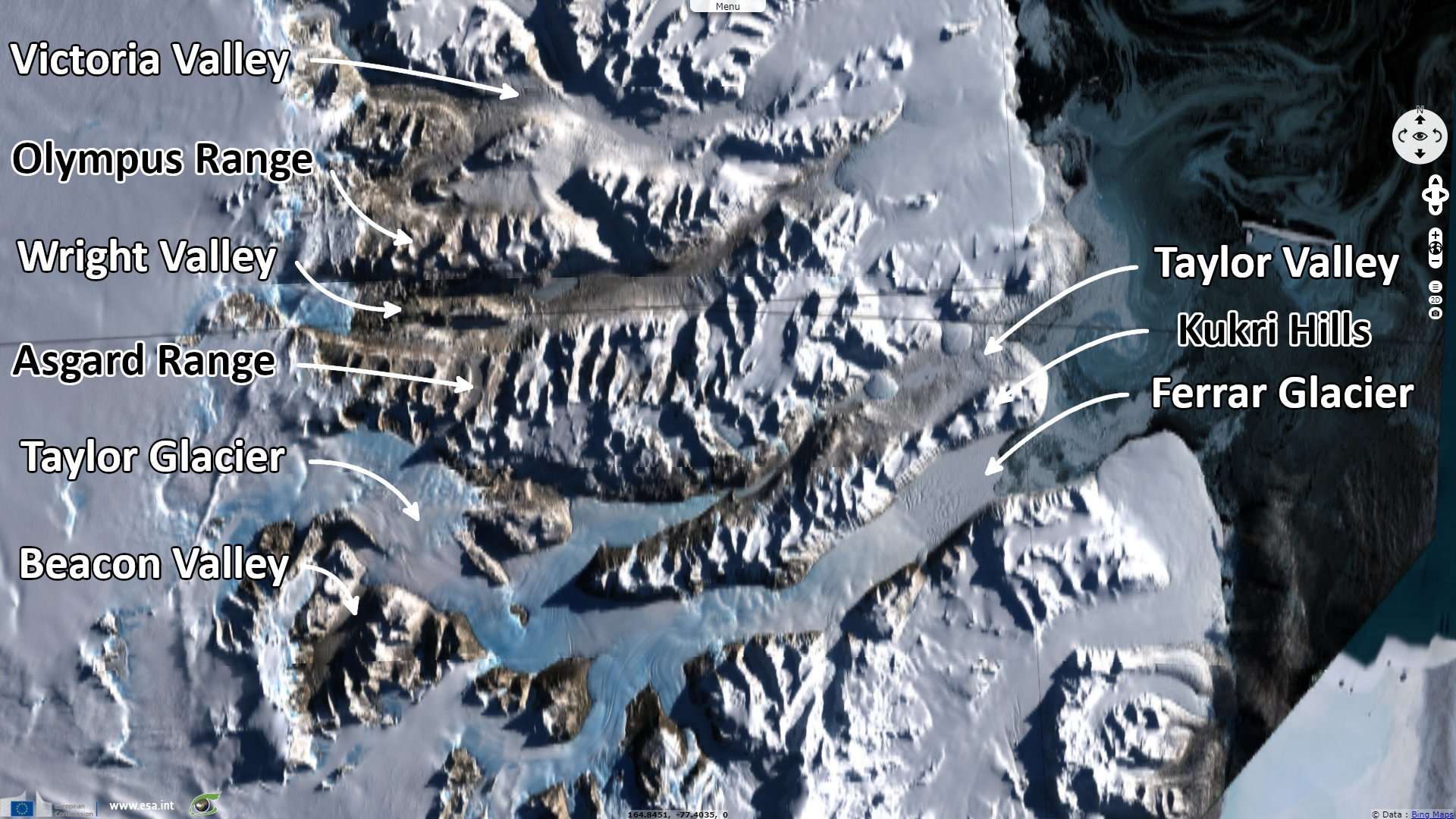
The McMurdo Dry Valleys are a unique place of ice-free, snow-free oases in Antarctica. In her article Foehn Winds in the McMurdo Dry Valleys, Antarctica: The Origin of Extreme Warming Events, Johanna C. Speirs described: The McMurdo Dry Valleys are situated in the Transantarctic Mountains, bounded by the McMurdo Sound/Ross Sea to the east and the east Antarctic ice sheet to the west. The McMurdo Dry Valleys consist of three large northeast–southwest-trending ice-free valleys (the Victoria, Wright, and Taylor Valleys), which collectively cover an area of approximately 4800 km², the largest ice-free area in Antarctica.
Large mountain ranges rising over 2000 m above sea level separate the valleys, which have a polar desert climate because of their location in a precipitation shadow of the Transantarctic Mountains (Monaghan et al. 2005). Annual precipitation is <50-mm water equivalent, with precipitation decreasing away from the coast (Fountain et al. 2009). Mean annual air temperature from seven valley floor AWSs range between −14.8° and −30°C.
Maciej K. Obryk goes further in the description of the local climate in his article, Climate from the McMurdo Dry Valleys, Antarctica, 1986 – 2017: surface air temperature trends and redefined summer season: "The terrain is primarily ice-free, largely covered with a sandy gravelly soil, dotted with perennially ice-covered lakes, and local alpine and a few outlet glaciers from the East Antarctic Ice Sheet. The soils are underlain by ice-cemented or dry permafrost [Marchant and Head, 2007]."
"Snowfall in the valley bottoms reaches an annual maximum of ~50 mm water equivalent near the coast and much less inland [Fountain et al., 2010]. Although precipitation occurs as snow, rain has been observed on rare occasions (Myers 2019, personal communication). Snow accumulations on the valley floors largely sublimate before melting thus limiting infiltration into soils."
"As a consequence, this arid polar desert has one of the lowest erosion rates in the world ~1m/Ma in the valley bottoms and ~0.06 m/Ma -1 in perennially frozen landscapes at high elevations [Marchant and Head, 2007]. Most of the lakes are in closed basins fed by ephemeral streams draining glacial melt in December and January. Water loss from the lakes is mostly through sublimation of the ice cover during the winter [Obryk et al., 2017]."
In addition to the low albedo of the valleys, Johanna C. Speirs develops on the importance of the foehn wind on the landscape: "Foehn winds result from topographic modification of flow in the lee of mountain barriers. They are a climatological feature common to many of the world’s midlatitude mountainous regions, where they can be responsible for wind gusts exceeding 50 m/s (Brinkmann 1971; McGowan and Sturman 1996a) and warming at foehn onset of +28°C (Math 1934).
Foehn-induced warming frequently exceeds 40°C within several hours at valley surfaces in the McMurdo Dry Valleys during winter. Dramatic temperature changes on the valley floor at foehn onset can be explained by the displacement of cold, stable air by potentially warmer air from upper levels, in addition to adiabatic warming as air is brought to the surface from above ridge level.
South-southwesterly upper-level airflow is deflected by the valley walls, observed as a southwesterly wind at the valley floor. In addition to forced deflection, a component of the flow may be driven down valley from high to low pressure with the strong along-valley pressure gradient."
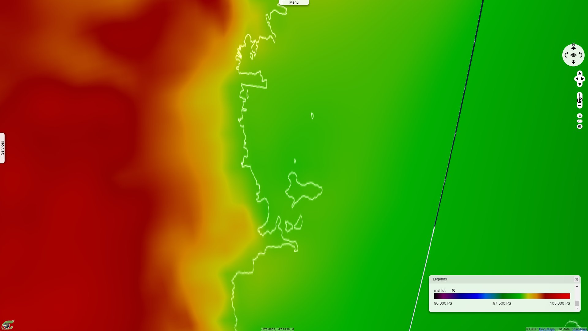
ECMWF (23.05.2007) - Mean sea level pressure during the foehn event, a high pressure is visible on the Antarctic Plateau - 2D_View.
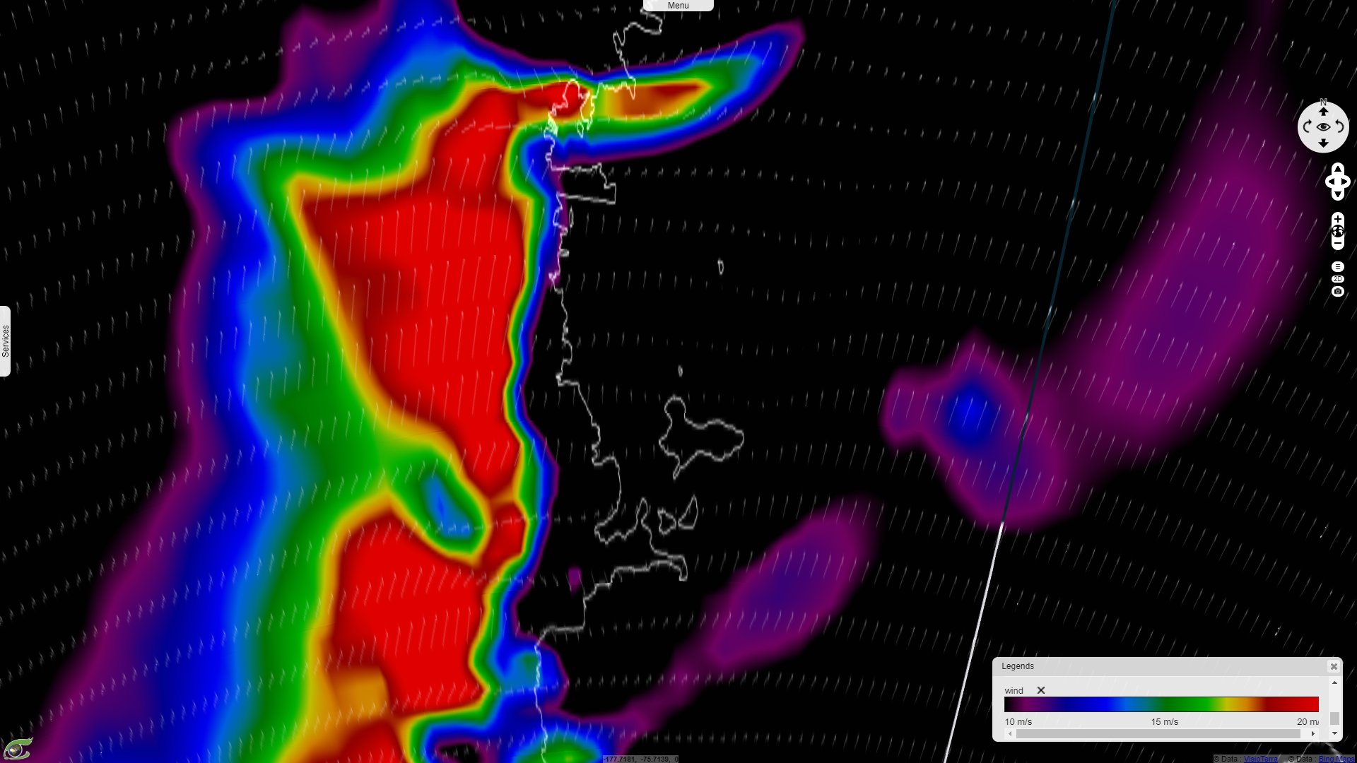
ECMWF (23.05.2007) - 10 metres wind speed during the foehn event, wind speed exceeding 20 m/s is visible near the Ross Sea - 2D_View.
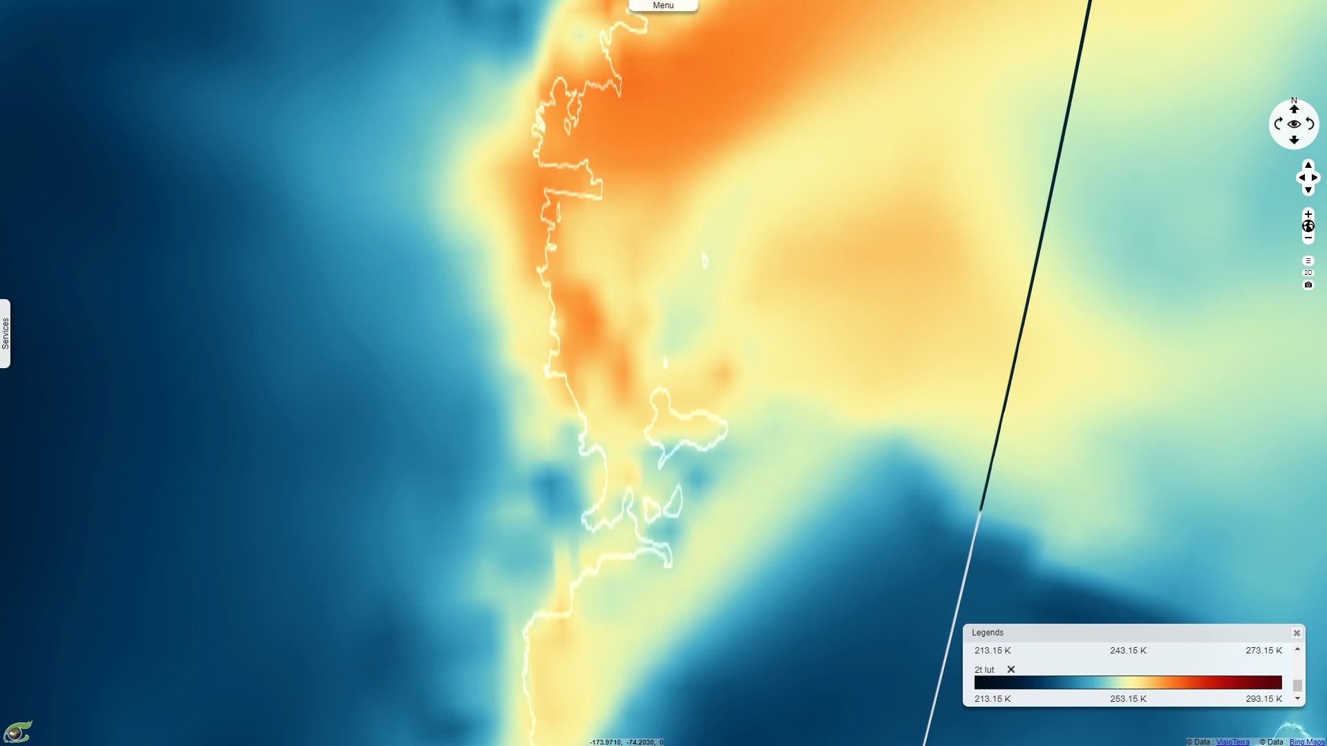
ECMWF (25.05.2007) - 2 metres air temperature at the end of the event, the temperature has largely increased after the warm dry wind had blown for several days - 2D_View.
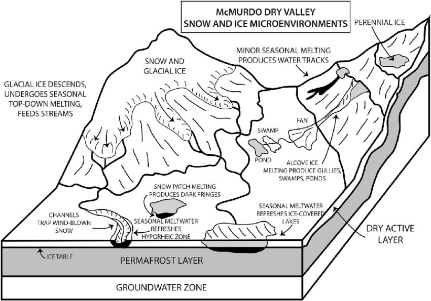
Left: "McMurdo Dry Valleys snow and ice microenvironments illustrating the multiple sources of snow and ice concentrations available for seasonal melting" - Source: David Marchant.
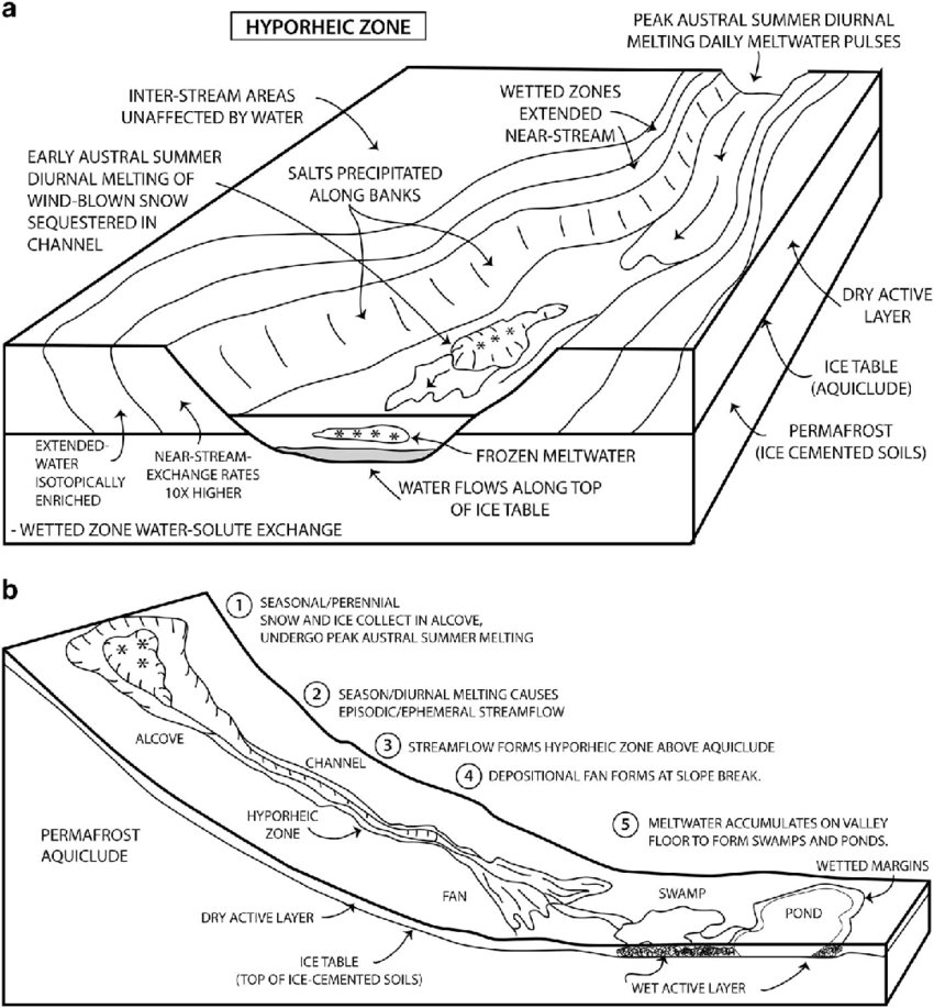
Right: "The hyporheic zone associated with streams. a. Block diagram illustrating the role of the hyporheic zone in water and ice migration and storage, chemical alteration, solute storage and migration, ecosystem development, and relation to seasonal melting processes forming ephemeral streams. The important role of the shallow ice table that forms an aquiclude, perched aquifer and horizontally stratified hydrologic system, is illustrated. This diagram does not portray a specific time, but rather the integrated features and processes. b. Relationship of surface features in a gully system to the perched aquifer and the hyporheic zone (meltwater source associated with sequestered snow in alcove, channel, fan, and swampy area/pond on the valley floor)" - Source: David Marchant.
The site Oceanwide Expeditions explain what makes this lakes interesting: "Ice-covered lakes in the Dry Valleys, which have ice around 3-5 meters thick throughout the year, provide a unique habitat for life to thrive. Some of the key characteristics of these lakes include:
- Ice cover that results in a stable water column, allowing saltwater layers to persist over many years,
- It limits the speed at which nutrients, that accumulate in deep waters, can return to the upper layer of the lake,
- The thick ice blocks 80-99% of the sun’s energy.
The views expressed herein can in no way be taken to reflect the official opinion of the European Space Agency or the European Union.
Contains modified Copernicus Sentinel data 2026, processed by VisioTerra.
Contains modified Copernicus Sentinel data 2026, processed by VisioTerra.
| More on European Commission space: |  |
 |
 |
||||
| More on ESA: | |
|
|
S-1 website | S-2 website | S-3 website | |
| More on Copernicus program: | |
|
|
Scihub portal | Cophub portal | Inthub portal | Colhub portal |
| More on VisioTerra: | |
|
|
Sentinel Vision Portal | Envisat+ERS portal | Swarm+GOCE portal | CryoSat portal |