Aftermath of Cyclone Gabrielle on New Zealand's North Island
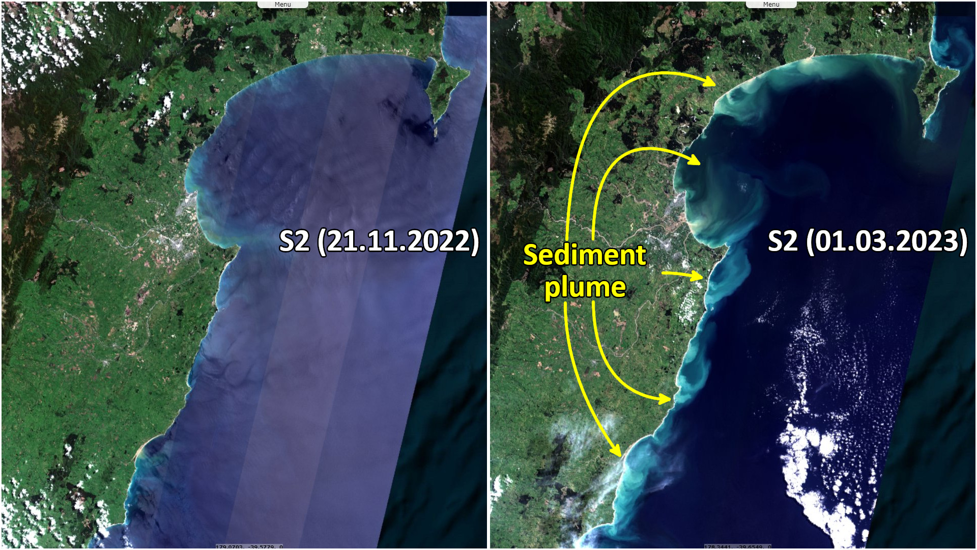
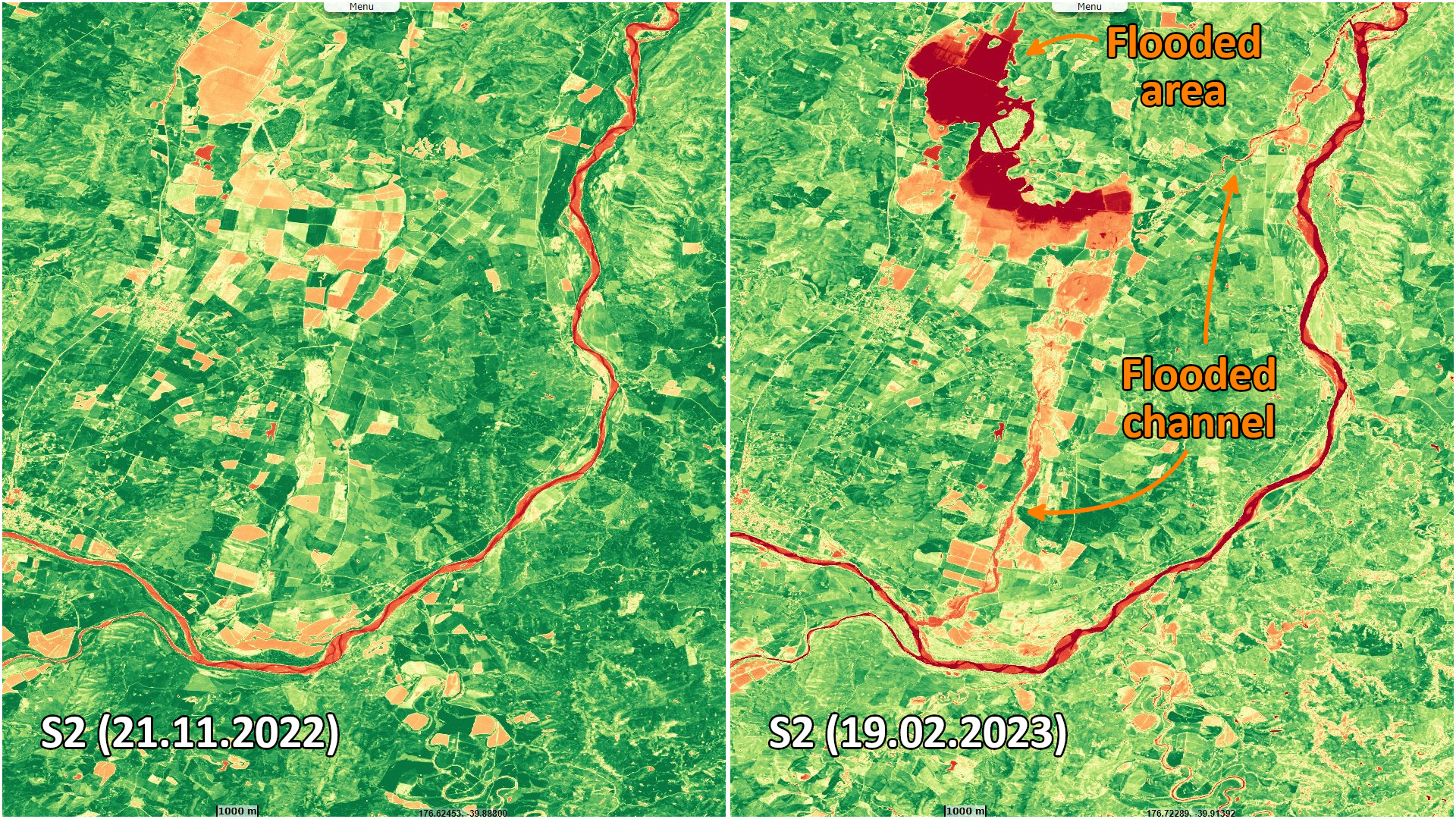
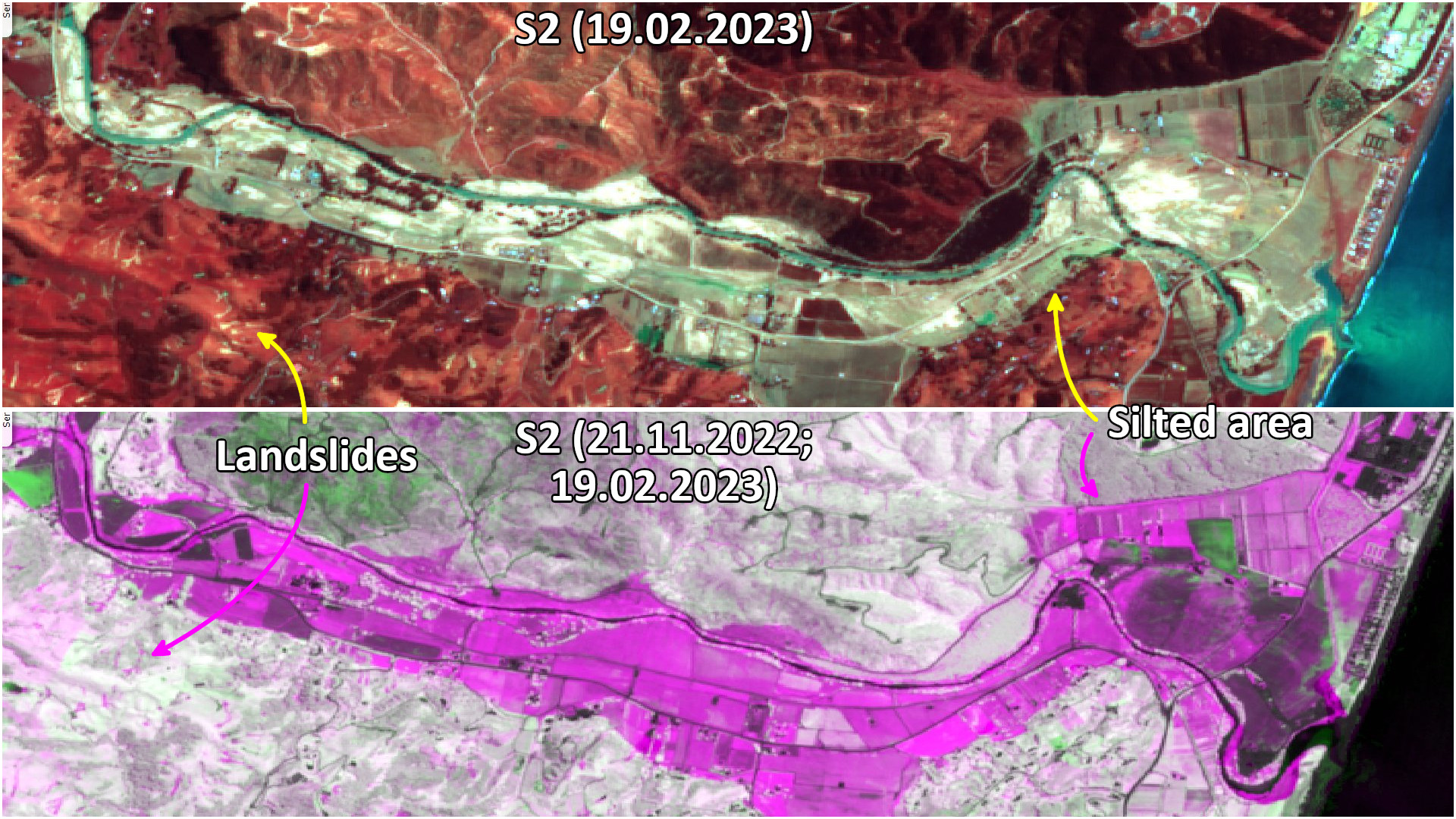
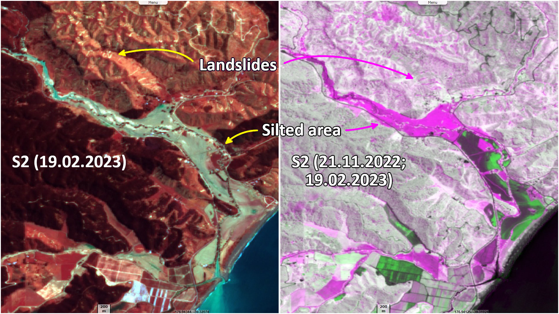
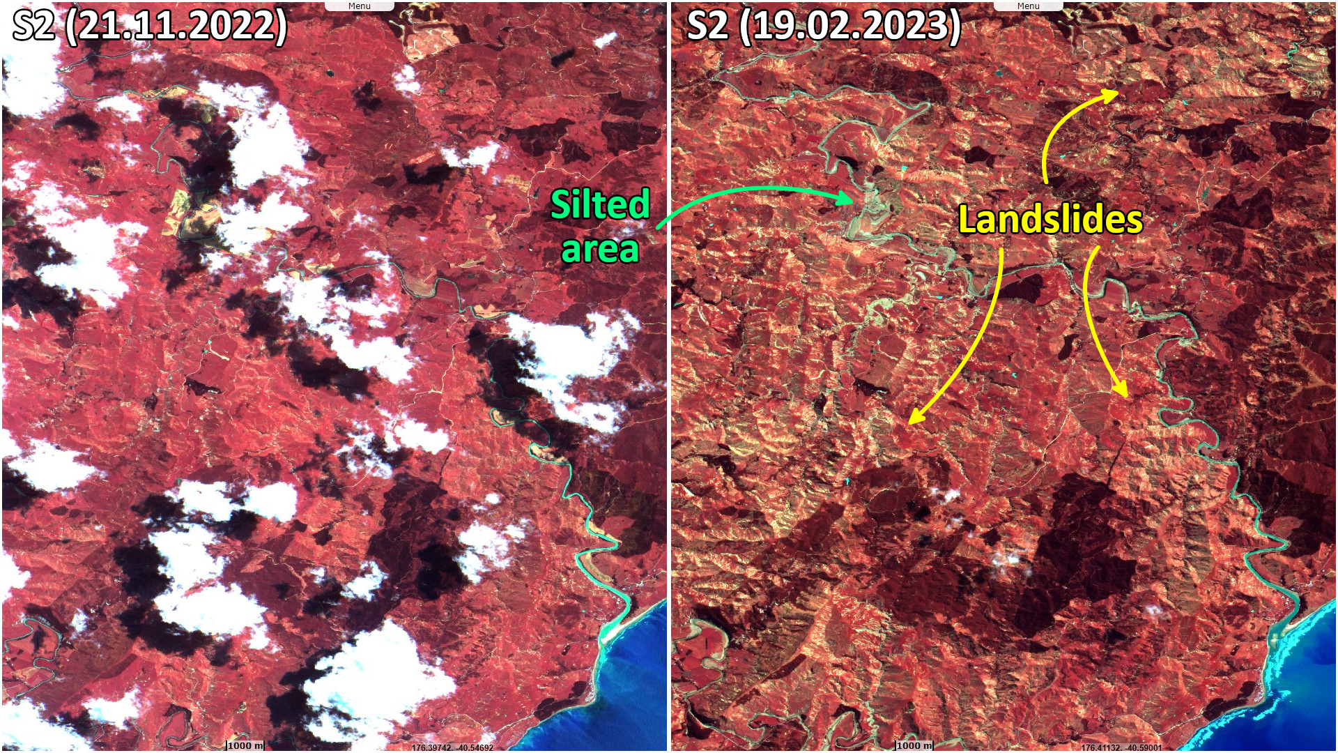
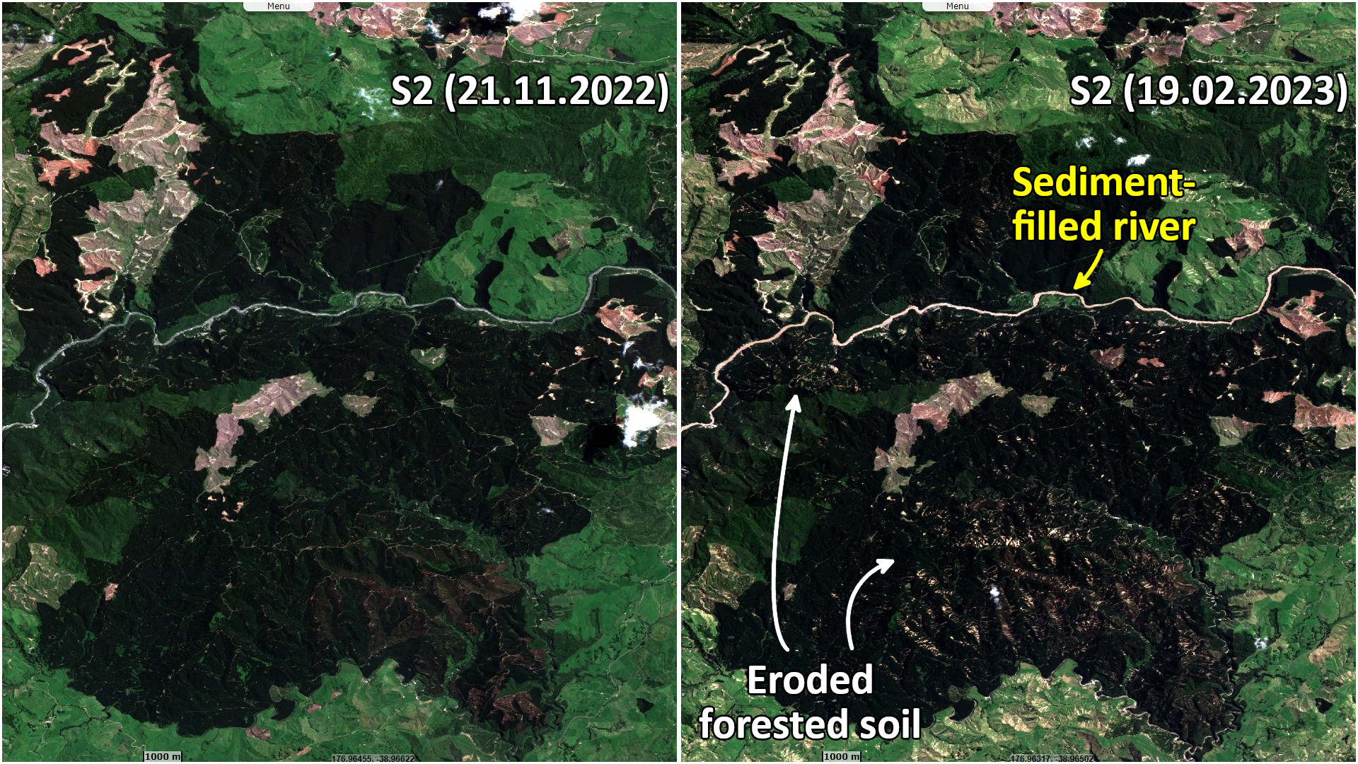
Sentinel-2 MSI acquired on 21 November 2022 at 22:16:01 UTC
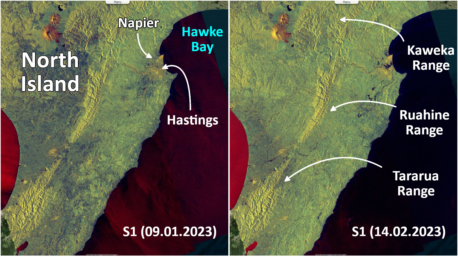
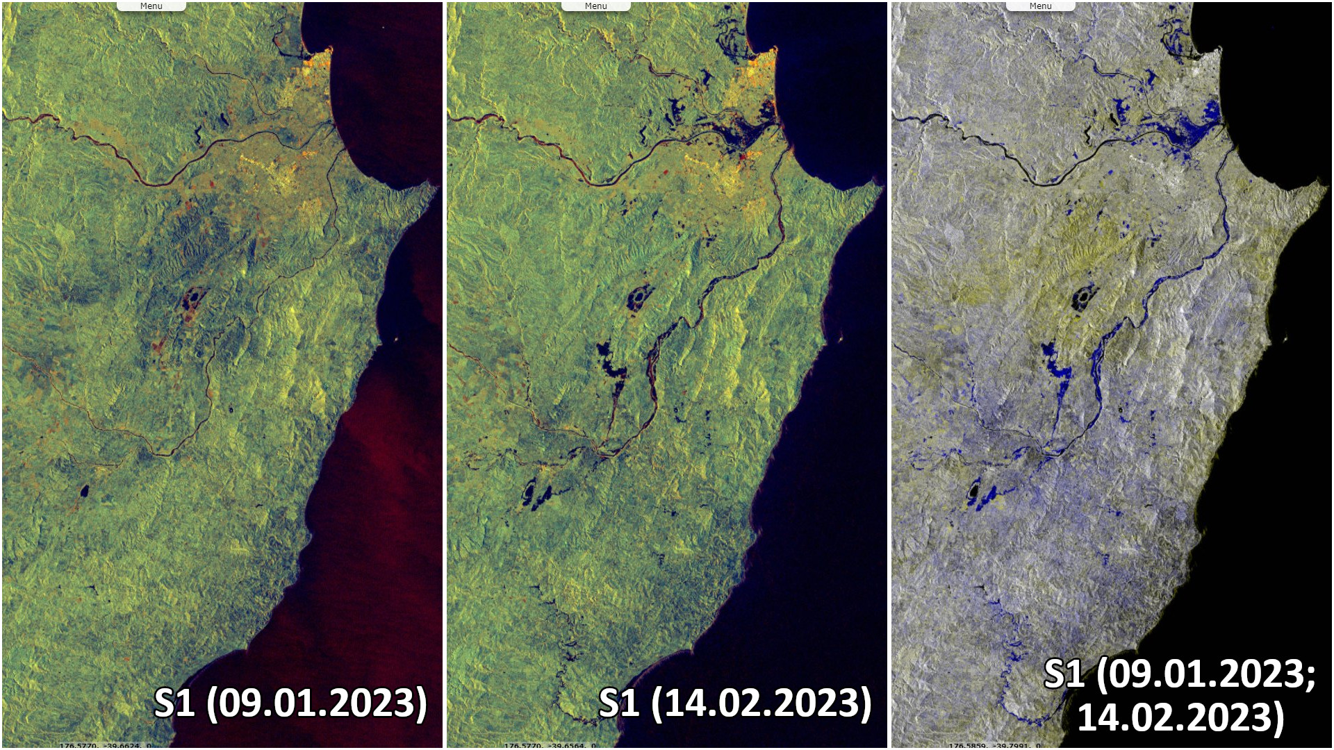
Sentinel-1 CSAR IW acquired on 09 January 2023 from 07:07:08 to 07:07:37 UTC
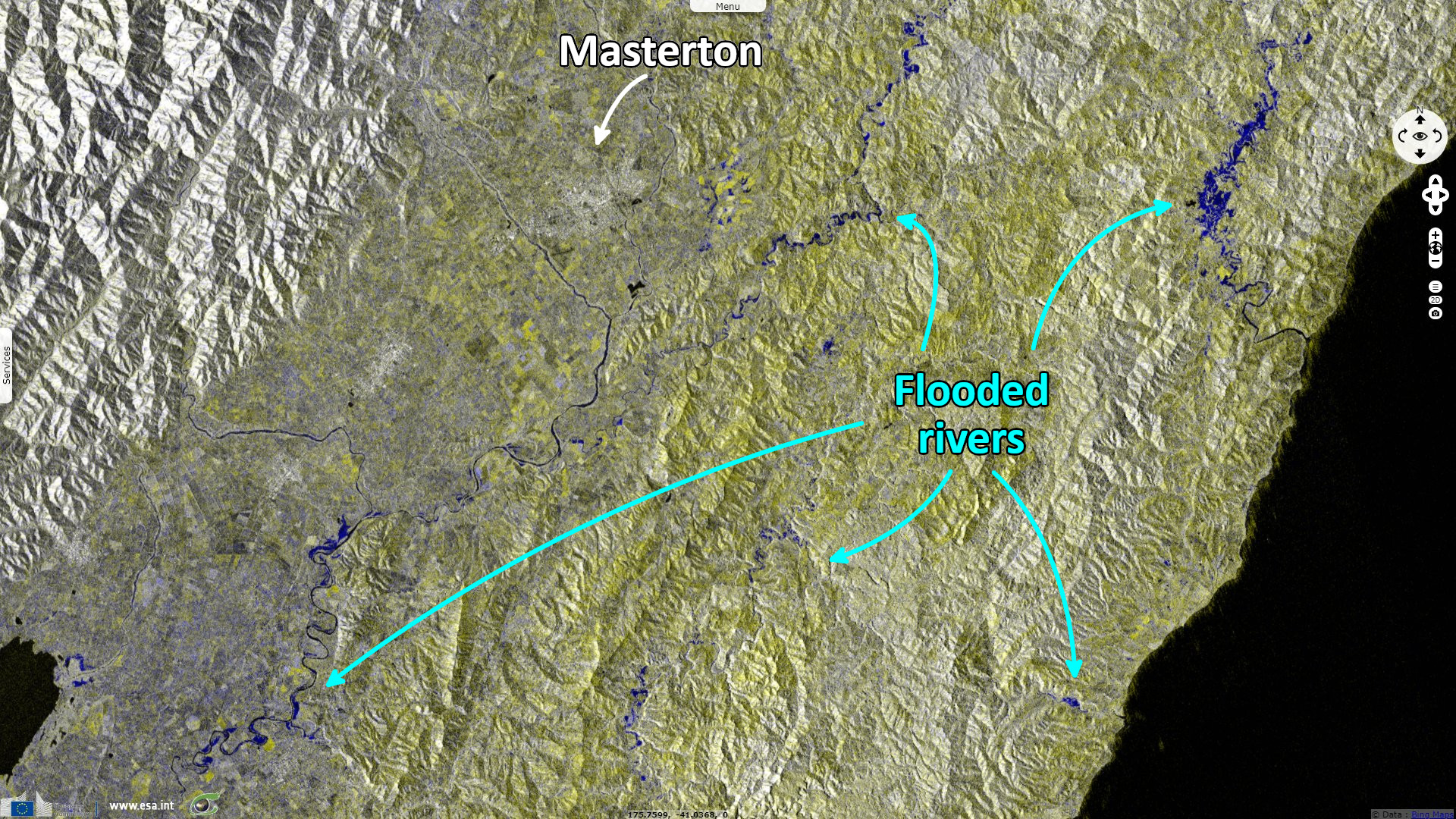
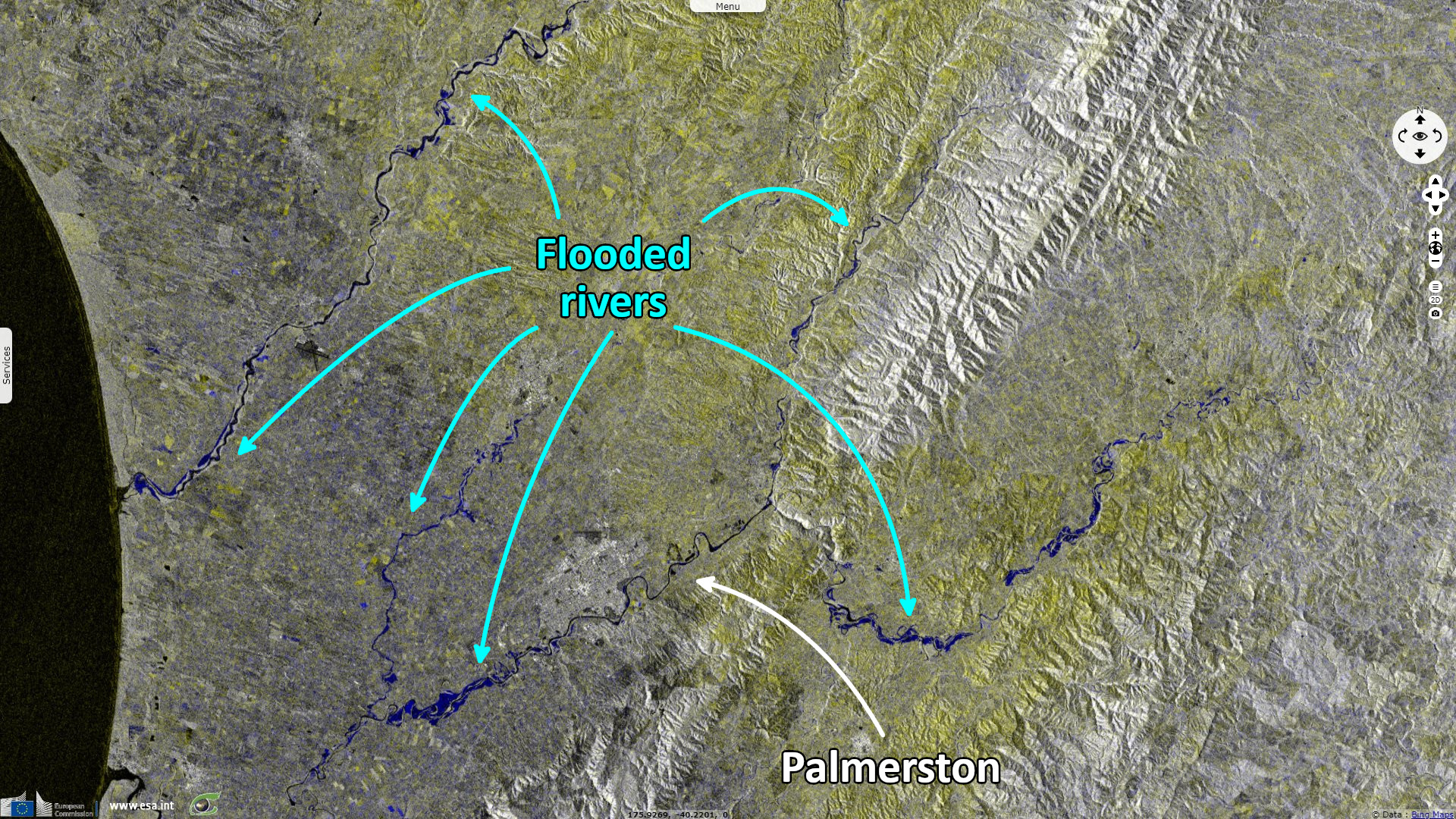
Sentinel-1 CSAR IW acquired on 14 February 2023 from 07:07:07 to 07:07:36 UTC
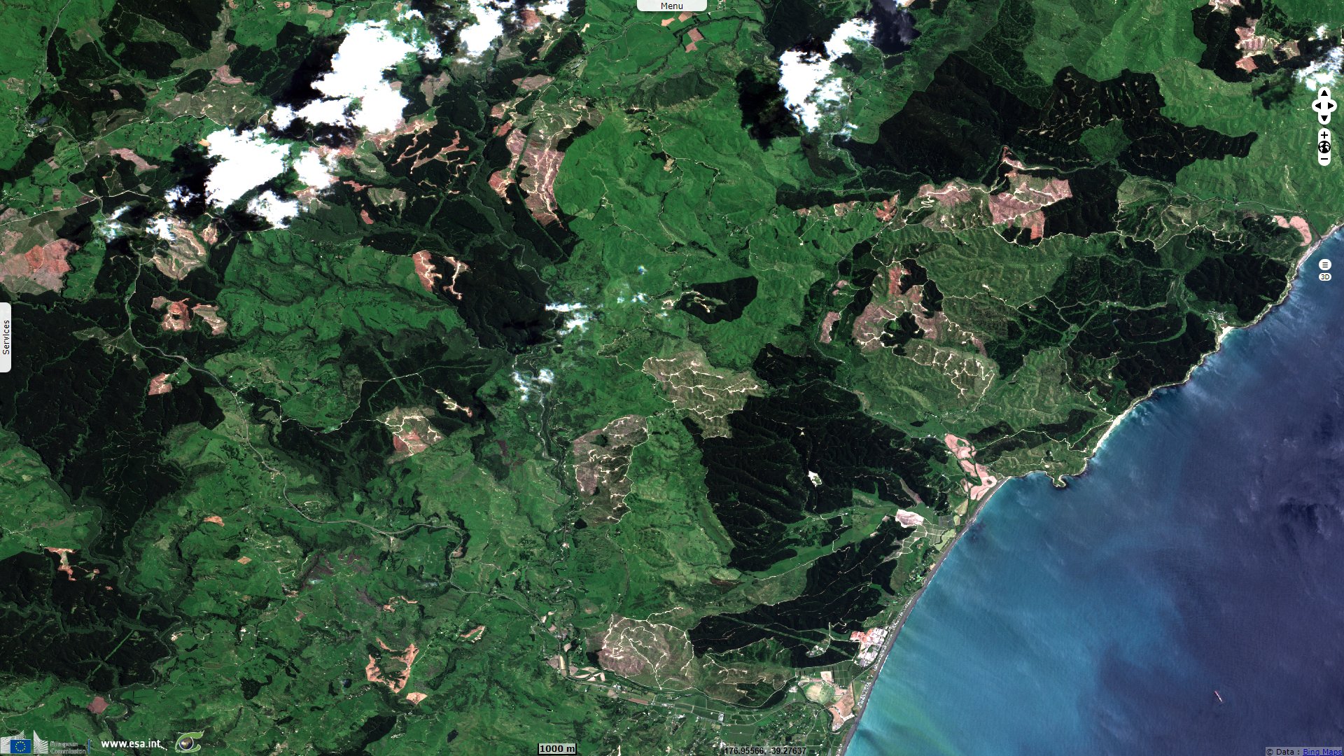
Sentinel-2 MSI acquired on 19 February 2023 at 22:16:01 UTC
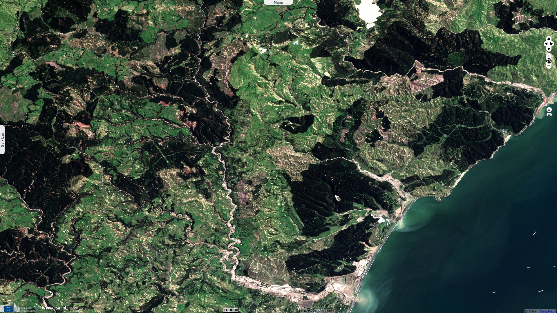
Sentinel-2 MSI acquired on 01 March 2023 at 22:16:01 UTC
Sentinel-1 CSAR IW acquired on 09 January 2023 from 07:07:08 to 07:07:37 UTC
Sentinel-1 CSAR IW acquired on 14 February 2023 from 07:07:07 to 07:07:36 UTC
Sentinel-2 MSI acquired on 19 February 2023 at 22:16:01 UTC
Sentinel-2 MSI acquired on 01 March 2023 at 22:16:01 UTC
Keyword(s): Natural disaster, emergency, hydrology, water colour, sediments, alluvium, erosion, precipitation, New Zealand
Cyclone Gabrielle has hit the New Zealand's North Island, causing a large array of destructive phenomenons. Dave Petley, Vice-Chancellor of the University of Hull in the United Kingdom, wrote in the Landslide blog: "As forecast, Cyclone Gabrielle has struck New Zealand, bringing very high rainfall totals to North Island. This comes on top of the recent heavy rainfall events in the area, which have already triggered many landslides. The Prime Minister has declared a National State of Emergency for only the third time."
Floodlist added: "Between 12 and 14 February, parts of New Zealand recorded rainfall amounts of 300-400 mm, wind gusts of 130-140km/h and waves as high as 11 metres along some coasts."
Head of MetService New Zealand Weather Communications explained: 'Gabrielle is one of the worst storms to hit Aotearoa New Zealand in living history. Like Cyclone Bola in 1988, Giselle that caused the Wahine disaster in 1968 and the unnamed cyclone of 1936, Gabrielle caused shocking impacts to the North Island. The difference between this cyclone and others is the track Gabrielle took, along with warmer sea surface temperatures and an atmospheric environment that encouraged tropical cyclone growth,' Lisa Murray said."
The Insurance Council of New Zealand (ICNZ) is expecting claims for damages caused by severe flooding and landslides that struck Auckland in late January 2023 to exceed $1 Billion NZD ($620 million USD). The total includes over 36 000 home and contents claims valued at around $565 million, 3800 commercial claims valued at around $320 million and 7500 motor claims worth $109 million.
One of their experts commented the perspectives: 'As insurers work with their customers to get on with the recovery process, it is clear that massive investment is required to reduce the risks people face. This is about keeping people and communities safe. Insurers are playing their part in the many ongoing discussions and work programmes to promote that'.
Another Floodlist article focuses on the impact on infrastructures: "Ulrich Speidel, Senior Lecturer in Computer Science at the University of Auckland. Modern communication systems need two main things: power, and what engineers call 'backhaul', the connections that link cell towers and exchanges to the national network. When Cyclone Gabrielle struck, both were badly compromised.
Many sites lost power not long after the mains went down. They were only designed to run on battery for a few hours (or days at most) – enough for routine faults, not for disasters.
Much of the backhaul – usually fibre optic cables running along main roads, often parallel to power lines – was also knocked out by landslips and flooding. Because of this, even where cell sites still had power, they couldn’t connect anyone to anywhere."
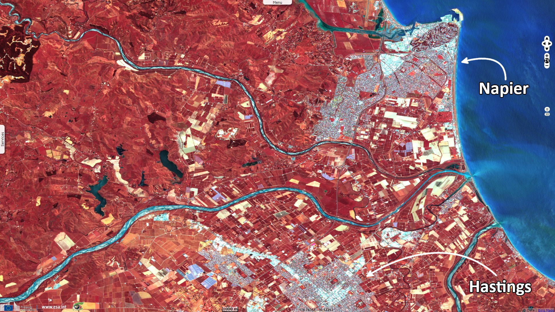
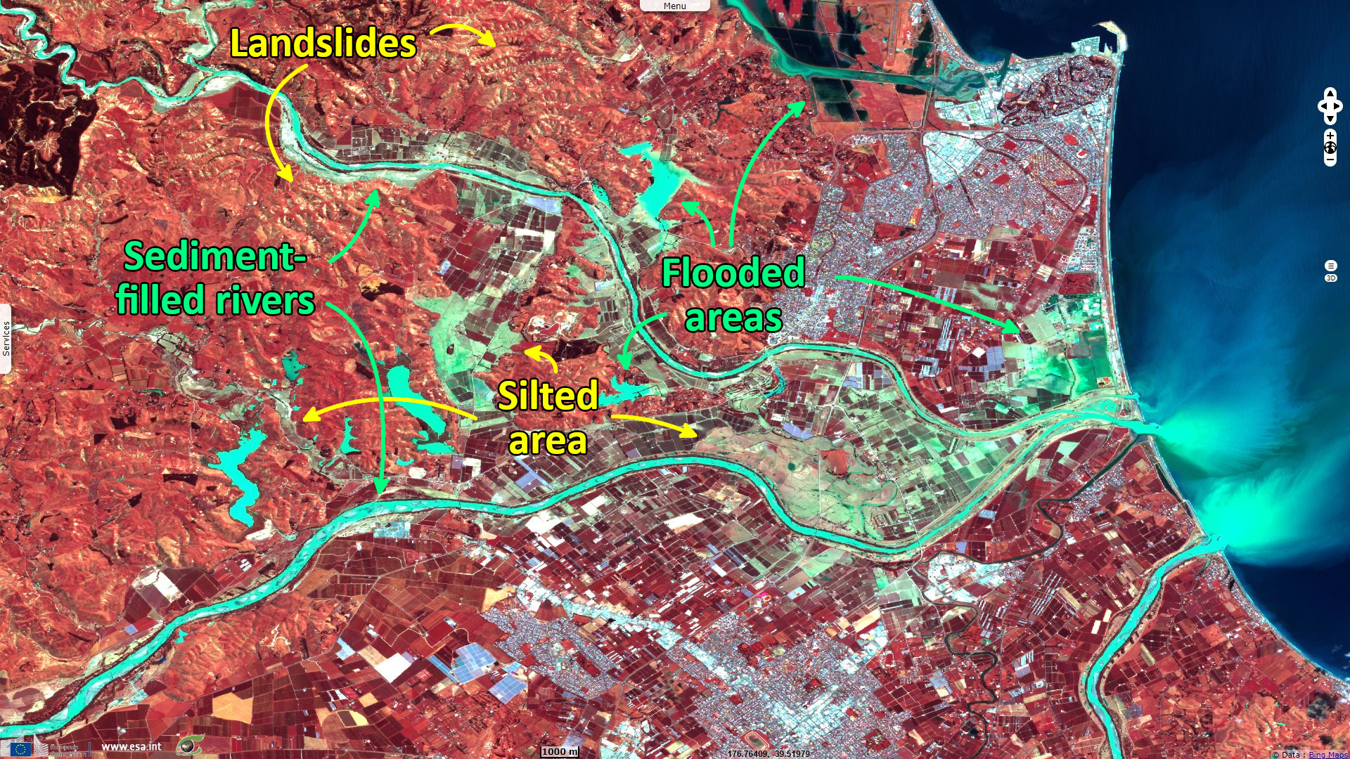
A Defence Force helicopter flew over the destruction in the Esk Valley, showing homes with silt all the way to the roofline, with many properties surrounded by silt and little else.
The views expressed herein can in no way be taken to reflect the official opinion of the European Space Agency or the European Union.
Contains modified Copernicus Sentinel data 2026, processed by VisioTerra.
Contains modified Copernicus Sentinel data 2026, processed by VisioTerra.
| More on European Commission space: |  |
 |
 |
||||
| More on ESA: | |
|
|
S-1 website | S-2 website | S-3 website | |
| More on Copernicus program: | |
|
|
Scihub portal | Cophub portal | Inthub portal | Colhub portal |
| More on VisioTerra: | |
|
|
Sentinel Vision Portal | Envisat+ERS portal | Swarm+GOCE portal | CryoSat portal |