New eruption of Anak Krakatau, Indonesia
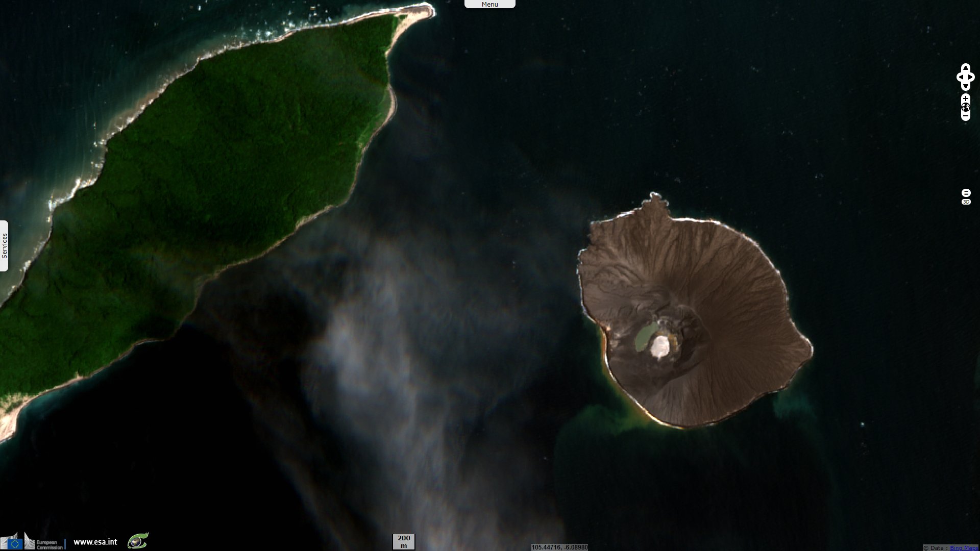
Sentinel-2 MSI acquired on 24 February 2020 at 02:57:19 UTC
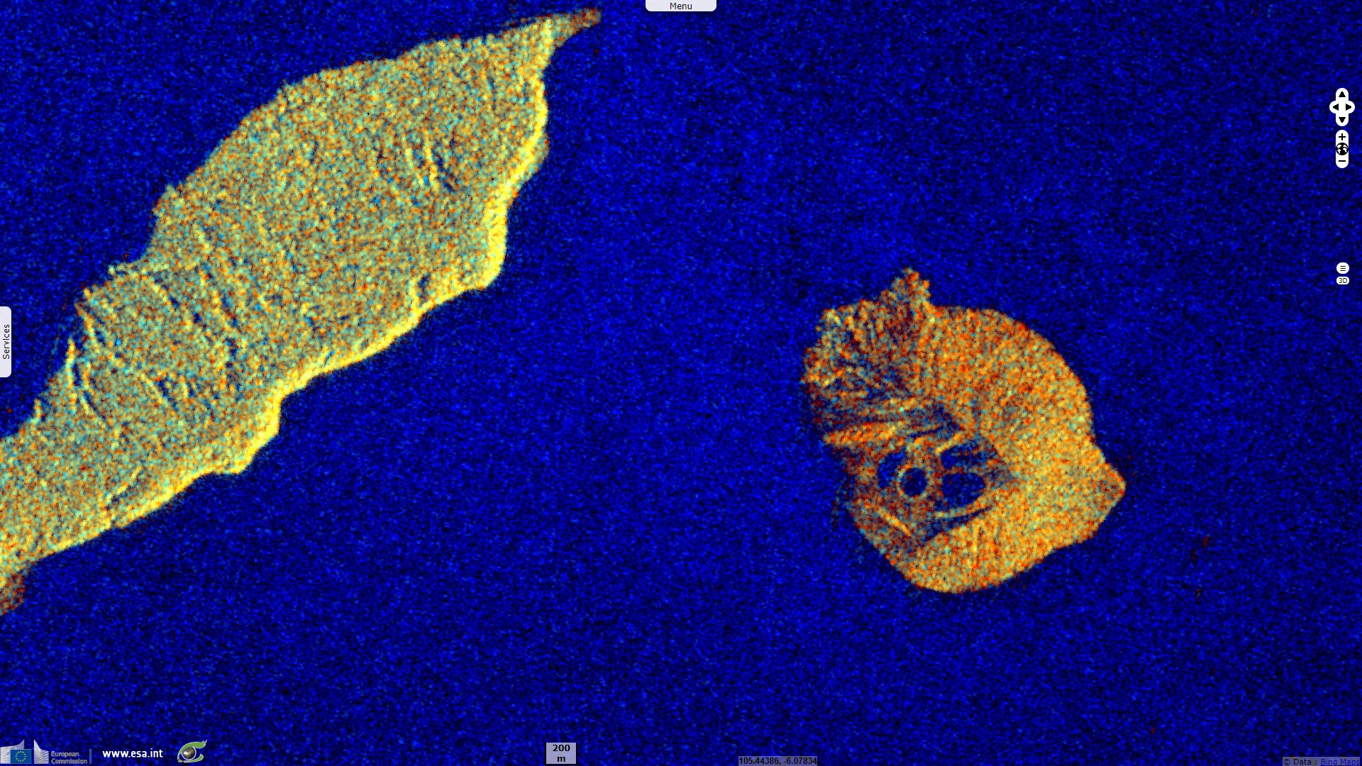
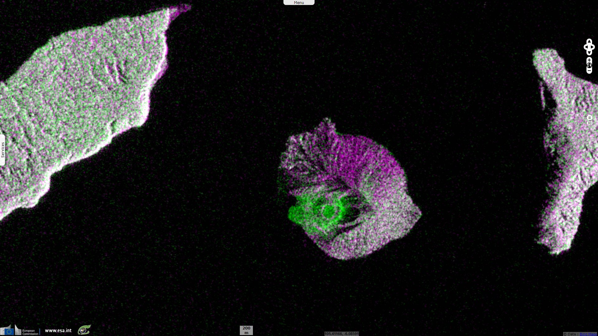
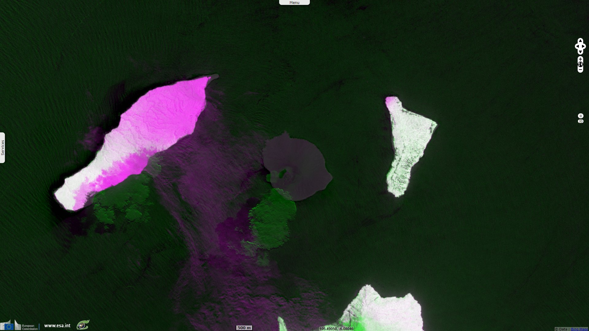
Sentinel-1 CSAR IW acquired on 03 April 2020 at 22:33:50 UTC
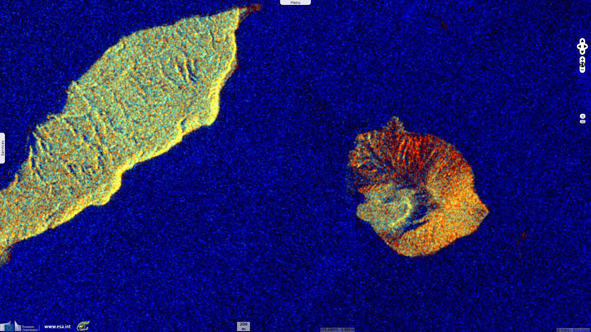
Sentinel-1 CSAR IW acquired on 15 April 2020 at 22:33:50 UTC
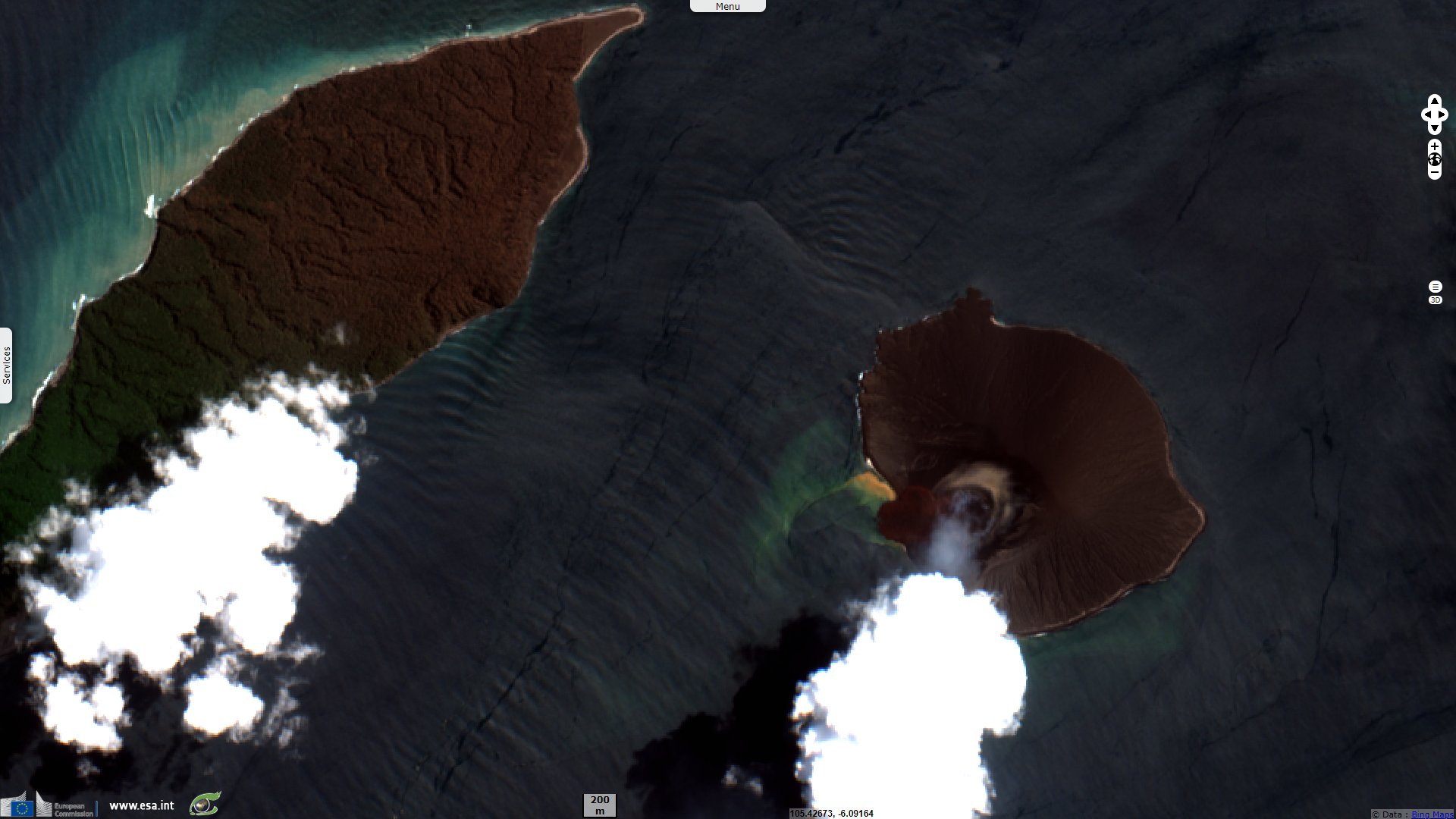
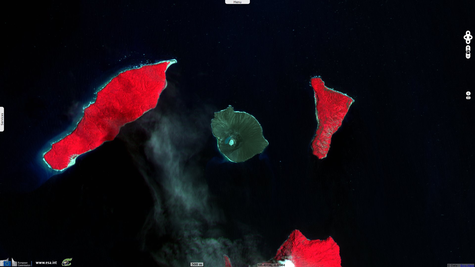
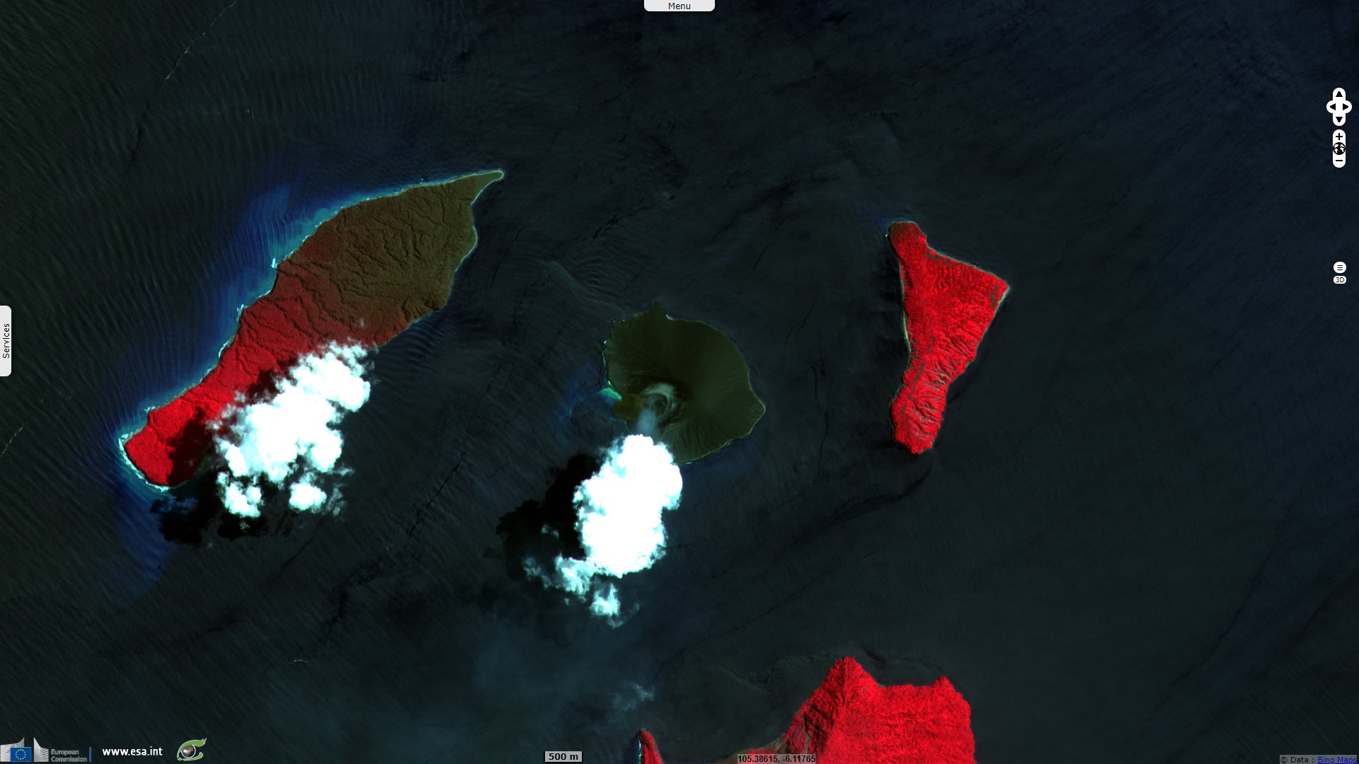
Sentinel-2 MSI acquired on 17 April 2020 at 03:05:39 UTC
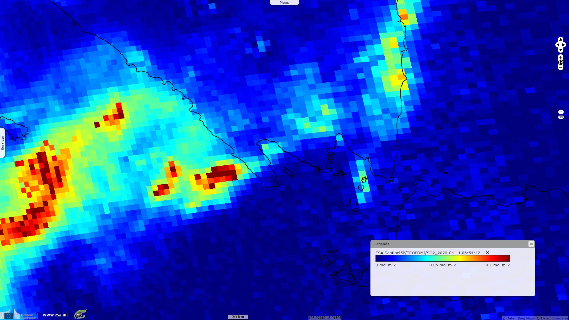
Sentinel-5P TROPOMI acquired on 11 April 2020
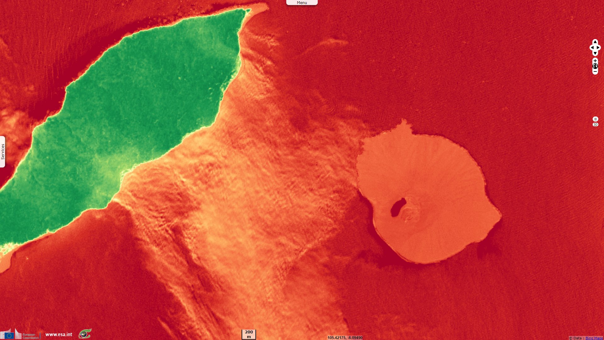
Sentinel-1 CSAR IW acquired on 03 April 2020 at 22:33:50 UTC
Sentinel-1 CSAR IW acquired on 15 April 2020 at 22:33:50 UTC
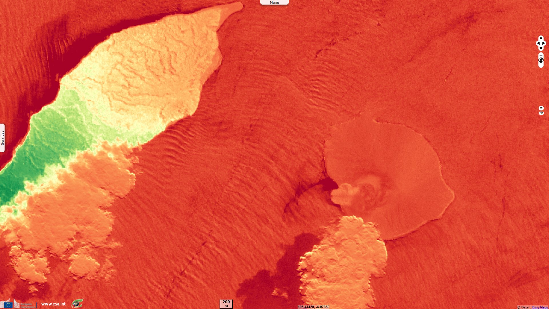
Sentinel-2 MSI acquired on 17 April 2020 at 03:05:39 UTC
Sentinel-5P TROPOMI acquired on 11 April 2020
Keyword(s): Geohazard, island, archipelago, coastal, natural disaster, volcano, Indonesia, Pacific Ring of Fire
After a major eruption on December 2018, Anak Krakatau awoke again. VolcanoDiscovery explains the event: "After dark, at around 20:00 local time, increasingly larger plumes can be seen rising from the new crater of Anak Krakatau, probably emissions of steam and ash generated by the first explosions, likely phreatomagmatic in nature when rising magma pushed its way up to the still partially lake filled crater and leading to explosive interaction between magma and water (phreatomagmatic activity). Around 22:20, strombolian explosions start, which quickly become stronger and near-continuous."
"At around 23:00, the activity dramatically increases: lava bombs are seen landing all over in the vicinity of the webcam (bright traces), but the camera survives... this is the moment probably, the lava fountaining phase started, which also generated a ash/steam plume rising up to 15 km altitude."
"The eruption could be a resumption of the pattern of activity during 2018, when the volcano produced violent paroxysms with lava fountains and lava flows at intervals of few weeks. It will be interesting to monitor whether this is the case and how activity will evolve in the coming weeks and months."
Regarding the plume, the Smithsonian Institution complements: "PVMBG [Pusat Vulkanologi dan Mitigasi Bencana Geolog or Center for Volcanology and Geological Hazard Mitigation] reported that at 21:58 and 22:35 on 10 April an eruptive event at Anak Krakatau generated dense white, gray, and black ash plumes that rose as high as 2 km above the summit and drifted S and E. The events were followed by Strombolian activity that ejected incandescent material onto the crater floor and summit areas; video revealed lightning visible in the ash cloud."
"The Darwin VAAC [Volcanic Ash Advisory Centers] issued a notice at 01:45 on 11 April stating that an eruption plume had risen to 14.3 km a.s.l. [above sea level], but noted low confidence in the altitude due to the possible mixing of the eruption plume with meteorological storm clouds. An intense thermal anomaly was visible. An hour later the VAAC reported an on-going sulfur-rich plume rising to 11.3 km a.s.l. and drifting W; the previous plume remained visible and continued to drift NW. Later that day ash plumes rose to 3 km a.s.l. and drifted N."
"During 12-13 April plumes comprised mostly of sulfur dioxide and steam rose to 3 km a.s.l.; the plumes did not have a strong ash signal. The Alert Level remained at 2 (on a scale of 1-4), and the public was warned to remain outside of the 2-km-radius hazard zone from the crater."
The views expressed herein can in no way be taken to reflect the official opinion of the European Space Agency or the European Union.
Contains modified Copernicus Sentinel data 2026, processed by VisioTerra.
Contains modified Copernicus Sentinel data 2026, processed by VisioTerra.
| More on European Commission space: |  |
 |
 |
||||
| More on ESA: | |
|
|
S-1 website | S-2 website | S-3 website | |
| More on Copernicus program: | |
|
|
Scihub portal | Cophub portal | Inthub portal | Colhub portal |
| More on VisioTerra: | |
|
|
Sentinel Vision Portal | Envisat+ERS portal | Swarm+GOCE portal | CryoSat portal |