Zoom on a selection of Iranian wetlands
Sentinel-2 MSI acquired on 14 March 2017 at 07:16:41 UTC
Sentinel-1 CSAR IW acquired on 16 April 2017 at 02:14:46 UTC
...
Sentinel-3 OLCI FR & SLSTR RBT acquired on 25 May 2017 from 06:05:16 to 06:08:16 UTC
Sentinel-1 CSAR IW acquired on 16 April 2017 at 02:14:46 UTC
...
Sentinel-3 OLCI FR & SLSTR RBT acquired on 25 May 2017 from 06:05:16 to 06:08:16 UTC
Keyword(s): Land, coastal, water colour, river, ramsar wetland, vegetation, agriculture, irrigation, mangrove, saline lake, endorheic basin, desert
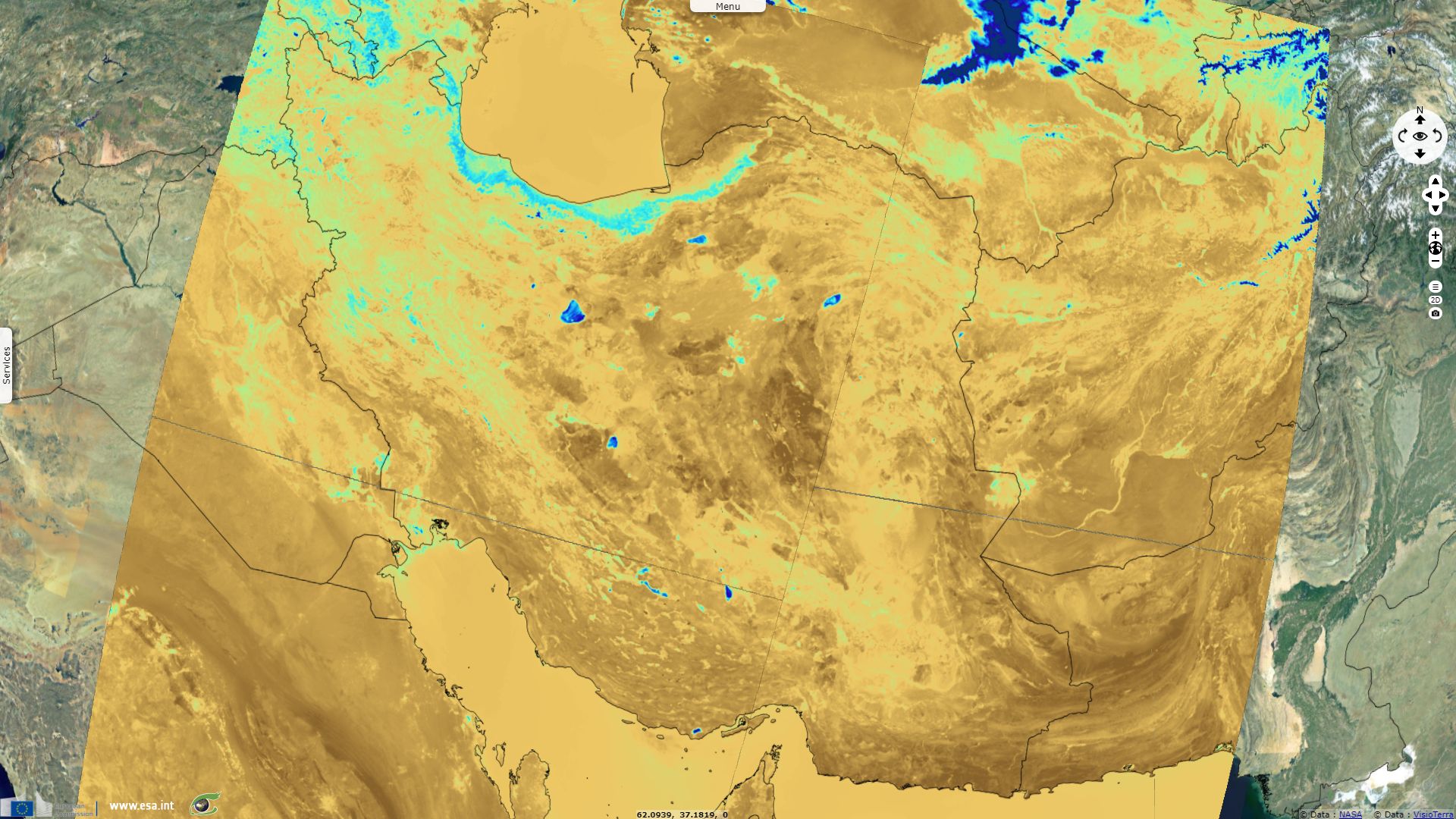
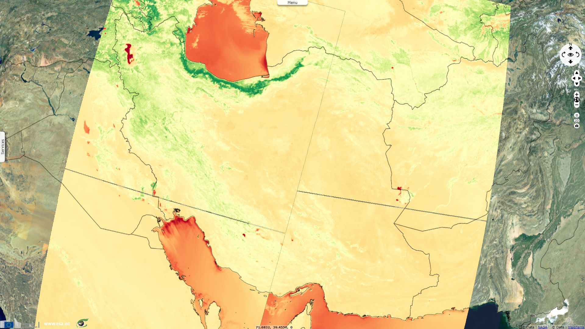
NDVI indicates areas with the most luxuriant vegetation. Comparing of fig.1 and fig.2, one can see how most endorheic lakes evidenced by the NDWI do not correlate with vegetation which can be explained by their mineral concentration detrimental to vegetation.
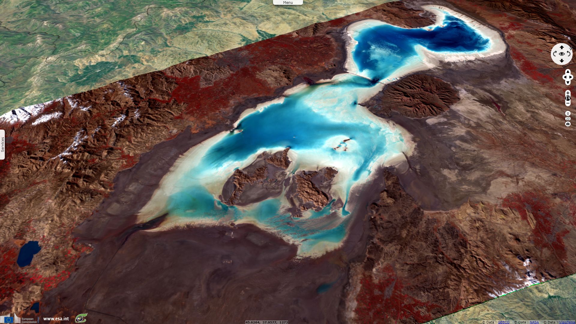
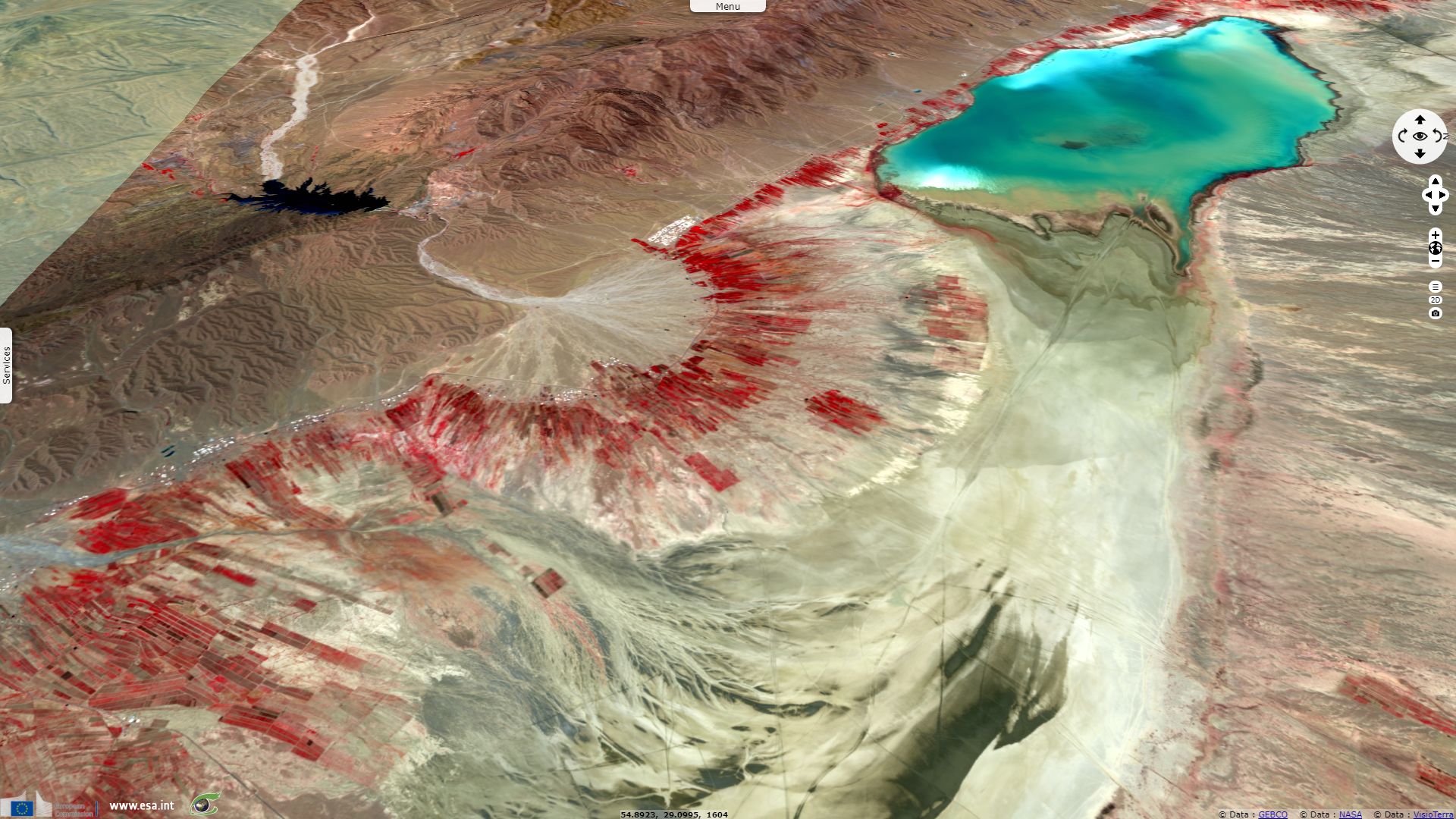
This endorheic lake is surrounded by several mountains high enough to provide snow melt water in addition to runoff water and precipitations. It is described by Ramsar as: "A vast hypersaline lake with many islands, surrounded by extensive brackish marshes. The lake is fed by rainfall, springs and streams and subject to seasonal variation in level and salinity. The brackish marshes support reeds and large breeding colonies of various waterbirds with large numbers of flamingos (40,000-80,000 pairs), and are an important staging area for migratory waterbirds."
Since vegetation usually protects the soil, limiting erosion, bare ground is more likely to be subject to erosion and develop eroded patterns as one can see on fig.4. In such endorheic basins, eroded material and minerals usually concentrates in depressions, forming salt lakes that cannot support vegetation either. Depending on precipitations, mineral concentration can decrease or at the opposite reach saturation point, creating deposits, up to the point the lakes entirely dries up.
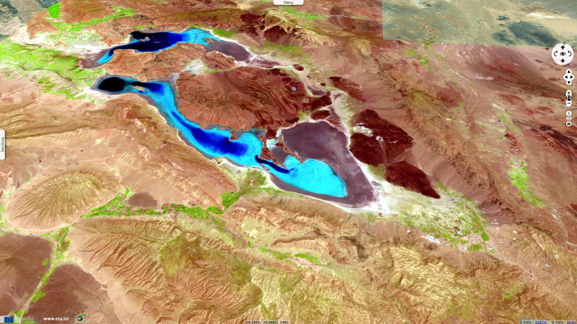
Neiriz Lake is a Ramsar site, characterized as follows: "Two very large saline lakes in a closed, high altitude drainage basin; contiguous during very wet winters but may become completely dry in exceptionally dry years. The site embraces the extensive, permanent freshwater Kamjan marshes and supports a wide variety of breeding, staging and wintering waterbirds. Up to 50,000 flamingos may occur in winter, whilst other species include Anatidae (ducks, geese, swans, etc.) and cranes. The surrounding areas are arid steppe hills and plains, with some cultivated land in the valley. "
The water of brackish lake visible on fig.5 cannot by used for irrigation. Crops are grown in alluvial fans using runoff water naturally flowing from upstream. A small reservoir is used to irrigate crops located in the biggest alluvial fan.
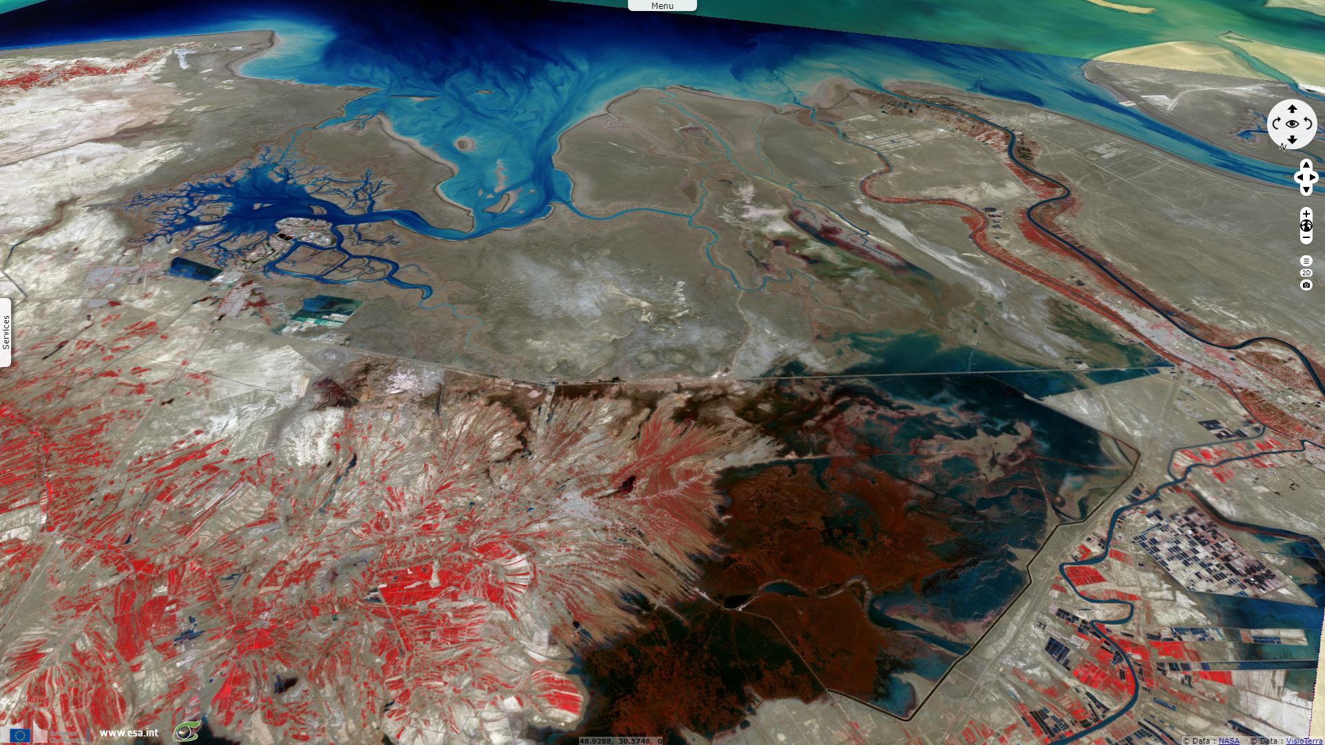
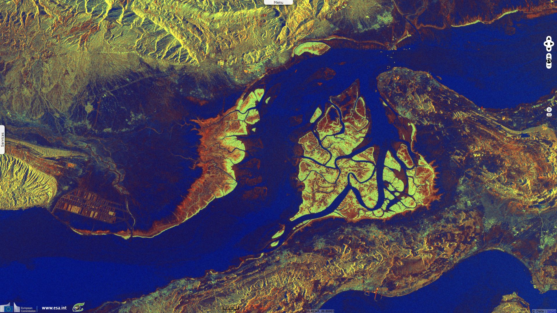
Fig.6 shows a coastal wetland fed by river Shatt el-Arab. According to the Ramsar Sites Information, Shadegan Marshes & mudflats of Khor-al Amaya & Khor Musa are: "An extensive delta on the border with Iraq, forming part of the largest lowland in Iran, and composed of the floodplains of major rivers draining 11.5 million hectares. The site includes fresh and brackish sedge marshes, tidal flats, creeks, sandbanks and a low island. The delta is fed by overflow channels of the Karun river, irrigation canals and local rainfall. The area is important for breeding and wintering waterbirds and is possibly the most important wintering site in the world for Marbled Teal. The wetland is bordered by saltflats, rice fields, date palms and human settlements."
The Strait of Hormuz separates the Persian Gulf and the Gulf of Oman. Nearby lies Qeshm island, along the Iranian coast, its hosts the Khuran Straits wetland, depicted by Ramsar as follows: "Located in the lower Mehrãn River delta, with extensive intertidal silt flats, saltmarshes, mangrove forests, and numerous estuarine creeks and islands. Shallow saline waters support growths of red and brown algae, while the intertidal mangroves provide habitat for crustaceans - an important food source for waterbirds. Particularly valuable for large nesting colonies of Ardeidae (herons, bitterns, etc.) as well as passage and wintering waterbirds, including the endangered Dalmatian Pelican."
The views expressed herein can in no way be taken to reflect the official opinion of the European Space Agency or the European Union.
Contains modified Copernicus Sentinel data 2026, processed by VisioTerra.
Contains modified Copernicus Sentinel data 2026, processed by VisioTerra.
| More on European Commission space: |  |
 |
 |
||||
| More on ESA: | |
|
|
S-1 website | S-2 website | S-3 website | |
| More on Copernicus program: | |
|
|
Scihub portal | Cophub portal | Inthub portal | Colhub portal |
| More on VisioTerra: | |
|
|
Sentinel Vision Portal | Envisat+ERS portal | Swarm+GOCE portal | CryoSat portal |