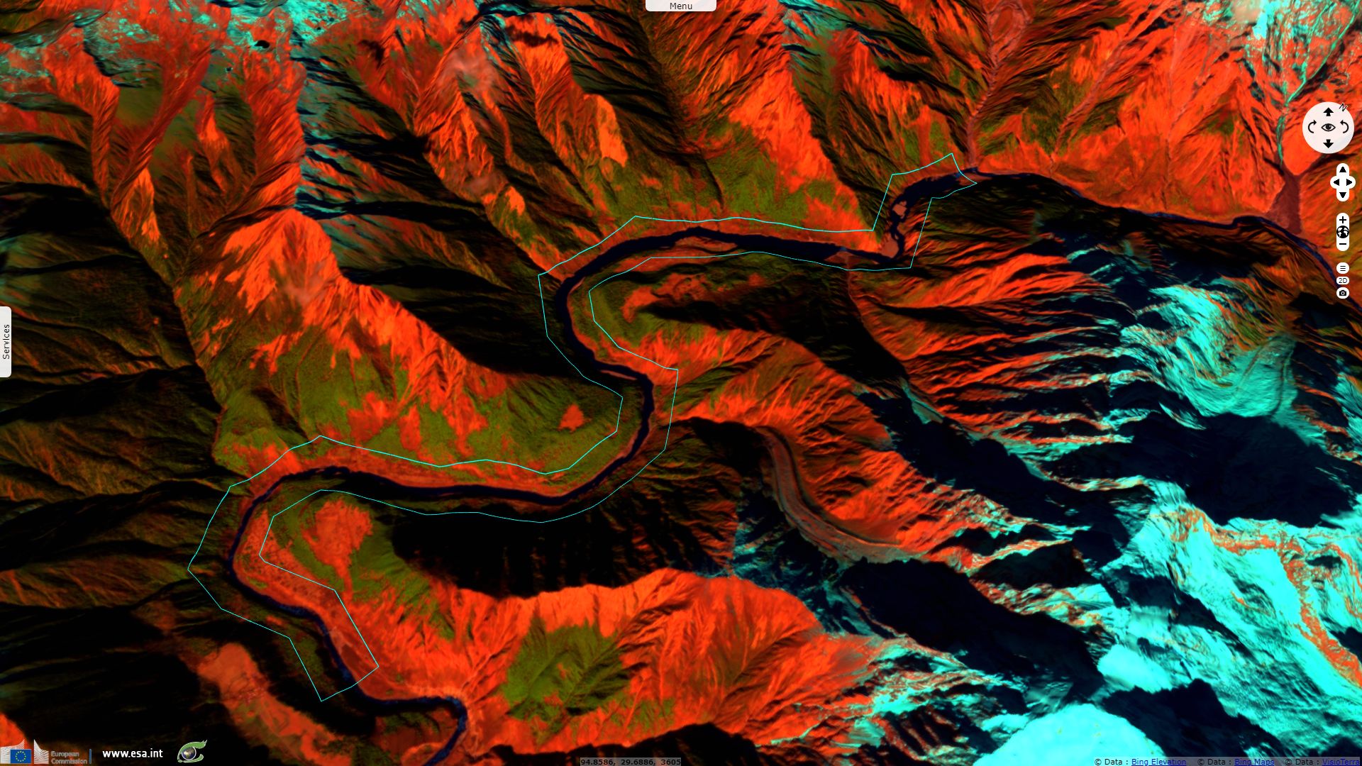
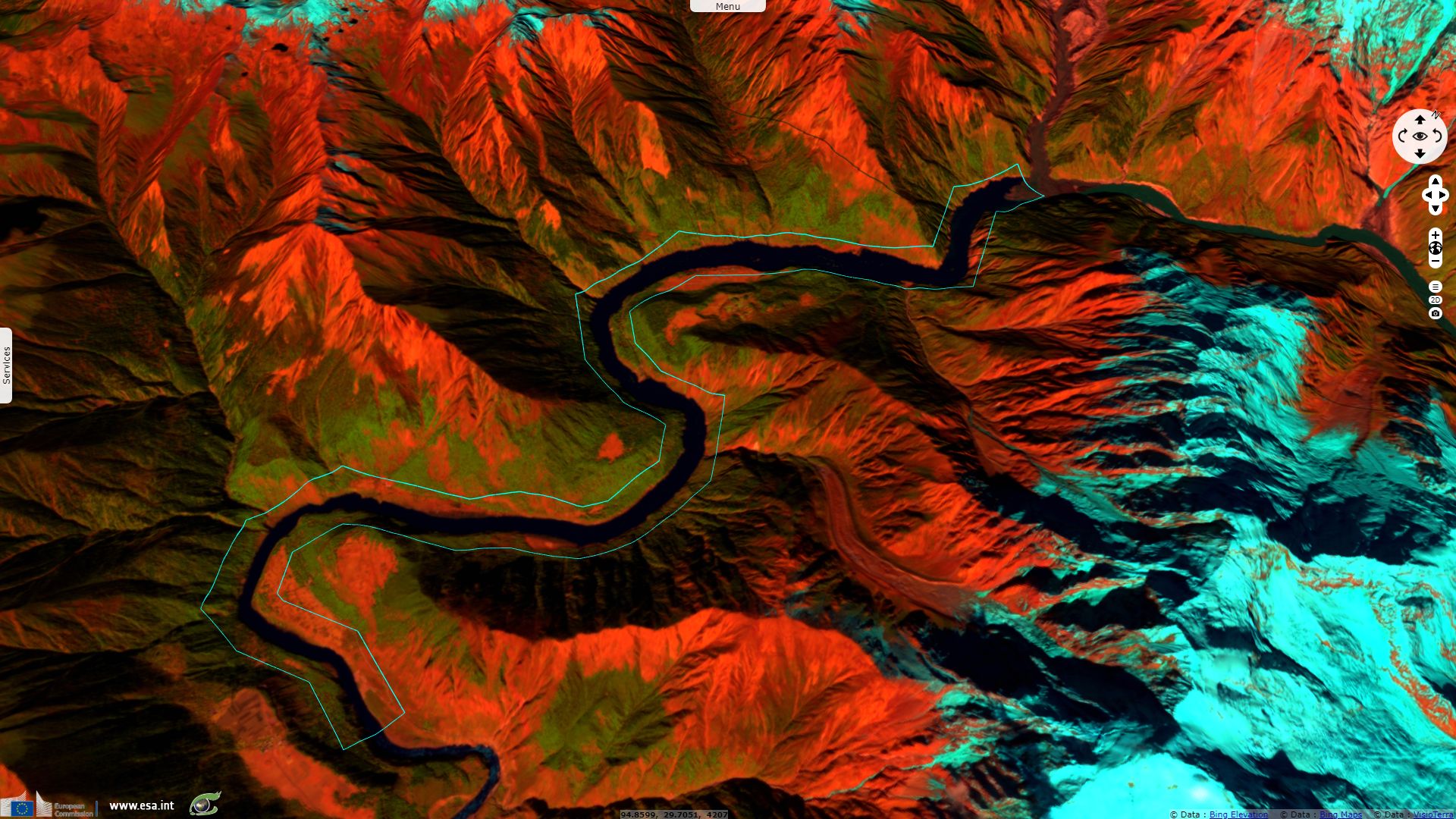
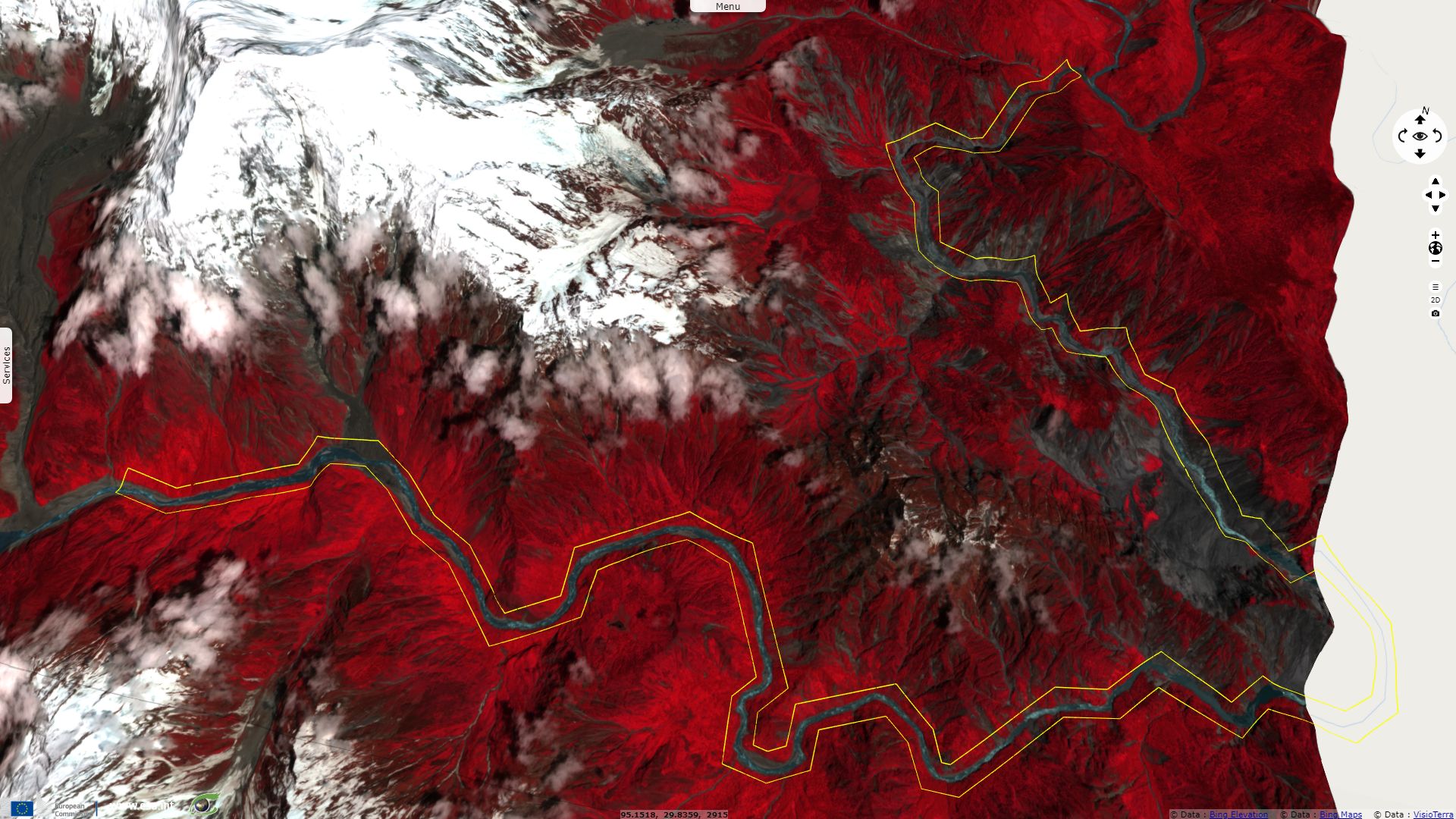
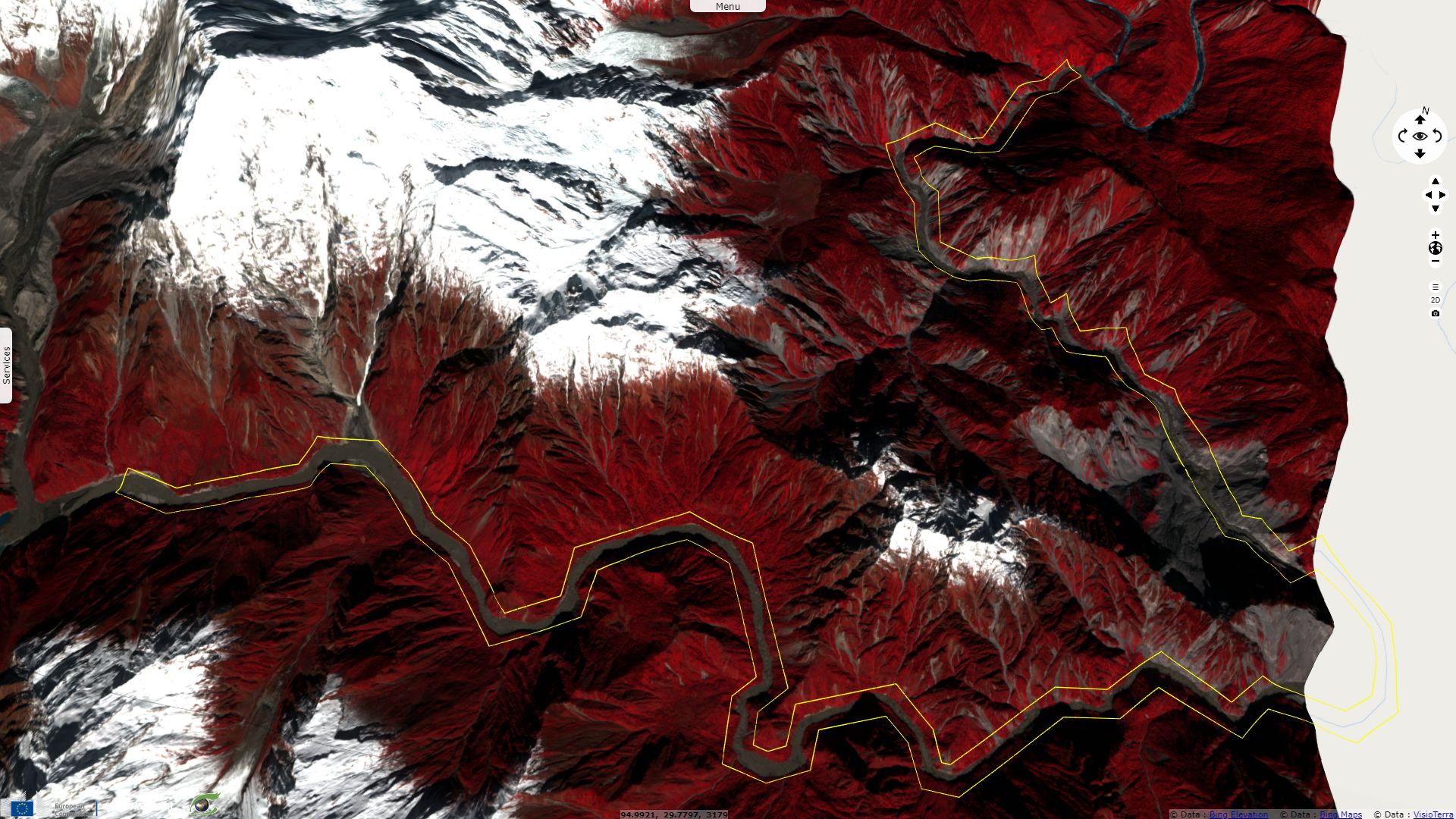
Landslide causes temporary dam in Himalaya
Sentinel-2 MSI acquired on 08 June 2018 at 04:16:59 UTC
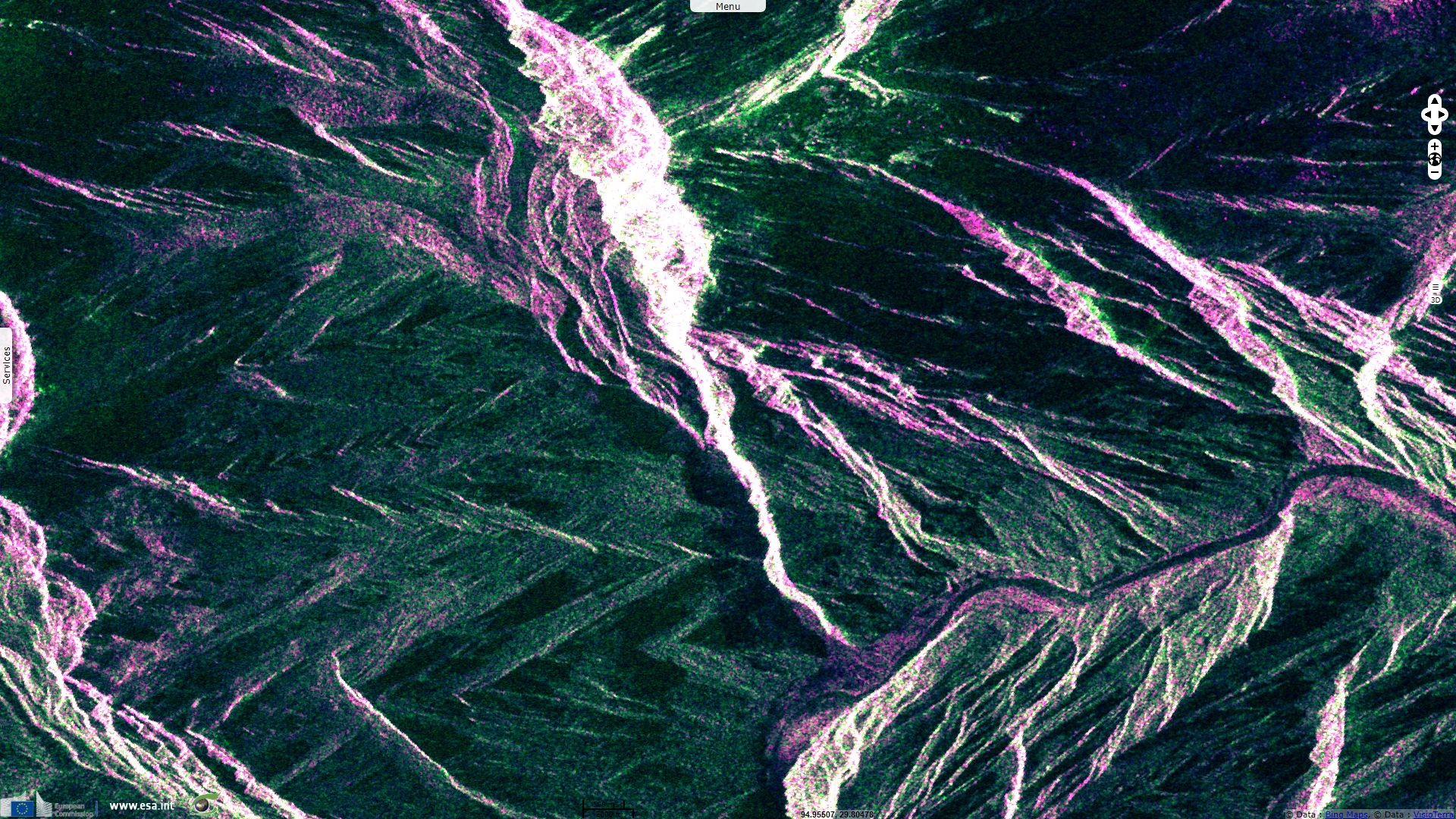
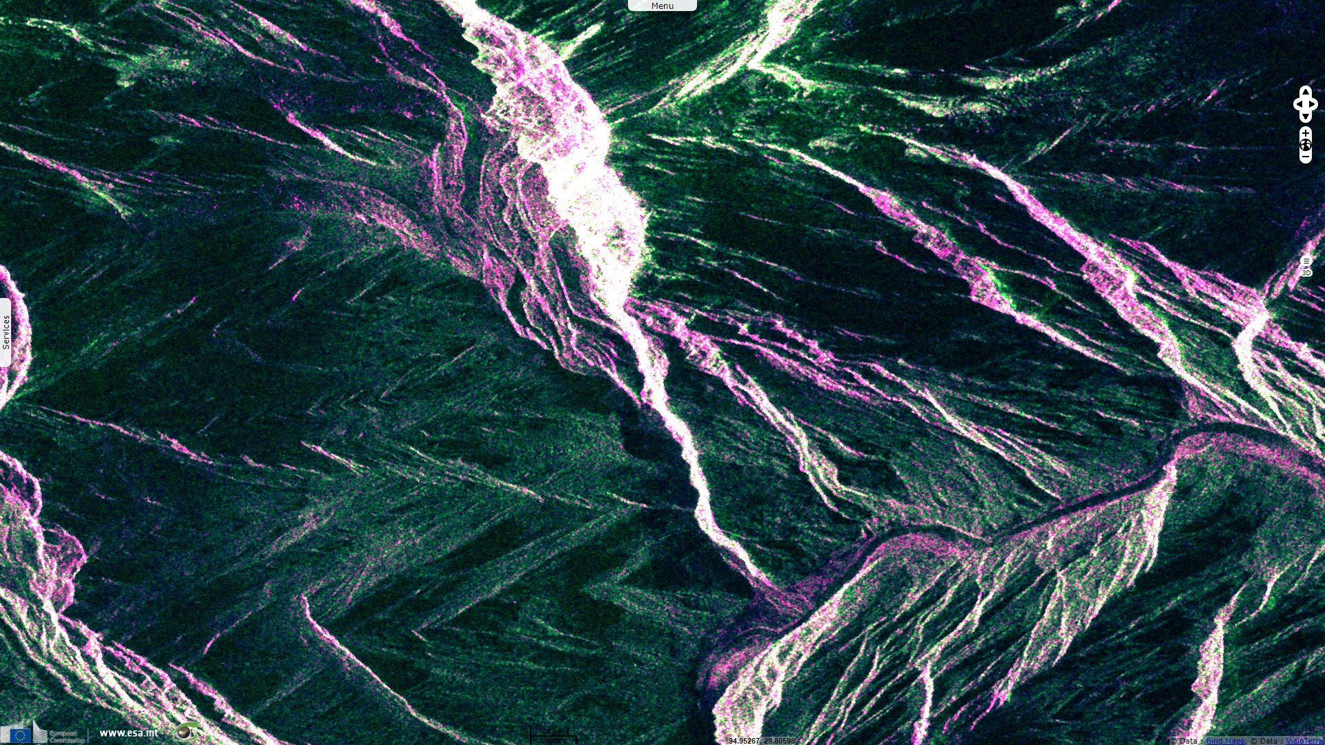
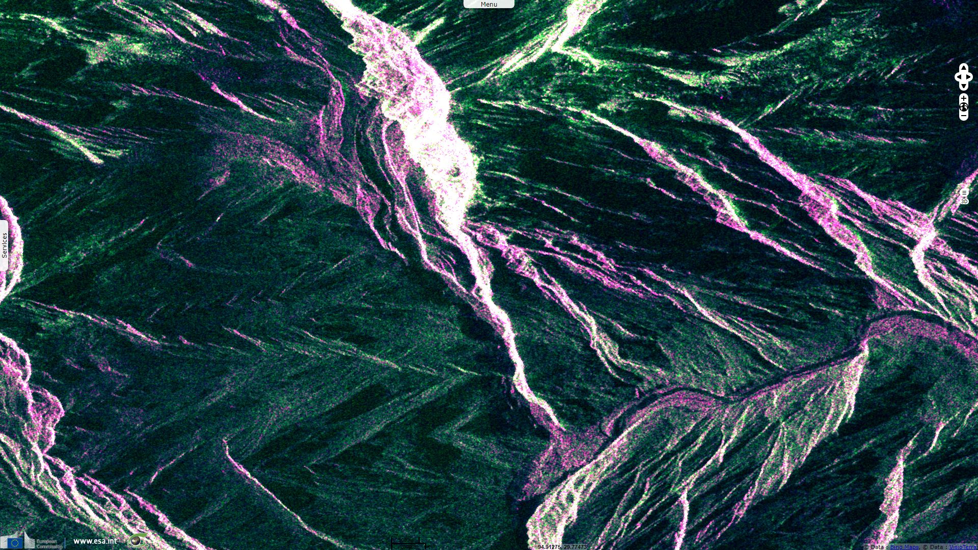
Sentinel-1 CSAR IW acquired on 01 October 2018 at 11:41:21 UTC
Sentinel-1 CSAR IW acquired on 13 October 2018 at 11:41:22 UTC
Sentinel-1 CSAR IW acquired on 25 October 2018 at 11:41:21 UTC
Sentinel-2 MSI acquired on 31 October 2018 at 04:19:11 UTC
Sentinel-1 CSAR IW acquired on 01 October 2018 at 11:41:21 UTC
Sentinel-1 CSAR IW acquired on 13 October 2018 at 11:41:22 UTC
Sentinel-1 CSAR IW acquired on 25 October 2018 at 11:41:21 UTC
Sentinel-2 MSI acquired on 31 October 2018 at 04:19:11 UTC
Keyword(s): Landslide, river, dam, flooding, mountain range, Himalaya, China
A landslide in Sedong Ri glacier cause a dam on the Yarlung Tsangpo river. It temporarily caused a lack of water downstream, a flood upstream but also menaced to cause a catastrophic flood downstream if a bigger lake had formed in the canyon and the dam had breached too late.
The phenomenon is explained by retired Colonel Vinayak Bhat who wrote on The Print: "The longest and deepest canyon in the world is Brahmaputra Canyon between Mt Namcha Barwa and Mt Gyala Peri. Gyala Peri, along with Sedong Ri and Tiba Kangri, form a gorge southwards. The gorge has four glaciers, forming a funnel before their waters join the Brahmaputra."
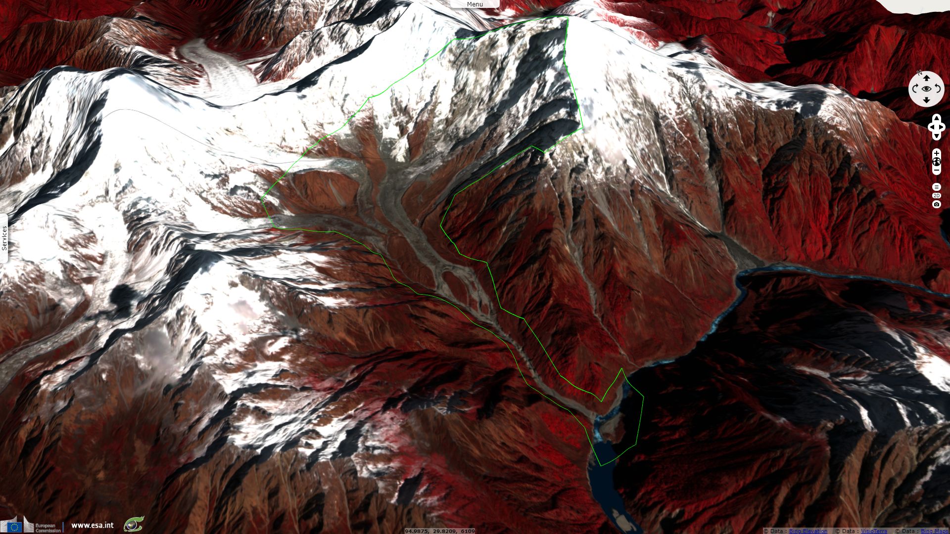
"The mountains in this Himalayan region — being very brittle and seismically active — have faced many landslides, avalanches and combinations of both. As a result, the width of the Sedong Ri glacier was halved and its length shortened by almost a kilometre and a half."
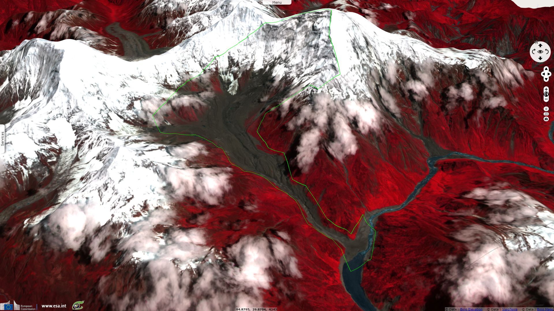
Dave Petley, Pro-Vice-Chancellor (Research and Innovation) at the University of Sheffield in the United Kingdom later published the following analysis the American Geophysical Union blog dedicated to landslides: "On 17th October 2018 a major debris flow occurred on the Sedong Ri glacier above the Yarlung Tsangpo river in Tibet, one of the tributaries of the Brahmaputra."
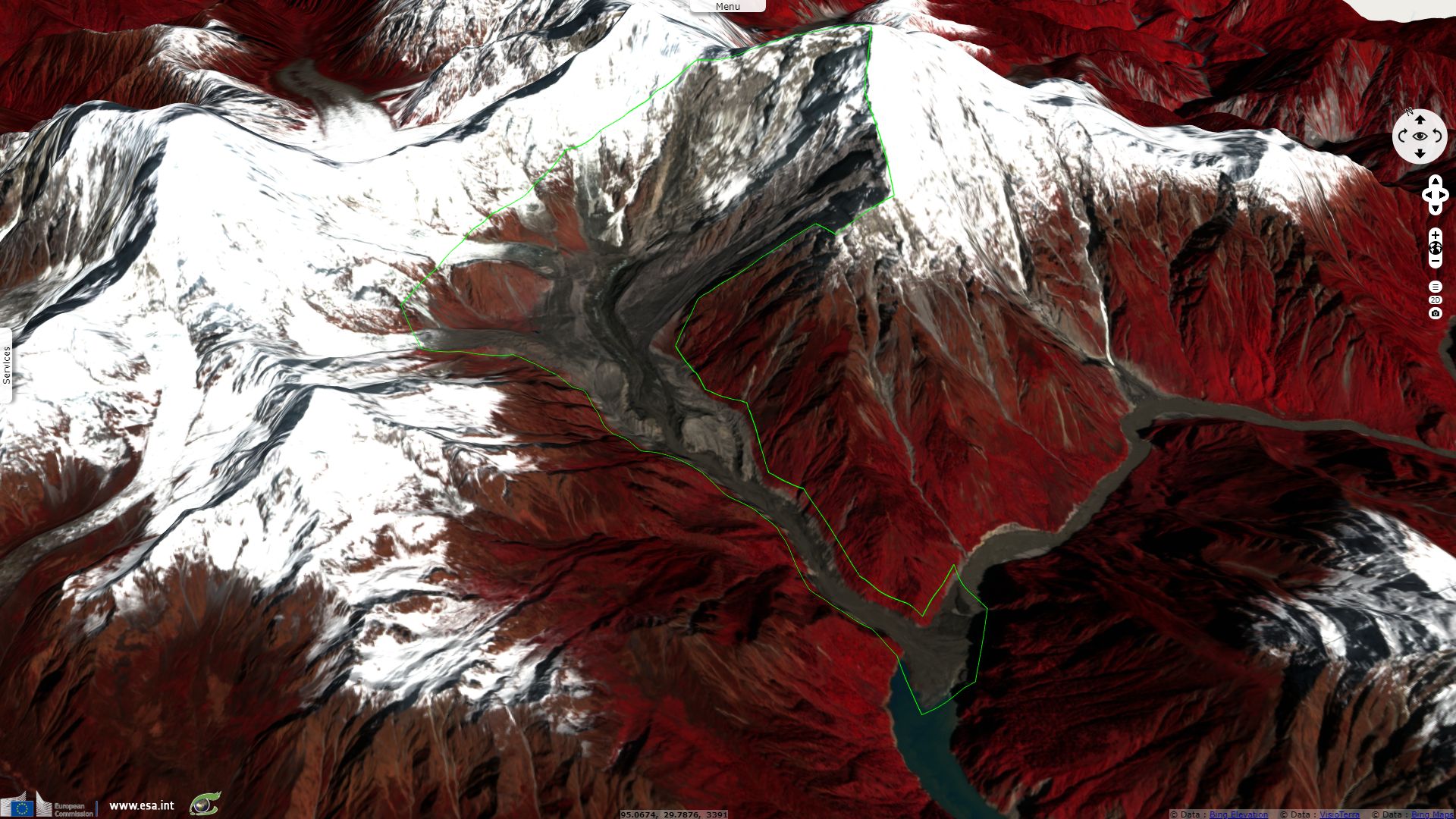
In another post, he added: "The volume of the barrier lake quickly increased, reaching a reported 300 million m³, and thus presenting a substantial hazard."
"Interestingly, this is the second barrier lake to form in Tibet in a short period, as on 11th October 2018 a further large, valley blocking landslide occurred at Bolo township in Jomda County, also causing a substantial blockage."
He later detailed:
"Initially the landslide caused a complete blockage of the Yarlung Tsangpo river, but the blockage has now breached. There is some evidence that the overtopping event caused flood damage downstream, but prompt evacuation of the downstream communities appears to have ensured that no lives were lost."
The views expressed herein can in no way be taken to reflect the official opinion of the European Space Agency or the European Union.
Contains modified Copernicus Sentinel data 2026, processed by VisioTerra.
Contains modified Copernicus Sentinel data 2026, processed by VisioTerra.
| More on European Commission space: |  |
 |
 |
||||
| More on ESA: | |
|
|
S-1 website | S-2 website | S-3 website | |
| More on Copernicus program: | |
|
|
Scihub portal | Cophub portal | Inthub portal | Colhub portal |
| More on VisioTerra: | |
|
|
Sentinel Vision Portal | Envisat+ERS portal | Swarm+GOCE portal | CryoSat portal |