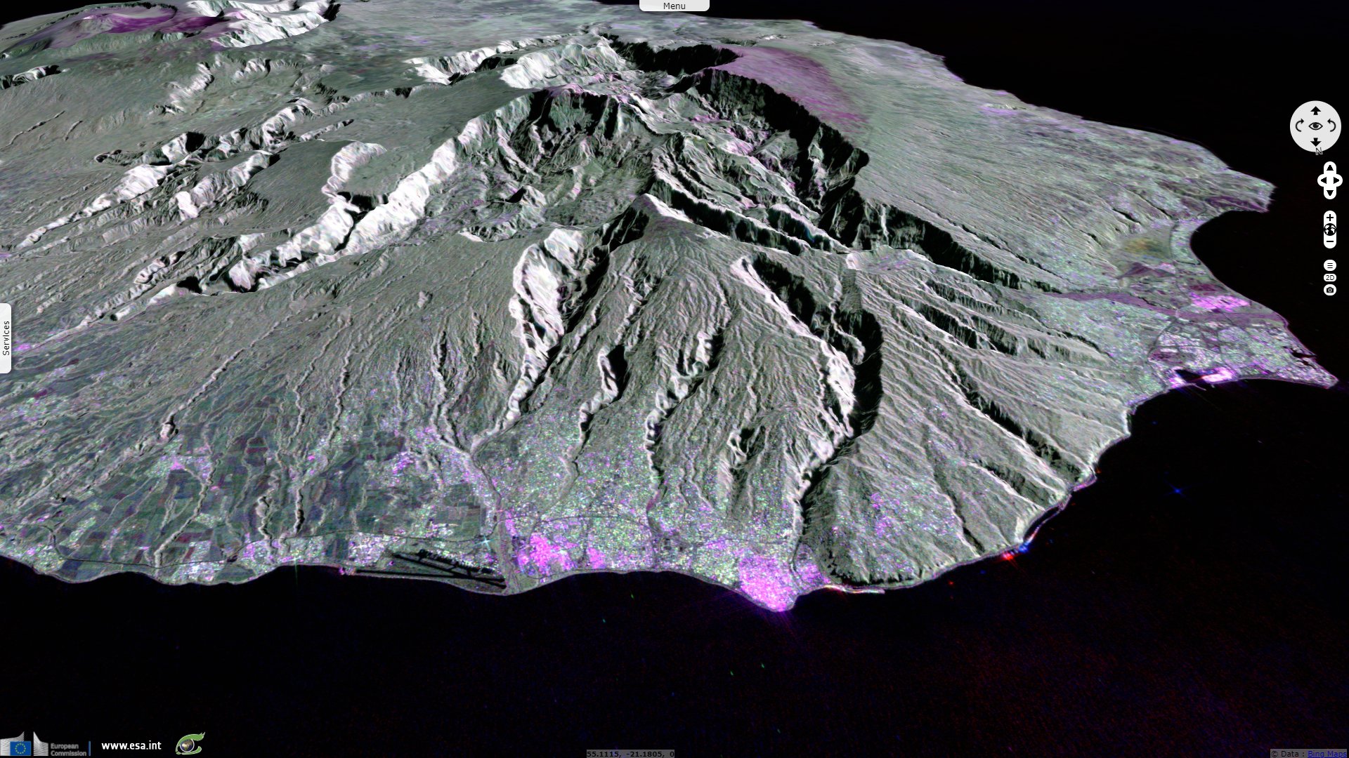
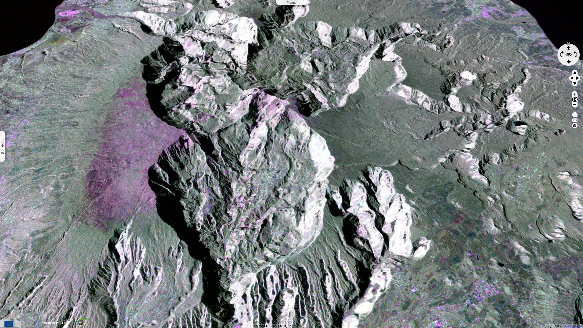
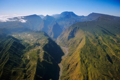
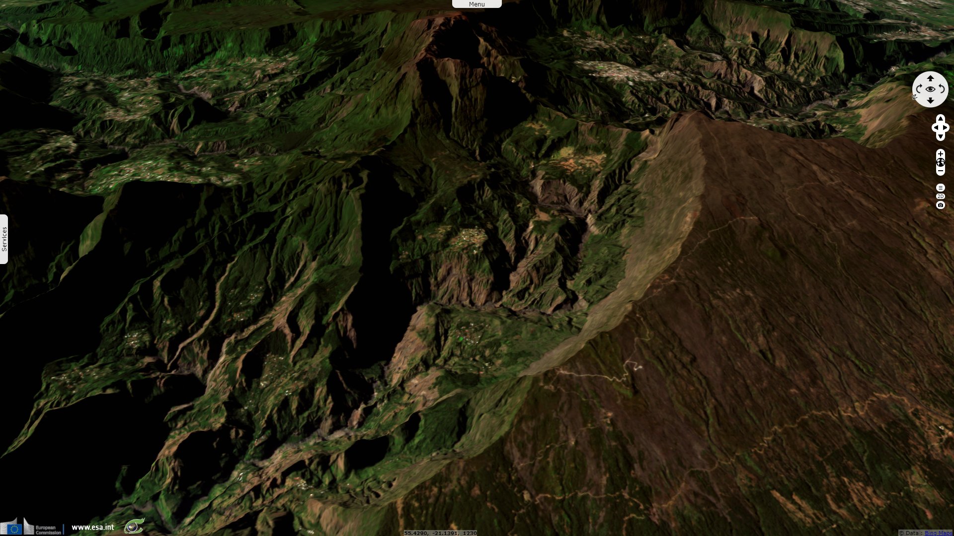
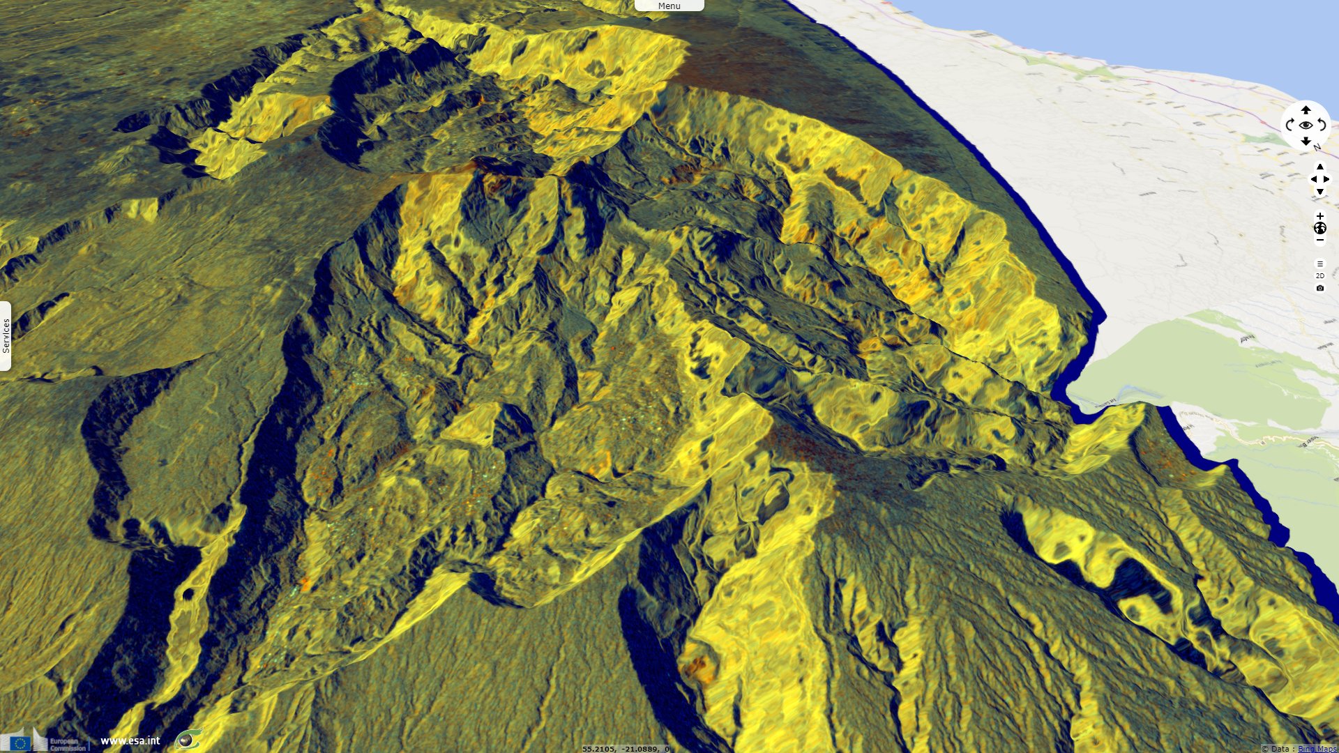
Piton des Neiges, Reunion Island, France
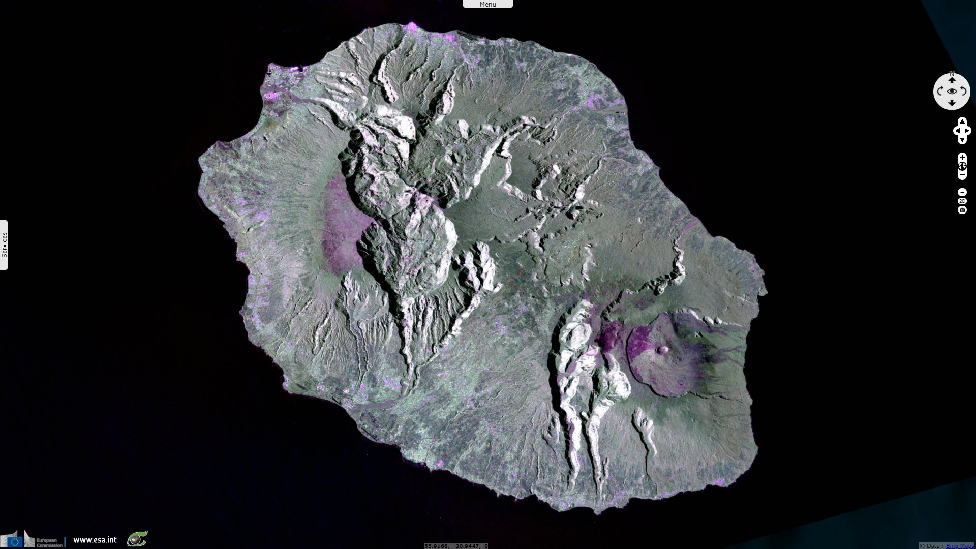
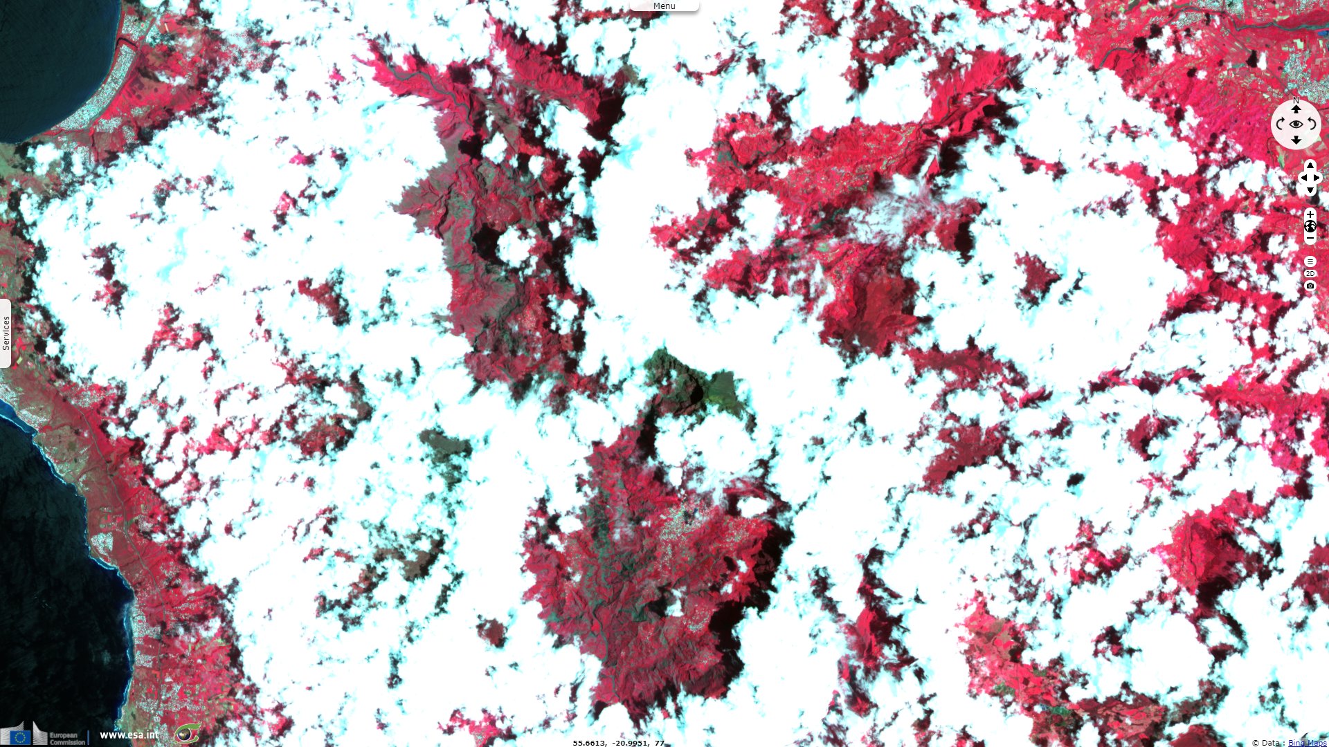
Sentinel-1 CSAR IW acquired on 29 September 2017 at 14:53:02 UTC
...
Sentinel-1 CSAR IW acquired on 04 November 2017 at 14:53:02 UTC
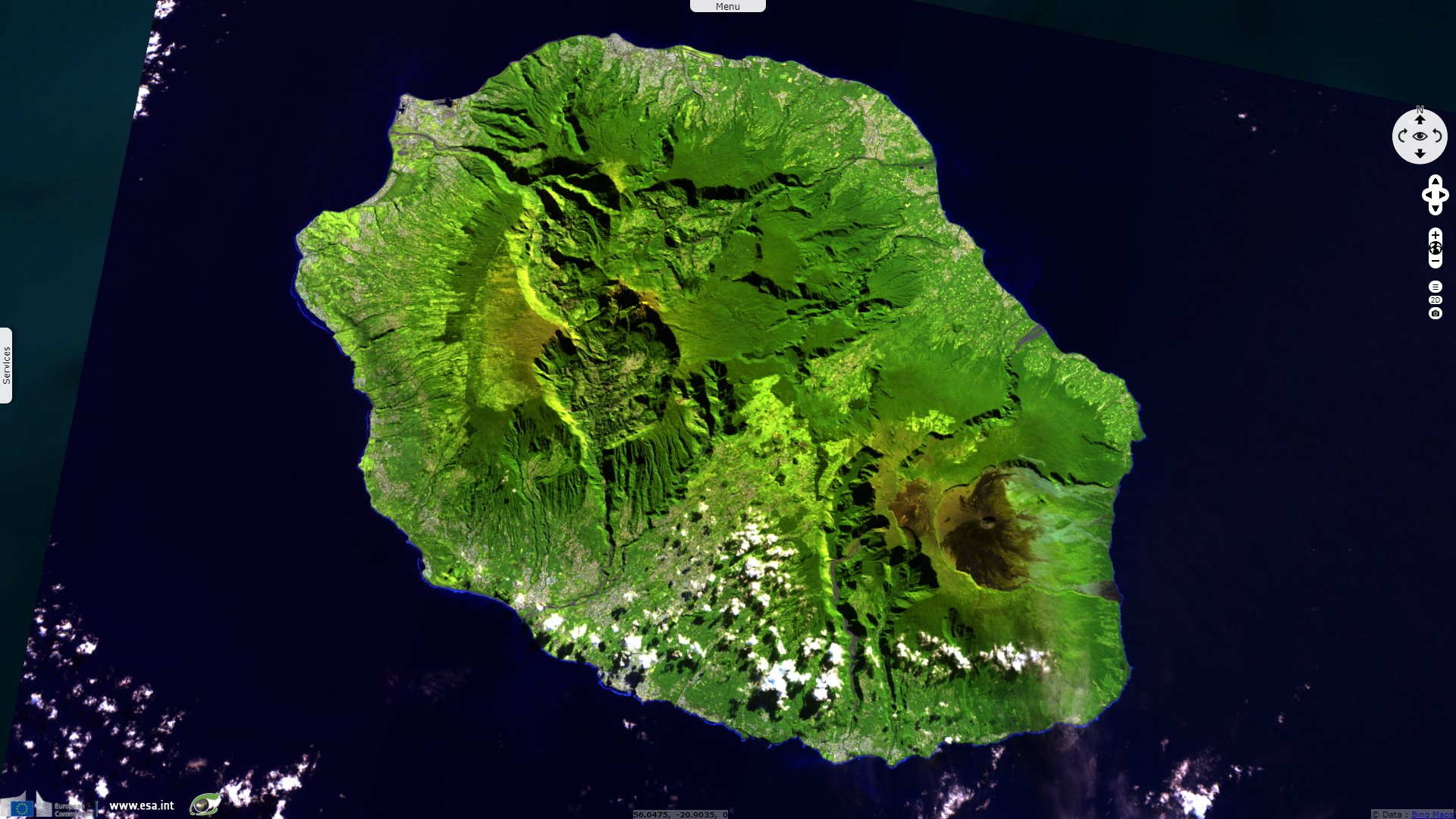
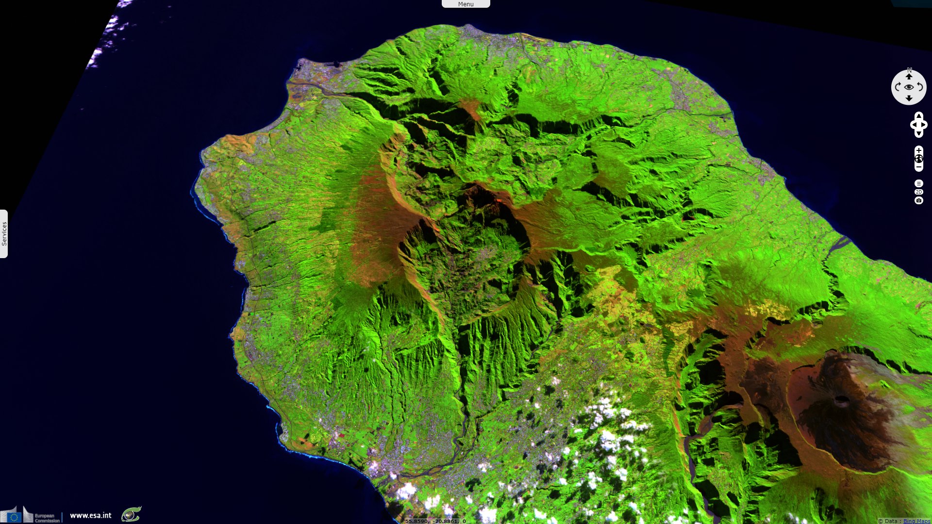
Sentinel-2 MSI acquired on 16 July 2018 at 06:35:11 UTC
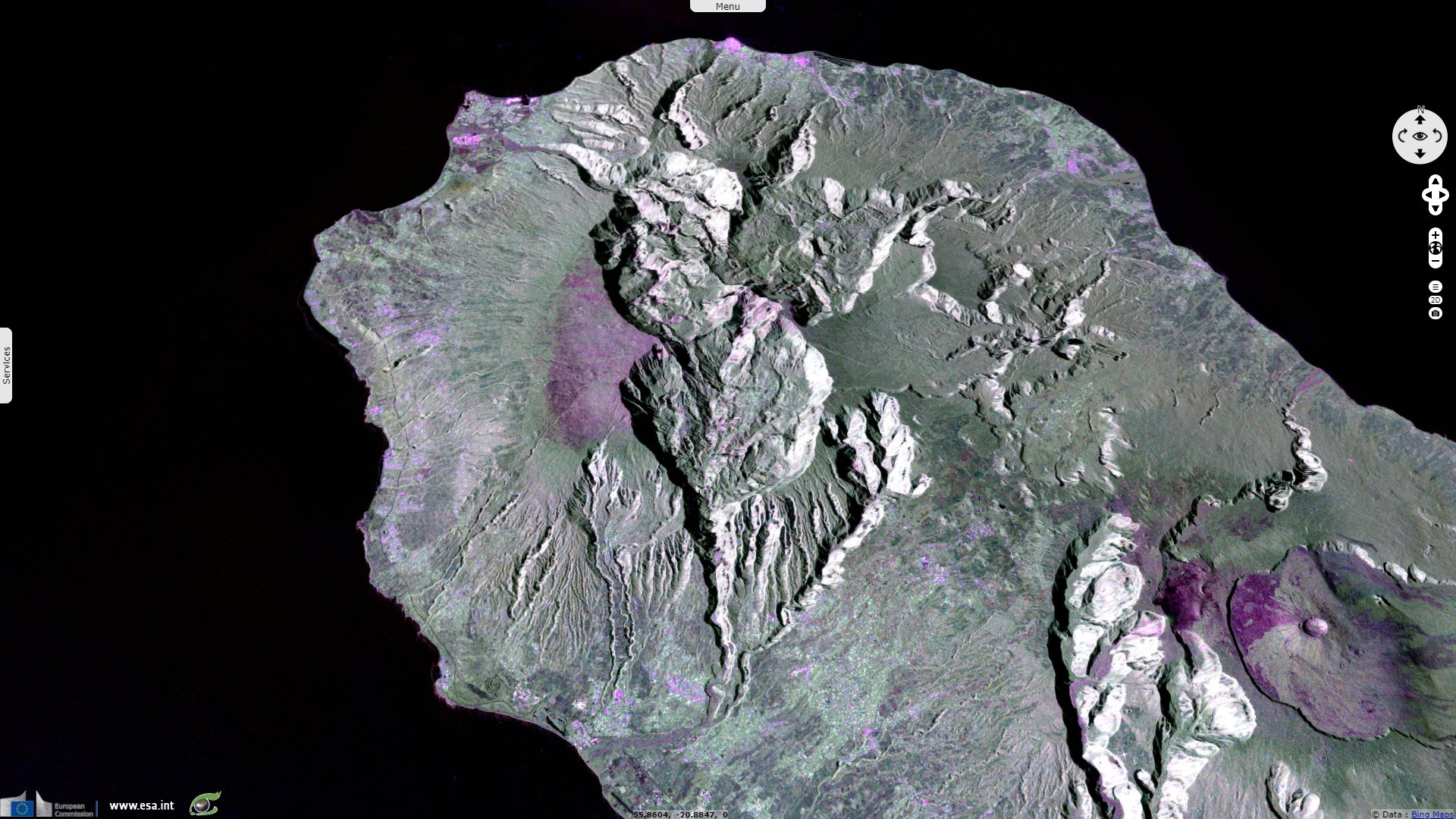
Sentinel-1 CSAR SM acquired on 18 January 2021 at 01:46:32 UTC
...
Sentinel-1 CSAR IW acquired on 04 November 2017 at 14:53:02 UTC
Sentinel-2 MSI acquired on 16 July 2018 at 06:35:11 UTC
Sentinel-1 CSAR SM acquired on 18 January 2021 at 01:46:32 UTC
Keyword(s): Island, volcano, geohazard, hotspot, cirque, erosion, caldera, urban planning, biodiversity, UNESCO World Heritage, France
Paris Institute of Earth Physics (Institut de Physique du Globe de Paris or IPGP) wrote the following explaination of the formation of Réunion Island: "Reunion Island is the youngest link in the hot spot trail, which formed the Trapps du Deccan in India, the Laccadives, the Maldives, the Chagos Islands and the Mascarene Islands. Reunion is a young volcanic island, located 800 km east of Madagascar, at 21° south latitude and 55°30' east longitude, and 200 km west-southwest of its sister island Mauritius. Elliptical in shape with a north-west-south-east axis, it has a perimeter of 207 km and a surface area of 2512 km². It is the emerged top of a flattened cone resting on the sea floor at a depth of 4000 m, with a base of 200 km by 240 km. The total altitude from the sea floor to the summit is 7000 m."
"About 200 million years ago, the supercontinent Pangaea broke up into several separate continents. The opening of the Indian Ocean took place about 160 million years ago and, driven by convection cells, India separated from the continent of Africa and drifted northwards. 65 million years ago, the Indian plate was at the present location of Reunion Island. At that time, a new mantle plume was coming to the surface. After crossing the continental crust of India, the plume flooded the central part of the Indian continent and the oceanic crust to the west of it. This was the birth of a new hot spot."
"It caused exceptional volcanism, covering 1.5 million km² with a thickness of several kilometres. This flow of magma was poured out in a very short period of time on a geological scale, with most of the volume being put in place in less than 500 000 years (Vincent P.M., 1994). This corresponds to about 1010 m3 of magma per year, i.e. about 1000 times the annual production of the Piton de la Fournaise (Staudacher et al. 2003)."
"These magmas are essentially basaltic and the immense plateau thus created is called the "Trapps of the Deccan". It covers a large part of the interior and the west of India. The erosion of the west coast gave access to the different flows stacked one on top of the other. Today lava flows can be observed over a height of 1700 m, but the total thickness could reach about 3000 m (Vincent P.M., 1994)".
"After passing over the hot spot on Reunion Island, the northward drift from India continues, leaving behind the continental block of the Seychelles with the submerged counterpart of the Trapps of the Deccan, the basaltic Saya de Mahla Bank, whose age has also been determined at 64 million years, the age of the birth of the hot spot (White and McKenzie, 1989)."
"Then there remained a lesser magmatism. This is at the origin of the formation on the ocean floor of a string of islands and underwater volcanic reliefs, comparable to the Hawaiian islands, lined up from the Trapps of the Deccan: the Laccadives, the Maldives, the Chagos, the Mascarene Plateau, Mauritius and finally Reunion Island, the last active chain, located above the hot spot.", concludes the analysis made by IPGP.
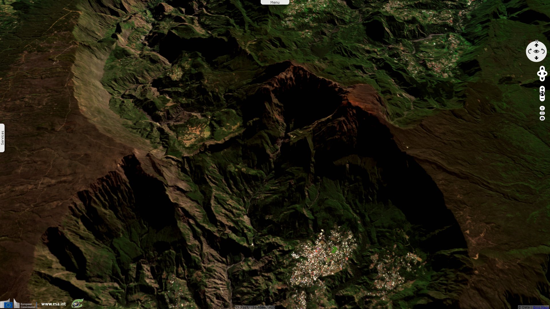
According to the Smithsonian Institution: "The massive Piton des Nieges shield volcano occupies the NW side of Reunion Island. The now 3070-m-high volcano emerged from the sea about 2.1 million years ago, beginning construction of a basaltic subaerial shield volcano that was active in two stages. Three large central depression dissect the island, and large submarine debris-avalanche deposits are found offshore. The latest eruptions of Piton des Nieges occurred as recently as about 12 000 years ago."
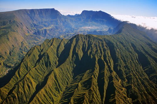
Left: Pitons, cirques and remparts of Reunion Island, view from Cilaos Caldera - Source: Hervé Douris
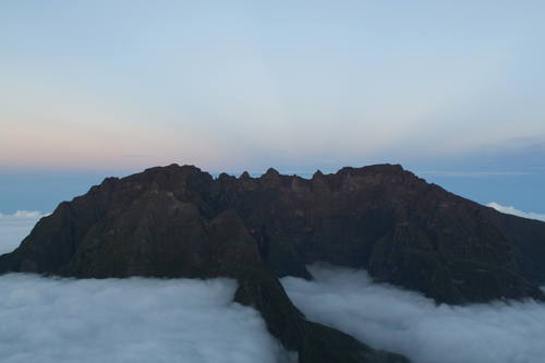
Right: Piton des Neiges at sunset, La Reunion, France - Source: James Russell
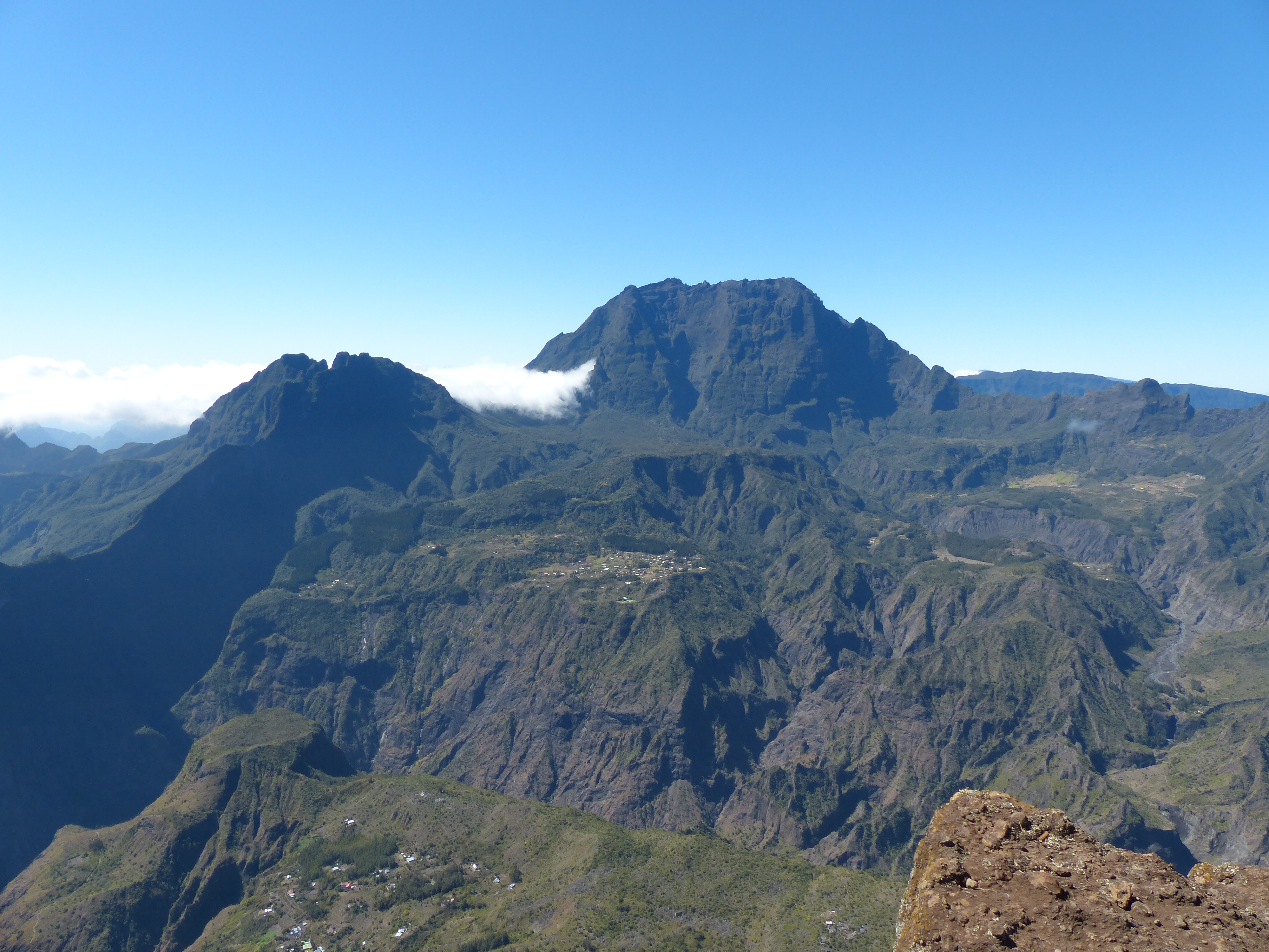
Left: Field photography from Maïdo - Source: Kevin Gross
Right: Pitons, cirques and remparts of Reunion Island, view from Mafate Caldera - Source: Hervé Douris
Piton des Neiges is the highest point on Réunion and is the highest point in the Indian Ocean. The volcano was formed by the Réunion hotspot and emerged from the sea about two million years ago. Now deeply eroded, the volcano is surrounded by three massive crater valleys, the Cirques. Piton des Neiges forms the northwestern two thirds of Réunion, with the very active Piton de la Fournaise comprising the rest. The other two islands in the archipelago, Mauritius and Rodrigues, are 7.8 million (Miocene) and 11⁄2 million (Pleistocene) years old, respectively.
UNESCO has added both volcanoes as a World Heritage site where the landscapes is described as follows: "The Pitons, cirques and remparts of Reunion Island site coincides with the core zone of La Réunion National Park. The property covers more than 1000 km² or 40% of La Réunion, an island comprising two adjoining volcanic massifs located in the south-west of the Indian Ocean. Dominated by two towering volcanic peaks, massive walls and three cliff-rimmed cirques, the property includes a great variety of rugged terrain and impressive escarpments, forested gorges and basins creating a visually striking landscape. It is the natural habitat for a wide diversity of plants, presenting a high level of endemism. There are subtropical rainforests, cloud forests and heaths creating a remarkable and visually appealing mosaic of ecosystems and landscape features."
The island possesses a high endemism of flowering plants (about 225); this has justified the creation of a biological reserve on the lower slopes of the Piton des Neiges. Recognized as an Important Bird Area, The Piton des Neiges and Gros Morne site "is made up of the mountainous massif that includes Le Piton des Neiges (3069 m) and Le Gros Morne (2991 m, the meeting point of the island’s three cirques). Its formation resulted from the activity of the now extinct volcano, followed by its collapse and severe erosion. The lower parts (2000–2800 m) are covered by montane shrubland or bushland and thicket, whereas the summits are largely bare rock and volcanic scree."
The views expressed herein can in no way be taken to reflect the official opinion of the European Space Agency or the European Union.
Contains modified Copernicus Sentinel data 2026, processed by VisioTerra.
Contains modified Copernicus Sentinel data 2026, processed by VisioTerra.
| More on European Commission space: |  |
 |
 |
||||
| More on ESA: | |
|
|
S-1 website | S-2 website | S-3 website | |
| More on Copernicus program: | |
|
|
Scihub portal | Cophub portal | Inthub portal | Colhub portal |
| More on VisioTerra: | |
|
|
Sentinel Vision Portal | Envisat+ERS portal | Swarm+GOCE portal | CryoSat portal |