Flash flood in the Death Valley, Mojave Desert, USA
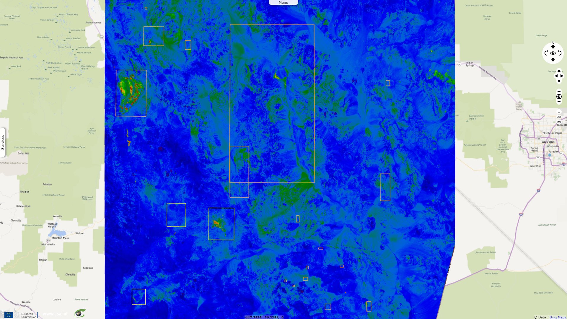
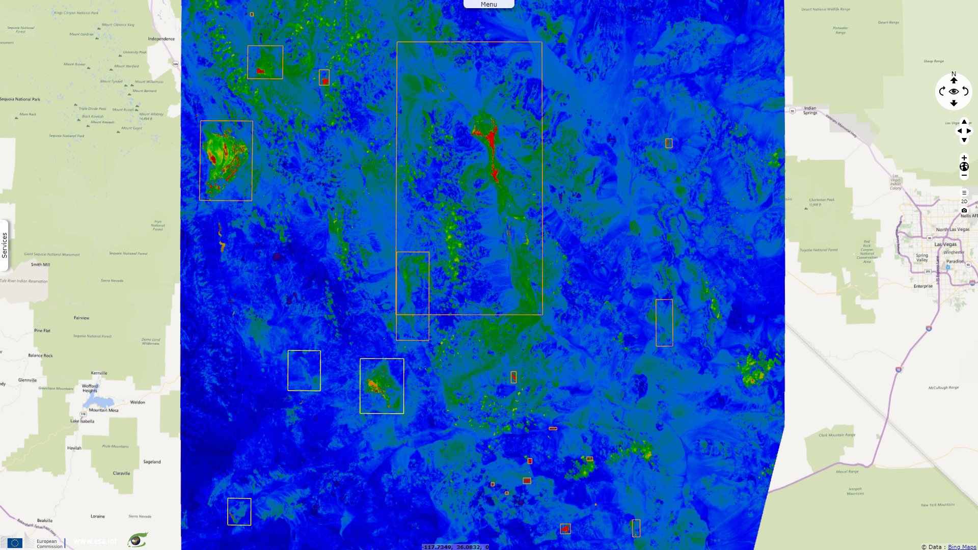
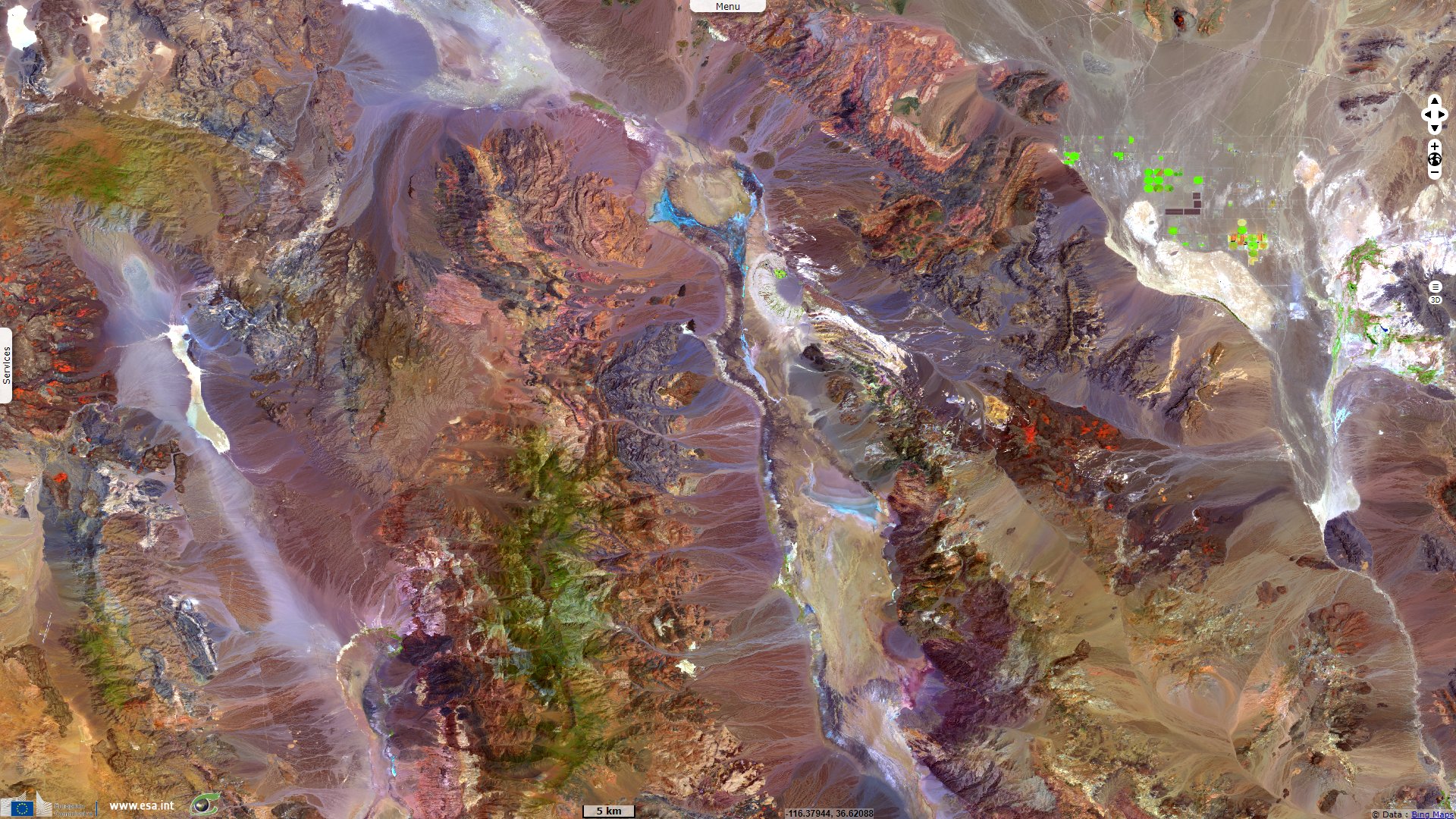
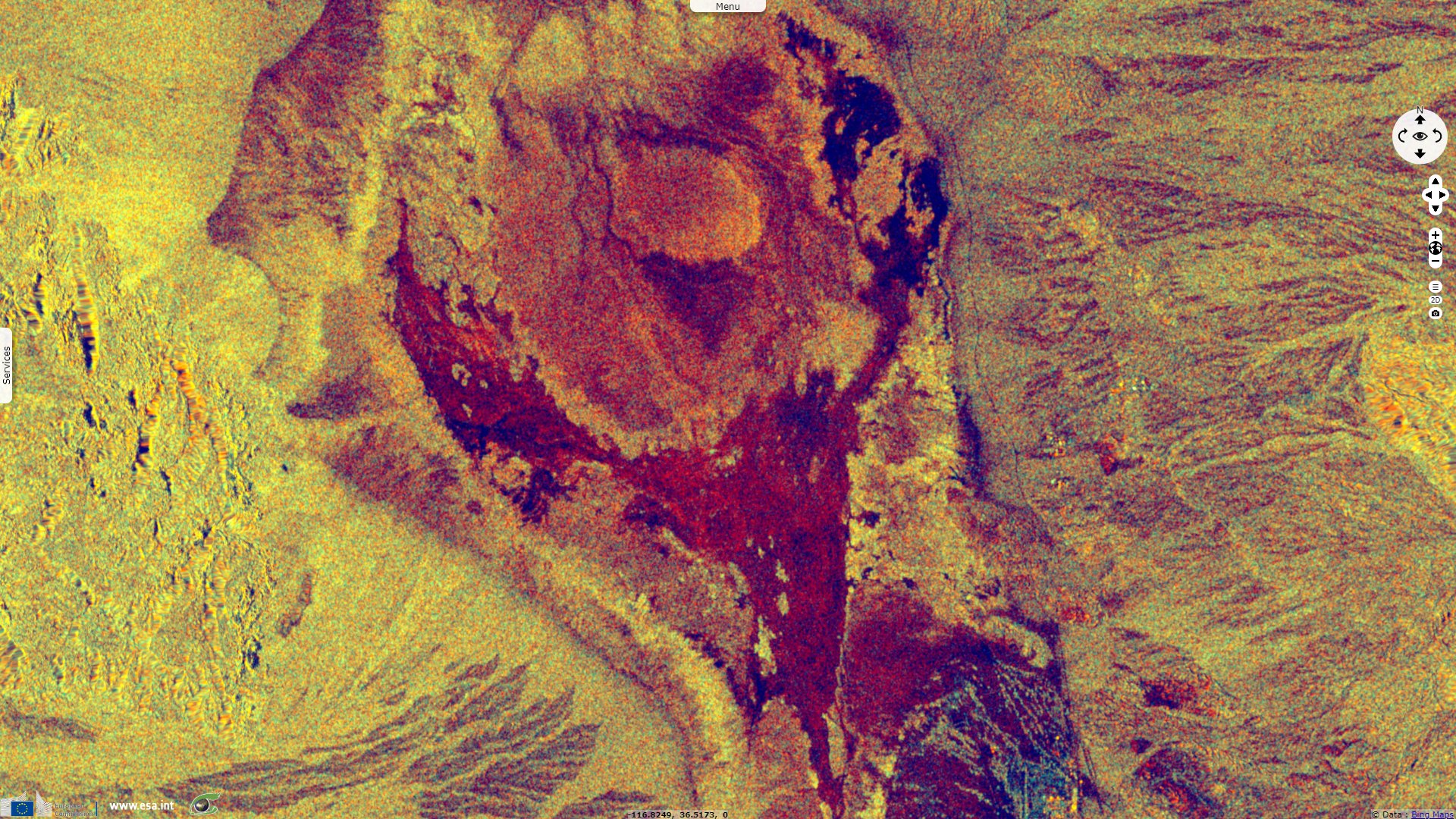
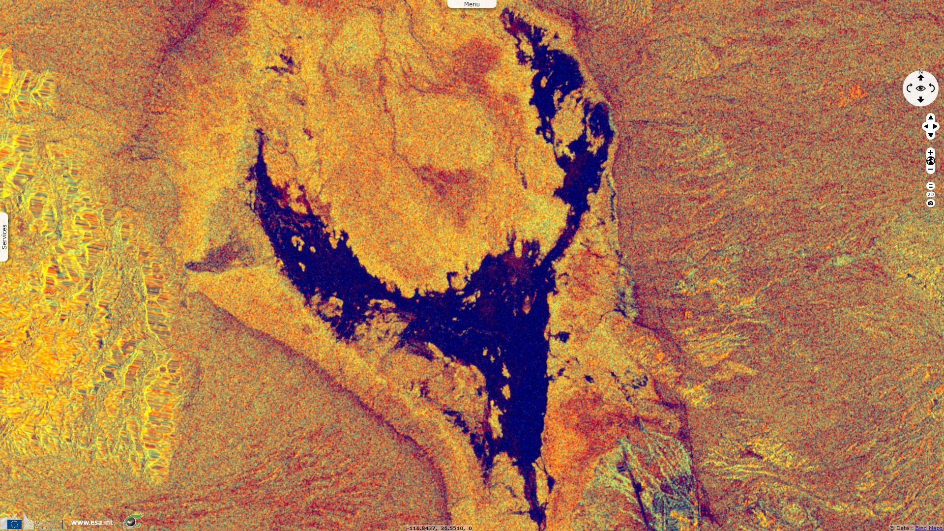
Sentinel-1 CSAR IW acquired on 05 August 2022 from 01:50:42 to 01:51:07 UTC
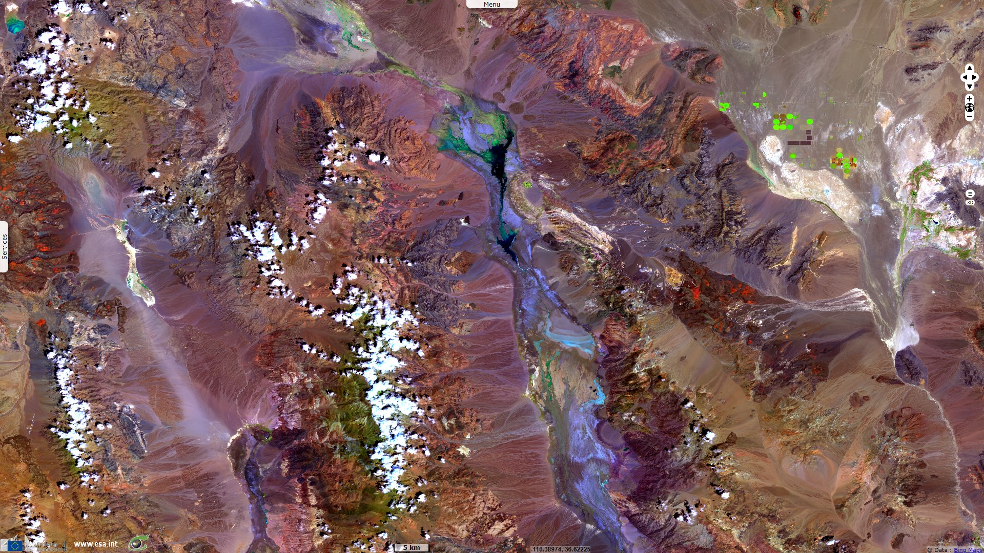
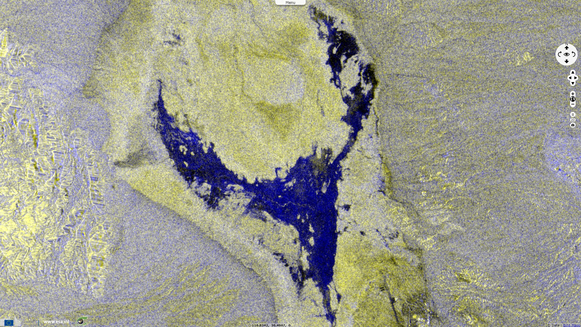
Sentinel-1 CSAR IW acquired on 05 August 2022 from 13:52:00 to 13:52:25 UTC
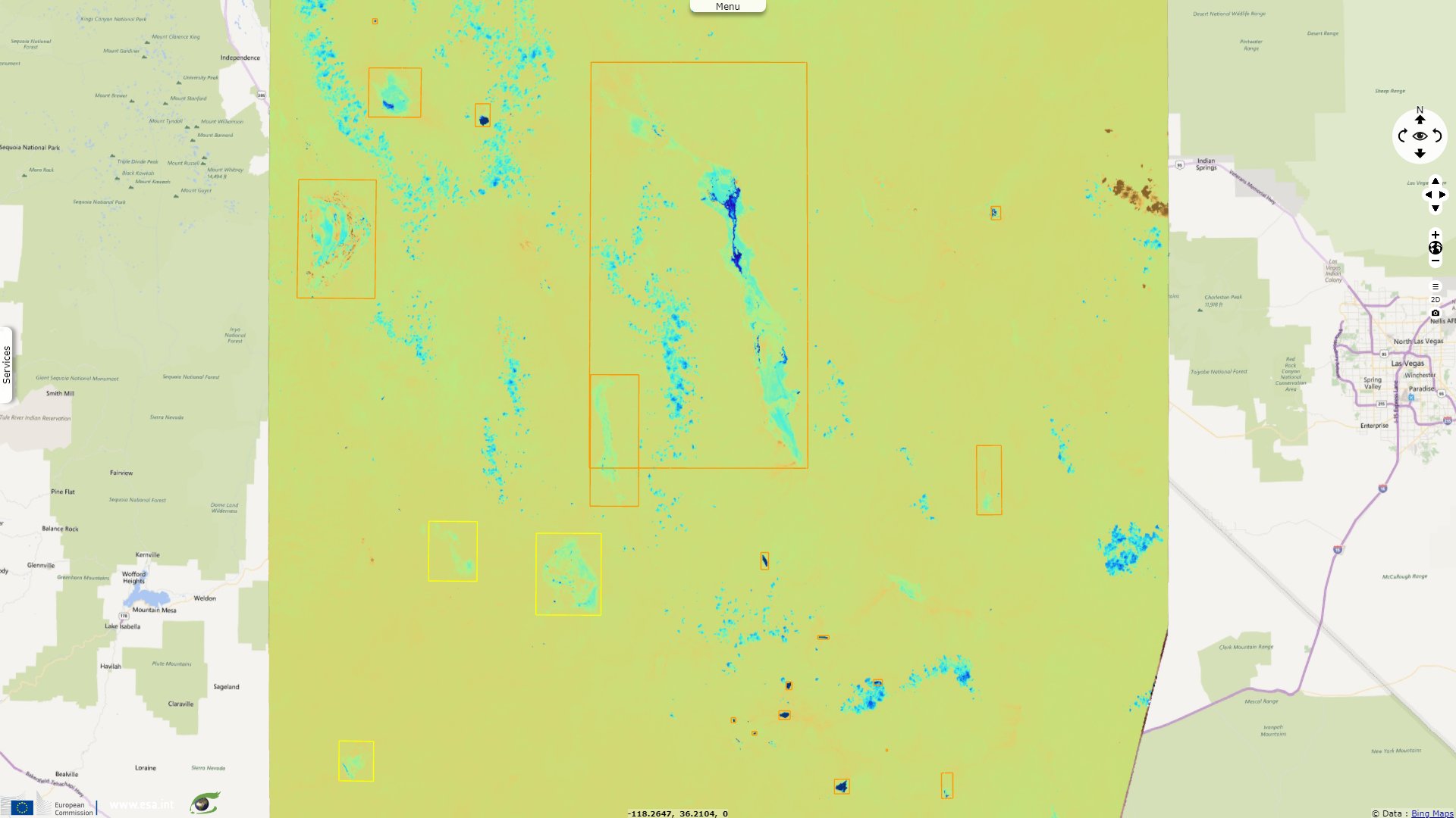
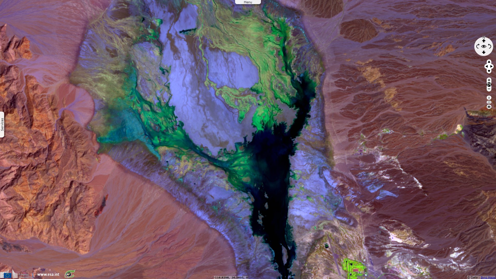
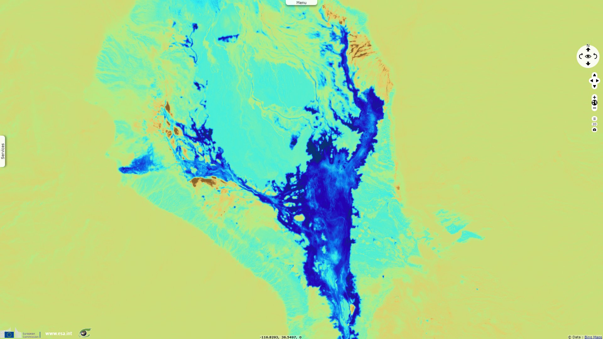
Sentinel-3 OLCI FR & SLSTR RBT acquired on 06 August 2022 at 18:20:39 UTC
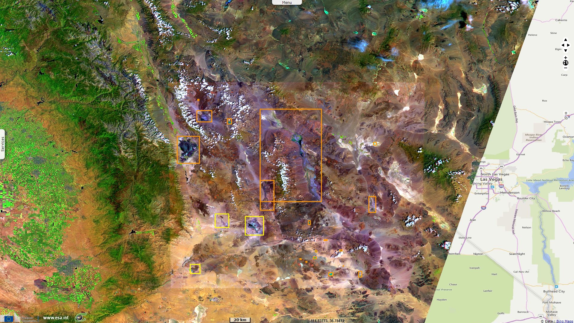
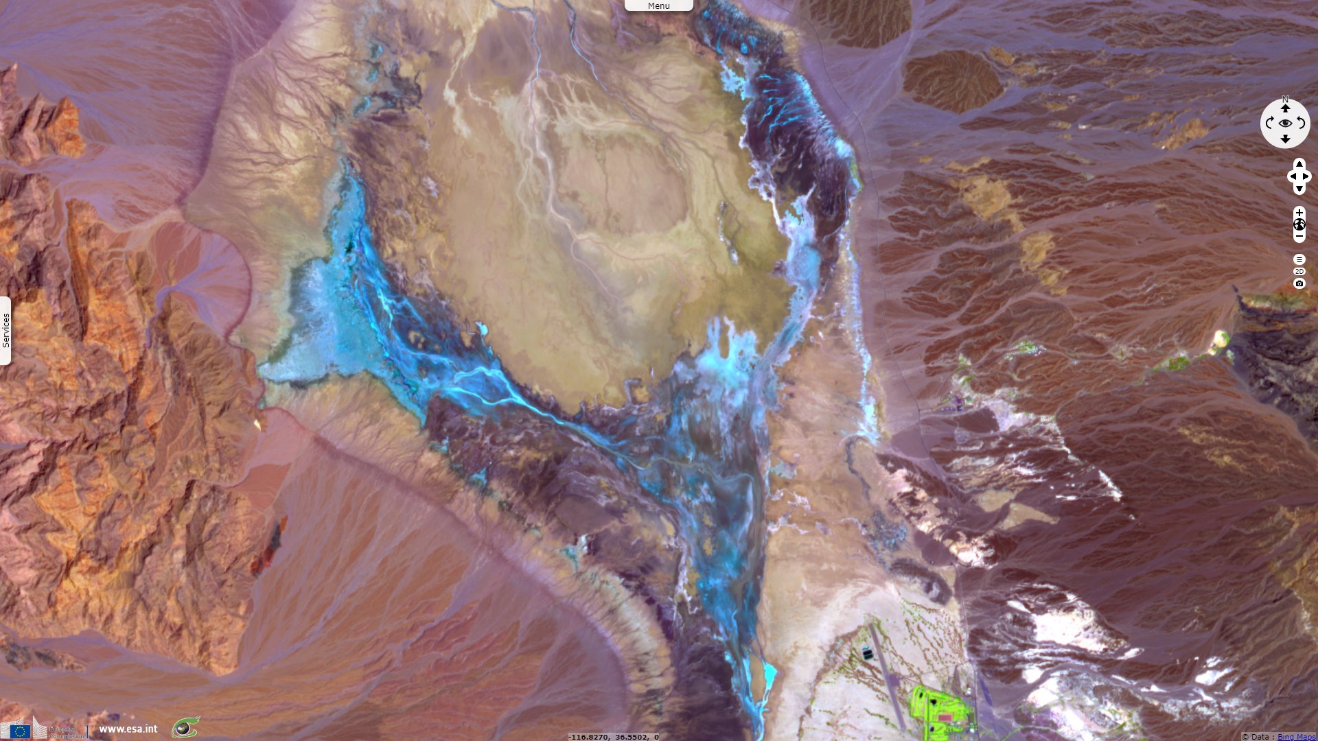
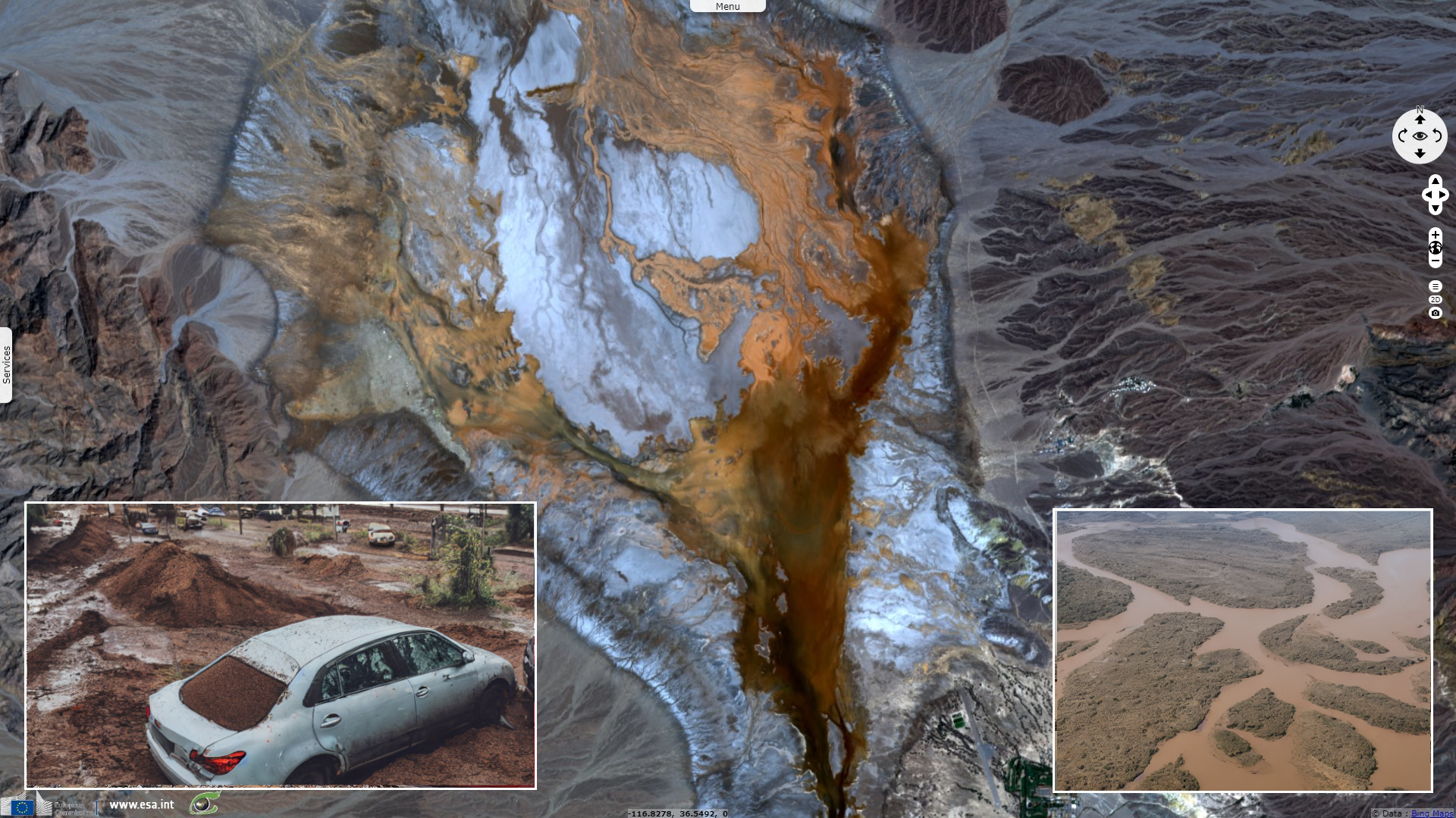
Sentinel-2 MSI acquired on 06 August 2022 at 18:29:31 UTC
Sentinel-1 CSAR IW acquired on 05 August 2022 from 13:52:00 to 13:52:25 UTC
Sentinel-3 OLCI FR & SLSTR RBT acquired on 06 August 2022 at 18:20:39 UTC
Sentinel-2 MSI acquired on 06 August 2022 at 18:29:31 UTC
Keyword(s): Precipitation, weather, rainfall, flooding, endorheic basin, alluvium, sediments, playa, salty depression, desert, California, United States, USA
On August 7, 2022, Steve Gorman reported an exceptional flash flood event in Death Valley for Reuters: "Flash flooding triggered by a near-record downpour on Friday over one of the hottest, driest spots on Earth has stranded nearly 1000 people inside California's Death Valley National Park and forced its temporary closure, park officials said."
"No injuries were reported. But about 500 visitors and 500 park staff were unable to leave the park because all roads into and out of Death Valley were closed, according to the statement. A water treatment system that serves the Cow Creek area for park residents and offices was knocked out of service."
"The flooding was unleashed by a torrential shower that dumped 1.46 inches (3.7 cm) of rain at Furnace Creek, nearly matching the previous daily record there of 1.47 inches measured from a downpour in 1988, park spokesperson Amy Wines said. By comparison, the park averages 2.2 inches of rainfall per year, making it the driest place in North America. Furnace Creek holds the record for the highest temperature ever recorded on Earth, 56.7°C, Wines said."
"Flash floods from monsoonal rains are a natural part of Death Valley's ecology and occur somewhere in the park almost every year, constantly carving and reshaping its dramatic canyon landscape. But flooding of a scale seen Friday last struck Death Valley in August 2004, forcing a 10-day closure of all its roads and killing two people whose vehicle was swept away, according to Wines."
Meena Venkataramanan adds more context about this event: "The torrent was triggered by the Southwest monsoon, which develops each summer as prevailing winds shift from out of the west to out of the south, drawing a surge of humidity northward. This moisture can fuel vigorous downpours that douse the parched desert landscape. Because there is little soil to soak up the rains, any measurable rains can cause flooding in low-lying areas, and heavier rains can collect into normally dry creeks, triggering flash floods."
"The Death Valley flood also comes amid a series of extreme rain events over the Lower 48 states. Over the week spanning the end of July and beginning of August, three 1-in-1,000 year rain events occurred — inundating St. Louis, eastern Kentucky, and southeast Illinois. Earlier this summer, Yellowstone National Park also flooded."
The views expressed herein can in no way be taken to reflect the official opinion of the European Space Agency or the European Union.
Contains modified Copernicus Sentinel data 2026, processed by VisioTerra.
Contains modified Copernicus Sentinel data 2026, processed by VisioTerra.
| More on European Commission space: |  |
 |
 |
||||
| More on ESA: | |
|
|
S-1 website | S-2 website | S-3 website | |
| More on Copernicus program: | |
|
|
Scihub portal | Cophub portal | Inthub portal | Colhub portal |
| More on VisioTerra: | |
|
|
Sentinel Vision Portal | Envisat+ERS portal | Swarm+GOCE portal | CryoSat portal |