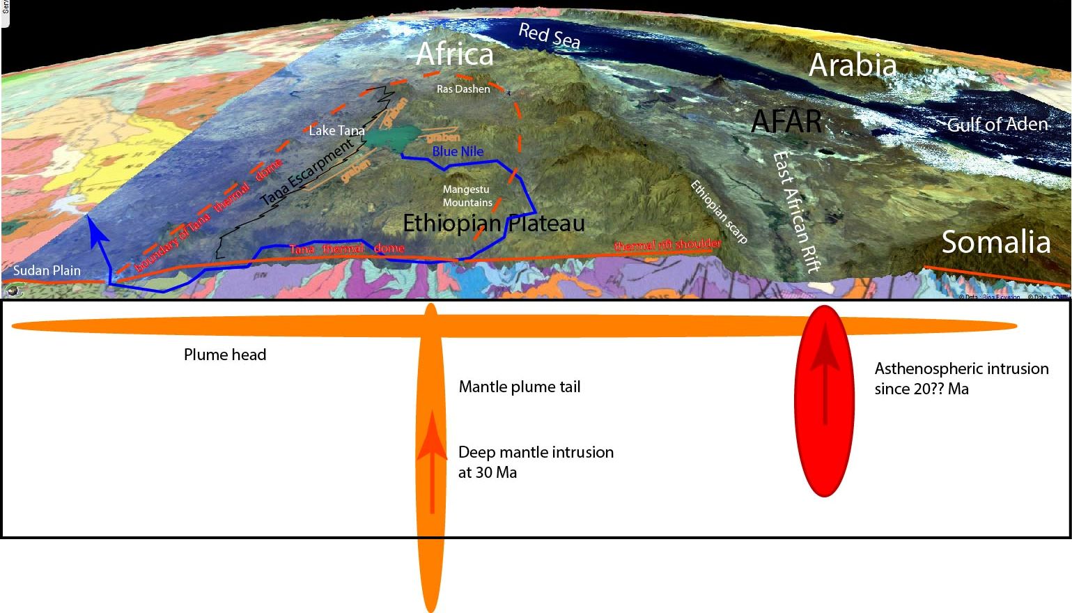
Geology in the Ethiopian Plateau
Sentinel-1 CSAR IW acquired on 02 March 2015 from 03:24:15 to 03:24:40 UTC
Sentinel-1 CSAR IW acquired on 21 March 2015 at 15:42:51 UTC
Sentinel-3 OLCI FR acquired on 27 January 2017 at 07:11:04 UTC
...
Sentinel-2 MSI acquired on 30 December 2017 at 07:43:19 UTC
Sentinel-1 CSAR IW acquired on 21 March 2015 at 15:42:51 UTC
Sentinel-3 OLCI FR acquired on 27 January 2017 at 07:11:04 UTC
...
Sentinel-2 MSI acquired on 30 December 2017 at 07:43:19 UTC
Keyword(s): Land, geology, continental rift, mantle plume, dyke, fault, graben, mountain, tilted block, volcano, flood basalt, rift, rift shoulder Afar, Arabia, Danakil, Djibouti, East African Rift, Eritrea, Ethiopia, Gulf of Aden, Nile, Red Sea, Somalia, Sudan, Lake Tana, Tana escarpment
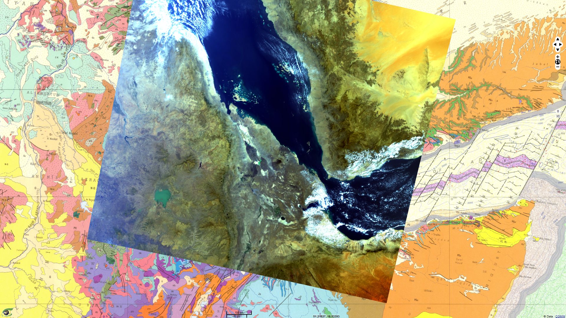
Comments from Pr. Jean Chorowicz: "The region is largely covered by a more than 1,000 m-thick pile of continental flood basalt strata formed from very low viscosity magma eruptions 30 Ma ago (Ethiopian-Yemen trapps), unconformably resting on a basement of metamorphic Precambrian and sedimentary Mesozoic rocks. These eruptions result from the activity of a mantle plume, the first event which induced the East African Rift genesis but also that of the Red Sea and Gulf of Aden.
The Ethiopian Plateau is not a collisional belt, uplift of the continental lithosphere here results from thermal effects combining two types of magmatic intrusions:
1) Mantle plume. Around Lake Tana, the topography forms a large bulge, culminating at ~2,500 m. Within the bulge Lake Tana is a subsided area at the junction of three short grabens. These structures are related to the impingement of the mantle plume issued from the deep mesosphere, which impacted the continental lithosphere. This impact, together with the plume head largely spread under the lithosphere (1,000 km in diameter), is supposed to have weakened ancient (Proterozoic) lithospheric-scale structures such as large deep suture faults, which reactivation is responsible for the emplacement during the Cenozoic of the East African Rift. Since 30 Ma northward motion of the African (Nubian) plate relative to the fixed plume have eased progressive propagation of the reactivation of lithospheric ancient structures and subsequent propagation of the EAR from north to south.
2) Lithospheric scale rift. Rift genesis is characterized by extension. Along weak fault lines the brittle crust is submitted to tension and subsequent subsidence occurs over several tens of kilometres across (width, #30 km). The lithospheric upper mantle has a ductile rheology. It also extends but by simple stretching and thinning, giving way up to hot asthenosphere into continental lithosphere, which then is heated. The lithosphere density decreases, inducing a large (width, #300 km) regional uplift along the rift. This mechanism contrasts with rift subsidence and forms rift shoulders including a western crest line that reaches 4,000 m in elevation. In the Ethiopian Plateau, from the scarp crest westward, the shoulders gently dip west, decreasing in elevations down to ~1500 m."
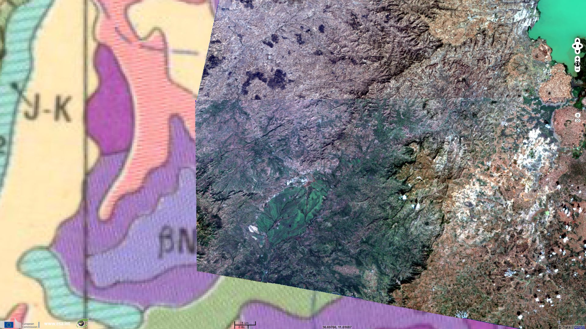
Comments from Pr. Jean Chorowicz: "An ovoid-shaped dark green surface corresponds to plantations. The landscape includes NE-striking lines corresponding to vertical dykes (meaning ‘walls’ in the landscape). They generally are basaltic in composition, more resistant to weathering-erosion than nearby rocks and form local reliefs. In image view, they typically have one side (SE) clearer because under sun illumination, the other (NW) darker under shadow. These dykes became solid inside old fissures (30 Ma old) that had permitted the flood basalt magmas to reach the surface from the plume. They subsequently have been dug up by regressive erosion west of the Tana Escarpment, where they can be observed. Elsewhere the dykes are hidden by the flood basalt pile.
The Tana Escarpment is the west looking Ethiopian Plateau border (large shadows and no sun illuminated side). Flood basalts consequently were covering in the past a larger area west of the Tana Escarpment. Lake Tana is located almost at the centre of the surface initially occupied by flood basalts and of the topographic bulge.
Along the western shore of Lake Tana, the imagery also shows tectonic tilted blocks separated by tensional (normal) faults. They lie along the western side of the southern graben (one of the three short grabens around Lake Tana, Fig.1B), which now is in inverted relief."
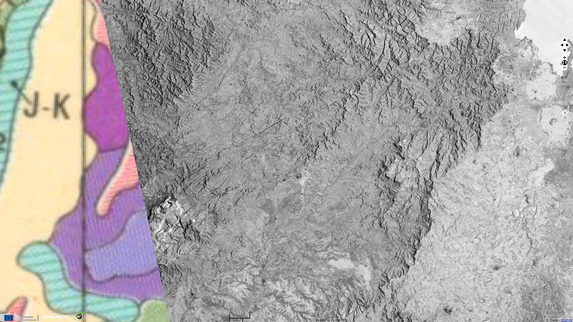
Comments from Pr. Jean Chorowicz: "The scenes look right in ascending or descending modes, providing different radar illuminations at right angle to their respective tracks. Consequently, the aspect of the dykes and of the Tana Escarpment may be affected by changes in radar illuminations or shadows when shifting screen display of the two mode categories and this argues for the geomorphic interpretations."
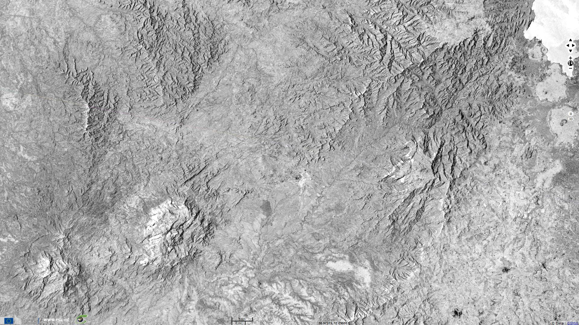
Comments from Pr. Jean Chorowicz: "The NE-striking dykes are thicker than the NW- ones. The dyke swarms seem to be arranged radially or concentrically to Lake Tana. Faults express as narrow valleys, along the western border of the N-trending short graben situated at the northern shore of Lake Tana."
Comments from Pr. Jean Chorowicz: "The view shows the regular step arrangement (trapps) of the sub-horizontal flood basalt pile in the Ethiopian Plateau. Total thickness was more than 1,200 m, and they covered an area of ~1,000 km in diameter."
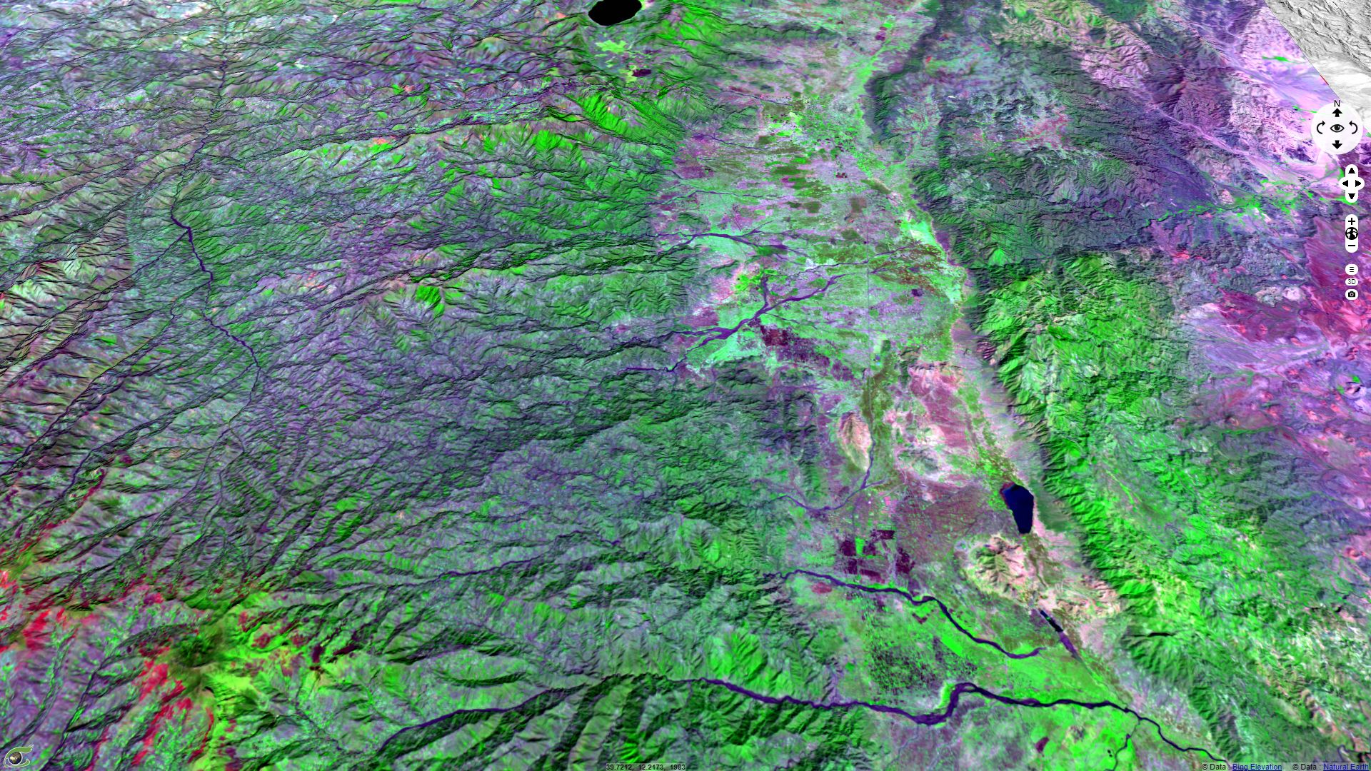
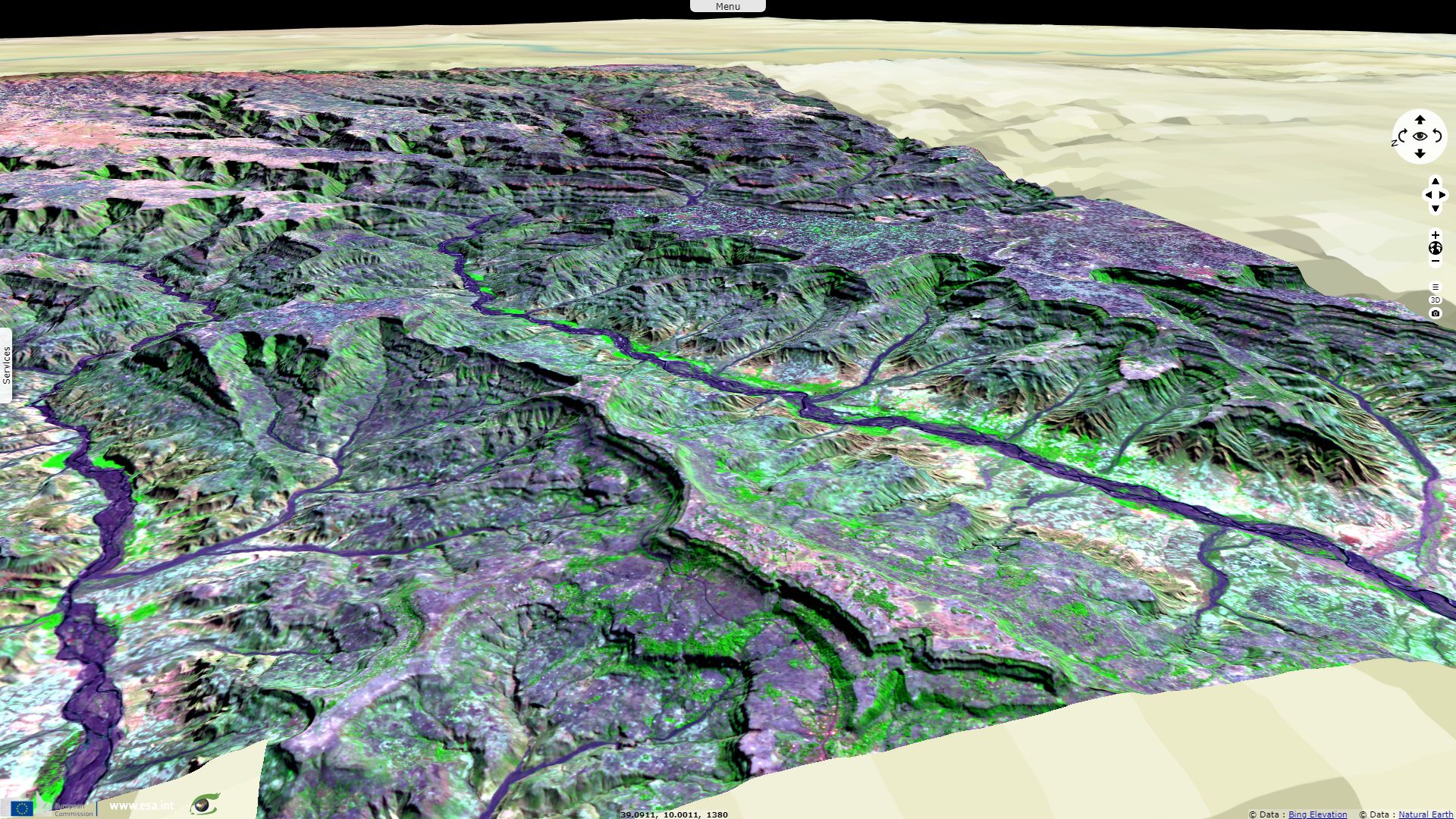
Comments from Pr. Jean Chorowicz: "From west to east the optical image displays different structures:
- The Ethiopian Plateau flood basalts, characterized by deep hydrographic networks, distinct layers of the trapp series, a vegetation cover of forests (green), burnt savannas (red), savannas and fields (mauve). In the SW corner of the image, a W-trending structure at more than 4,000 m elevation is the Abuna Joseph Massif, a group of ancient volcanoes that are part of the flood basalt series. Lake Ashenge, in the north, is an old caldera.
- NNW-striking elongate sedimentary grabens with flat topography, fields and forests, bounded by extensional (normal) fault zones.
- A downthrown elongate block, 20 km wide, tilted to the east, made of flood basalts, deeply eroded, partly covered with forests.
- The Afar depression, composed of bare rocks in arid environment (red to purple colors), numerous small Quaternary volcanoes and related projections and lava flows.
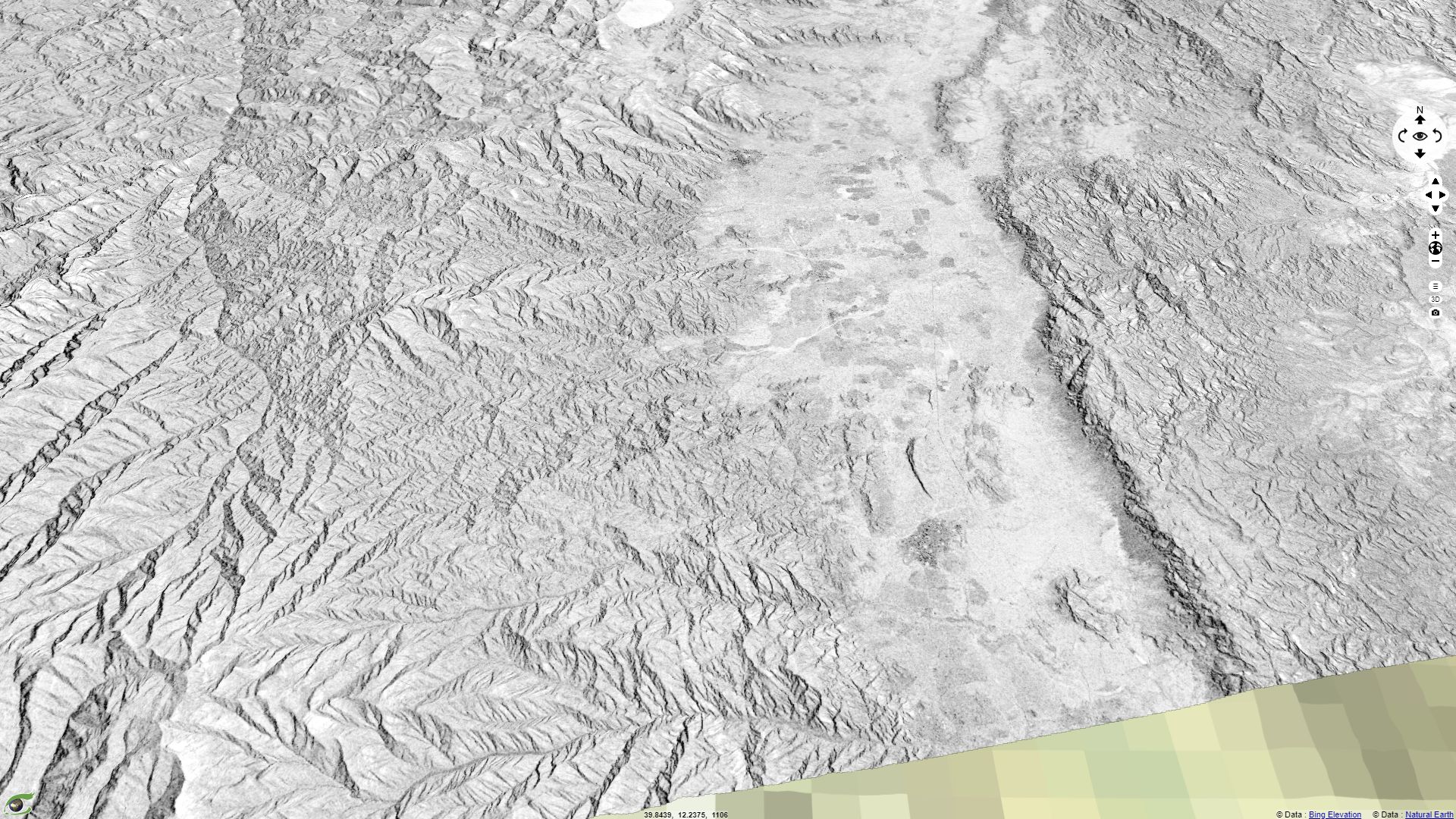
Comments from Pr. Jean Chorowicz: "The elongate block is a large continental tilted block that detached and moved down to the east in the future passive margin between the Ethiopian Plateau (continental crust) and the Afar (thin continental or oceanic crust). The CSAR image distinctly shows the detachment fault scarp. This structure demonstrates the early instability of the continental crust in passive margins."
The views expressed herein can in no way be taken to reflect the official opinion of the European Space Agency or the European Union.
Contains modified Copernicus Sentinel data 2026, processed by VisioTerra.
Contains modified Copernicus Sentinel data 2026, processed by VisioTerra.
| More on European Commission space: |  |
 |
 |
||||
| More on ESA: | |
|
|
S-1 website | S-2 website | S-3 website | |
| More on Copernicus program: | |
|
|
Scihub portal | Cophub portal | Inthub portal | Colhub portal |
| More on VisioTerra: | |
|
|
Sentinel Vision Portal | Envisat+ERS portal | Swarm+GOCE portal | CryoSat portal |
- Lake Tana, at 1,788 m above sea level (depth, 15 m);
- the Blue Nile, which flows eastward out from the lake, forms a large loop in the south and then runs to the west into the Sudan plain;
- large central volcanoes such as the Talo (4,154 m) in the Mangestu Mountains and the Ras Dashen Terara (4,550 m).
"