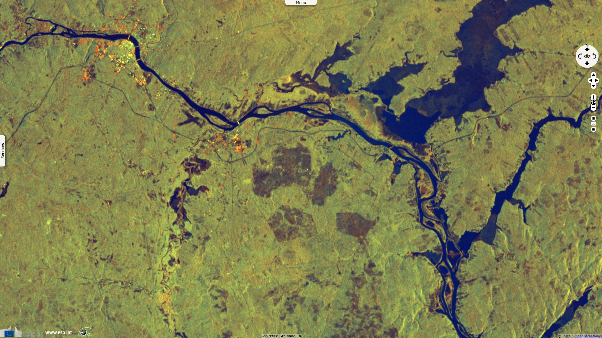
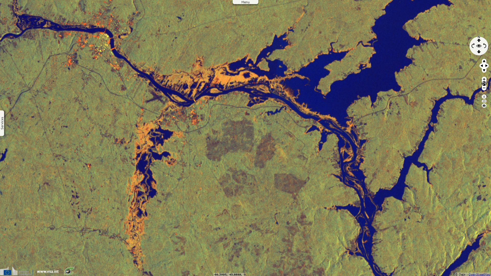
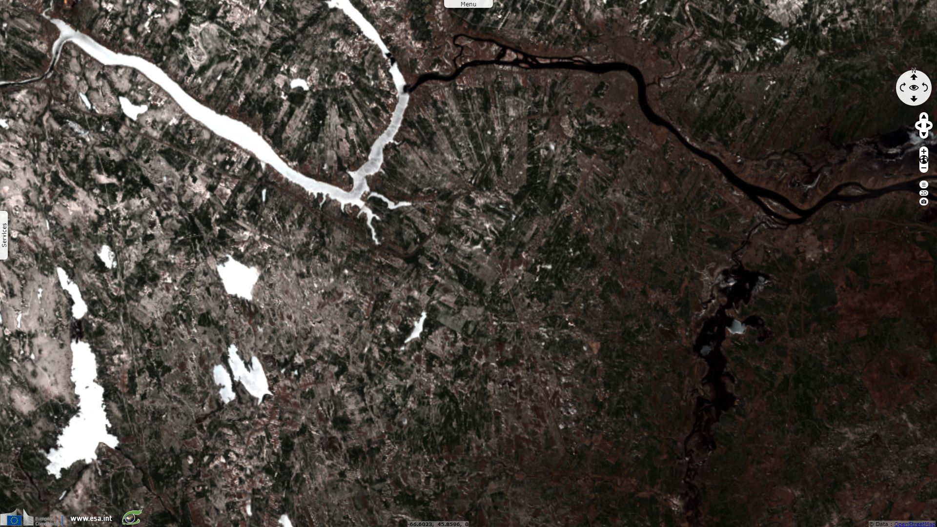
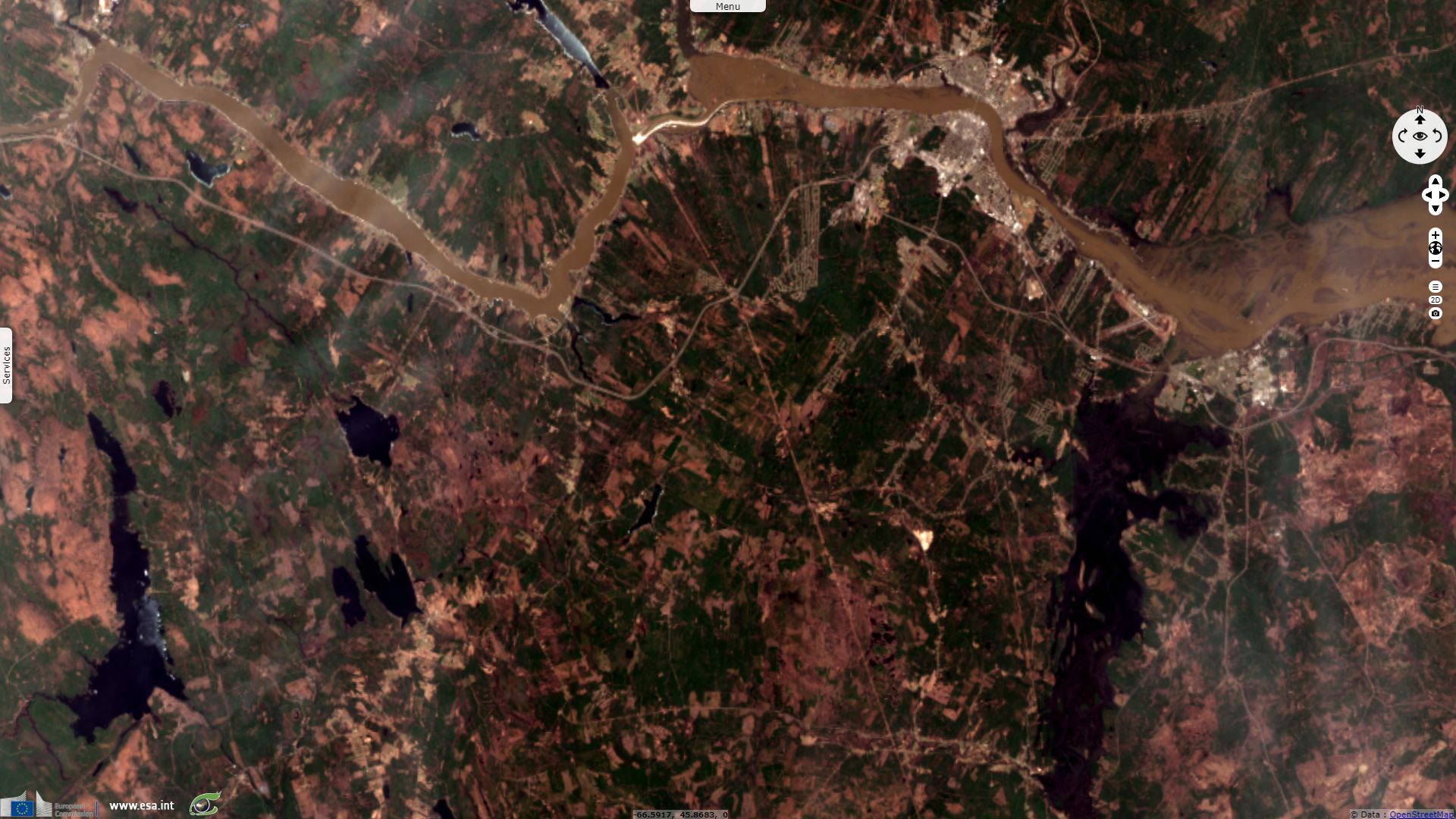
Flooding in New Brunswick
Sentinel-1 CSAR IW acquired on 03 May 2017 at 10:31:30 UTC
Sentinel-1 CSAR IW acquired on 16 April 2018 at 10:31:36 UTC
Sentinel-2 MSI acquired on 22 April 2018 at 15:26:31 UTC
Sentinel-2 MSI acquired on 02 May 2018 at 15:26:31 UTC
Sentinel-1 CSAR IW acquired on 04 May 2018 at 10:30:55 UTC
Sentinel-1 CSAR IW acquired on 16 April 2018 at 10:31:36 UTC
Sentinel-2 MSI acquired on 22 April 2018 at 15:26:31 UTC
Sentinel-2 MSI acquired on 02 May 2018 at 15:26:31 UTC
Sentinel-1 CSAR IW acquired on 04 May 2018 at 10:30:55 UTC
Keyword(s): Land, river, emergency, natural disaster, hydrology, cryosphere, flooding, ice melt, rain, precipitations, Canada
The views expressed herein can in no way be taken to reflect the official opinion of the European Space Agency or the European Union.
Contains modified Copernicus Sentinel data 2026, processed by VisioTerra.
Contains modified Copernicus Sentinel data 2026, processed by VisioTerra.
| More on European Commission space: |  |
 |
 |
||||
| More on ESA: | |
|
|
S-1 website | S-2 website | S-3 website | |
| More on Copernicus program: | |
|
|
Scihub portal | Cophub portal | Inthub portal | Colhub portal |
| More on VisioTerra: | |
|
|
Sentinel Vision Portal | Envisat+ERS portal | Swarm+GOCE portal | CryoSat portal |