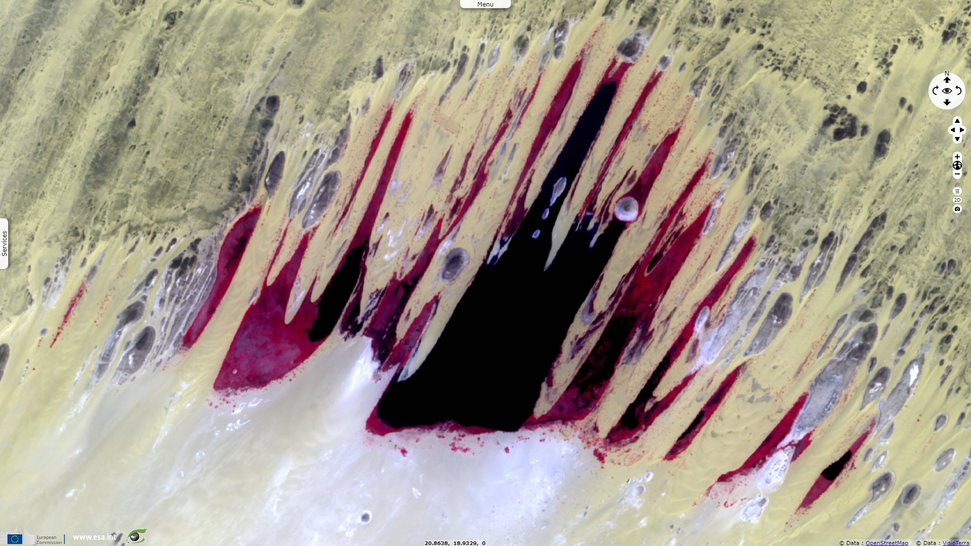
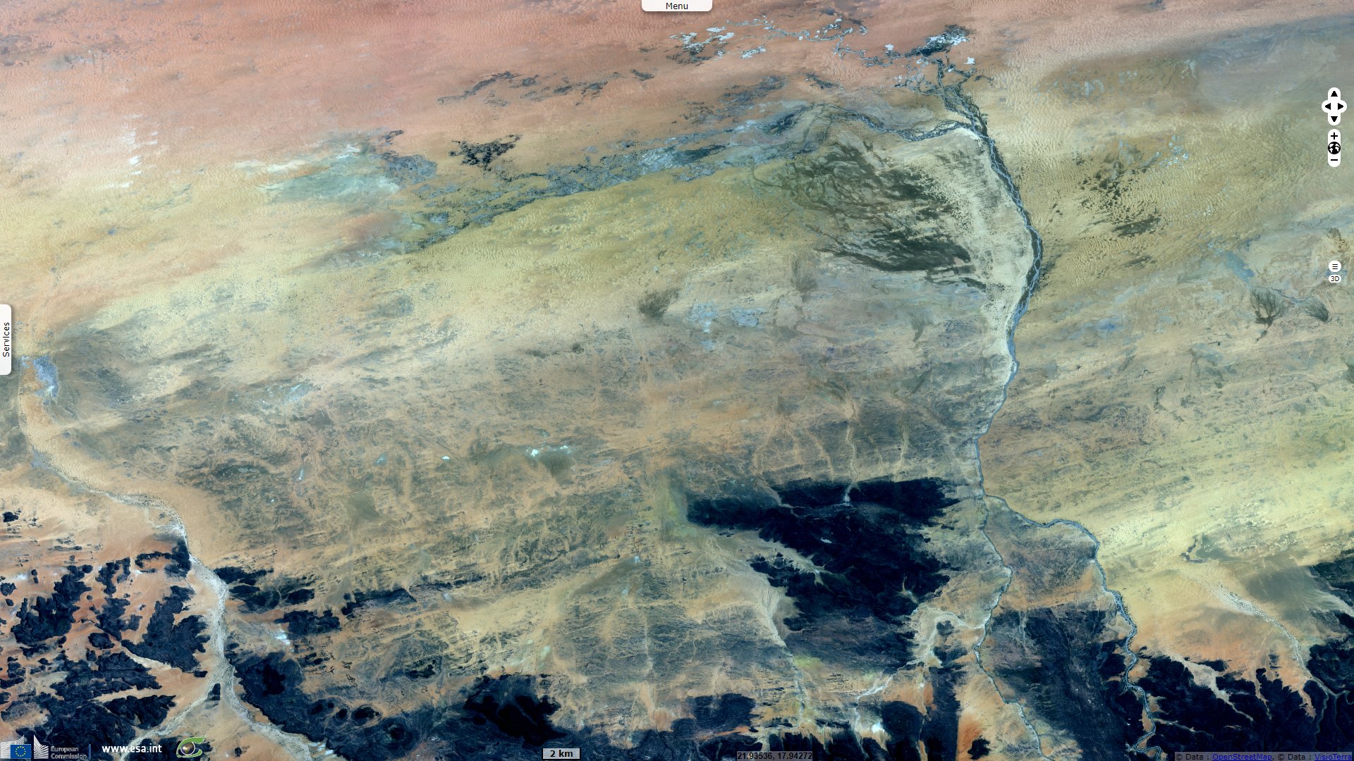
Ounianga Lakes, remnants of a large Saharan paleo-lake, Chad
Sentinel-2 MSI acquired on 22 April 2021 at 08:55:51 UTC
Sentinel-2 MSI acquired on 10 August 2021 at 08:56:01 UTC
Sentinel-2 MSI acquired on 10 August 2021 at 08:56:01 UTC
Keyword(s): Desert, lake, sand, hydrology, UNESCO World Heritage, Chad
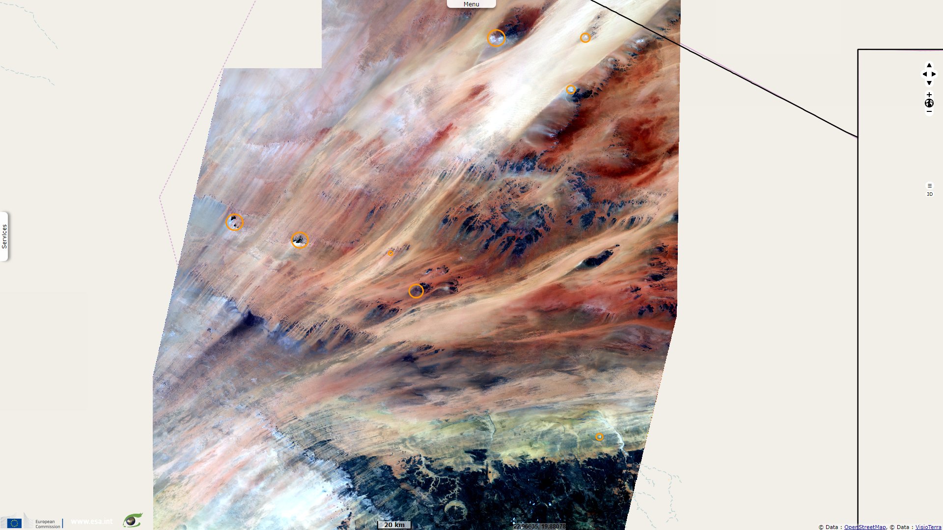
The lakes of Ounianga are the remnant of a much larger lake, that filled the basin during the so-called green Sahara-time, which lasted from about BC 10000–1500. Today, these permanent lakes are a UNESCO World Heritage site which "includes eighteen interconnected lakes in the hyper arid Ennedi region of the Sahara desert covering an area of 62 808 ha. It constitutes an exceptional natural landscape of great beauty with striking colours and shapes. The saline, hyper saline and freshwater lakes are supplied by groundwater and are found in two groups 40 km apart."
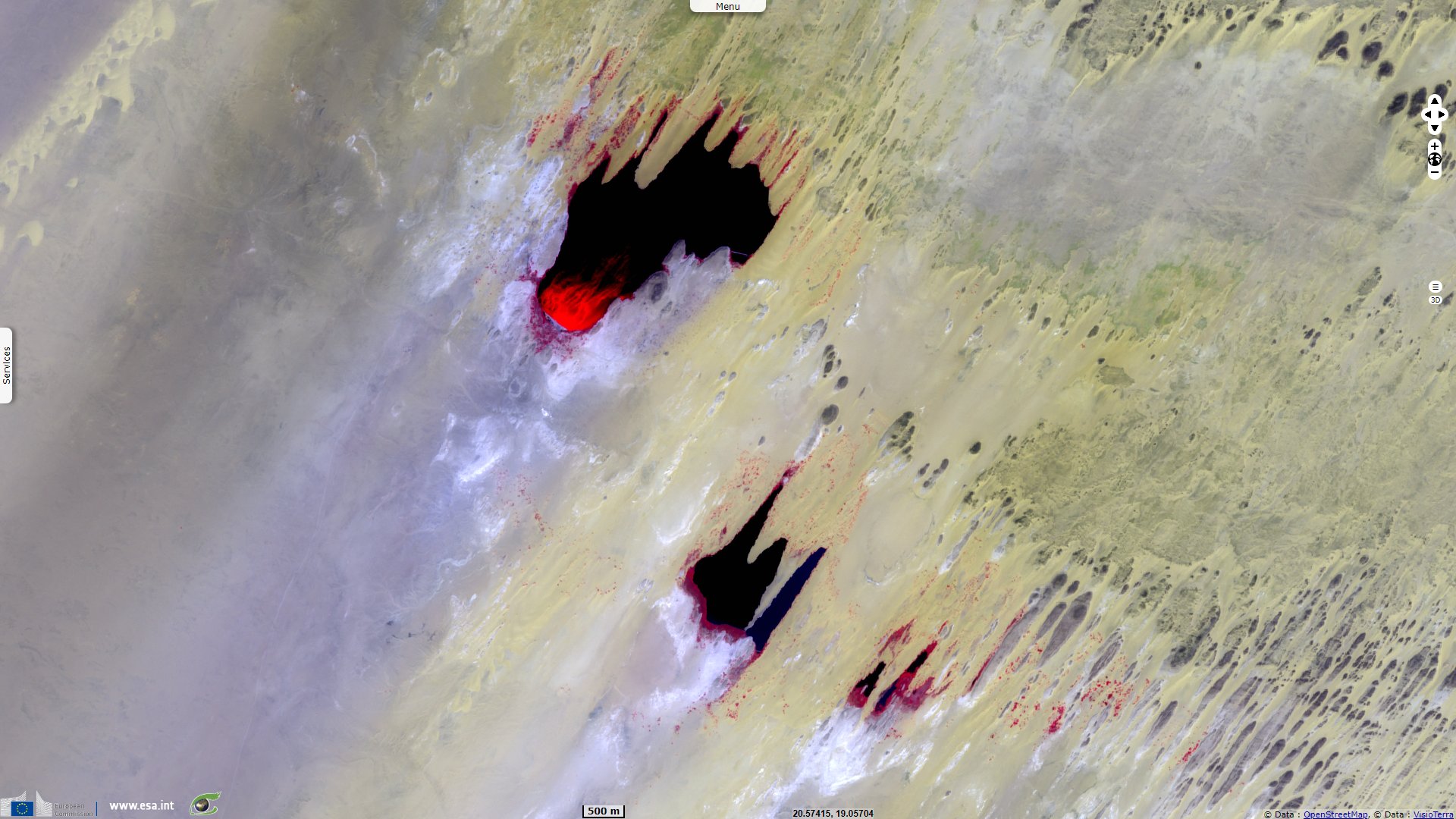
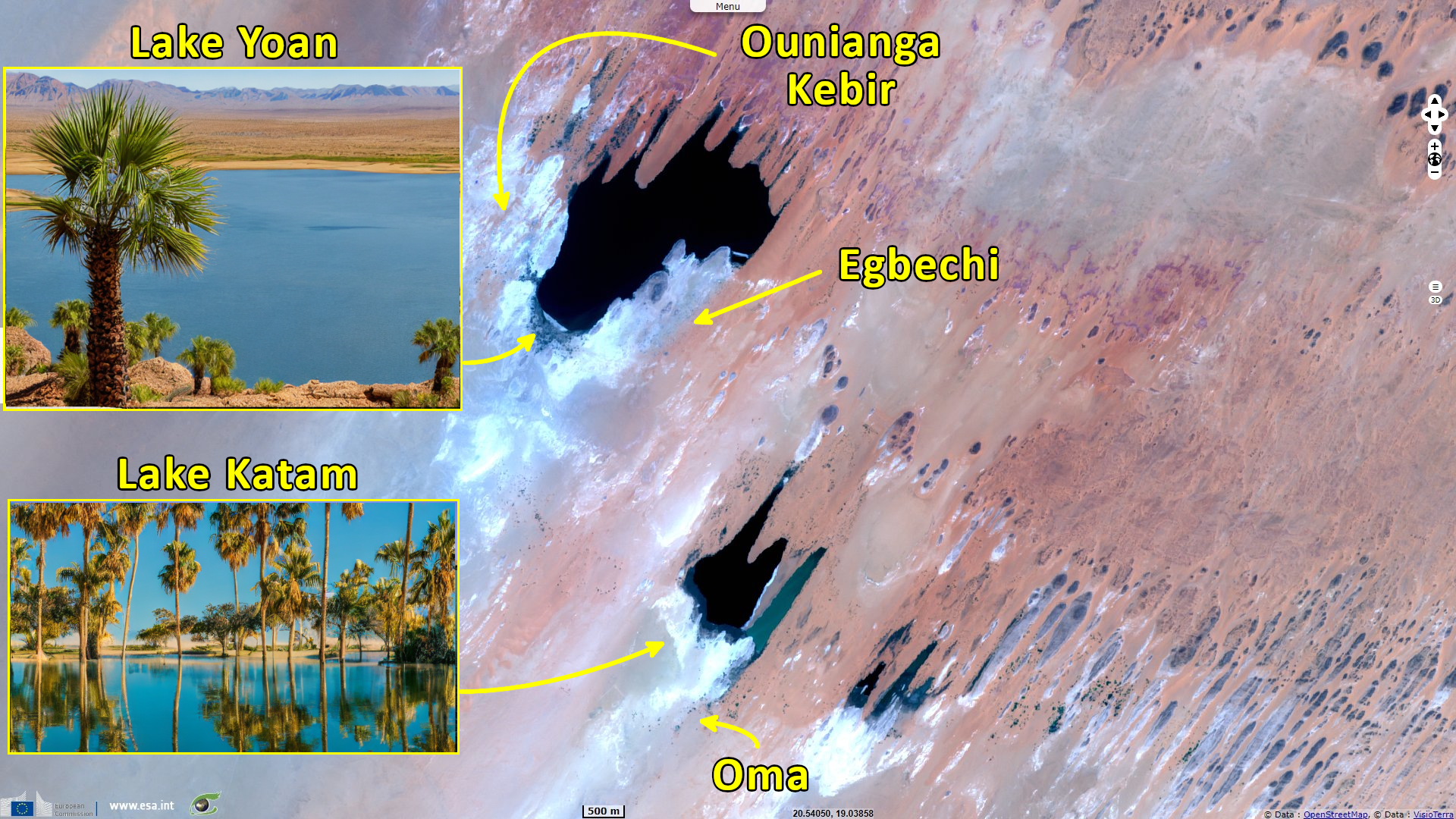
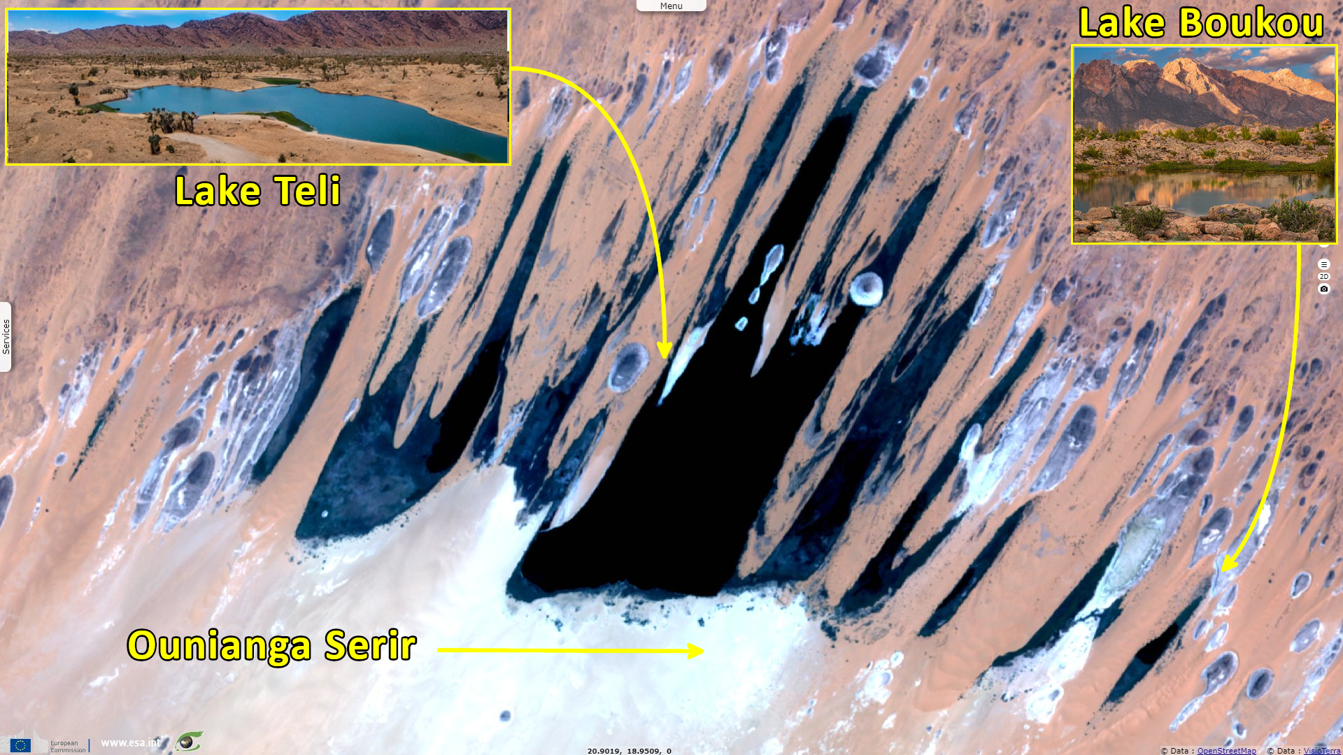
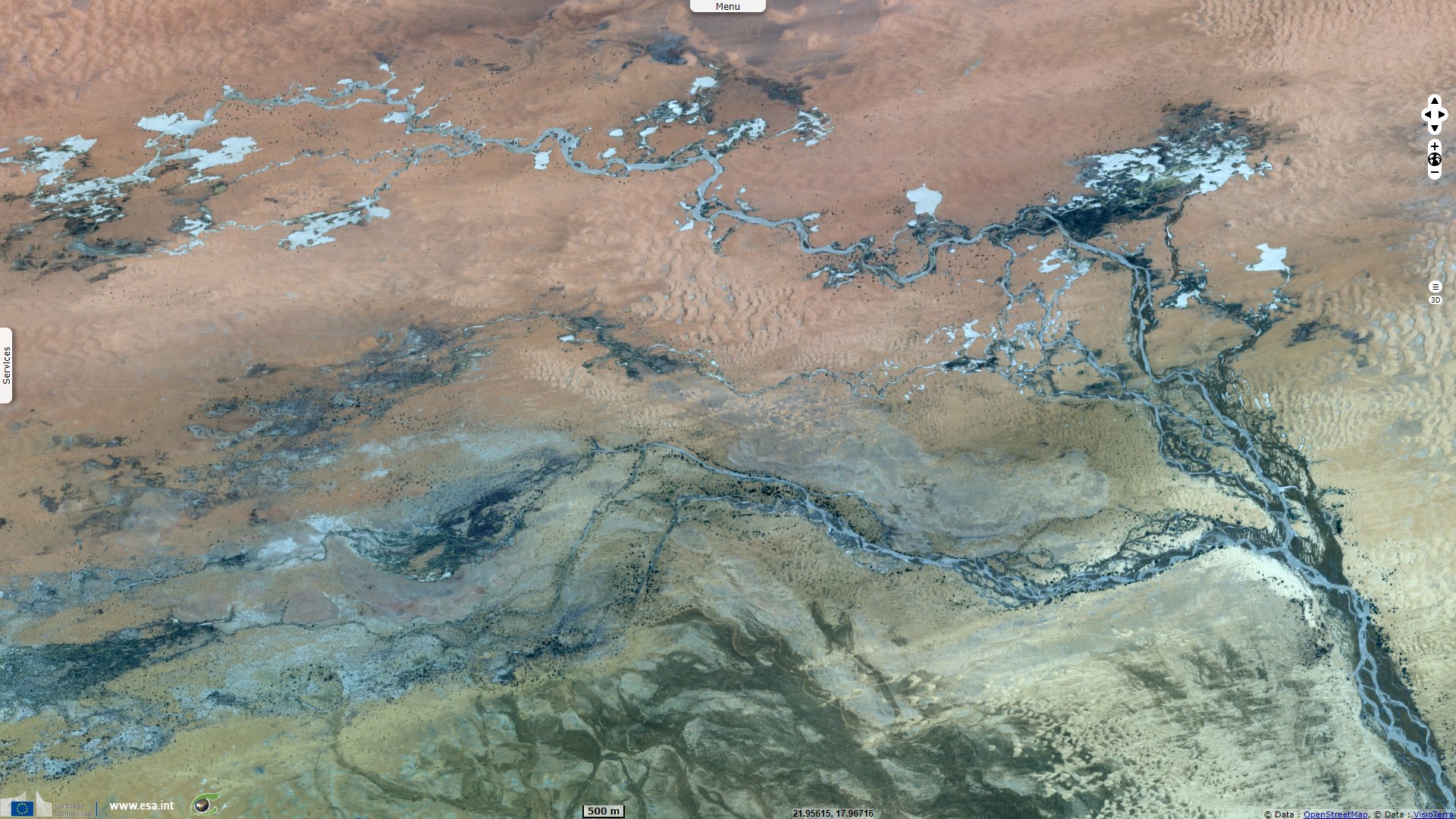
"Ounianga Kebir comprises four lakes, the largest of which, Yoan, covers an area of 358 ha and is 27 m deep. Its highly saline waters only sustain algae and some microorganisms. The second group, Ounianga Serir, comprises fourteen lakes separated by sand dunes. Floating reeds cover almost half the surface of these lakes reducing evaporation. At 436 ha, Lake Teli has the largest surface area but is less than 10 m deep. With their high quality freshwater, some of these lakes are home to aquatic fauna, particularly fish."
"Located in North-Eastern Chad, in a hot and hyperarid desert setting with less than 2mm rainfall per year, the Lakes of Ounianga comprises a total of 18 lakes, in two groups, displaying a variety of sizes, depths, colorations and chemical compositions. The property covers 62 808 ha and has a 4869 ha buffer zone. The Lakes of Ounianga property is located in a basin which, less than 10 000 years ago, was occupied by a much larger lake and has a globally unique hydrological system, sustaining the largest permanent freshwater lakes system in the heart of a hyperarid environment."
"The property also displays a range of striking aesthetic features, with varied coloration associated with the different lakes and their vegetation, and the presence of dramatic natural desert landforms that all contribute to the exceptional natural beauty of the landscape of the property. The shape and distribution of the lakes, combined with the effect of the wind moving the floating vegetation in the lakes, gives the impression of 'waves of water flowing in the desert'."
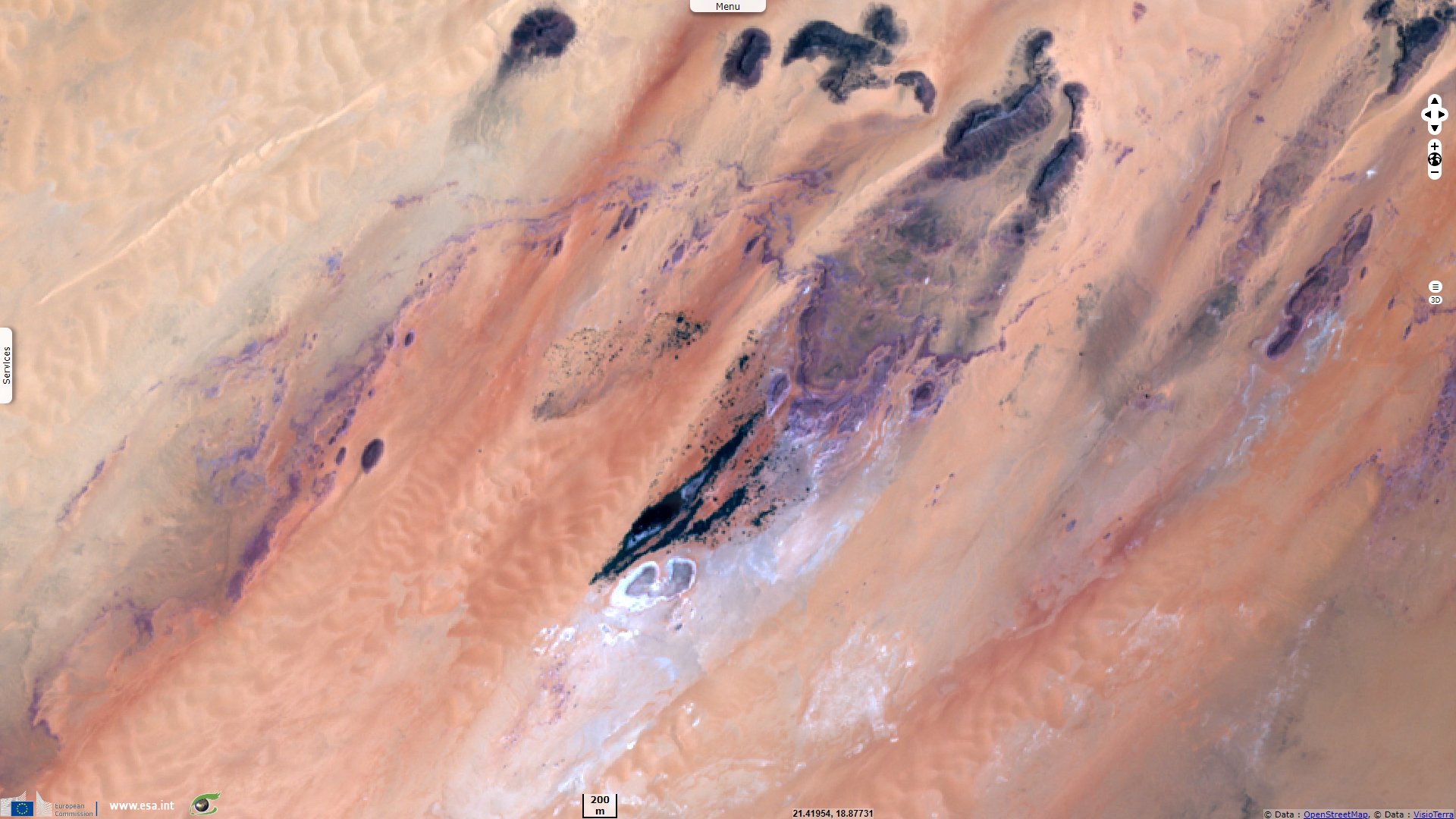
Marie-José Tubiana wrote an article for CNRS-INALCO that translates as The lakes of Ounianga and the Ounia people: The lakes of Ounianga, in reality a series of lakes, ponds and swamps, are grouped in two sets mentioned on the maps under the names of Ounianga Kebir and Ounianga Seghr / Serir, about 60 km apart. They are located below the 19° parallel, in the southern Sahara, between the Tibesti and Ennedi massifs, on the road that leads from Ouaddai to the oases of Koufra and as far as Benghazi (Libya). More broadly, they should be situated between the Chad and Nile basins.
The climatic data collected indicate a hyper-aridity, due to the weakness of the precipitations, always lower than 25 mm with sometimes several consecutive years without any precipitation, an extraordinary intensity of evaporation (evaluated by DUBJEF in 1953 at 7800 mm per annum), a very strong thermal amplitude (the difference between the average of the maxima of the hottest month (May) and the average of the minima of the coldest month (January) is higher than 30° and the extreme amplitude reaches 47° (CAPOT-REY 1961: 29). A north-easterly wind blows seven months a year.
In this desert area, in the middle of immense and bare regs, water is present in the form of in the form of magnificent lakes, blue or green, calm or agitated by short waves of white foam. Lake Yoan in Ounianga Kebir covers 3.7 km² and is over 20 metres deep; Lake Elimé in Ounianga seglllr covers 4.2 km², to mention only the main ones. The waters of both are heavily natronised and contain no life. While the water in the ponds on either side of Elimé are fresh or brackish and contain fish.
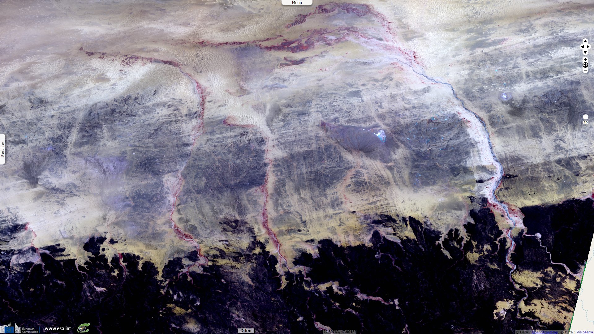
Water is also present in the form of springs, which rise from the foot of the cliffs or dunes that border the lakes. It is this near-surface water that allows the palm groves that surround the lakes to flourish, the villagers to get water and to water small gardens grown under the palm trees. Swing wells located in each garden provide water at a depth of one or two metres. The ounianga region has the triple characteristic of having open water surfaces, water in the subsoil at a shallow depth and deep water as revealed by boreholes. The Ounia who live in this region share their time between palm groves and gardens, salt pans and pastures.
In his article Pastoralist appropriation of landscape by means of rock art in Ennedi Highlands, Chad, Tilman Lenssen-Erz explains the origin of the Ounianga Lakes: "Significant detailed investigations relating to the climatic development in the Holocene were also part of the ACACIA research, based on coring of lake sediments in the Ounianga Lakes 250 km northwest of the highlands. Preliminary results can be summarised as follows (Kröpelin et al. 2008) while bearing in mind that due to the Ennedi’s location somewhat further south the timing and absolute figures of the climatic conditions may vary systematically from the core results:
- at ca. 6000 calBP [calendar years before the present] the region was a savannah with annual precipitation of ~250 mm and representing a Sahelian climatic zone (Andigue et al. 2006: 13); this was a period when the climatic optimum was already past and aridification prevailed (Kuper & Kröpelin 2006).
- By 4300 calBP precipitation went down to ~150 mm per year, nourishing an open grass savannah with a modest population of trees which today are found 300 km further south.
- Roughly around 2700 calBP the present-day hyperarid status with ~50 mm annual precipitation was reached. This implies that the Ennedi Highlands would since that time be part of the Saharo-Sahelian climate zone (Andigue et al. 2006), receiving between 100 and 200 mm of annual precipitation.
The views expressed herein can in no way be taken to reflect the official opinion of the European Space Agency or the European Union.
Contains modified Copernicus Sentinel data 2026, processed by VisioTerra.
Contains modified Copernicus Sentinel data 2026, processed by VisioTerra.
| More on European Commission space: |  |
 |
 |
||||
| More on ESA: | |
|
|
S-1 website | S-2 website | S-3 website | |
| More on Copernicus program: | |
|
|
Scihub portal | Cophub portal | Inthub portal | Colhub portal |
| More on VisioTerra: | |
|
|
Sentinel Vision Portal | Envisat+ERS portal | Swarm+GOCE portal | CryoSat portal |