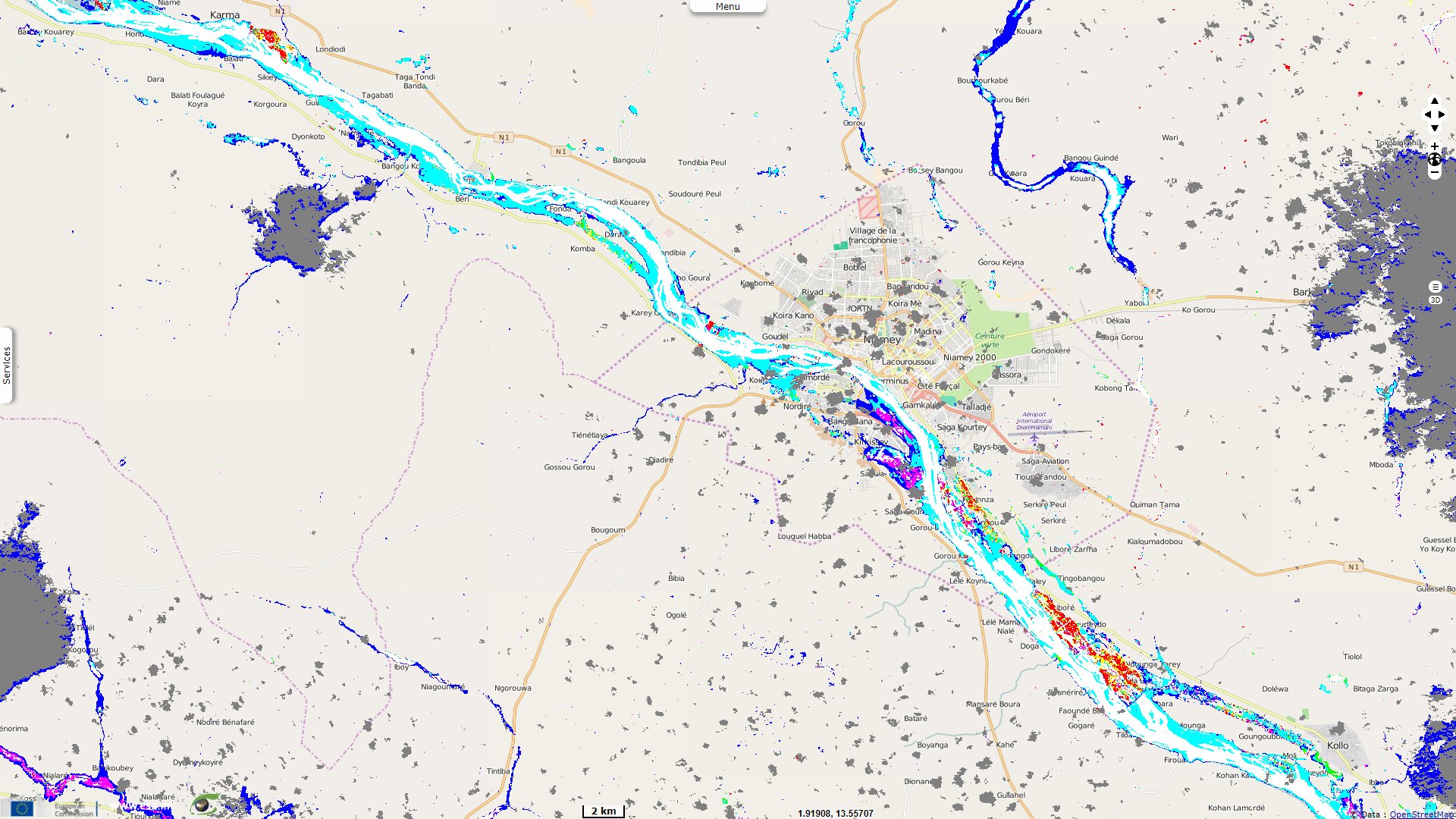
Record flood of the Niger river worsens in Niamey
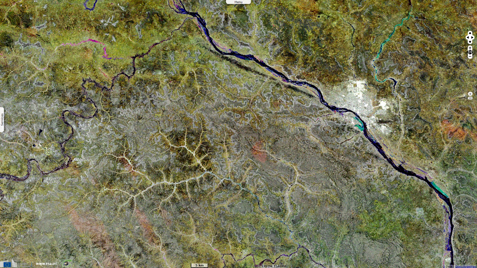
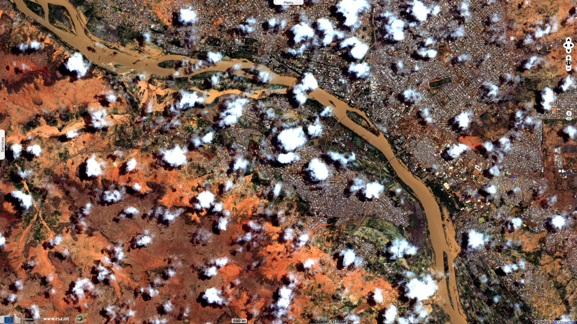
Sentinel-2 MSI acquired on 22 July 2020 at 10:05:59 UTC
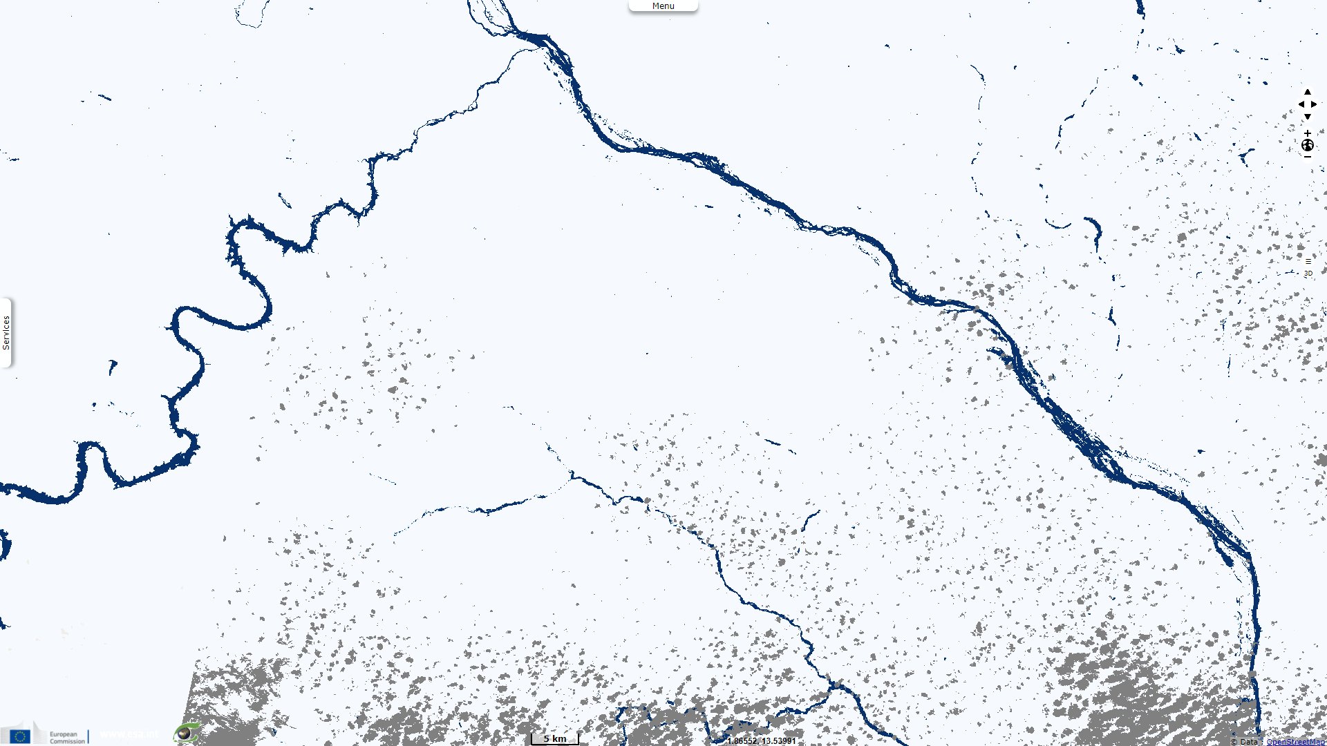
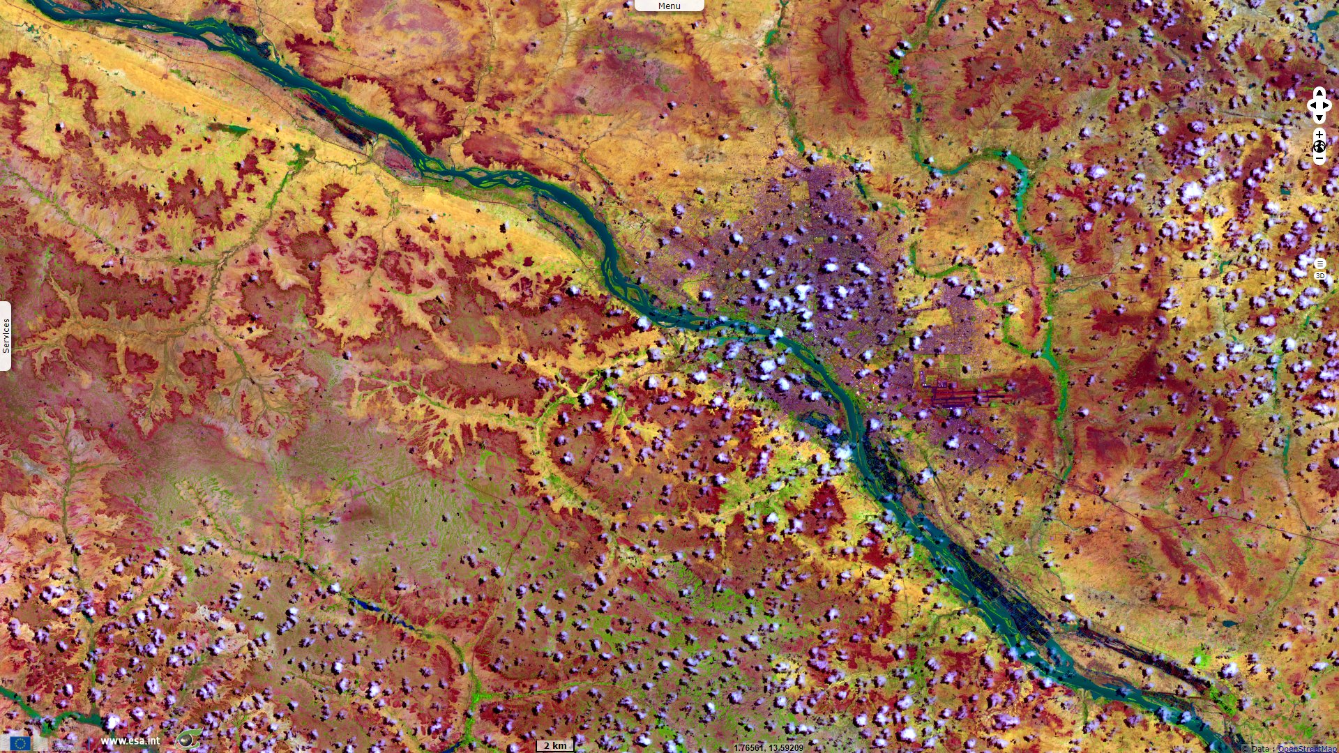
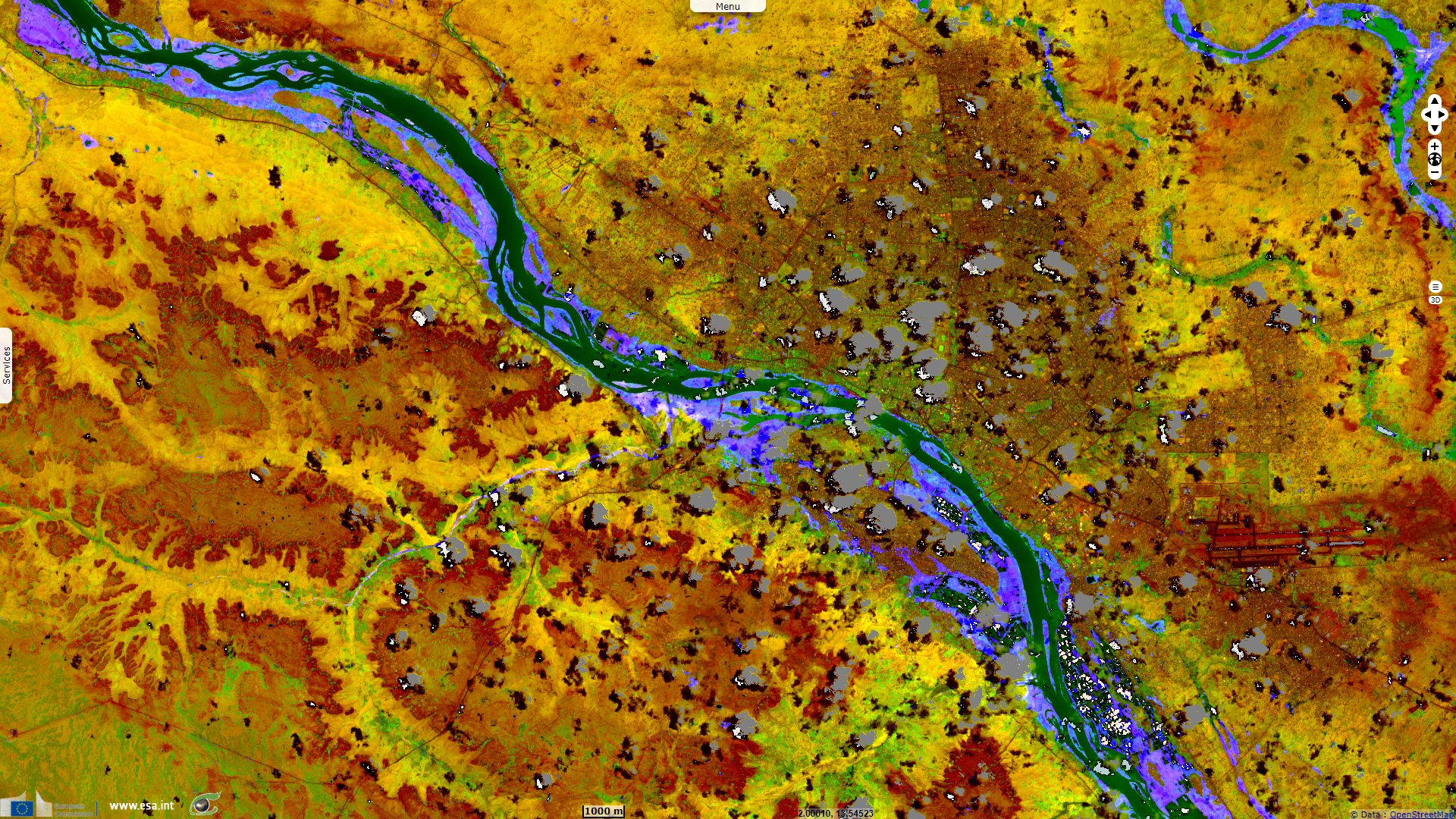
Sentinel-1 CSAR IW acquired on 22 July 2020 from 18:11:43 to 18:03:59 UTC
...
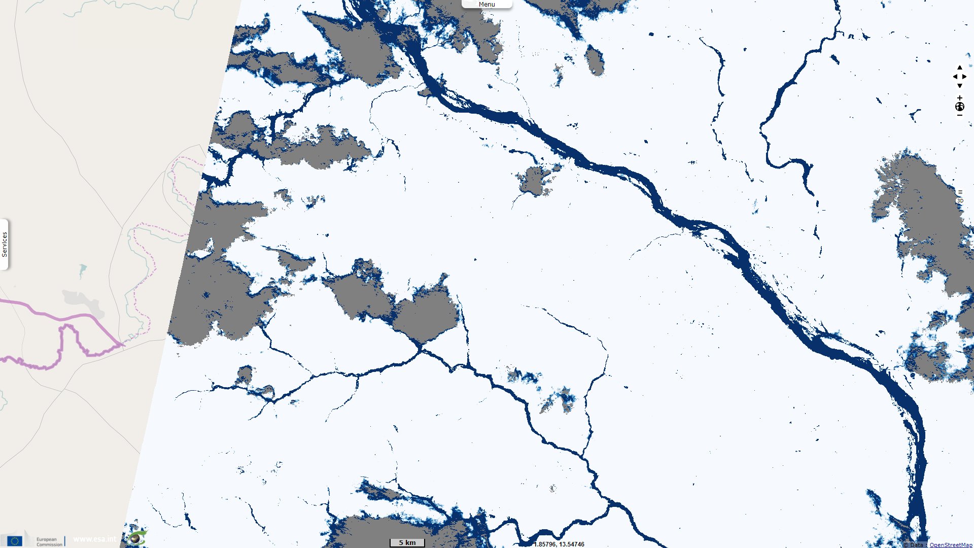
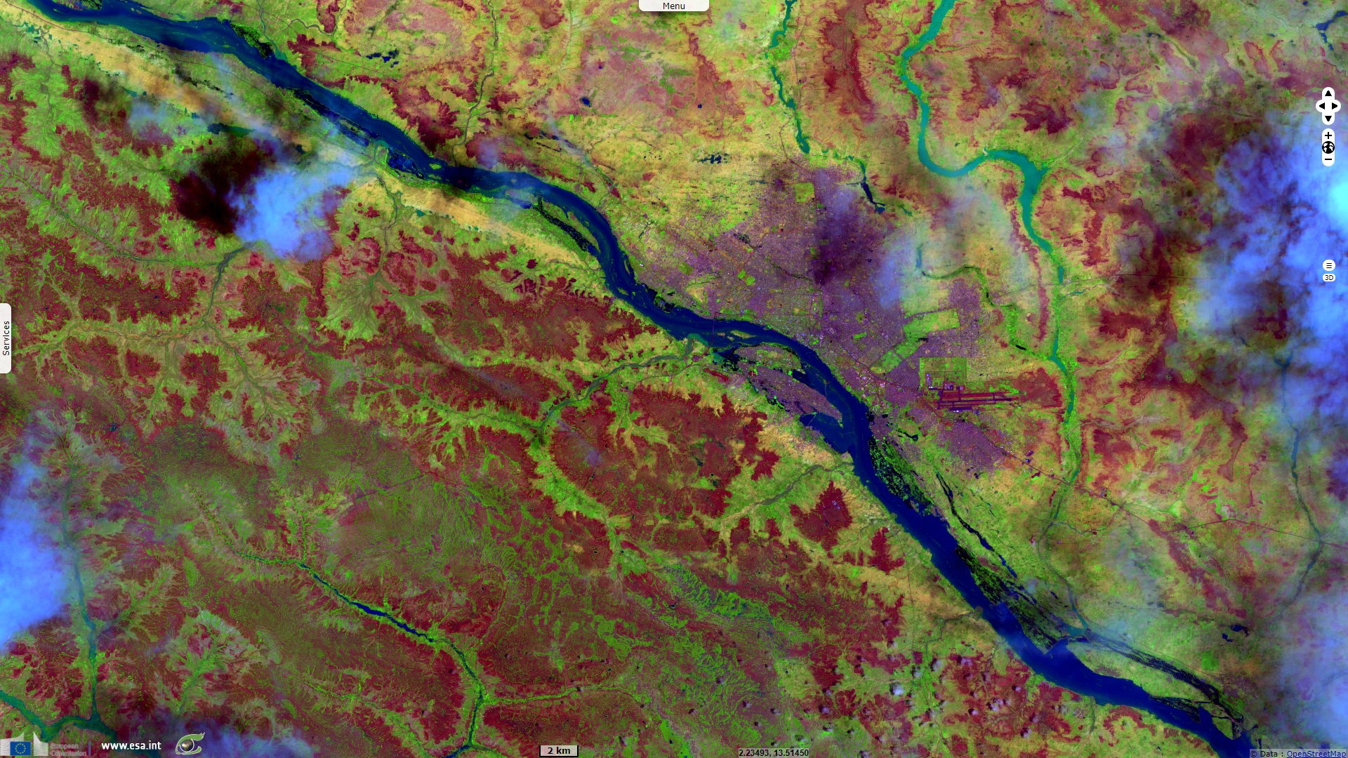
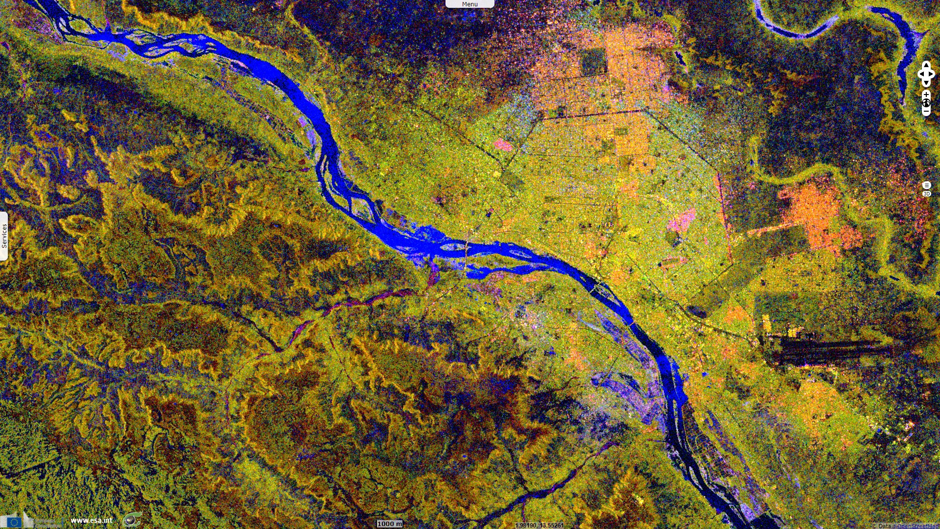
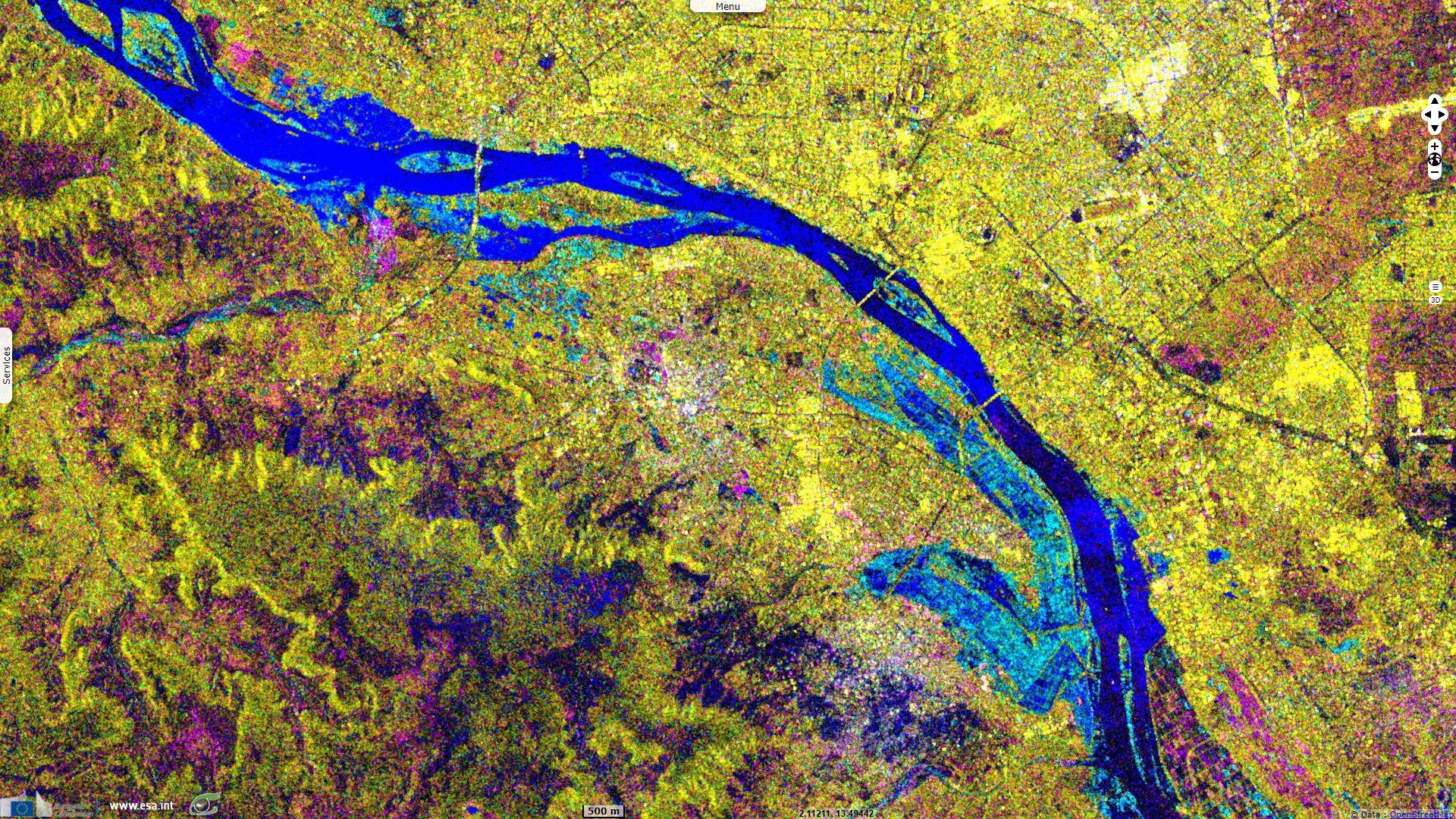
Sentinel-1 CSAR IW acquired on 03 September 2020 from 18:03:36 to 18:04:01 UTC
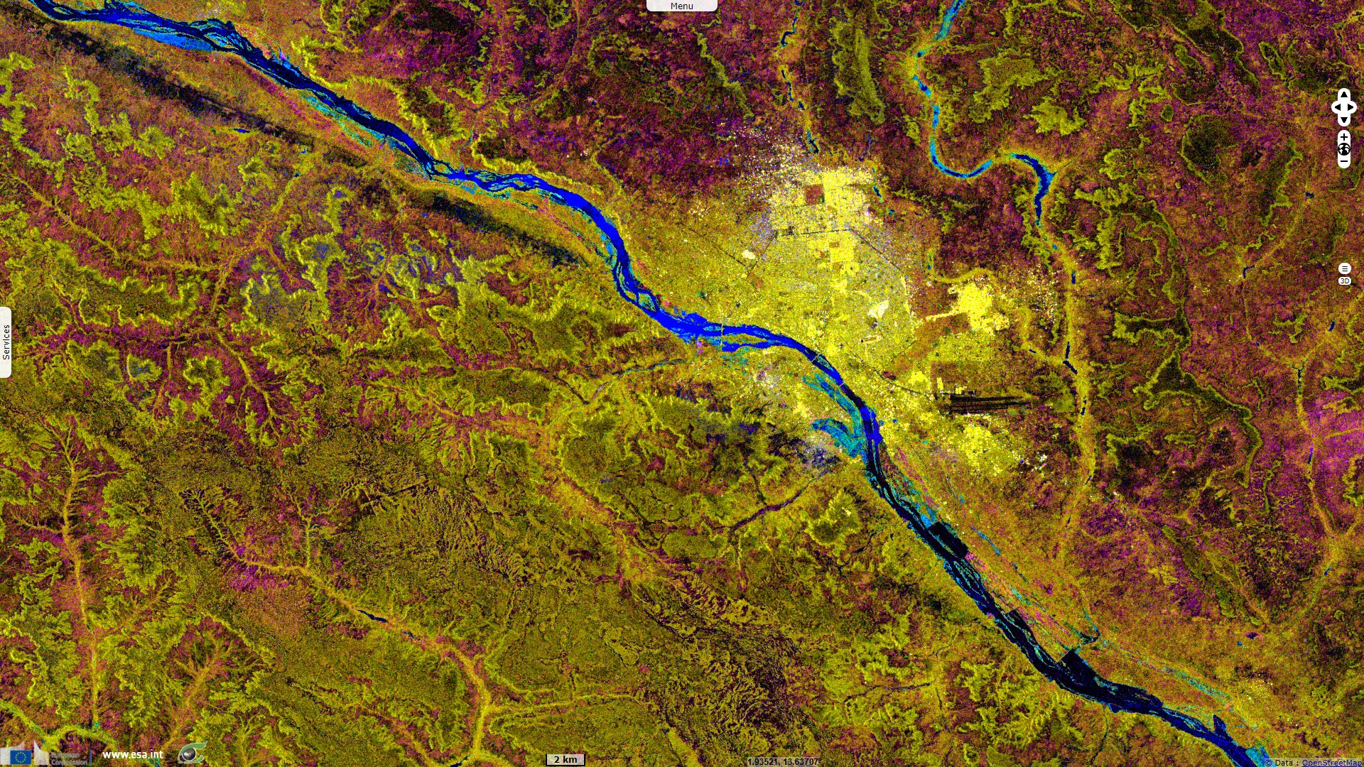
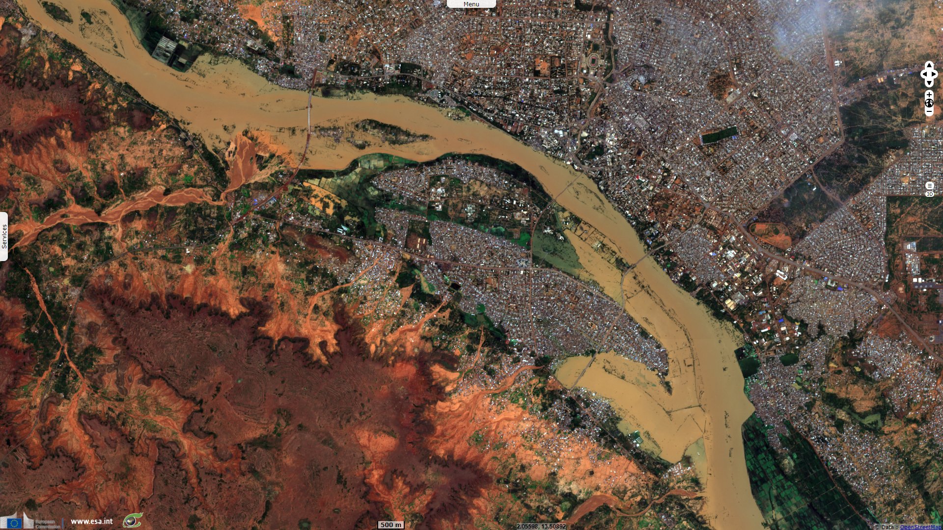
Sentinel-2 MSI acquired on 05 September 2020 at 10:10:31 UTC
Sentinel-1 CSAR IW acquired on 22 July 2020 from 18:11:43 to 18:03:59 UTC
...
Sentinel-1 CSAR IW acquired on 03 September 2020 from 18:03:36 to 18:04:01 UTC
Sentinel-2 MSI acquired on 05 September 2020 at 10:10:31 UTC
Keyword(s): Emergency, natural disaster, flooding, rainfall, precipitations, urban planning, Niger
After the flood of the Niger river worsened, Le Monde related: The heavy rains that have fallen since June on Niger, a poor and very dry Sahelian state, have killed 45 people and over 226 000 people affected, while several districts of Niamey, the capital, are engulfed by water, announced Thursday, August 27 the authorities of the country.
As of 24 August, 25 834 affected households with a total of 226 563 people had been registered throughout the country, with "45 human lives lost" as of 24 August, the Nigerien Minister for Humanitarian Action and Disaster Management said in a statement. A previous official assessment on 18 August reported 38 deaths and more than 150 000 people affected.
The most affected regions are Maradi (south), Tahoua, Tillabéri, Dosso and Niamey (west). According to the ministry, 20 201 houses, 1 167 huts, 64 classrooms, 24 mosques have collapsed as well as a dispensary. More than 4 290 head of livestock were decimated while 448 granaries, 713 drinking water wells and 5 306 hectares of crops were damaged.
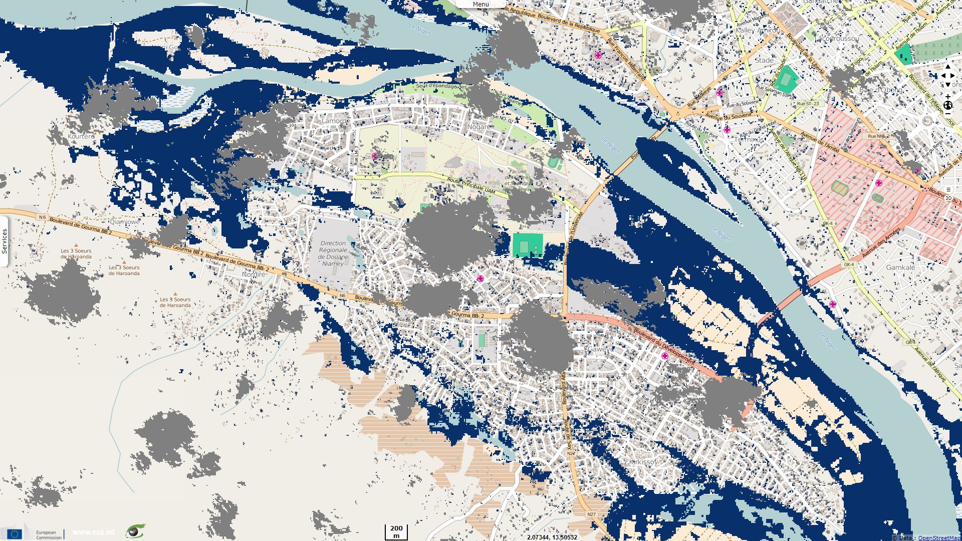
Almost all of Niamey's 1.5 million inhabitants live on the banks of the river and some have even built their houses in its bed. By 2019, floods had left 32 people dead and more than 226 000 affected.
Despite the short duration - at most three months - and low rainfall, the country has been facing floods for several years, including in the desert areas of the north. This is a paradox for this very dry state, where crop failures are usually due to drought.
Martin Mateso added for France TV Info: Every year, the same spectacle of desolation takes place in several West African cities. Devastating floods that cause loss of life, destroy property and crops, and spread epidemics in their wake.
In 2019, eight of the 12 African countries most affected by floods were in West Africa: Côte d'Ivoire, Ghana, Mali, Mauritania, Niger, Nigeria, Senegal and Sierra Leone. Most of them suffer from a lack of urban infrastructure without which flood control is impossible.
Regarding the present flood in Niamey, Hervé Trebossen, an expert working on floods in Niamey since 2007, tempers this statement: "Most of the dikes in Niamey have been reinforced and heightened in the past recent years. Major pits are cleaned up once or twice a year. One of the main problems are that a part of Niamey is built within the major bed of the Niger river or even in some of its oxbows. Another is the lack of knowledge of the urban planning rules from the population and a poor monitoring of the urban extents from the authorities."
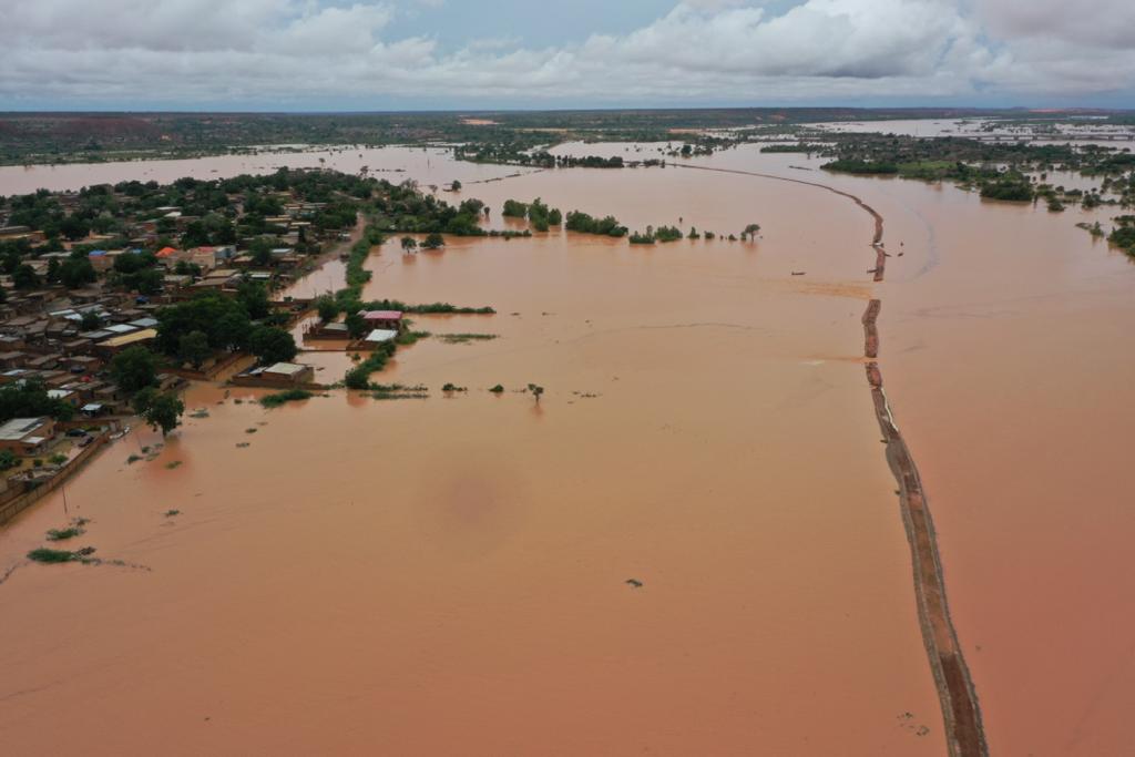
West-looking view of the dike cracking at the Central Bridge - Source: AGRHYMET Regional Centre twitter account
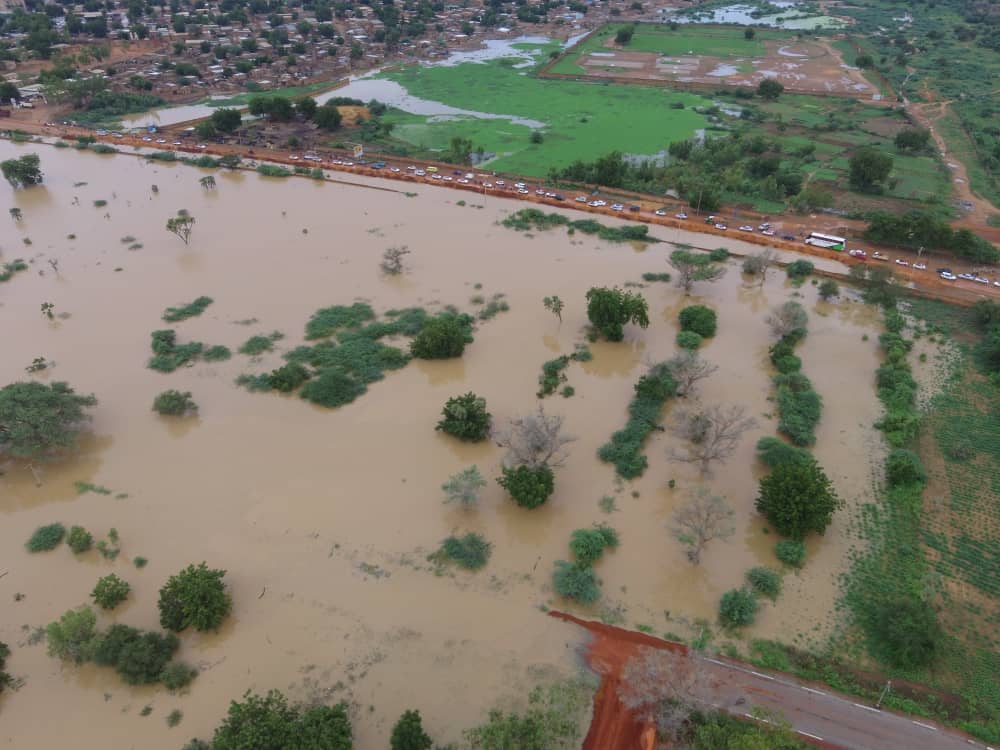
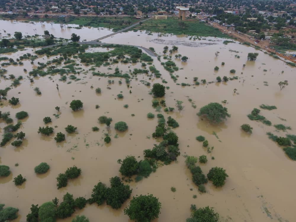
The neighbourhoods on the right bank west of the central bridge of Niamey are being flooded after the dike gave way - Source: AGRHYMET Regional Centre twitter account.
The views expressed herein can in no way be taken to reflect the official opinion of the European Space Agency or the European Union.
Contains modified Copernicus Sentinel data 2026, processed by VisioTerra.
Contains modified Copernicus Sentinel data 2026, processed by VisioTerra.
| More on European Commission space: |  |
 |
 |
||||
| More on ESA: | |
|
|
S-1 website | S-2 website | S-3 website | |
| More on Copernicus program: | |
|
|
Scihub portal | Cophub portal | Inthub portal | Colhub portal |
| More on VisioTerra: | |
|
|
Sentinel Vision Portal | Envisat+ERS portal | Swarm+GOCE portal | CryoSat portal |