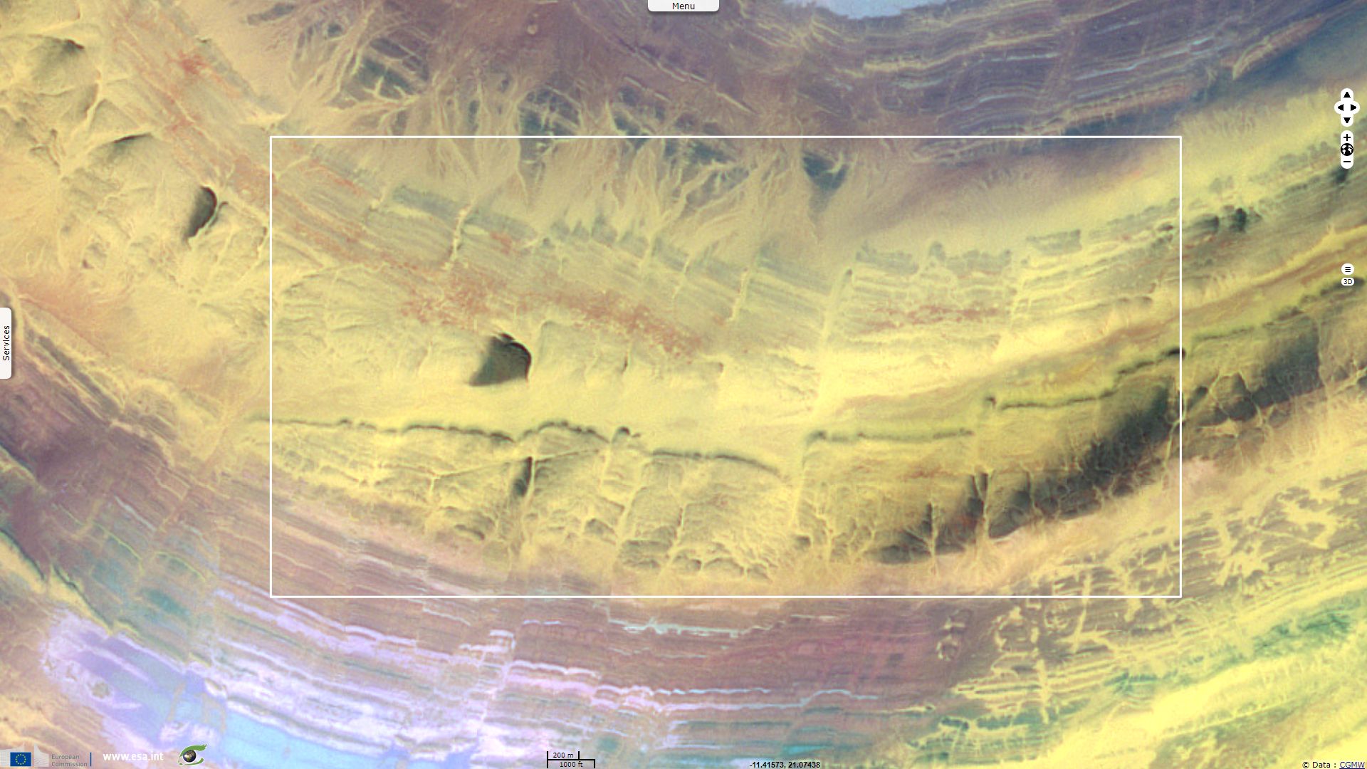
Geology of Richat circular structure
Sentinel-2 MSI acquired on 14 September 2017 at 11:06:39 UTC
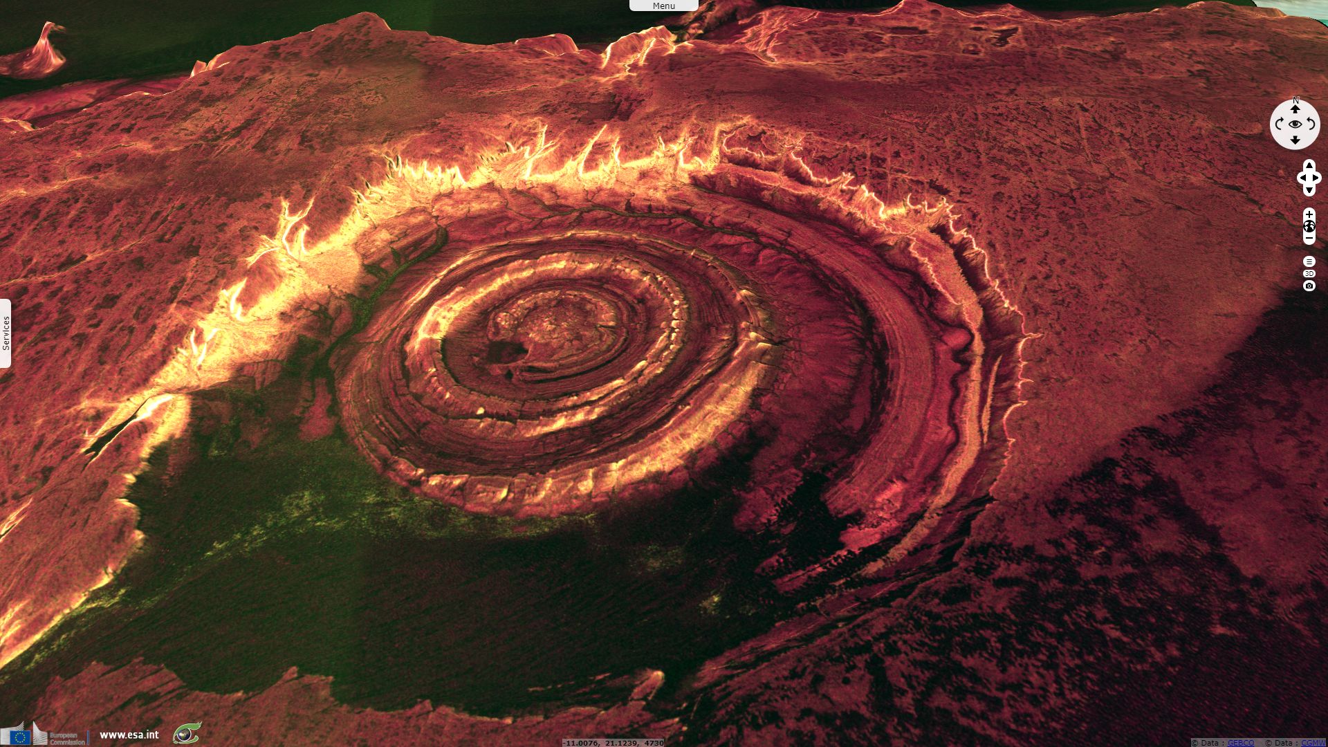
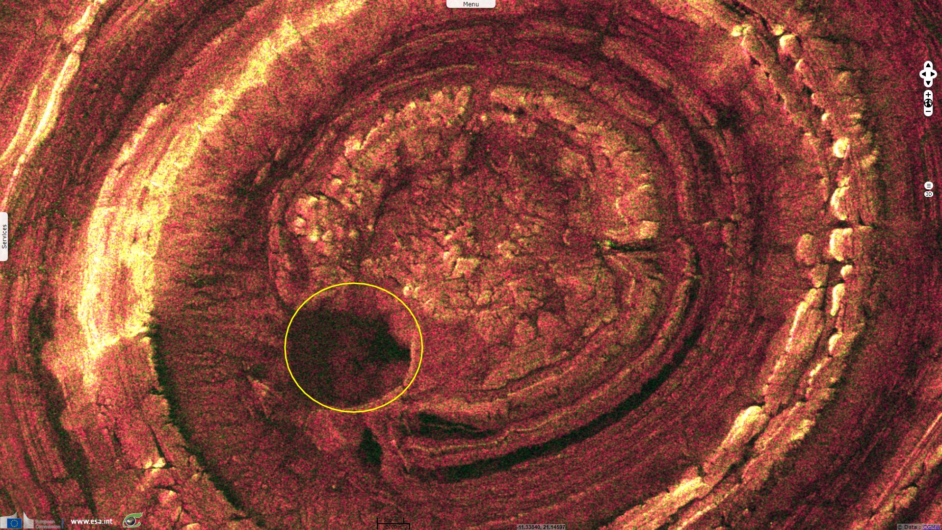
Sentinel-1 CSAR IW acquired on 24 November 2017 at 18:55:08 UTC
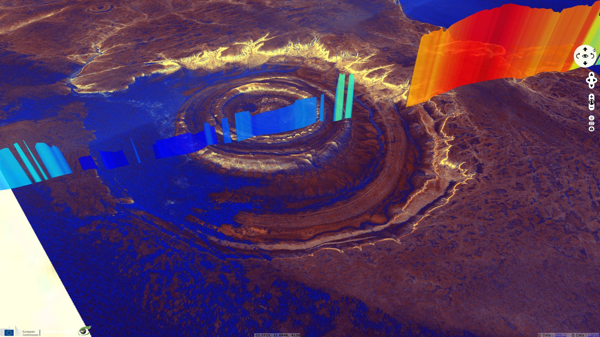
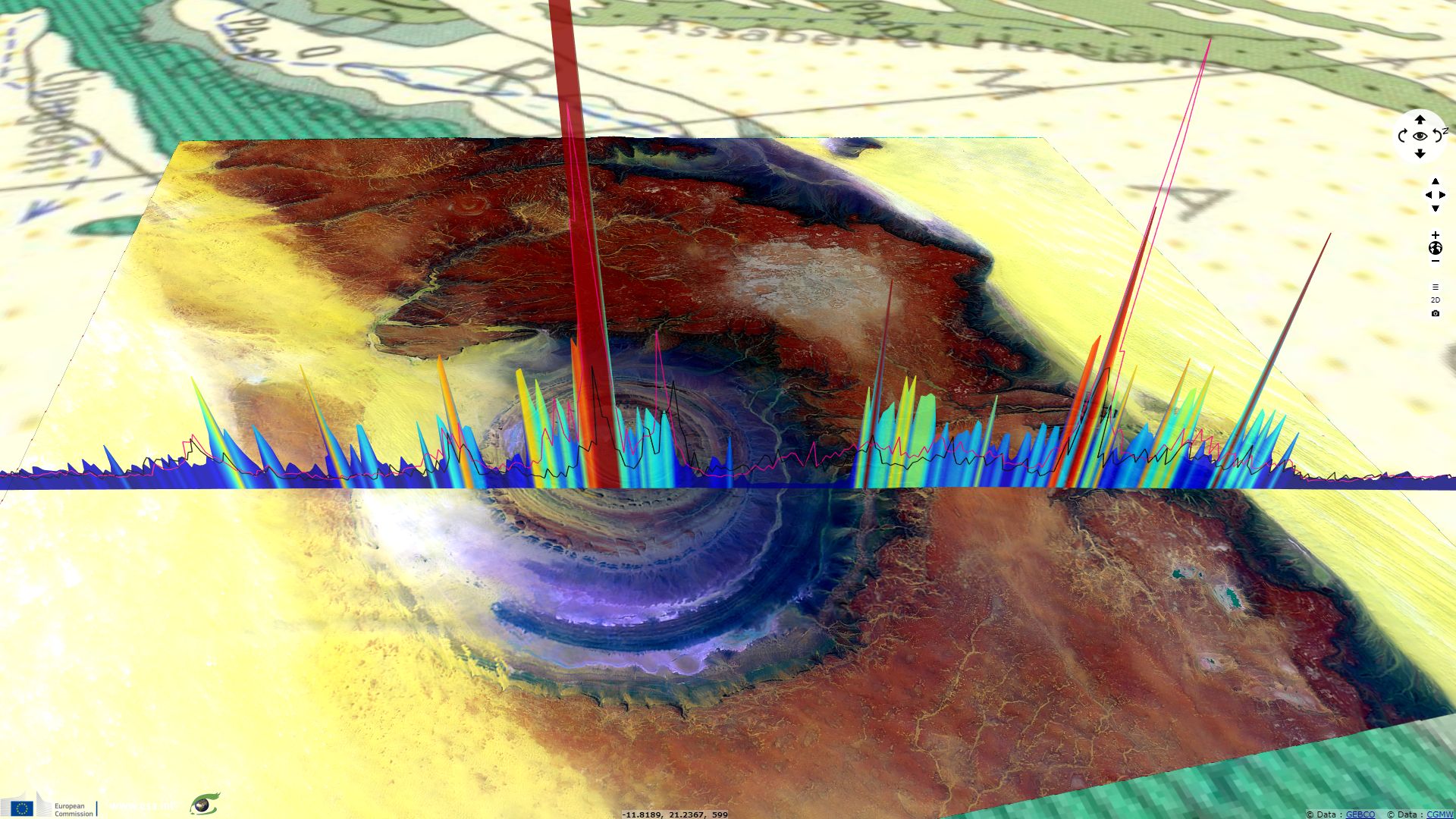
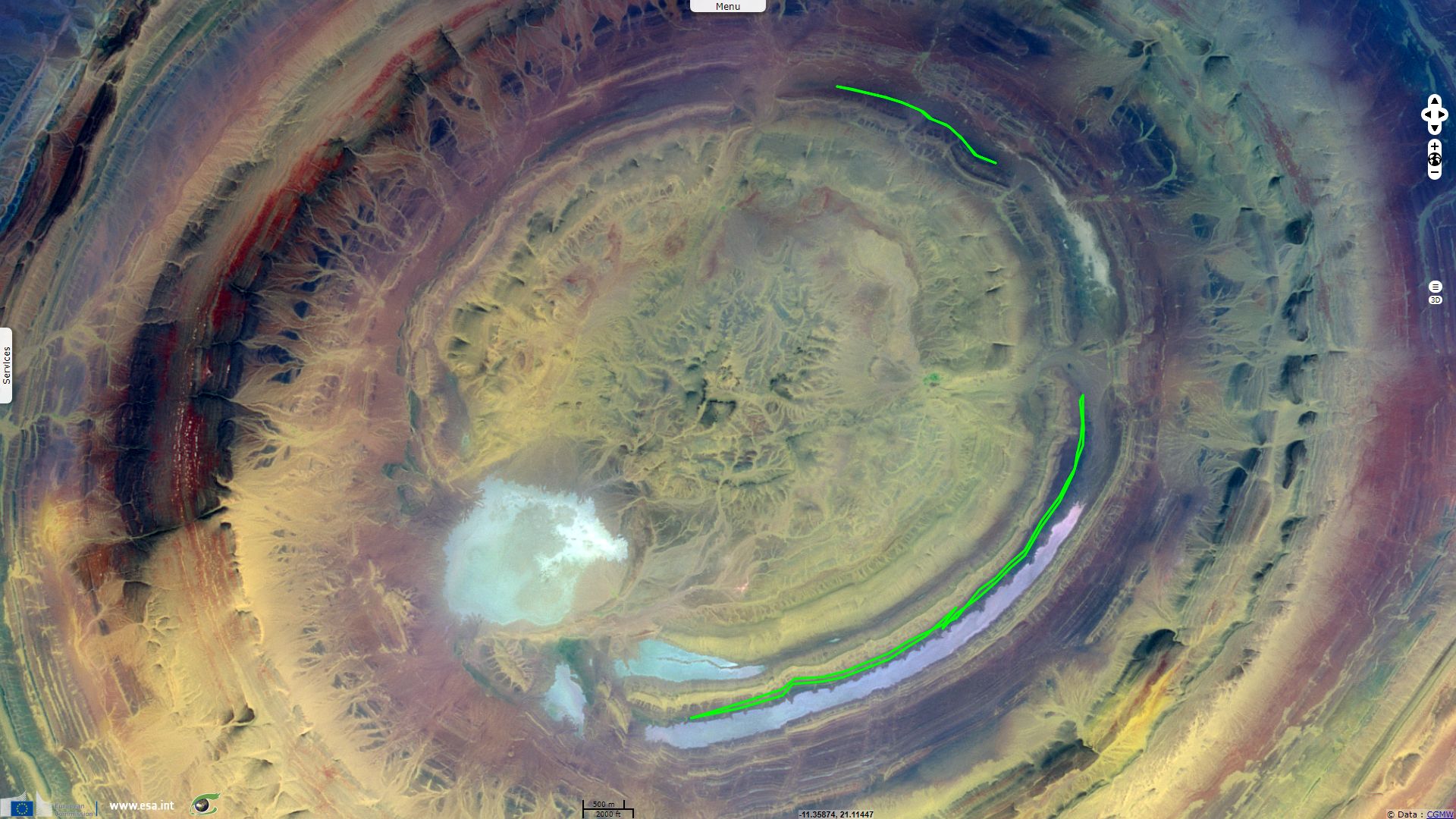
Sentinel-3 SRAL LAND acquired on 30 April 2018 at 10:40:08 UTC
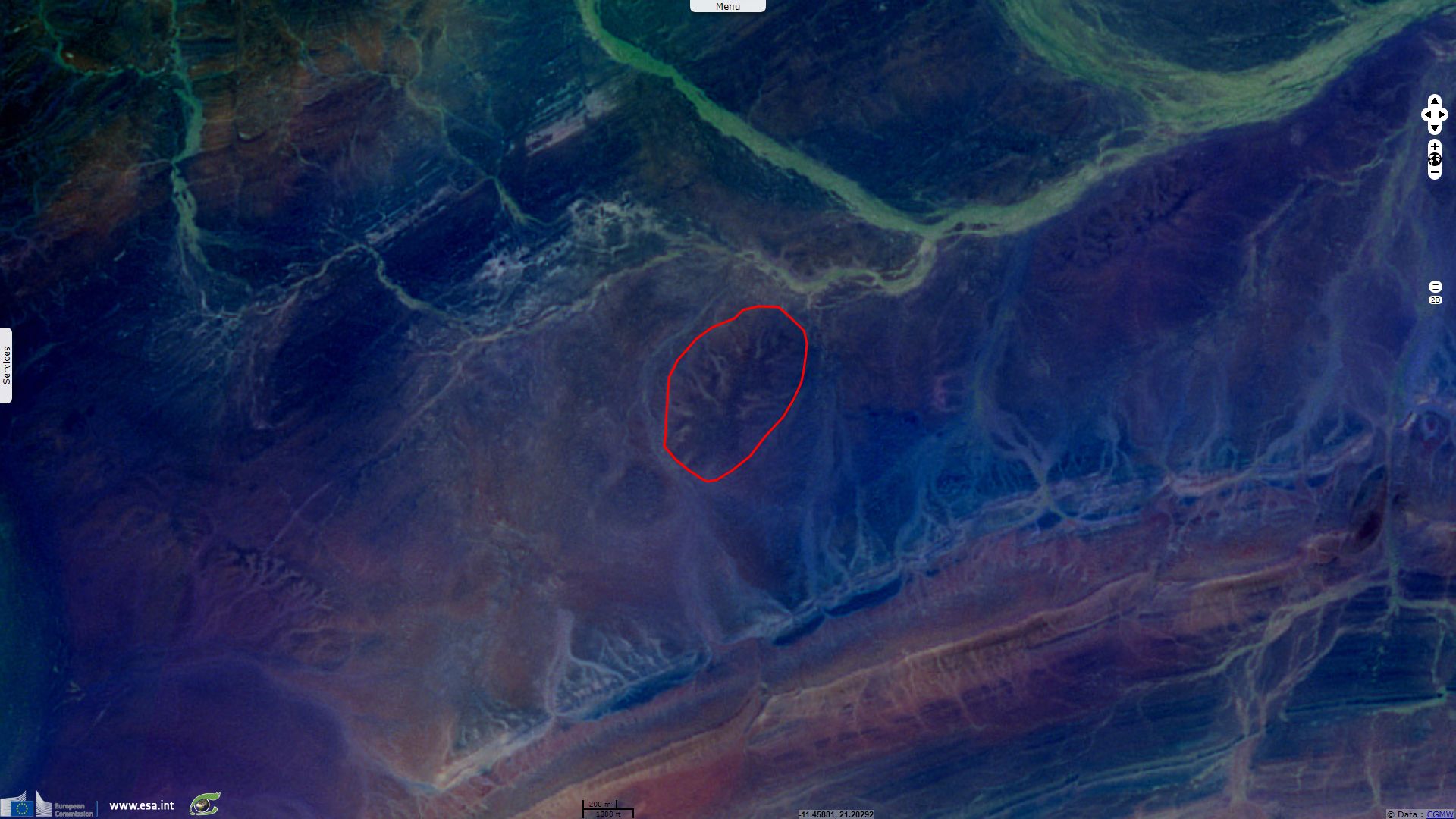
Sentinel-1 CSAR IW acquired on 24 November 2017 at 18:55:08 UTC
Sentinel-3 SRAL LAND acquired on 30 April 2018 at 10:40:08 UTC
Keyword(s): Desert, volcanism, erosion, depression, sebkha, geology, Sahara, Mauritania
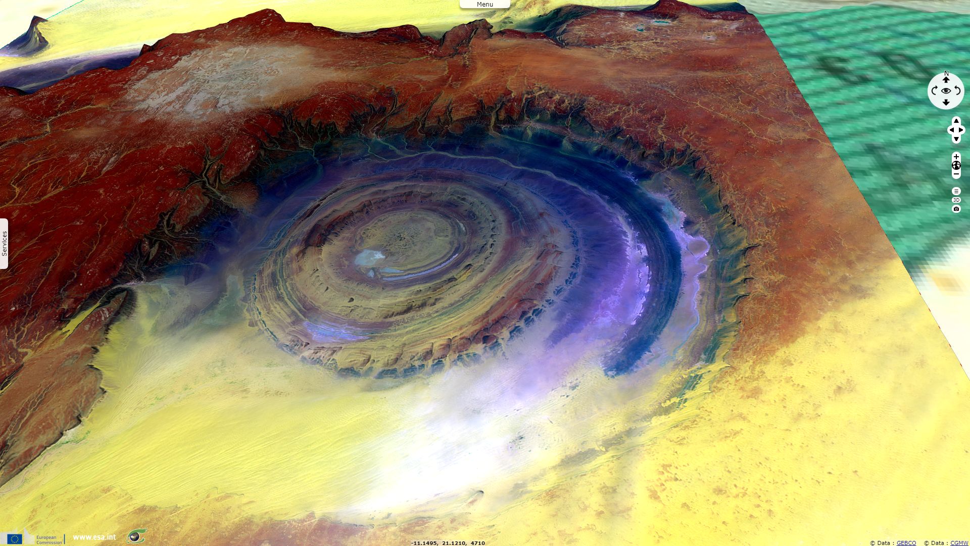
Pr. Jean Chorowicz, emeritus Professor of University Paris 6 wrote: "The spectacular Richat circular structure (Mauritania) – famous ‘Eye of the Sahara’ - appears as alternating types of rocks forming concentric rings. It lies down a circular scarp and shows a Late Proterozoic to Early Palaeozoic rock sequence. Inside, erosion has created circular cuestas dipping outward from the structure. By places, can also be identified a volcanic crater (with a sebkhra inside), a kimberlitic plug, light coloured carbonatite dykes (more frequent in southern part of the structure), rhyolitic volcanites, high-K gabbroic ring dykes."
He describes the geological context, writing "the structure lies in the Reguibat Shield, northern part of the West African Craton. Further to the west (Geological Map of Africa, CGMW) there is a succession of stacked nappes of Variscan age (late Palaeozoic), part of the Mauritanides-Appalaches orogen lying now along both sides of the Atlantic for it served at around 100 Ma as the major lithospheric discontinuity reactivated by evolution of a proto-Atlantic continental rift and opening of the Atlantic Ocean."
Regarding carbonatites, he adds: "The center consists of a limestone-dolomite shelf that encloses siliceous breccia created during karst dissolution and collapse. Carbonatites are sub-surface intrusive magmatic rocks, essentially crystalline limestone or dolomite, originating from deep magma enriched in Ca and CO2. They have the highest rare earth element (REE) concentrations of all igneous rocks. Age of the intrusion is ~100 Ma (middle of the Cretaceous). There are ring faults and numerous small straight faults."
Professor Jean Chorowicz finally describes: "The evolution of the structure is thought to be as follows
- Ancient subduction-collision process may have favored the assimilation in the continental lithosphere of preexisting subducted sedimentary carbonates, forming a carbonatite melt. Another debated hypothesis is that carbonatite and proto-kimberlite magmas are related to mantle plume activity, which had played a part in the proto-Atlantic rift evolution.
- Mid-Cretaceous breakup of Gondwana continent may have provided opportunities for this magma to reach the sub-surface.
- Intrusions induced the uplift of a dome at the surface with, beneath, accumulation of a mushroom-like carbonatite body, fed by dykes and ring dykes.
- Subsequent erosion and thermal activity dissolved most of the carbonatite, from which remained karstic breccia and the root of the structure.”
The views expressed herein can in no way be taken to reflect the official opinion of the European Space Agency or the European Union.
Contains modified Copernicus Sentinel data 2026, processed by VisioTerra.
Contains modified Copernicus Sentinel data 2026, processed by VisioTerra.
| More on European Commission space: |  |
 |
 |
||||
| More on ESA: | |
|
|
S-1 website | S-2 website | S-3 website | |
| More on Copernicus program: | |
|
|
Scihub portal | Cophub portal | Inthub portal | Colhub portal |
| More on VisioTerra: | |
|
|
Sentinel Vision Portal | Envisat+ERS portal | Swarm+GOCE portal | CryoSat portal |